Category:Wexham Court
Jump to navigation
Jump to search
English: Wexham Court is a civil parish in the county of Berkshire. It is in the unitary authority of Slough, in southern England.
Nederlands: Wexham Court is en voormalige civil parish in het bestuurlijke gebied Slough, in het Engelse graafschap Berkshire.
suburb and civil parish in Slough, Berkshire, England, UK | |||||
| Upload media | |||||
| Instance of | |||||
|---|---|---|---|---|---|
| Location | Slough, Berkshire, South East England, England | ||||
| Population |
| ||||
 | |||||
Media in category "Wexham Court"
The following 36 files are in this category, out of 36 total.
-

-
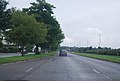 A412, northbound - geograph.org.uk - 3202939.jpg 640 × 430; 54 KB
-
 Bikes ^ Balconies - geograph.org.uk - 5969442.jpg 3,456 × 4,291; 2.31 MB
-
 Church of the Holy Redeemer - geograph.org.uk - 5969754.jpg 4,525 × 3,202; 1.53 MB
-
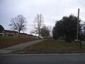
 Footpath from Wexham Street - geograph.org.uk - 4554622.jpg 2,000 × 1,333; 2.5 MB
-
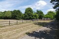
 Footpath near Bell Farm - geograph.org.uk - 4554629.jpg 2,000 × 1,333; 2.98 MB
-
 Grand Union Canal (Slough Arm) - geograph.org.uk - 206627.jpg 640 × 480; 97 KB
-
 Green in Upton Lea - geograph.org.uk - 2824812.jpg 640 × 438; 227 KB
-
 Housing, Wexham Road - geograph.org.uk - 4554474.jpg 2,000 × 1,333; 2.31 MB
-
 Huxley Close, Wexham - geograph.org.uk - 5624503.jpg 2,262 × 1,670; 1.35 MB
-

-
 Keeper's Cottage, Wexham Park Lane - geograph.org.uk - 2824857.jpg 640 × 432; 216 KB
-
 Knolton Way, Upton Lea - geograph.org.uk - 4554471.jpg 2,000 × 1,333; 2.52 MB
-
 Norway Drive at the corner of Wexham Road - geograph.org.uk - 5625357.jpg 2,304 × 1,728; 841 KB
-
 Norway Drive, Upton Lea - geograph.org.uk - 4554454.jpg 2,000 × 1,333; 2.36 MB
-
 Norway Drive, Upton Lea - geograph.org.uk - 4554480.jpg 2,000 × 1,333; 2.12 MB
-
 Path by Bell Farm - geograph.org.uk - 4554583.jpg 2,000 × 1,333; 2.35 MB
-
 Red and Blue Panels - geograph.org.uk - 5969441.jpg 4,999 × 3,104; 2.02 MB
-
 Shops in Upton Lea, Slough - geograph.org.uk - 126431.jpg 640 × 480; 188 KB
-
 The Frithe, Upton Lea, Slough - geograph.org.uk - 126430.jpg 640 × 481; 194 KB
-
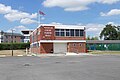 Wexham Court Parish Hall - geograph.org.uk - 4554083.jpg 2,000 × 1,333; 1.95 MB
-
 Wexham Park Golf Course - geograph.org.uk - 4554595.jpg 2,000 × 1,333; 3.24 MB
-
 Wexham Park hospital - geograph.org.uk - 2824865.jpg 640 × 429; 199 KB
-
 Wexham Park hospital - geograph.org.uk - 2824869.jpg 640 × 428; 181 KB
-
 Wexham Park Hospital - geograph.org.uk - 4555563.jpg 2,000 × 1,333; 2.56 MB
-
 Wexham Park Hospital - geograph.org.uk - 4555582.jpg 2,000 × 1,333; 2.29 MB
-
 Wexham Park Hospital, Stoke Green, Slough - geograph.org.uk - 126434.jpg 640 × 480; 231 KB
-
 Wexham Road at the junction of Norway Road - geograph.org.uk - 5629556.jpg 2,304 × 1,728; 806 KB
-
 Wexham Road, Upton Lea - geograph.org.uk - 4554460.jpg 2,000 × 1,333; 2.34 MB
-
 Wexham Road, Upton Lea - geograph.org.uk - 4554469.jpg 2,000 × 1,333; 2.58 MB
-
 Wexham Road, Upton Lea - geograph.org.uk - 5621632.jpg 2,304 × 1,728; 805 KB
-
 Wexham Road, Upton Lea - geograph.org.uk - 5629557.jpg 2,304 × 1,728; 849 KB
-
 Bridge over the canal near Slough - geograph.org.uk - 374199.jpg 640 × 416; 77 KB
-
 Grand Union Canal, Slough arm. - geograph.org.uk - 374201.jpg 640 × 416; 62 KB
-
 Grand Union Canal, Slough arm. - geograph.org.uk - 374204.jpg 640 × 416; 68 KB
-
 Houses in Church Lane, Stoke Green - geograph.org.uk - 126432.jpg 640 × 480; 220 KB


_-_geograph.org.uk_-_206627.jpg)


