
Category:Wexford
Български: Уексфорд (на английски Wexford, на ирландски Loch Garman) е пристанищен град в югоизточната част на Ирландия, провинция Ленстър. Главен административен център е на едноименното графство Уексфорд. Разположен е на брега на Ирландско море около устието на река Слейни. Основан е от викингите около 800 г. Има жп гара, която е открита на 17 август 1874 г. Населението му е 8 854, а с прилежащите му околности 18 163 жители от преброяването през 2006 г. [1]
Brezhoneg: Loch Garman (Wexford e saozneg) a zo ur gêr en arvor gevred Iwerzhon. Gevellet eo gant Koueron.
Cymraeg: Prif dref Swydd Wexford yn ne-ddwyrain Gweriniaeth Iwerddon yw Loch Garman (Saesneg: Wexford). Saif heb fod ymhell o borthladd Rosslare, ar ochr ddeheuol aber Afon Slaney. Roedd y boblogaeth yn 2006 yn 18,163.
Dansk: Wexford ( Irsk: Loch Garman, fra gl. norsk Waes Fjord) er en irsk by i County Wexford i provinsen Leinster, i den centrale del af Republikken Irland med en befolkning (inkl. opland) på 18.163 indb i 2006 (17.235 i 2002)
Deutsch: Wexford ( irisch: Loch Garman) ist die Hauptstadt der gleichnamigen Grafschaft Wexford im Südosten der Republik Irland nahe dem Hafen Rosslare Harbour. Die Stadt mit 8.854 Einwohnern (Stand: 2006) liegt an der Nationalstraße N11 nach Dublin sowie an der N25 zwischen Cork und Rosslare. Wexford ist über die Strecke Dublin–Rosslare Harbour auch an das irische Schienensystem angeschlossen.
English: Wexford (from Old Norse: Veisafjǫrðr, Yola: Weisforthe, Irish: Loch Garman) is the county town of County Wexford, Ireland.
Español: Wexford (en irlandés: Loch Garman, en Nórdico antiguo: Veisafjǫrðr) es una localidad de la República de Irlanda, capital del Condado de Wexford. Se encuentra en el extremo suroriental de la isla, cerca del Europuerto de Rosslare. La ciudad está conectada con la capital del país, Dublín por carretera y ferrocarril.
Euskara: Wexford ( irlanderaz: Loch Garman, aintzineko norvegieraz: Veisafjǫrðr) Irlandako Errepublikako hiri bat da eta Wexfordeko konderriaren hiriburua. Irlandako uhartearen hego-ekialdeko muturrean kokatzen da, Rosslare itsas Euro Portutik hurbil. Wexford herrialdeko hiriburua den Dublin hiriarekin errepidez nahiz trenbidez loturik dago.
Suomi: Wexford on noin 10 000 asukkaan kaupunki Irlannissa, saaren kaakkoisosassa.
Français : Wexford (Loch Garman en irlandais) est une ville du comté de Wexford en République d'Irlande.
Gaeilge: Príomhbhaile chontae Loch Garman agus an baile is mó sa chontae é baile Loch Garman, le daonra tuairim is 15,000. Ar inbhear na Sláine atá sé, agus tá a chalafort leathan, cé nach bhfuil sé an-domhain.
Galego: Wexford (en irlandés: Loch Garman, en Nórdico antigo: Veisafjǫrðr) é unha localidade de Éire, capital do Condado de Wexford. Atópase no extremo suroriental da Illa, cerca do Europorto de Rosslare. A cidade está conectada coa capital do país, Dublín por estrada e ferrocarril.
Gaelg: Ta'Logh Garman ( Baarle: Wexford (veih'n Çhenn-Loghlynish: Veisafjǫrðr ta çhyndaait myr "Fiord y Traie Laaghey"), Yernish: Loch Garman, Ladjyn: Menapia) ny valley countee ayns Coontae Logh Garman, Pobblaght Nerin. T'eh soit ayns shiar yiass Nerin faggys da purt Ros Laar. Ta'n balley kianglt lesh Divlyn liorish y raad N11/M11 as liorish raad yiarn.
Bahasa Indonesia: Wexford (diturunkan dari bahasa Norse Kuno Veisafjǫrðr (dalam beberapa sumber disebut "Waes Fiord") – veisa berartig "pantai berlumpur, kolam yang tersendat", dalam bahasa Irlandia: Loch Garman, Latin: Menapia) ialah ibukota County Wexford, Republik Irlandia. Terletak dekat ujung tenggara Pulau Irlandia, dekat Rosslare Europort. Kota ini dihubungkan dengan ibukota Dublin dengan jalan nasional N11 (rute Eropa E1), dan jaringan KA nasional. Sekarang, Wexford menikmati ledakan bangunan sebagai akibat dari pertumbuhan baru di seluruh county dan kota.
Italiano: 1Wexford (Loch Garman in gaelico irlandese) è la county town dell'omonima contea della Repubblica d'Irlanda. È situata nella parte sud-orientale dell'isola d'Irlanda, molto vicina all'Europorto di Rosslare, e connessa alla capitale Dublino tramite la strada nazionale N11 e la rete ferroviaria nazionale che parte da Dublino al porto di Rosslare.
Latina: Vexfordia ( Hibernice: Loch Garman, Anglice: Wexford) est oppidum parvum in Vexfordia Comitatu in Hibernia, et hodie circiter 9 000 hominum Vexfordia incolunt.
Lietuvių: Veksfordas – miestas pietryčių Airijoje, uostas prie Airijos jūros Veksfordo įlankos ir Sleino upės estuarijos. Grafystės centras.
Nederlands: Wexford is de hoofdstad van het Ierse graafschap County Wexford. De plaats telt 18.163 inwoners.
Norsk nynorsk: Wexford (irsk Loch Garman) er ein by i Republikken Irland. Han er det administrative senteret i County Wexford og ligg nær søraustspissen av Irland.
Norsk bokmål: Wexford (irsk Loch Garman, gammelnorsk: Veisafjǫrðr or Waes Fiord) er administrasjonsbyen i grevskapet Wexford i Republikken Irland. Den ligger nær sørøstspissen av Irland.
Polski: Wexford (irl. Loch Garman) – miasto portowe nad Morzem Irlandzkim położone w hrabstwie Wexford, na południowym wschodzie Irlandii
Português: Wexford (em irlandês: Loch Garman) é a sede do Condado de Wexford na República da Irlanda. A cidade é ligada a capital Dublin via rodovia N11, e a rede nacional ferroviária.
Русский: Уэ́ксфорд — столица омонимического графства. Город находится на юго-восточной части Ирландии.
Simple English: Wexford (coming from Old Norse Veisafjǫrðr meaning "mudflat, stagnant pool", also Irish: Loch Garman, Latin: Menapia) is the county town of County Wexford in the Republi of Ireland. It is found near the south-eastern tip of Ireland, close to Rosslare Europort.
Svenska: Wexford (iriska: Loch Garman) är huvudort i grevskapet Wexford i Republiken Irland. Wexford hade år 2002 totalt 9 449 invånare.
county town of Co. Wexford, Ireland  Rue principale de Wexford.  | |||||
| Upload media | |||||
| Pronunciation audio | |||||
|---|---|---|---|---|---|
| Instance of | |||||
| Location |
| ||||
| Population |
| ||||
| Elevation above sea level |
| ||||
| Different from | |||||
| official website | |||||
 | |||||
Subcategories
This category has the following 10 subcategories, out of 10 total.
Media in category "Wexford"
The following 146 files are in this category, out of 146 total.
-

-

-
 Submarine Foundations Courtown a.jpg 5,535 × 3,504; 2.52 MB
-
 Submarine Foundations Courtown.jpg 4,286 × 2,336; 1.64 MB
-
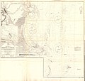
 MURPHY(1883) p185 Map of Wexford.jpg 1,193 × 1,989; 1.02 MB
-
 20231228 142007 editb.jpg 1,168 × 1,632; 546 KB
-
 Admiralty Chart No 1410 Carnsore Point to Braich-y-Pwll, Published 1954.jpg 16,378 × 11,307; 56.88 MB
-
 Admiralty Chart No 1772 Wexford Harbour, Published 1883.jpg 15,968 × 15,202; 56.36 MB
-
 Admiralty Chart No 1787 Ireland Wexford to Wicklow, Published 1875.jpg 8,510 × 15,757; 15.89 MB
-
 Admiralty Chart No 2046 Waterford Harbour, Published 1882.jpg 11,126 × 16,238; 70.55 MB
-
 Admiralty Chart No 2049 Ireland south coast Kinsale to Wexford, Published 1890.jpg 14,836 × 8,251; 13.53 MB
-
 Ard na Slaine park, Wexford - geograph.org.uk - 1249963.jpg 640 × 480; 86 KB
-
 Ballast Bank, Wexford.jpg 4,030 × 2,165; 867 KB
-
 Bringing up the plane.jpg 932 × 670; 154 KB
-
 Castles of Leinster, Killiane, Wexford (1) - geograph.org.uk - 6527438.jpg 1,024 × 806; 1.01 MB
-

-
 Castles of Leinster, Newcastle, Wexford - geograph.org.uk - 6277524.jpg 1,024 × 683; 982 KB
-
 Castles of Leinster, Rathlannon, Wexford (3) - geograph.org.uk - 6277533.jpg 1,024 × 686; 1.32 MB
-
 Civic Guards Wexford, group (27091452219).jpg 2,000 × 1,518; 2.03 MB
-
 Coastal Footpath - geograph.org.uk - 7027720.jpg 800 × 600; 655 KB
-
 College Buildings - geograph.org.uk - 7050303.jpg 800 × 600; 148 KB
-
 College Buildings - geograph.org.uk - 7050305.jpg 600 × 800; 103 KB
-
 Commemorative Plaque - geograph.org.uk - 7027716.jpg 800 × 600; 717 KB
-
 Communications tower in Wexford - geograph.org.uk - 1249825.jpg 480 × 640; 50 KB
-
 Country Lane - geograph.org.uk - 7027709.jpg 800 × 600; 561 KB
-
 Crescent Quay - geograph.org.uk - 4750789.jpg 1,024 × 768; 138 KB
-
 Crescent Quay, Wexford - geograph.org.uk - 1249143.jpg 640 × 480; 68 KB
-
 Crescent Quay, Wexford - geograph.org.uk - 2439271.jpg 1,024 × 659; 170 KB
-
 Crescent Quay, Wexford - geograph.org.uk - 3550339.jpg 800 × 450; 179 KB
-
 Cut stone mark - geograph.org.uk - 4551391.jpg 3,648 × 2,736; 4.24 MB
-
 Dolphin Road, Wexford - geograph.org.uk - 5145935.jpg 2,000 × 1,333; 1.35 MB
-
 Drainage Channel - geograph.org.uk - 7027614.jpg 800 × 600; 601 KB
-

-
 Estuaire du Slainey.jpg 2,816 × 2,112; 616 KB
-
 Evening train passing former Killinick station - geograph.org.uk - 6472254.jpg 1,600 × 1,200; 412 KB
-
 Fence and Lane - geograph.org.uk - 7027704.jpg 800 × 600; 597 KB
-
 Fish market - geograph.org.uk - 4551396.jpg 3,648 × 2,736; 4.18 MB
-
 Fishing boats at Wexford - geograph.org.uk - 4750811.jpg 1,024 × 768; 201 KB
-
 Fleadh advertisement, Wexford credit union.jpg 5,184 × 3,888; 9.63 MB
-
 Foreshore at Crosstown, Wexford - geograph.org.uk - 4635037.jpg 1,024 × 768; 259 KB
-
 Fossils - panoramio.jpg 2,048 × 1,536; 1.3 MB
-
 Good luck^ - geograph.org.uk - 631823.jpg 640 × 480; 81 KB
-
 Horizontal water wheel, Irish National Heritage Museum - geograph.org.uk - 6761816.jpg 2,000 × 1,363; 786 KB
-
 House flag of the Wexford Steamship Company.svg 900 × 600; 3 KB
-
 In the crannog, Irish National Heritage Park - geograph.org.uk - 6761930.jpg 2,000 × 1,348; 1 MB
-
-
 Ireland Victor Grigas 2011-23.jpg 5,184 × 2,802; 3.49 MB
-

-
 John Redmond's family vault, Wexford.jpg 2,560 × 1,920; 1.82 MB
-
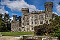
 Johnstown Castle, Murrintown, Co. Wexford (1) - geograph.org.uk - 6275836.jpg 1,024 × 668; 1.13 MB
-
 Johnstown Castle, Murrintown, Co. Wexford (2) - geograph.org.uk - 6275846.jpg 1,024 × 678; 1.06 MB
-
 Johnstown Castle, Murrintown, Co. Wexford (3) - geograph.org.uk - 6275853.jpg 1,024 × 694; 1,015 KB
-
 Johnstown Castle, Murrintown, Co. Wexford (4) - geograph.org.uk - 6275860.jpg 1,024 × 685; 913 KB
-
 Keysers Lane, Wexford.jpg 5,184 × 3,888; 10.07 MB
-
 Lane and Buildings - geograph.org.uk - 7027587.jpg 800 × 600; 569 KB
-
 Lone Walker - geograph.org.uk - 7027729.jpg 800 × 600; 440 KB
-

-
 Major William Redmond bust, Wexford city.jpg 1,472 × 1,815; 251 KB
-
 Manuscript in the Irish National Heritage Park - geograph.org.uk - 6761802.jpg 2,000 × 1,352; 954 KB
-
 Mariner memorial, Wexford.jpg 3,888 × 5,184; 9.76 MB
-
 Muddy Lane - geograph.org.uk - 7027593.jpg 800 × 600; 604 KB
-
 Neolithic farmstead, Irish National Heritage Park - geograph.org.uk - 6761924.jpg 2,000 × 1,338; 1.11 MB
-
 North Main Street, Wexford, 1980 - geograph.org.uk - 6878171.jpg 1,024 × 683; 198 KB
-
 Ordnance Survey Ireland Cut Bench Mark - geograph.org.uk - 4530527.jpg 3,648 × 2,736; 4.12 MB
-
 Ordnance Survey Ireland Cut Bench Mark - geograph.org.uk - 4530533.jpg 3,648 × 2,736; 4.14 MB
-
 Out of town retail units, Wexford - geograph.org.uk - 1275548.jpg 640 × 480; 59 KB
-
 Parapet and Channel - geograph.org.uk - 7027582.jpg 800 × 600; 346 KB
-
 Pierce Engineering sculpture, Wexford.jpg 3,888 × 5,184; 9.2 MB
-
 Plaque in Wexford 2.jpg 4,000 × 3,000; 3.53 MB
-
 Pond Reflections - geograph.org.uk - 7027578.jpg 800 × 600; 666 KB
-
 Posers in the sunny South East (35380747664).jpg 2,000 × 1,294; 1.21 MB
-
 Public telephones - geograph.org.uk - 4530519.jpg 3,648 × 2,736; 3.93 MB
-
 Puffin from Saltee.jpg 4,000 × 6,000; 8.22 MB
-
 Puffins.jpg 4,000 × 6,000; 8.24 MB
-
 Pump Station - geograph.org.uk - 7027619.jpg 800 × 600; 440 KB
-
 Rail Line - geograph.org.uk - 7027584.jpg 800 × 600; 572 KB
-
 Railway Bridge near Crescent Quay, Wexford - geograph.org.uk - 2439231.jpg 1,024 × 675; 153 KB
-
 Railway Crossing - geograph.org.uk - 4551394.jpg 3,648 × 2,736; 4.19 MB
-
 Redmond Place (R730), Wexford - geograph.org.uk - 6572888.jpg 542 × 800; 71 KB
-
 Reeds and Loch - geograph.org.uk - 7027611.jpg 800 × 600; 683 KB
-
 Reservoir above Wexford - geograph.org.uk - 1240513.jpg 640 × 480; 67 KB
-
 Rileybaugusfiddlesticks.jpg 1,024 × 768; 365 KB
-
 Rocklands Lane - geograph.org.uk - 5120400.jpg 2,000 × 1,333; 1.47 MB
-
 Rocklands Service Station - geograph.org.uk - 1444412.jpg 640 × 480; 43 KB
-
 Rolls-Royce, but where? Ballyboggan, that's where! (8630009253).jpg 2,000 × 1,524; 1.66 MB
-
 Rosslare bound train at Wexford - geograph.org.uk - 4579110.jpg 1,024 × 768; 132 KB
-
 Saltee Island birds.jpg 4,000 × 6,000; 7.88 MB
-
 Sea View - geograph.org.uk - 7027598.jpg 800 × 600; 434 KB
-
 Selskar Young Irelands plaque, Wexford - geograph.org.uk - 3646189.jpg 1,870 × 1,405; 429 KB
-

-
 Snow Princess (6149055257).jpg 639 × 827; 187 KB
-
 Snowy Ireland - panoramio.jpg 2,376 × 1,584; 511 KB
-
 Snowy Rock - panoramio.jpg 2,376 × 1,584; 621 KB
-
 South Main Street, Wexford - geograph.org.uk - 6572859.jpg 540 × 800; 64 KB
-
 South Main Street, Wexford - geograph.org.uk - 6572863.jpg 552 × 800; 72 KB
-
 St Iberius' church, Wexford 2.jpg 3,000 × 4,000; 2.86 MB
-
 St Iberius' church, Wexford.jpg 4,000 × 3,000; 3.9 MB
-

-
 Sunlit Reeds - geograph.org.uk - 7027607.jpg 800 × 600; 515 KB
-
 Sunlit Walk - geograph.org.uk - 7027731.jpg 800 × 600; 755 KB
-
 The Faythe - geograph.org.uk - 2485669.jpg 640 × 480; 101 KB
-
 The Faythe, Wexford - geograph.org.uk - 5145929.jpg 2,000 × 1,333; 1.11 MB
-
 The Quay, Wexford, Co. Wexford (35700125121).jpg 2,000 × 1,318; 1.29 MB
-
 The Raven - geograph.org.uk - 7027724.jpg 800 × 600; 385 KB
-
 The Rosslare Hotel (15062501087).jpg 2,500 × 1,601; 3.05 MB
-
 Thomas D'Arcy McGee memorial, Wexford.jpg 4,000 × 3,000; 5.96 MB
-
 Tiny offshore island - geograph.org.uk - 4750807.jpg 1,024 × 768; 103 KB
-
 Tomb of James Roche, Wexford.jpg 4,000 × 3,000; 6.79 MB
-
 Tree - panoramio (26).jpg 1,536 × 2,048; 1.1 MB
-
 Urine deflector Selskar Avenue 1.jpg 4,032 × 2,016; 2.36 MB
-
 Urine deflector Selskar Avenue 2.jpg 4,032 × 2,016; 3.69 MB
-
 View from JFK Park - panoramio - Marek Czerwinski.jpg 1,893 × 1,248; 422 KB
-
 View from JFK Park - panoramio.jpg 2,352 × 1,568; 1.22 MB
-
 View from Wexford town June 2023.jpg 1,600 × 900; 102 KB
-

-
 W.R. Hamilton ^ Son - geograph.org.uk - 5092772.jpg 5,184 × 3,456; 4.15 MB
-
 Wexford - 1982 - geograph.org.uk - 2779169.jpg 2,272 × 1,520; 523 KB
-
 Wexford - 1982 - geograph.org.uk - 2779175.jpg 2,272 × 1,520; 460 KB
-
 Wexford - 1982 - geograph.org.uk - 2779186.jpg 2,272 × 1,520; 395 KB
-
 Wexford - 1982 - geograph.org.uk - 2779200.jpg 1,520 × 2,272; 466 KB
-
 Wexford - Crescent Quay - geograph.org.uk - 4635018.jpg 1,024 × 768; 141 KB
-
 Wexford - geograph.org.uk - 403260.jpg 640 × 459; 66 KB
-
 Wexford - Paul Quay - geograph.org.uk - 4635041.jpg 1,024 × 768; 165 KB
-
 Wexford - S Main St - geograph.org.uk - 4635002.jpg 1,024 × 768; 173 KB
-
 Wexford - S Main St, The Sky ^ The Ground Bar - geograph.org.uk - 4635013.jpg 1,024 × 768; 178 KB
-
 Wexford - S Main St. - geograph.org.uk - 4635009.jpg 1,024 × 768; 153 KB
-
 Wexford 1800.jpg 304 × 193; 19 KB
-
 Wexford Bridge, 1980 - geograph.org.uk - 6878244.jpg 1,600 × 1,067; 427 KB
-
 Wexford Harbour - geograph.org.uk - 4579097.jpg 1,024 × 768; 126 KB
-
 Wexford Harbour - geograph.org.uk - 4750397.jpg 1,024 × 768; 162 KB
-
 Wexford Harbour - geograph.org.uk - 4784224.jpg 1,024 × 768; 130 KB
-
 Wexford Harbour - geograph.org.uk - 5221583.jpg 2,240 × 1,488; 1.52 MB
-
 Wexford Harbour Improvement plaque.jpg 4,320 × 3,240; 6.85 MB
-
 Wexford Harbour with US Curtiss H-16.jpg 789 × 607; 194 KB
-
 Wexford Harbour, 1993 - geograph.org.uk - 4451264.jpg 2,383 × 1,315; 2.83 MB
-
 Wexford Harbour, 2021-06-01.jpg 4,032 × 3,024; 3.52 MB
-
 Wexford in 1985 - geograph.org.uk - 2829080.jpg 945 × 670; 134 KB
-
 Wexford Opera House rises above the old skyline.jpg 3,327 × 3,035; 2.84 MB
-
 Wexford railway line - geograph.org.uk - 4530505.jpg 3,648 × 2,736; 4.21 MB
-
 Wexford riverside and fishing boats - geograph.org.uk - 4629985.jpg 1,600 × 1,200; 303 KB
-
 Wexford Slobs bird reserve.jpg 3,240 × 4,320; 6.76 MB
-
 Wexford, Pikeman statue at Bullring, 1993 - geograph.org.uk - 4451333.jpg 2,392 × 1,548; 3.63 MB
-
 Wexford- aerial 2015 (geograph 4689373).jpg 427 × 640; 58 KB
-
 Wexford.jpg 5,164 × 1,556; 5.74 MB
-
 Winter 2010 - panoramio (5).jpg 2,226 × 1,023; 329 KB
-


_p185_Map_of_Wexford.jpg)


_-_geograph.org.uk_-_6527438.jpg)
_-_geograph.org.uk_-_6527441.jpg)

_-_geograph.org.uk_-_6277533.jpg)
.jpg)


,_Irish_National_Heritage_Centre_-_geograph.org.uk_-_6761797.jpg)


_-_geograph.org.uk_-_6275836.jpg)
_-_geograph.org.uk_-_6275846.jpg)
_-_geograph.org.uk_-_6275853.jpg)
_-_geograph.org.uk_-_6275860.jpg)


,_Irish_National_Heritage_Centre_-_geograph.org.uk_-_6761792.jpg)


.jpg)


,_Wexford_-_geograph.org.uk_-_6572888.jpg)


.jpg)


.jpg)


.jpg)

.jpg)


.jpg)


.jpg)
.jpg)
