Category:Wetlands in Midlothian
Jump to navigation
Jump to search
Council areas (municipalities) of Scotland: Aberdeen · Aberdeenshire · Angus · Argyll and Bute · Clackmannanshire · Dumfries and Galloway · East Ayrshire · East Dunbartonshire · East Lothian · East Renfrewshire · Falkirk · Fife · Highland · Inverclyde · Midlothian · Moray · North Lanarkshire · Perth and Kinross · Renfrewshire · Scottish Borders · South Ayrshire · South Lanarkshire · West Dunbartonshire · West Lothian
Subcategories
This category has the following 2 subcategories, out of 2 total.
A
- Auchencorth Moss (27 F)
G
- Gowkley Moss (5 F)
Media in category "Wetlands in Midlothian"
The following 15 files are in this category, out of 15 total.
-
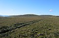
 Beneath the Moorfoots. - geograph.org.uk - 178670.jpg 640 × 480; 85 KB
-
 Blackhope Scar. - geograph.org.uk - 115577.jpg 640 × 480; 112 KB
-
 Bush Estate - Edinburgh Technopole - geograph.org.uk - 583172.jpg 640 × 480; 80 KB
-
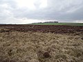
 Farmland near Cuiken Farm - geograph.org.uk - 1225508.jpg 640 × 480; 100 KB
-
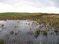 Flooded bog, Walstone Muir. - geograph.org.uk - 74969.jpg 640 × 480; 73 KB
-
 Kitchen Moss - geograph.org.uk - 53953.jpg 640 × 421; 61 KB
-
 Leat, Gladhouse. - geograph.org.uk - 108251.jpg 640 × 480; 38 KB
-
 Marsh, Castlelaw - geograph.org.uk - 1735805.jpg 640 × 359; 79 KB
-
 Moss, Herbertshaw - geograph.org.uk - 158097.jpg 640 × 480; 85 KB
-
 Permanent wetland near Temple farm - geograph.org.uk - 834043.jpg 640 × 480; 87 KB
-
 Rushy dip near Howgate - geograph.org.uk - 906594.jpg 640 × 426; 66 KB
-
 Wetland below Birky Bank - geograph.org.uk - 1557825.jpg 640 × 480; 99 KB
-
 Wetland, Halkerston Glen - geograph.org.uk - 1356696.jpg 640 × 480; 100 KB
-
 Wetlands, Backhill - geograph.org.uk - 19707.jpg 640 × 434; 67 KB
-
 Whitelaw. - geograph.org.uk - 111862.jpg 640 × 480; 63 KB


