Category:Westgate Road, Newcastle upon Tyne
Jump to navigation
Jump to search
Subcategories
This category has the following 19 subcategories, out of 19 total.
B
E
- Ever Changing (sculpture) (7 F)
M
- Milecastle 4 (1 F)
N
O
S
- Science Central, Newcastle upon Tyne (1 P, 8 F)
T
- Tyne Theatre (19 F)
W
Media in category "Westgate Road, Newcastle upon Tyne"
The following 46 files are in this category, out of 46 total.
-
 'Sausage Emporium', Westgate Road - geograph.org.uk - 4597349.jpg 1,024 × 768; 219 KB
-

-

-
-
 Arriva North East bus 4660 (NK07 FZC), 4 September 2013.jpg 3,648 × 2,736; 2.53 MB
-
 Baron House, Westgate Road (geograph 1693685).jpg 3,000 × 1,642; 1.1 MB
-
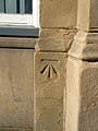
 Benchmark on 209 Westgate Road.jpg 683 × 1,024; 260 KB
-
 Benchmark, 2 Westgate Road (geograph 2849857).jpg 480 × 640; 99 KB
-
 Building of new Sleeperz Hotel, Westgate Road (geograph 2471875).jpg 1,024 × 768; 217 KB
-
 Collingwood Street and Westgate Road - geograph.org.uk - 1111344.jpg 640 × 480; 79 KB
-
 Cooper's Motor Mart Building, Westgate Road, 29 November 2010.jpg 1,024 × 815; 201 KB
-
 Corner of Clayton Street and Westgate road, Newcastle - geograph.org.uk - 1708057.jpg 1,600 × 1,200; 336 KB
-
 Corner of Westgate Road and Collingwood Street (geograph 2280514).jpg 3,000 × 1,726; 1.08 MB
-
 Corner of Westgate Road and Collingwood Street - geograph.org.uk - 1690291.jpg 4,000 × 2,249; 1.65 MB
-
 Corner of Westgate Road and Cross Street in Newcastle.jpg 3,648 × 2,736; 2.16 MB
-
 Courtyard off Westgate Road, NE1 (geograph 2975234).jpg 480 × 640; 110 KB
-
 Cross House, Westgate Road (geograph 1694226).jpg 768 × 1,024; 171 KB
-
 Former British Rail Parcel Offices, Westgate Road (geograph 1833258).jpg 1,024 × 768; 227 KB
-
 Former Hertz Rent A Car Building.jpg 2,848 × 4,272; 5.67 MB
-
 Former Salvation Army City Temple, Westgate Road - geograph.org.uk - 1746972.jpg 873 × 1,024; 199 KB
-
 Georgian Building, Westgate Road (geograph 2158991).jpg 1,024 × 768; 197 KB
-

-
 Junction of Westgate Road and Fenkle Street (geograph 1694184).jpg 4,000 × 1,795; 1.35 MB
-
 Literary And Philiosophical Society Of Newcastle (222427057).jpeg 2,048 × 1,365; 1.2 MB
-
 NEW BEST KEBAB - geograph.org.uk - 764758.jpg 640 × 427; 63 KB
-
 Newcastle Arts Centre, 67 Westgate Road, NE1 (geograph 4502388).jpg 640 × 480; 94 KB
-
 Newcastle Upon Tyne - Railway Arches - geograph.org.uk - 763336.jpg 640 × 480; 69 KB
-
 Newcastle Upon Tyne - Street Scene - geograph.org.uk - 771722.jpg 640 × 480; 77 KB
-
 Nexus House, Newcastle upon Tyne, 4 September 2013.jpg 3,648 × 2,736; 2.65 MB
-

-
 Tactical on westgate.jpg 1,656 × 2,208; 371 KB
-
 The Bodega, Westgate Road, Newcastle - geograph.org.uk - 1710011.jpg 1,024 × 768; 177 KB
-

-
 The Stamp Exchange, Westgate Road (geograph 2180131).jpg 1,024 × 631; 215 KB
-
 The Star Inn - geograph.org.uk - 659309.jpg 640 × 418; 82 KB
-
 Tyne Theatre 1903 - panoramio.jpg 1,210 × 772; 652 KB
-
 Westgate and Grainger - geograph.org.uk - 1199130.jpg 640 × 480; 102 KB
-
 Westgate Hill - geograph.org.uk - 764770.jpg 387 × 640; 90 KB
-
 Westgate Road - geograph.org.uk - 1694114.jpg 3,000 × 1,244; 871 KB
-
 Westgate Road Baptist Church - geograph.org.uk - 2388025.jpg 3,467 × 2,263; 1.5 MB
-
 Westgate Road from junction with Fenkle Street (geograph 1694242).jpg 1,024 × 768; 250 KB
-
 Westgate Road, 16 February 2012.jpg 1,024 × 769; 250 KB
-
 Westgate Road, east of Central Station (geograph 1693828).jpg 768 × 1,024; 169 KB
-
 Westgate Road, east of Clayton Street (geograph 1694074).jpg 1,024 × 768; 181 KB
-

-
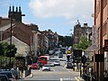
 Westgate Road, Newcastle upon Tyne, 4 September 2013.jpg 2,736 × 3,648; 2.51 MB


_Hadrian%27s_Wall_-_Westgate_Road_(2)_-_geograph.org.uk_-_911792.jpg)
_Hadrian%27s_Wall_-_Westgate_Road_-_geograph.org.uk_-_911786.jpg)
,_4_September_2013.jpg)
.jpg)

.jpg)
.jpg)


.jpg)


.jpg)
.jpg)
.jpg)


.jpg)

.jpg)
.jpeg)

.jpg)


.jpg)
.jpg)


.jpg)

.jpg)
.jpg)
.jpg)
