Category:Western Australian Mulga Shrublands Ecoregion
Jump to navigation
Jump to search
terrestrial ecoregion in Western Australia   | |||||
| Upload media | |||||
| Instance of |
| ||||
|---|---|---|---|---|---|
| Location | Australasian realm, South Australia, AUS | ||||
| Has part(s) |
| ||||
| Area |
| ||||
| official website | |||||
 | |||||
The Western Australian Mulga Shrublands Ecoregion is a designated ecoregion by WWF and One Earth. It is classified as a Deserts & Xeric Shrublands Biome. It is one of eight ecoregions in the Greater Australian Interior Desert & Shrublands Bioregion.
Subcategories
This category has the following 7 subcategories, out of 7 total.
Media in category "Western Australian Mulga Shrublands Ecoregion"
The following 19 files are in this category, out of 19 total.
-
 Big Bell Ghost town ruins.jpg 3,000 × 2,000; 4.57 MB
-
 CSIRO ScienceImage 1633 Agnew Nickel Mine Site.jpg 2,657 × 1,787; 1.68 MB
-
 KAL 010 Octopus Bore track buffer 7 Lorna Glen V-2015.jpg 1,958 × 1,469; 1.19 MB
-
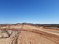
 Looking south from Emu Hill Lookout, July 2020.jpg 4,608 × 3,456; 4.51 MB
-
 Middle of nowhere - panoramio.jpg 1,600 × 1,200; 912 KB
-
 Mount Sandiman, Upper Gascoyne, Western Australia, July 2020.jpg 4,608 × 3,456; 5.46 MB
-
 Mt Magnet - 32.png 1,650 × 1,072; 3.16 MB
-
 MT Magnet granite - 31.png 1,655 × 1,088; 2.69 MB
-
 Mt Magnet, granite - 35.png 1,583 × 1,062; 2.73 MB
-
 Paynes Find 030923 Gnangarra-10.jpg 4,928 × 3,264; 15.26 MB
-
 Paynes Find 030923 Gnangarra-12.jpg 3,264 × 4,928; 15.49 MB
-
 Paynes Find 030923 Gnangarra-13.jpg 3,264 × 4,928; 17.41 MB
-
 Paynes Find tree.jpg 720 × 960; 196 KB
-
 Upper Gascoyne landscape, July 2020 01.jpg 4,608 × 3,456; 5.46 MB
-
 Upper Gascoyne landscape, July 2020 02.jpg 4,608 × 3,456; 5.25 MB
-
 Upper Gascoyne landscape, July 2020 03.jpg 4,608 × 2,592; 3.75 MB
-
 Upper Gascoyne landscape, July 2020 04.jpg 4,608 × 2,592; 4.19 MB
-
 WALGA Rock 01.jpg 1,440 × 1,440; 714 KB
-
 WALGA Rock 02.jpg 1,440 × 1,440; 684 KB


