Category:Welton (civil parish), East Riding of Yorkshire
Jump to navigation
Jump to search
English: Welton is a civil parish in the East Riding of Yorkshire, England. It is situated approximately 1 mile (1.6 km) east of the town of Brough on the north side of the A63 road to Kingston upon Hull.
Subcategories
This category has the following 9 subcategories, out of 9 total.
Media in category "Welton (civil parish), East Riding of Yorkshire"
The following 27 files are in this category, out of 27 total.
-
 Driftwood and boulders - geograph.org.uk - 714609.jpg 640 × 428; 182 KB
-

-
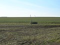 Farmland near Welton Wold Farm - geograph.org.uk - 1734770.jpg 800 × 600; 126 KB
-
 Here Comes The Rain - geograph.org.uk - 247511.jpg 640 × 480; 97 KB
-
 Industry on Gibson Lane - geograph.org.uk - 1462095.jpg 640 × 480; 55 KB
-
 Low Field Lane Level Crossing - geograph.org.uk - 900207.jpg 640 × 478; 137 KB
-
 Minor Road, Elloughton Wold - geograph.org.uk - 1604639.jpg 640 × 480; 71 KB
-
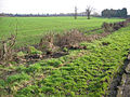
 Near Bow Plantation, Welton - geograph.org.uk - 668036.jpg 640 × 480; 181 KB
-
 Near Low Field Farm - geograph.org.uk - 528832.jpg 640 × 481; 108 KB
-
 Near Low Field Farm - geograph.org.uk - 530023.jpg 640 × 481; 124 KB
-
 Oak Wood - geograph.org.uk - 130182.jpg 640 × 480; 101 KB
-
 On the 'Beverley 20' Path - geograph.org.uk - 565022.jpg 640 × 480; 103 KB
-
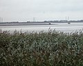
 River Humber - geograph.org.uk - 1604709.jpg 640 × 480; 98 KB
-
 South of Welton - geograph.org.uk - 110514.jpg 640 × 480; 188 KB
-
 Stuck fast - geograph.org.uk - 653287.jpg 640 × 512; 64 KB
-
 Swanland Dale - geograph.org.uk - 1733624.jpg 800 × 600; 112 KB
-
 The Lower Whitton Buoy - geograph.org.uk - 755328.jpg 640 × 480; 76 KB
-
 The Trans-Pennine Trail - geograph.org.uk - 688356.jpg 640 × 480; 85 KB
-
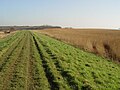
 Track to Welton Common - geograph.org.uk - 755341.jpg 480 × 640; 109 KB
-

-
 Trans Pennine Trail - geograph.org.uk - 1604717.jpg 640 × 480; 47 KB
-
 Welton Ings - geograph.org.uk - 446749.jpg 640 × 468; 90 KB
-
 Welton Top - geograph.org.uk - 829542.jpg 640 × 480; 142 KB
-
 Welton Wold Farm - geograph.org.uk - 579774.jpg 640 × 480; 94 KB
-
 Welton, East Riding of Yorkshire UK parish locator map.svg 1,425 × 1,107; 1.68 MB
-
 West Clough - geograph.org.uk - 444234.jpg 479 × 640; 104 KB
-
 West Clough, near Welton, E Yorkshire - geograph.org.uk - 688379.jpg 551 × 640; 88 KB


_-_geograph.org.uk_-_1734776.jpg)


