Category:Wellow, Somerset
Jump to navigation
Jump to search
English: Wellow is a village and civil parish in Somerset, England, about south of Bath. The parish has a population of 511.
village and civil parish in Somerset, England  | |||||
| Upload media | |||||
| Instance of | |||||
|---|---|---|---|---|---|
| Location | Bath and North East Somerset, Somerset, South West England, England | ||||
| Population |
| ||||
 | |||||
Subcategories
This category has the following 10 subcategories, out of 10 total.
F
- Fox and Badger, Wellow (6 F)
J
- St Julian's church, Wellow (40 F)
M
- Midford Viaduct (B&NSR) (11 F)
- Wellow Mosaics (3 F)
S
- St Julian's Church School (4 F)
T
- Twinhoe (11 F)
W
- Wellow packhorse bridge (6 F)
- Wellow railway station (5 F)
Media in category "Wellow, Somerset"
The following 200 files are in this category, out of 266 total.
(previous page) (next page)-
 A bantam at the heart of the village - geograph.org.uk - 3864708.jpg 1,704 × 2,304; 1.58 MB
-
 A boat under cover - geograph.org.uk - 5154852.jpg 2,304 × 1,704; 1.73 MB
-
 A bridge to the sky - geograph.org.uk - 3862303.jpg 1,704 × 2,304; 2.26 MB
-
 A carpet of Spring flowers - geograph.org.uk - 3863892.jpg 2,304 × 1,704; 1.78 MB
-
 A door in need - geograph.org.uk - 3860841.jpg 2,304 × 1,704; 1.59 MB
-
 A space for St Julian's waters - geograph.org.uk - 5958378.jpg 1,704 × 2,304; 1.58 MB
-
 A stick to make it good - geograph.org.uk - 5953904.jpg 2,304 × 1,704; 1.77 MB
-
 A track off Ford Road - geograph.org.uk - 5958390.jpg 2,304 × 1,704; 1.64 MB
-
 Above St Julian's Well - geograph.org.uk - 5958398.jpg 2,304 × 1,704; 1.58 MB
-
 Across the Cam Brook valley - geograph.org.uk - 4847367.jpg 1,920 × 1,208; 798 KB
-
 Across the Wellow Brook - geograph.org.uk - 5954058.jpg 2,304 × 1,704; 1.63 MB
-
 An engine driver's view - geograph.org.uk - 5214663.jpg 4,896 × 3,264; 6.52 MB
-
 And Why Not^ - geograph.org.uk - 5958488.jpg 1,704 × 2,304; 1.6 MB
-
 Any which way you like - geograph.org.uk - 3860877.jpg 2,304 × 1,704; 1.58 MB
-
 Baggridge Byway - geograph.org.uk - 2064672.jpg 3,648 × 2,736; 3.59 MB
-
 Baggridge Ford - geograph.org.uk - 4972068.jpg 3,000 × 1,684; 5.44 MB
-
 Baggridge Hill - geograph.org.uk - 4897589.jpg 2,048 × 2,928; 1.98 MB
-
 Baggridge Hill - geograph.org.uk - 4897705.jpg 1,920 × 2,318; 1.23 MB
-
 Baggridge Hill - geograph.org.uk - 4897717.jpg 1,920 × 1,161; 878 KB
-
 Barn on Brimscombe Lane - geograph.org.uk - 682813.jpg 640 × 447; 135 KB
-
 Bath Hill - geograph.org.uk - 6544695.jpg 1,200 × 800; 969 KB
-
 Battered benchmark on the bridge - geograph.org.uk - 5957900.jpg 2,304 × 1,704; 1.69 MB
-
 Beginning of the bridleway - geograph.org.uk - 3278494.jpg 3,264 × 2,448; 1.68 MB
-
 Benchmark on Bull's Hill - geograph.org.uk - 5957904.jpg 2,304 × 1,704; 1.63 MB
-
 Benchmark on the old Granary - geograph.org.uk - 3862284.jpg 2,304 × 1,704; 1.78 MB
-
 Bend, Littleton Lane - geograph.org.uk - 4898092.jpg 1,920 × 1,214; 941 KB
-
 Bridge benchmark - geograph.org.uk - 3862306.jpg 2,304 × 1,704; 1.68 MB
-
 Bridge over byway, Lower Twinhoe - geograph.org.uk - 4845614.jpg 2,361 × 1,762; 1,015 KB
-
 Bridge over byway, Lower Twinhoe - geograph.org.uk - 4899081.jpg 1,920 × 1,144; 957 KB
-
 Bridge over Cam Brook - geograph.org.uk - 4899488.jpg 1,920 × 1,280; 911 KB
-
 Bridge over the Byway - geograph.org.uk - 1983101.jpg 3,648 × 2,736; 4.61 MB
-
 Bridge over the St Julian's waters - geograph.org.uk - 5957898.jpg 1,704 × 2,304; 1.52 MB
-
 Bridge over the Wellow Brook - panoramio.jpg 2,048 × 1,536; 850 KB
-
 Bridges at Midford - geograph.org.uk - 6091044.jpg 1,024 × 700; 202 KB
-
 Bridleway off Norton Lane - geograph.org.uk - 363214.jpg 640 × 480; 72 KB
-
 Bridleway to Stony Littleton - geograph.org.uk - 1288692.jpg 640 × 481; 217 KB
-
 Bridleway to Stony Littleton - geograph.org.uk - 1398974.jpg 640 × 480; 147 KB
-
 Bridleway to the Cam Brook valley - geograph.org.uk - 4899027.jpg 1,920 × 1,180; 736 KB
-
 Brinscombe Lane - geograph.org.uk - 4898436.jpg 3,072 × 2,048; 1.48 MB
-
 Bull's Hill - geograph.org.uk - 5957901.jpg 2,304 × 1,704; 1.57 MB
-
 Business hasn't been good - geograph.org.uk - 3860835.jpg 1,704 × 2,304; 1.72 MB
-
 By White Ox Mead Lane - geograph.org.uk - 4899933.jpg 1,920 × 1,149; 794 KB
-
 Byway east of Wellow - geograph.org.uk - 1983052.jpg 3,648 × 2,736; 3.16 MB
-
 Byway hill up to the railway bridge - geograph.org.uk - 1983069.jpg 3,648 × 2,736; 4.33 MB
-
 Byway near Lower Baggridge Farm - geograph.org.uk - 4897487.jpg 1,920 × 1,123; 790 KB
-
 Byway north of Wellow - geograph.org.uk - 1804694.jpg 2,592 × 1,944; 1.51 MB
-
 Byway through Hankley Wood - geograph.org.uk - 1983062.jpg 3,648 × 2,736; 5.12 MB
-
 Byway to the Norton Brook - geograph.org.uk - 4897475.jpg 1,920 × 2,880; 1.87 MB
-
 Byway to Upper Baggridge Farm - geograph.org.uk - 2064690.jpg 3,648 × 2,736; 4.19 MB
-
 Byway, Baggridge - geograph.org.uk - 4839632.jpg 1,920 × 1,280; 798 KB
-
 Byway, Baggridge - geograph.org.uk - 4897496.jpg 1,920 × 1,280; 974 KB
-
 Byway, Lower Twinhoe - geograph.org.uk - 4845396.jpg 1,528 × 1,826; 635 KB
-
 Cam Brook - geograph.org.uk - 4898959.jpg 1,920 × 2,880; 1.71 MB
-
 Cam Brook - geograph.org.uk - 4898982.jpg 1,920 × 2,880; 1.87 MB
-
 Cam Brook - geograph.org.uk - 6544648.jpg 1,200 × 807; 1.43 MB
-
 Cast Iron Signpost - geograph.org.uk - 1804707.jpg 2,592 × 1,944; 1.53 MB
-
 Cemetery gates - geograph.org.uk - 359307.jpg 640 × 480; 113 KB
-
 Chapel marked - geograph.org.uk - 3862324.jpg 1,704 × 2,304; 1.82 MB
-
 Combe Hay (1) - geograph.org.uk - 4846575.jpg 3,068 × 1,519; 924 KB
-
 Combe Hay (2) - geograph.org.uk - 4847341.jpg 2,048 × 1,536; 692 KB
-
 Combe Hay Manor - geograph.org.uk - 6544692.jpg 1,200 × 800; 1.1 MB
-
 Converted barn, Upper Baggridge Farm - geograph.org.uk - 4897581.jpg 1,920 × 1,148; 670 KB
-
 Course of former railway, Littleton Lane - geograph.org.uk - 4898038.jpg 1,920 × 1,358; 778 KB
-
 Crop by White Ox Mead Lane - geograph.org.uk - 4899938.jpg 1,920 × 1,280; 788 KB
-
 Cycle route 24 - geograph.org.uk - 4966481.jpg 640 × 479; 195 KB
-
 Cyclist coming up the hill on route 24 - geograph.org.uk - 4966435.jpg 640 × 479; 224 KB
-
 Deeper than it looks - geograph.org.uk - 3863855.jpg 2,304 × 1,704; 1.65 MB
-
 Disused and derelict - geograph.org.uk - 3864689.jpg 2,304 × 1,704; 1.6 MB
-
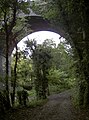
 Disused Railway Bridge - geograph.org.uk - 1190419.jpg 479 × 640; 124 KB
-
 Droplet on a Blade of Grass - panoramio.jpg 3,872 × 2,592; 2.39 MB
-
 East of Wellow - geograph.org.uk - 644699.jpg 603 × 640; 89 KB
-
 Entrance to Stoney Littleton Long Barrow - geograph.org.uk - 6195267.jpg 3,648 × 2,736; 3.11 MB
-
 Farmland near Wellow - geograph.org.uk - 4897683.jpg 1,920 × 1,174; 675 KB
-
 Farmland north of Twinhoe - geograph.org.uk - 4899023.jpg 1,920 × 1,280; 1.01 MB
-
 Farmland, Stoney Littleton - geograph.org.uk - 4844921.jpg 1,920 × 1,247; 617 KB
-
 Fast flow - geograph.org.uk - 3863862.jpg 1,704 × 2,304; 1.62 MB
-
 Field above Norton Brook - geograph.org.uk - 4897465.jpg 1,920 × 1,128; 750 KB
-
 Field by White Ox Mead Lane - geograph.org.uk - 4945883.jpg 3,069 × 1,783; 1.53 MB
-
 Field in valley by White Ox Mead Lane - geograph.org.uk - 4899930.jpg 3,072 × 2,048; 1.14 MB
-
 Field near Double Hill - geograph.org.uk - 4898492.jpg 1,920 × 1,280; 1.06 MB
-
 Fields by Underdown Wood - geograph.org.uk - 4846568.jpg 1,920 × 1,043; 457 KB
-
 Fields in the Wellow Brook valley - geograph.org.uk - 4845637.jpg 1,920 × 1,218; 919 KB
-
 Fields near Wellow - geograph.org.uk - 4846063.jpg 1,920 × 1,296; 878 KB
-
 First one in Wellow - geograph.org.uk - 5958293.jpg 2,304 × 1,704; 1.62 MB
-
 Footman's Cottage - geograph.org.uk - 5953749.jpg 1,704 × 2,304; 1.68 MB
-
 Footpath to the Cam Brook valley - geograph.org.uk - 4839901.jpg 1,920 × 1,280; 951 KB
-
 Footpath to the Cam Brook valley - geograph.org.uk - 4847541.jpg 3,072 × 2,048; 1.32 MB
-
 Ford, Norton Brook - geograph.org.uk - 4839353.jpg 1,920 × 1,280; 979 KB
-
 Ford, Norton Brook - geograph.org.uk - 4897388.jpg 1,920 × 1,280; 1.15 MB
-
 Ford, Wellow - geograph.org.uk - 4897777.jpg 1,920 × 1,280; 1.08 MB
-
 Ford, Wellow - geograph.org.uk - 4897876.jpg 1,920 × 1,280; 846 KB
-
 Ford, Wellow - geograph.org.uk - 4897889.jpg 1,920 × 1,280; 1,001 KB
-
 Ford, Wellow - geograph.org.uk - 4897898.jpg 1,920 × 1,280; 961 KB
-
 Former occupation bridge at Wellow - geograph.org.uk - 5214755.jpg 4,896 × 3,264; 6.83 MB
-
 Former railway bridge, Littleton Lane - geograph.org.uk - 4898018.jpg 2,997 × 1,895; 1.22 MB
-

-
 Frosty field at Middle Twinhoe - geograph.org.uk - 4899050.jpg 1,920 × 1,180; 681 KB
-
 Frosty field by Hankley Wood - geograph.org.uk - 4899234.jpg 3,072 × 2,048; 1.3 MB
-
 Gate with a view to Combe Hay - geograph.org.uk - 4847396.jpg 1,920 × 1,335; 982 KB
-
 Gates by White Ox Mead Lane - geograph.org.uk - 4899934.jpg 1,920 × 1,290; 622 KB
-
 Gently flows the brook - geograph.org.uk - 5802504.jpg 4,320 × 3,240; 5.33 MB
-
 Good pasture at Haywood Farm - geograph.org.uk - 777432.jpg 640 × 427; 71 KB
-
 Hatches closed - geograph.org.uk - 3864692.jpg 2,304 × 1,704; 1.64 MB
-
 Have you seen this cat^ - geograph.org.uk - 3860889.jpg 2,304 × 1,704; 1.76 MB
-
 High Street - geograph.org.uk - 6544699.jpg 1,200 × 807; 1.03 MB
-
 High Street cottages - geograph.org.uk - 5958444.jpg 1,704 × 2,304; 1.68 MB
-
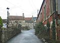
 High Street, Wellow - geograph.org.uk - 4897975.jpg 1,920 × 1,126; 589 KB
-
 High Street, Wellow - geograph.org.uk - 4897990.jpg 1,920 × 1,152; 598 KB
-
 Hillside by White Ox Mead Farm - geograph.org.uk - 4899979.jpg 1,920 × 1,280; 665 KB
-
 Hillside, Double Hill - geograph.org.uk - 4839831.jpg 1,920 × 1,280; 561 KB
-
 Hinton Hill Wellow.jpg 640 × 479; 82 KB
-
 Horse lorry near the riding school - geograph.org.uk - 4966477.jpg 640 × 479; 127 KB
-
 House, White Ox Mead - geograph.org.uk - 4899946.jpg 1,920 × 1,280; 698 KB
-
 Houses in Wellow - geograph.org.uk - 4966441.jpg 640 × 479; 166 KB
-
 Houses, Wellow - geograph.org.uk - 4846498.jpg 1,920 × 1,233; 922 KB
-
 I'll stay dry - geograph.org.uk - 3863863.jpg 2,304 × 1,704; 1.64 MB
-
 In need of some support - geograph.org.uk - 6509766.jpg 3,296 × 2,472; 1.85 MB
-
 Junction at the top of Bath Hill - geograph.org.uk - 6175453.jpg 2,690 × 1,487; 461 KB
-
 Lane to White Ox Mead - geograph.org.uk - 1804679.jpg 2,592 × 1,944; 1.72 MB
-
 Listed building, Wellow - geograph.org.uk - 4846341.jpg 3,072 × 2,048; 1.16 MB
-
 Listed building, Wellow - geograph.org.uk - 4899440.jpg 2,832 × 1,801; 785 KB
-
 Listed cottages, Wellow - geograph.org.uk - 4846510.jpg 1,920 × 1,296; 583 KB
-
 Little banks where the coal canal was - geograph.org.uk - 5958548.jpg 2,304 × 1,704; 1.76 MB
-
 Littleton Lane - geograph.org.uk - 4898108.jpg 1,920 × 1,280; 946 KB
-
 Looking along the Byway towards White Ox Mead Knoll - geograph.org.uk - 1801295.jpg 2,592 × 1,944; 1.77 MB
-

-
 Low levels under the ford - geograph.org.uk - 5953903.jpg 2,304 × 1,704; 1.69 MB
-
 Manor Court, Wellow.jpg 1,830 × 1,887; 3.83 MB
-
 Meadow by Wellow Brook - geograph.org.uk - 4898114.jpg 1,920 × 1,196; 755 KB
-
 Meadow tree - geograph.org.uk - 5154848.jpg 2,304 × 1,704; 1.55 MB
-
 Memorial seat at Wellow - geograph.org.uk - 359296.jpg 480 × 640; 113 KB
-
 Middle Twinhoe Barn - geograph.org.uk - 4899067.jpg 1,920 × 1,177; 726 KB
-

-
 Midford Aqueduct - geograph.org.uk - 3912623.jpg 4,000 × 3,000; 3.74 MB
-
 Midford Aqueduct - geograph.org.uk - 3912645.jpg 4,000 × 3,000; 3.33 MB
-
 Midford Mill - geograph.org.uk - 5938157.jpg 3,648 × 2,736; 1.89 MB
-
 Midford Station ^ viaduct - geograph.org.uk - 6091066.jpg 1,024 × 731; 159 KB
-
 Midford Viaduct - a broadside view from the east - geograph.org.uk - 6092395.jpg 1,024 × 648; 105 KB
-
 Midford viaduct - geograph.org.uk - 5200421.jpg 4,896 × 3,264; 6.67 MB
-
 Mill Hill benchmark - geograph.org.uk - 3862309.jpg 1,704 × 2,304; 2.05 MB
-
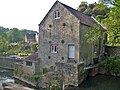 Mill House and former mill (1) - geograph.org.uk - 5802495.jpg 4,195 × 3,146; 3.21 MB
-
 Mill House and former mill (2) - geograph.org.uk - 5802498.jpg 4,320 × 3,240; 4.03 MB
-
 Norton Brook - geograph.org.uk - 363259.jpg 480 × 640; 127 KB
-
 Norton Brook - geograph.org.uk - 4897455.jpg 1,920 × 1,280; 985 KB
-
 Norton Brook valley - geograph.org.uk - 4839509.jpg 1,920 × 1,221; 926 KB
-
 Norton St Philip - geograph.org.uk - 2456567.jpg 3,648 × 2,736; 2.27 MB
-

-
 Over Wellow Brook - geograph.org.uk - 5801038.jpg 4,320 × 3,240; 4.17 MB
-
 Pasture by White Ox Mead Farm - geograph.org.uk - 4900006.jpg 1,920 × 1,280; 770 KB
-
 Path under the bridge - geograph.org.uk - 5154833.jpg 1,704 × 2,304; 2.03 MB
-
 Path, Middle Twinhoe - geograph.org.uk - 4845369.jpg 1,920 × 2,314; 1.99 MB
-
 Pheasant rearing pens near Wellow - geograph.org.uk - 1288623.jpg 640 × 480; 144 KB
-
 Pheasant rearing pens near Wellow - geograph.org.uk - 1288652.jpg 640 × 480; 153 KB
-
 Picking up a stranger - geograph.org.uk - 5953907.jpg 2,304 × 1,704; 1.71 MB
-
 Picnic table or artwork, Two Tunnels Greenway - geograph.org.uk - 4899270.jpg 1,920 × 1,146; 772 KB
-
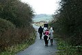 Pony Trekking near Wellow - geograph.org.uk - 644561.jpg 640 × 426; 78 KB
-
 Postie on the High Street - geograph.org.uk - 5953901.jpg 2,304 × 1,704; 1.73 MB
-
 Railway Lane, Wellow - geograph.org.uk - 644735.jpg 640 × 459; 81 KB
-
 Rambling on^ - geograph.org.uk - 3863875.jpg 1,704 × 2,304; 1.49 MB
-
 Recycled Railway Bridge - geograph.org.uk - 644570.jpg 640 × 427; 67 KB
-
 Red spells danger - geograph.org.uk - 3860848.jpg 2,304 × 1,704; 1.7 MB
-
 Rotten frames and rotten sills - geograph.org.uk - 3860839.jpg 2,304 × 1,704; 1.58 MB
-
 Running high - geograph.org.uk - 3863809.jpg 2,304 × 1,704; 1.75 MB
-
 Rusty rustic - geograph.org.uk - 3860827.jpg 2,304 × 1,704; 1.61 MB
-
 Seats by the brook - geograph.org.uk - 5154144.jpg 2,304 × 1,704; 1.74 MB
-
 Sewage works, Wellow - geograph.org.uk - 4845965.jpg 1,920 × 1,263; 812 KB
-
 Sheep by Ford Road, Wellow - geograph.org.uk - 4846024.jpg 1,920 × 1,288; 919 KB
-
 Showing the cracks - geograph.org.uk - 5154841.jpg 1,704 × 2,304; 1.71 MB
-
 Shut the gate^ - geograph.org.uk - 3860924.jpg 2,304 × 1,704; 1.65 MB
-
 Signpost on Bath Hill - geograph.org.uk - 4846551.jpg 1,920 × 1,351; 748 KB
-
 Site of railway bridge - geograph.org.uk - 3278489.jpg 3,264 × 2,448; 1.72 MB
-
 South east from Baggridge Farms - geograph.org.uk - 924152.jpg 640 × 460; 84 KB
-
 South from Baggridge Farms - geograph.org.uk - 924163.jpg 640 × 427; 81 KB
-
 South of east from Baggridge Farms - geograph.org.uk - 924139.jpg 640 × 431; 75 KB
-
 Spruced up - geograph.org.uk - 3864710.jpg 2,304 × 1,704; 1.47 MB
-
 St Julian's church, Wellow - geograph.org.uk - 4846455.jpg 1,920 × 1,320; 511 KB
-
 St Julian's Well - geograph.org.uk - 5958414.jpg 2,304 × 1,704; 1.69 MB
-
 Stone column by Somerset ^ Dorset Joint Railway - geograph.org.uk - 4839894.jpg 1,920 × 1,271; 732 KB
-
 Stoney Littleton long barrow - geograph.org.uk - 4898096.jpg 1,242 × 1,467; 499 KB
-
 Take the high road - geograph.org.uk - 3863846.jpg 2,304 × 1,704; 1.81 MB
-
 Terrace of cottages - geograph.org.uk - 3862310.jpg 1,704 × 2,304; 1.82 MB
-
 The Byway goes under the railway line - geograph.org.uk - 1983094.jpg 3,648 × 2,736; 4.63 MB
-
 The Ford - geograph.org.uk - 6544707.jpg 1,200 × 805; 1.01 MB
-
 The ford in spate - geograph.org.uk - 3278482.jpg 3,264 × 2,448; 1.68 MB
-
 The horses rarely use it now - geograph.org.uk - 5958373.jpg 2,304 × 1,704; 1.72 MB
-
 The last of the line - geograph.org.uk - 3862534.jpg 2,304 × 1,704; 1.77 MB
-
 The old chapel - geograph.org.uk - 3862321.jpg 1,704 × 2,304; 1.51 MB
-
 The Old Granary - geograph.org.uk - 3862288.jpg 2,304 × 1,704; 1.66 MB
-
 The old mill in Midford - geograph.org.uk - 6227315.jpg 3,296 × 2,472; 3.52 MB
-
 The road out of Middle Twinhoe - geograph.org.uk - 6175436.jpg 2,850 × 2,353; 1.1 MB
-
 The road to Stony Littleton - geograph.org.uk - 644615.jpg 640 × 426; 67 KB
-
 The slopes below Wellow - geograph.org.uk - 5954059.jpg 2,304 × 1,704; 1.57 MB
-
 The Square, Wellow - geograph.org.uk - 4846530.jpg 1,920 × 1,167; 578 KB
-
 Thunderstorm near Baggridge Farms - geograph.org.uk - 919274.jpg 640 × 468; 100 KB
-
 To the church - geograph.org.uk - 3860874.jpg 1,704 × 2,304; 2.24 MB
-
 Track by the Two Tunnels Greenway - geograph.org.uk - 4845734.jpg 1,920 × 2,880; 1.91 MB
-
 Track near Ford Farm - geograph.org.uk - 4899382.jpg 1,920 × 1,235; 843 KB
-
 Track near Wellow - geograph.org.uk - 4845996.jpg 1,920 × 1,222; 884 KB
-
 Track near White Ox Mead Farm - geograph.org.uk - 4847550.jpg 1,920 × 1,258; 1,007 KB
-
 Track over former railway near Wellow - geograph.org.uk - 4899399.jpg 1,920 × 1,083; 463 KB


_-_geograph.org.uk_-_4846575.jpg)
_-_geograph.org.uk_-_4847341.jpg)


_-_geograph.org.uk_-_3660786.jpg)


_-_geograph.org.uk_-_5802495.jpg)
_-_geograph.org.uk_-_5802498.jpg)


