Category:Wellington, Shropshire
Jump to navigation
Jump to search
town in Shropshire, England | |||||
| Upload media | |||||
| Instance of | |||||
|---|---|---|---|---|---|
| Location | Telford and Wrekin, Shropshire, West Midlands, England | ||||
| Population |
| ||||
| Said to be the same as | Wellington (Wikimedia duplicated page, civil parish) | ||||
 | |||||
Subcategories
This category has the following 8 subcategories, out of 8 total.
Media in category "Wellington, Shropshire"
The following 200 files are in this category, out of 343 total.
(previous page) (next page)-
"Pussy Cats" Wellington - geograph.org.uk - 1274481.jpg 640 × 326; 247 KB
-
1 Market Square, Wellington - geograph.org.uk - 6084562.jpg 3,264 × 2,448; 2.13 MB
-
13 ^ 14 Market Square, Wellington - geograph.org.uk - 6084880.jpg 2,448 × 3,264; 2.06 MB
-
15 ^ 15a Market Square, Wellington - geograph.org.uk - 6084879.jpg 2,448 × 3,264; 2.06 MB
-
16 ^ 17 Market Square, Wellington - geograph.org.uk - 6084878.jpg 2,203 × 2,938; 1.84 MB
-
2 ^ 3 Market Square, Wellington - geograph.org.uk - 6084882.jpg 2,448 × 3,264; 2.08 MB
-
20 ^ 22 Church Street, Wellington - geograph.org.uk - 6086642.jpg 3,264 × 2,448; 1.69 MB
-
24 New Street, Wellington - geograph.org.uk - 6084877.jpg 2,448 × 3,264; 1.92 MB
-
25 - 31 Park Street, Wellington - geograph.org.uk - 6114223.jpg 3,264 × 2,448; 1.74 MB
-
25-31 Park Street. Wellington.jpg 800 × 760; 127 KB
-
26 Vineyard Road, Wellington - geograph.org.uk - 6114258.jpg 3,264 × 2,448; 2.01 MB
-
30 - 36 Park Street, Wellington - geograph.org.uk - 6114241.jpg 3,264 × 2,448; 2 MB
-
49 Church Street, Wellington - geograph.org.uk - 3695125.jpg 800 × 665; 117 KB
-
5, 7 ^ 9 New Street, Wellington - geograph.org.uk - 6084588.jpg 2,203 × 2,938; 1.89 MB
-
6 Market Square, Wellington - geograph.org.uk - 6114274.jpg 2,448 × 3,264; 1.66 MB
-
62 Wrekin Road, Wellington - geograph.org.uk - 3705267.jpg 800 × 510; 95 KB
-
7 Church Street, Wellington - geograph.org.uk - 6086633.jpg 2,448 × 3,264; 2.03 MB
-
8, 10 ^ 12 New Street, Wellington - geograph.org.uk - 6084607.jpg 2,448 × 3,264; 2 MB
-
A5223 - geograph.org.uk - 4407436.jpg 640 × 426; 70 KB
-
A5223, Telford - geograph.org.uk - 6157010.jpg 800 × 600; 151 KB
-
AFC Telford United - geograph.org.uk - 3283793.jpg 2,000 × 1,361; 449 KB
-
Albert Road Wellington - geograph.org.uk - 3696353.jpg 800 × 576; 148 KB
-
All Saints' Church lychgate, Wellington - geograph.org.uk - 6869655.jpg 1,280 × 853; 1.2 MB
-
All Saints' Church, Wellington - geograph.org.uk - 6869799.jpg 1,280 × 853; 1.39 MB
-
Allotments in Wellington - geograph.org.uk - 4279711.jpg 640 × 360; 74 KB
-
Appledore Gardens, Wellington - geograph.org.uk - 3705260.jpg 800 × 589; 113 KB
-
Appledore Gardens, Wellington - geograph.org.uk - 6870355.jpg 1,280 × 853; 1.02 MB
-
Art deco glass front door.jpg 2,048 × 1,536; 1.12 MB
-
Barclays Wellington - geograph.org.uk - 3694807.jpg 796 × 800; 140 KB
-
Bell St. Wellington - geograph.org.uk - 1267457.jpg 640 × 480; 274 KB
-
Belmont community hall, Wellington - geograph.org.uk - 3701694.jpg 800 × 559; 124 KB
-
Bennetts Bank (B5061), Wellington - geograph.org.uk - 6157005.jpg 800 × 600; 153 KB
-
Blink in Wellington - geograph.org.uk - 3694008.jpg 800 × 576; 118 KB
-
Bowring Park, Wellington - geograph.org.uk - 2142252.jpg 870 × 653; 185 KB
-
Bowring Park, Wellington - geograph.org.uk - 6156560.jpg 800 × 600; 105 KB
-
Bus Station, Wellington - geograph.org.uk - 1267462.jpg 640 × 480; 292 KB
-
Chapel of Rest in Wellington cemetery - geograph.org.uk - 2558416.jpg 1,152 × 864; 420 KB
-
Chiropractic Clinic in Wellington - geograph.org.uk - 3696212.jpg 800 × 587; 109 KB
-
Christine Avenue, Wellington - geograph.org.uk - 6870591.jpg 1,280 × 853; 1.31 MB
-
Christophers on Watling Street - geograph.org.uk - 4893095.jpg 1,200 × 870; 314 KB
-
Church St. Wellington - geograph.org.uk - 1267450.jpg 640 × 480; 273 KB
-
Church Street, Wellington - geograph.org.uk - 1310790.jpg 640 × 480; 176 KB
-
Church Street, Wellington - geograph.org.uk - 6869881.jpg 1,280 × 853; 1.07 MB
-
Church Walk, Wellington - geograph.org.uk - 3703643.jpg 753 × 800; 205 KB
-
Citizens Advice Bureau, Wellington - geograph.org.uk - 3705318.jpg 800 × 583; 114 KB
-
Clift Crescent, Wellington - geograph.org.uk - 2555983.jpg 1,152 × 864; 262 KB
-
College buildings - geograph.org.uk - 4407458.jpg 640 × 357; 43 KB
-
Communication Mast in scrapyard - geograph.org.uk - 896968.jpg 640 × 480; 72 KB
-
Constitution Hill Wellington - geograph.org.uk - 3696900.jpg 800 × 555; 118 KB
-
Constitution Hill, Wellington - geograph.org.uk - 1310799.jpg 640 × 445; 58 KB
-
Crossroads on the A442 - geograph.org.uk - 5014686.jpg 1,469 × 1,102; 585 KB
-
Dawley Road, Wellington - geograph.org.uk - 3705168.jpg 800 × 671; 105 KB
-
DCL Vans UYC Wellington.png 1,475 × 830; 953 KB
-
Dereliction in High Street Wellington - geograph.org.uk - 3703371.jpg 800 × 643; 111 KB
-
Dhaka, Wellington - geograph.org.uk - 3692693.jpg 800 × 675; 135 KB
-
Domino's Pizza - geograph.org.uk - 4893086.jpg 1,200 × 851; 269 KB
-
Dothill pool - geograph.org.uk - 3069587.jpg 1,142 × 857; 346 KB
-
Dothill Primary School, Wellington - geograph.org.uk - 3069301.jpg 1,142 × 857; 378 KB
-
Drill Hall - King Street (geograph 3832590).jpg 1,600 × 1,200; 332 KB
-
Duke Street, Wellington - geograph.org.uk - 6870292.jpg 853 × 1,280; 1.02 MB
-
Eighteen Ninety Nine - geograph.org.uk - 2513732.jpg 4,000 × 3,000; 5.8 MB
-
Elmwood Road, Telford - geograph.org.uk - 2405639.jpg 640 × 480; 73 KB
-
Ex LMS 0-4-4 tank at Wellington, 1962 - geograph.org.uk - 6450553.jpg 1,280 × 800; 334 KB
-
Footbridge linking Wellington and Leegomery - geograph.org.uk - 5168593.jpg 1,600 × 1,200; 760 KB
-
Footbridge over A5223, Whitchurch Drive - geograph.org.uk - 5168585.jpg 1,600 × 1,200; 770 KB
-
Footbridge over the A5223 - geograph.org.uk - 3069589.jpg 979 × 734; 322 KB
-
Footbridge over the railway line - geograph.org.uk - 4407483.jpg 640 × 426; 96 KB
-
Former Clifton Cinema, Wellington - geograph.org.uk - 1266035.jpg 640 × 480; 219 KB
-
Former Drill Hall - King Street (geograph 3832574).jpg 1,600 × 1,064; 321 KB
-
Former Old Hall School, Wellington.jpg 800 × 588; 127 KB
-
Former Station House - geograph.org.uk - 1315217.jpg 640 × 449; 257 KB
-
Former Sunnycroft Lodge, Wellington - geograph.org.uk - 3705234.jpg 800 × 606; 164 KB
-
Former Union Workhouse, Wellington - geograph.org.uk - 3705343.jpg 706 × 800; 105 KB
-
From The Ercall - geograph.org.uk - 1086994.jpg 640 × 480; 89 KB
-
Gatepier at the church of All Saints - geograph.org.uk - 6084891.jpg 2,081 × 2,774; 1.88 MB
-
Geese on one of the pools at Rough Pits - geograph.org.uk - 3069296.jpg 1,091 × 818; 371 KB
-
Gold post box, Arleston Lane.jpg 324 × 553; 79 KB
-
Golf Links Lane, Wellington - geograph.org.uk - 3705243.jpg 800 × 612; 124 KB
-
Golf Links Lane, Wellington - geograph.org.uk - 6870571.jpg 1,280 × 853; 1.11 MB
-
Grassland by the railway - geograph.org.uk - 4407513.jpg 640 × 326; 43 KB
-
Green Man Close, Wellington - geograph.org.uk - 3703719.jpg 800 × 749; 177 KB
-
Hadrian Flats, Wellington - geograph.org.uk - 3705262.jpg 798 × 800; 156 KB
-
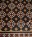
Hall Tiles.jpg 2,448 × 2,804; 2.45 MB
-
Harry Edwards ^ Sons, Wellington - geograph.org.uk - 3701766.jpg 800 × 561; 115 KB
-
Ho Mei Village in Wellington - geograph.org.uk - 3696349.jpg 800 × 496; 102 KB
-
Holyhead Road, Wellington - geograph.org.uk - 6156563.jpg 640 × 480; 73 KB
-
Holyhead Road, Wellington - geograph.org.uk - 6156578.jpg 800 × 600; 110 KB
-
Holyhead Road, Wellington - geograph.org.uk - 6156585.jpg 800 × 600; 91 KB
-
Holyhead Road, Wellington - geograph.org.uk - 6870501.jpg 1,280 × 853; 1.17 MB
-
Hornbeam Close, Arleston - geograph.org.uk - 4911451.jpg 1,200 × 799; 385 KB
-
Houses on Haybridge Road - geograph.org.uk - 6157004.jpg 800 × 604; 93 KB
-
Houses on Holyhead Road, Wellington - geograph.org.uk - 6156577.jpg 800 × 560; 77 KB
-
Houses on Holyhead Road, Wellington - geograph.org.uk - 6156580.jpg 800 × 564; 85 KB
-
Houses on Holyhead Road, Wellington - geograph.org.uk - 6159141.jpg 800 × 600; 95 KB
-
Houses on Wrekin Road, Wellington - geograph.org.uk - 6156572.jpg 800 × 514; 98 KB
-
Houses on Wrockwardine Road - geograph.org.uk - 2548499.jpg 1,152 × 864; 346 KB
-
HSBC Wellington - geograph.org.uk - 3693599.jpg 800 × 786; 151 KB
-
Is it scrap yet^ - geograph.org.uk - 810011.jpg 640 × 480; 85 KB
-
Izzy's, Wellington - geograph.org.uk - 3701630.jpg 800 × 537; 120 KB
-
Keay Flats, Lowe Court, Wellington - geograph.org.uk - 3703407.jpg 800 × 480; 90 KB
-
King Street Cafe in Wellington - geograph.org.uk - 3698392.jpg 800 × 550; 95 KB
-
La Rosa in Wellington - geograph.org.uk - 3694970.jpg 800 × 716; 159 KB
-
Lane near Isombridge - geograph.org.uk - 810007.jpg 640 × 480; 79 KB
-
Lidgates Green, Arleston - geograph.org.uk - 4911445.jpg 1,200 × 799; 290 KB
-
Limekiln Lane, Wellington - geograph.org.uk - 3705225.jpg 800 × 706; 154 KB
-
Little Apley Pool, Wellington - geograph.org.uk - 3696334.jpg 800 × 600; 197 KB
-
Locations near Wellington Shropshire - geograph.org.uk - 3696287.jpg 800 × 716; 146 KB
-
Lowe Court, Wellington - geograph.org.uk - 3703428.jpg 800 × 600; 105 KB
-
M54, Ercall Lane Bridge - geograph.org.uk - 3101398.jpg 640 × 430; 53 KB
-
Market Hall Buildings - geograph.org.uk - 3833090.jpg 1,600 × 1,064; 342 KB
-
Market St. Wellington - geograph.org.uk - 1267573.jpg 640 × 480; 323 KB
-
Market Street Benchmark - geograph.org.uk - 6906087.jpg 1,024 × 954; 327 KB
-
Market Street car park, Wellington - geograph.org.uk - 3693711.jpg 800 × 600; 111 KB
-
Market Street Wellington - geograph.org.uk - 7018235.jpg 640 × 480; 74 KB
-
Marton Drive, Dothill - geograph.org.uk - 3069306.jpg 1,142 × 857; 289 KB
-
Mast by Scrap yard - geograph.org.uk - 4407482.jpg 426 × 640; 53 KB
-
Mickey Bushell's gold post box - geograph.org.uk - 3513453.jpg 1,102 × 1,469; 663 KB
-
Mid Counties Brokers, Wellington - geograph.org.uk - 3705432.jpg 800 × 600; 173 KB
-
Milepost, Holyhead Road, Wellington.jpg 768 × 1,024; 259 KB
-
Mill Bank, Wellington - geograph.org.uk - 3703650.jpg 800 × 751; 185 KB
-
Nailors Row Car Park, Wellington - geograph.org.uk - 3701616.jpg 800 × 473; 114 KB
-
NatWest Wellington - geograph.org.uk - 3694800.jpg 800 × 704; 142 KB
-
New Car Park, Wellington - geograph.org.uk - 1452730.jpg 640 × 480; 322 KB
-
New Church Road houses, Wellington - geograph.org.uk - 3703670.jpg 800 × 623; 128 KB
-
New house by the railway line - geograph.org.uk - 4407510.jpg 640 × 426; 60 KB
-
New house, North Road, Wellington - geograph.org.uk - 2503238.jpg 640 × 451; 78 KB
-
New houses, Elmwood Road, Arleston - geograph.org.uk - 2503248.jpg 640 × 480; 78 KB
-
New St. Wellington - geograph.org.uk - 1267598.jpg 640 × 511; 350 KB
-
New-builds on Severn Drive, Dothill - geograph.org.uk - 3069578.jpg 1,142 × 857; 291 KB
-
Old Bakery Row, Wellington - geograph.org.uk - 3701556.jpg 800 × 636; 128 KB
-
Old Bus Station, Wellington - geograph.org.uk - 1383473.jpg 640 × 480; 271 KB
-
Old Chad Valley Toy Factory, Wellington - geograph.org.uk - 1396304.jpg 640 × 513; 273 KB
-
Old Hall Gardens, Wellington - geograph.org.uk - 3705210.jpg 800 × 632; 153 KB
-
Old Police Station, Wellington - geograph.org.uk - 1310824.jpg 640 × 525; 69 KB
-
Orleton Terrace, Wellington - geograph.org.uk - 2555992.jpg 1,152 × 864; 311 KB
-
OS benchmark - Wellington New College - geograph.org.uk - 3771034.jpg 857 × 1,142; 466 KB
-
OS benchmark - Wellington, 33 Albert Road - geograph.org.uk - 3770994.jpg 857 × 1,142; 509 KB
-
OS benchmark - Wellington, 36 Steventon Road - geograph.org.uk - 4104652.jpg 857 × 1,142; 514 KB
-
OS benchmark - Wellington, Belfrey Arts Centre - geograph.org.uk - 3770966.jpg 857 × 1,142; 571 KB
-
OS benchmark - Wellington, Crown Street - geograph.org.uk - 3771024.jpg 857 × 1,142; 273 KB
-
OS benchmark - Wellington, Ercall Lane - geograph.org.uk - 4104606.jpg 734 × 979; 399 KB
-
OS benchmark - Wellington, flats on High Street - geograph.org.uk - 3771027.jpg 857 × 1,142; 514 KB
-
OS benchmark - Wellington, Haygate Road - geograph.org.uk - 4107421.jpg 857 × 1,142; 517 KB
-
OS benchmark - Wellington, Holyhead Road - geograph.org.uk - 4104605.jpg 857 × 1,142; 505 KB
-
OS benchmark - Wellington, Mill Street - geograph.org.uk - 3771040.jpg 857 × 1,142; 563 KB
-
OS benchmark - Wellington, Vineyard Road - geograph.org.uk - 4104651.jpg 857 × 1,142; 625 KB
-
OS benchmark - Wellington, Wrekin Road - geograph.org.uk - 4104620.jpg 857 × 1,142; 541 KB
-
OS benchmark -Wellington, Park Street - geograph.org.uk - 4720947.jpg 979 × 1,306; 445 KB
-
Park Hotel, Wellington.jpg 800 × 533; 104 KB
-
Parville House, Wellington - geograph.org.uk - 6114248.jpg 2,448 × 1,836; 1.8 MB
-
Path and cycleway through to Shawbirch - geograph.org.uk - 810064.jpg 640 × 480; 110 KB
-
Path, Wellington - geograph.org.uk - 6446179.jpg 4,288 × 2,848; 1.74 MB
-
Pimp Rehearsal Wellington, Shropshire circa 1989.jpg 1,786 × 1,214; 968 KB
-
Plaque at the Cock Inn on Holyhead Road - geograph.org.uk - 4911572.jpg 1,176 × 1,200; 648 KB
-
Plough Road, Wellington - geograph.org.uk - 1310851.jpg 640 × 480; 67 KB
-
Portway House, Wellington - geograph.org.uk - 6114264.jpg 2,774 × 2,081; 2.02 MB
-
Post Office, Market St, Wellington - geograph.org.uk - 1266029.jpg 640 × 520; 372 KB
-
Postbox, Haygate Rd - geograph.org.uk - 1027373.jpg 480 × 640; 90 KB
-
Powder Lane Benchmark - geograph.org.uk - 6906089.jpg 1,024 × 576; 178 KB
-
Prince's Street, Wellington - geograph.org.uk - 3705208.jpg 800 × 684; 158 KB
-
Ptilium horioni Rosskothen, 1934 (3731922845).jpg 1,896 × 1,113; 241 KB
-
Rail bridge on Wrockwardine Road - geograph.org.uk - 4901503.jpg 1,200 × 745; 501 KB
