Category:Weather maps of India
Jump to navigation
Jump to search
Subcategories
This category has the following 3 subcategories, out of 3 total.
Media in category "Weather maps of India"
The following 25 files are in this category, out of 25 total.
-
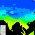 AsiaMaxTemp.png 600 × 600; 608 KB
-
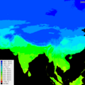 AsiaMeanTemp.png 600 × 600; 556 KB
-
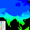 AsiaMinTemperature.png 600 × 600; 505 KB
-
 AsiaMonthlyPrecipitation.png 600 × 600; 298 KB
-
 AsiaMonthlyPrecipitation1.png 600 × 600; 418 KB
-
 Cloudburst isro.png 1,006 × 699; 217 KB
-
 Cyclone Yaas and Cyclone Taukutae.png 986 × 777; 1.26 MB
-
 Hann Atlas der Meteorologie 3.jpg 1,180 × 975; 346 KB
-
 India average annual temperature map en.svg 1,639 × 1,852; 366 KB
-
 India average annual temperature map ru.svg 1,639 × 1,852; 386 KB
-
 India climatic zone map en.svg 1,639 × 1,852; 354 KB
-
 India climatic zone map es.svg 1,639 × 1,852; 366 KB
-
 India climatic zone map ru.svg 1,639 × 1,852; 375 KB
-
 India, Bangladesh Tropical Cyclone Yaas.pdf 2,479 × 1,754; 1.33 MB
-
 India-physical-map.png 300 × 262; 14 KB
-
 Indiatemperaturetemp fr.png 350 × 306; 21 KB
-
 Indiatemperaturetemp.png 350 × 306; 21 KB
-
Mass Balance Change over India from GRACE.ogv 14 s, 1,920 × 1,080; 15.85 MB
-
 NASA's ECOSTRESS Detects ‘Heat Islands' in Extreme Indian Heat Wave.jpg 1,041 × 764; 1.2 MB
-
 NWS-NOAA South Asia Extreme minimum temperature.gif 612 × 792; 54 KB
-
 Rainfall forecast.png 965 × 703; 579 KB
-
 Tropical cyclone east of Sri Lanka May 8 1979.gif 399 × 450; 121 KB
-
 Weather isro.png 607 × 566; 65 KB
-
 Western-Ghats-rainfall.svg 600 × 1,000; 308 KB
-
 Índia - Clima.png 1,131 × 1,020; 260 KB


