Category:Wavertree Playground
Jump to navigation
Jump to search
| Object location | | View all coordinates using: OpenStreetMap |
|---|
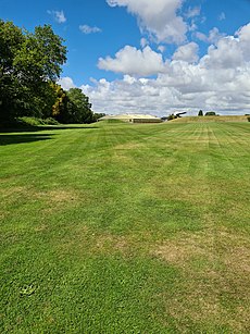
Wavertree Playground (otherwise known as "The Mystery") is an open space in Wavertree, Liverpool, bounded by Grant Avenue, Prince Alfred Road, High Street, Wellington Road and the railway line from Speke Junction to Edge Hill.
public playground in Liverpool, UK | |||||
| Upload media | |||||
| Location |
| ||||
|---|---|---|---|---|---|
 | |||||
Subcategories
This category has the following 9 subcategories, out of 9 total.
Media in category "Wavertree Playground"
The following 25 files are in this category, out of 25 total.
-
Anglican Cathedral from Wavertree Playground.jpg 2,031 × 1,298; 1.91 MB
-
Benchmark opposite end of Crawford Avenue.jpg 4,130 × 3,261; 7.05 MB
-
Bluecoat School from Wavertree Playground 1.jpg 5,152 × 3,864; 7.69 MB
-
Bluecoat School from Wavertree Playground 2.jpg 5,152 × 3,864; 7.56 MB
-
Derelict building, Wavertree Playground.jpg 4,373 × 3,474; 8.09 MB
-
Entrance to Wavertree Playground - geograph.org.uk - 2167786.jpg 1,600 × 1,198; 768 KB
-
Entrance to Wavertree Playground - geograph.org.uk - 2855603.jpg 640 × 436; 106 KB
-
Grant Ladies Bowling Club.jpg 5,152 × 3,864; 7.5 MB
-
Information board in Wavertree Playground.jpg 5,152 × 3,864; 7.4 MB
-
LNWR boundary marker, Wavertree Playground.jpg 2,808 × 4,383; 7.71 MB
-
Rusted casing, Wavertree Playground, Liverpool.jpg 1,422 × 1,983; 2.12 MB
-
Stone in Wavertree Playground.jpg 4,608 × 3,456; 14.67 MB
-
View of Wavertree Playground 1.jpg 2,048 × 1,536; 1.66 MB
-
View of Wavertree Playground 2.jpg 2,048 × 1,536; 1.4 MB
-
Wavertree Playground (3).JPG 4,320 × 3,240; 3.89 MB
-
Wavertree Playground (4).JPG 4,320 × 3,240; 4.44 MB
-
Wavertree Playground (5).JPG 4,320 × 3,240; 4.47 MB
-
Wavertree Playground (6).JPG 4,320 × 3,240; 4.04 MB
-
Wavertree Playground (7).JPG 4,320 × 3,240; 3.26 MB
-
Wavertree Playground (8).JPG 4,320 × 3,240; 3.58 MB
-
Wavertree Playground (9).JPG 4,320 × 3,240; 4.13 MB
-
Wavertree Playground - geograph.org.uk - 3213882.jpg 3,648 × 2,736; 3.84 MB
-
Wavertree Playground from Grange Terrace.jpg 5,044 × 3,352; 8.51 MB
-
Wavertree Playground.jpg 3,024 × 4,032; 6.42 MB
-
Wavertree.jpg 3,000 × 4,000; 4.6 MB


