Category:Watnall
Jump to navigation
Jump to search
English: Watnall is an area of settlement in Nottinghamshire, England. It is part of Greasley civil parish, and is located one mile north of Kimberley. The village is barely separated from Nuthall. Generally both areas are considered to be more affluent and middle-class than the neighbouring area of Kimberley. Watnall Hall was built c. 1690 and demolished in 1962.
village in United Kingdom | |||||
| Upload media | |||||
| Instance of | |||||
|---|---|---|---|---|---|
| Location | Greasley, Broxtowe, Nottinghamshire, East Midlands, England | ||||
 | |||||
Media in category "Watnall"
The following 25 files are in this category, out of 25 total.
-
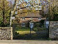
 Brookbreasting Farm Cottage, Watnall NG16, Notts. - geograph.org.uk - 3369163.jpg 3,183 × 2,054; 1.58 MB
-
 Brookbreasting Farm Cottage, Watnall, NG16, Notts. - geograph.org.uk - 3369181.jpg 2,756 × 2,090; 1.19 MB
-
 Crowhill Farm, Watnall NG16, Notts. - geograph.org.uk - 3369245.jpg 3,173 × 1,627; 1.14 MB
-
 Crowhill Farm, Watnall NG16, Notts. - geograph.org.uk - 3369251.jpg 3,233 × 1,981; 1.24 MB
-
 Hall Farm, Watnall Chaworth, NG16, Notts. - geograph.org.uk - 3369267.jpg 3,757 × 2,611; 2.29 MB
-
 Hall Farm, Watnall.jpg 1,280 × 960; 411 KB
-
 Hovis bakery, Main Street, Watnall - geograph.org.uk - 1830544.jpg 640 × 480; 55 KB
-

-
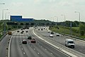 M1 near Watnall - geograph.org.uk - 1876464.jpg 1,280 × 854; 188 KB
-
 Main Street, Watnall - geograph.org.uk - 1830547.jpg 640 × 480; 56 KB
-
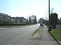
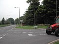
 Narrow Lane (B6009) Watnall - geograph.org.uk - 1830555.jpg 640 × 480; 108 KB
-
 Narrow Lane north of Watnall - geograph.org.uk - 1830564.jpg 640 × 480; 74 KB
-
 Northbound on the M1 near Watnall - geograph.org.uk - 2843073.jpg 640 × 480; 48 KB
-
 Rolleston Crescent, Watnall - geograph.org.uk - 2708346.jpg 1,600 × 1,200; 450 KB
-
 Stone Cottage, Watnall.jpg 1,280 × 960; 676 KB
-
 The Queens Head - geograph.org.uk - 1071062.jpg 640 × 426; 92 KB
-
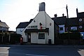
 The Queens Head, Watnall - geograph.org.uk - 1830548.jpg 640 × 480; 74 KB
-
 The Royal Oak, Watnall - geograph 5704288.jpg 1,280 × 851; 348 KB
-
 Track towards Watnall - geograph.org.uk - 1876941.jpg 1,280 × 854; 269 KB
-
 Watnall Brickworks - geograph.org.uk - 41061.jpg 640 × 480; 48 KB
-
 Watnall Colliery sidings - geograph.org.uk - 1877049.jpg 1,280 × 854; 329 KB
-
 Watnall Post Office - geograph.org.uk - 1751665.jpg 1,024 × 683; 159 KB
-
 Blenheim Lane and windsock - geograph.org.uk - 1465922.jpg 640 × 479; 94 KB
-
-
 Mobile Phone Masts, Watnall - geograph.org.uk - 41062.jpg 640 × 480; 35 KB


_Watnall_-_geograph.org.uk_-_1830555.jpg)


