Category:Wasserturm Lehrte
Jump to navigation
Jump to search
| Object location | | View all coordinates using: OpenStreetMap |
|---|
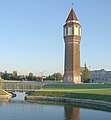
water tower in Lehrte, Germany | |||||
| Upload media | |||||
| Instance of | |||||
|---|---|---|---|---|---|
| Location | Lehrte, Hanover region, Lower Saxony, Germany | ||||
| Inception |
| ||||
 | |||||
Der Wasserturm in Lehrte wurde 1912 durch die hannoversche Baufirma Robert Grastorf GmbH errichtet.
Siehe auch Undatierte Fotos eines Sportereignisse (Geherwettbewerb) am Fuße des Wasserturms von Jochen Mellin im Bildarchiv der Region Hannover (Region Hannover).
Media in category "Wasserturm Lehrte"
The following 10 files are in this category, out of 10 total.
-
Lehrte - Germaniastraße - Wasserturm - Infotafel 2015-02-22 10.58.38.jpg 1,775 × 2,426; 2.86 MB
-
Lehrte Wasserturm 2.JPG 3,264 × 4,352; 1.85 MB
-
Lehrte Wasserturm 2022.jpg 3,672 × 4,896; 1.31 MB
-
Lehrte Wasserturm See.jpg 854 × 922; 160 KB
-
Lehrte Wasserturm.jpg 1,500 × 2,100; 1,024 KB
-
Lehrte, Germaniastraße, Wasserturm 2018-08-12 11.35.50.jpg 1,463 × 2,303; 1.82 MB
-
Wasserturm in Lehrte.JPG 768 × 1,024; 269 KB
-
Wasserturm Lehrte (01).jpg 4,000 × 5,868; 13.1 MB
-
Wasserturm Lehrte (02).jpg 4,000 × 5,868; 14.53 MB
-
Wasserturm Lehrte at night.JPG 1,210 × 1,754; 151 KB
Categories:
- Water towers in Lehrte
- Cultural heritage monuments in Lehrte
- Former water towers in Germany
- Brick water towers in Germany
- Brick buildings in Region Hannover
- Red brick buildings in Germany
- Brick towers in Lower Saxony
- Octagonal towers in Lower Saxony
- Built in Lower Saxony in 1912
- 44-meter-tall buildings in Germany


