Category:Washington City Canal
Jump to navigation
Jump to search
- English: The Washington City Canal operated from 1815 until the mid-1850s in Washington, D.C. The canal connected the Anacostia River, called the "Eastern Branch" at that time, to Tiber Creek, the Potomac River, and later the Chesapeake and Ohio Canal. The canal fell into disuse in the late 19th century and the city government covered over or filled in various sections.
historical canal in Washington, D.C., United States | |||||
| Upload media | |||||
| Instance of | |||||
|---|---|---|---|---|---|
| Location | Washington, D.C., District of Columbia | ||||
| Inception |
| ||||
| Dissolved, abolished or demolished date |
| ||||
 | |||||
Subcategories
This category has the following 2 subcategories, out of 2 total.
Media in category "Washington City Canal"
The following 22 files are in this category, out of 22 total.
-
1850 Mitchell Map of Washington D.C. ^ Georgetown - Geographicus - WashingtonDC-m-1850.jpg 4,000 × 3,234; 3.03 MB
-
1851 Map of City of Washington (Detail) showing the Washington City Canal.png 1,732 × 2,264; 8.67 MB
-
1851 Map of the City of Washington D.jpg 12,424 × 9,409; 44.37 MB
-
1866 Johnson Map of Washington D.C. - Geographicus - WashingtonDC-johnson-1866.jpg 3,500 × 2,816; 3.19 MB
-
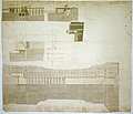
Canal ("Washington Canal"), Washington, D.C. Ground work and piling plans LCCN2001698966.tif 1,406 × 1,098; 4.42 MB
-
Flickr - USCapitol - View from Capitol c.1863 with Botanic Garden.jpg 928 × 596; 358 KB
-
L'Enfant plan.jpg 4,179 × 3,404; 5.26 MB
-
L'Enfant plan.svg 3,822 × 3,093; 3.37 MB
-
Part of new canal - (Washington Canal, Washington D.C.). LOC 88690730.jpg 5,659 × 7,733; 4.2 MB
-
Part of new canal - (Washington Canal, Washington D.C.). LOC 88690730.tif 5,659 × 7,733; 125.2 MB
-
South National Mall Washington DC 1863.jpg 926 × 597; 377 KB
-
Washington City Canal plaque by Matthew Bisanz.JPG 2,747 × 1,780; 1.82 MB


