Category:Wasatch and Uinta Montane Forests Ecoregion
Jump to navigation
Jump to search
temperate coniferous forests ecoregion of the United States | |||||
| Upload media | |||||
| Instance of | |||||
|---|---|---|---|---|---|
| Location |
| ||||
| |||||
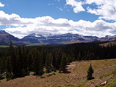
The Wasatch and Uinta Montane Forests Ecoregion is a designated ecoregion by WWF and One Earth. It is classified as a Temperate Conifer Forests Biome. It is one of five ecoregions in the Colorado Plateau & Mountain Forests Bioregion.
Subcategories
This category has the following 10 subcategories, out of 10 total.
A
B
C
D
F
M
T
U
W
Media in category "Wasatch and Uinta Montane Forests Ecoregion"
The following 35 files are in this category, out of 35 total.
-
Bull Mountain south aspect. Henry Mountains, Utah.jpg 4,103 × 3,014; 3.51 MB
-
Bull Mountain, Henry Mountains, Utah.jpg 3,133 × 1,818; 2.04 MB
-
Campground in the Flaming Gorge NRA 4178.jpg 3,264 × 2,448; 2.56 MB
-
Flaming Gorge 1831.jpg 3,000 × 2,003; 5.84 MB
-
Flaming Gorge 1838.jpg 3,000 × 2,003; 5.79 MB
-
Flaming Gorge 1843.jpg 3,000 × 2,003; 6.09 MB
-
Flaming Gorge 1850.jpg 3,000 × 2,003; 5.48 MB
-
Flaming Gorge 1852.jpg 3,000 × 2,003; 7.26 MB
-
Flaming Gorge National Recreational Area - 49179388783.jpg 3,000 × 2,000; 6.69 MB
-
Flaming Gorge National Recreational Area - 49179667177.jpg 3,000 × 2,000; 6.42 MB
-
Flaming Gorge National Recreational Area - 49181217517.jpg 3,000 × 2,000; 5.91 MB
-
Flaming Gorge National Recreational Area - 49181592296.jpg 3,000 × 2,000; 5.71 MB
-
Flaming Gorge National Recreational Area - 49182440237.jpg 3,000 × 2,000; 4.83 MB
-
Flaming Gorge National Recreational Area - 49184067416.jpg 3,000 × 2,000; 5.32 MB
-
Flaming Gorge National Recreational Area - 49186657297.jpg 2,000 × 3,000; 4.51 MB
-
Flaming Gorge National Recreational Area - 49186712803.jpg 3,000 × 2,000; 5.28 MB
-
Flaming Gorge National Recreational Area - 49188213851.jpg 3,000 × 2,000; 5.69 MB
-
Flaming Gorge National Recreational Area - 49194227912.jpg 3,000 × 1,788; 3.74 MB
-
Flaming Gorge National Recreational Area - 49195249456.jpg 3,000 × 2,000; 5.67 MB
-
Flaming Gorge National Recreational Area - 49196255051.jpg 3,000 × 2,000; 4.45 MB
-
Flaming Gorge National Recreational Area - 49197258643.jpg 3,000 × 1,931; 4.74 MB
-
Flaming Gorge National Recreational Area - 49197893428.jpg 3,000 × 2,000; 5.08 MB
-
Flaming Gorge National Recreational Area - 49199598727.jpg 3,000 × 2,000; 3.72 MB
-
Flaming Gorge National Recreational Area - 49200484201.jpg 3,000 × 2,000; 4.42 MB
-
Flaming Gorge National Recreational Area - 49201433856.jpg 3,000 × 2,000; 4.17 MB
-
Flaming Gorge National Recreational Area - 49202160851.jpg 3,000 × 2,000; 3.96 MB
-
Henry Mountains, Utah, 2005-06-01.jpg 768 × 512; 202 KB
-
Henry-waterfold.jpg 1,024 × 666; 103 KB
-
Mount Ellen Ridge, Garfield County, Utah.jpg 1,000 × 750; 467 KB
-
Mount Ellen, Henry Mountains.jpg 6,321 × 3,645; 7.26 MB
-
Mount Hillers from Halls Crossing.jpg 6,199 × 3,215; 5.96 MB
-
Mount Holmes, Henry Mountains.jpg 7,264 × 4,602; 11.21 MB
-
Mount Pennell, Henry Mountains.jpg 7,750 × 3,951; 7.19 MB
-
Rocks on Bull Mountain - panoramio.jpg 1,936 × 1,296; 891 KB


