Category:Warning signs in England
Jump to navigation
Jump to search
Subcategories
This category has the following 12 subcategories, out of 12 total.
Media in category "Warning signs in England"
The following 103 files are in this category, out of 103 total.
-

-

-
 2019 at Marine Parade (33).JPG 1,366 × 910; 657 KB
-
 2023 at Marsh Barton station - approach from the west.JPG 1,366 × 820; 435 KB
-
 2023-09-15 Bath Spa Railway Station 02.JPG 6,000 × 4,000; 7.23 MB
-
 3.10.16 Manchester 25 (29805670980).jpg 6,016 × 4,000; 5.15 MB
-

-
 A warning to dog-walkers - geograph.org.uk - 1592343.jpg 480 × 640; 100 KB
-
 A553 crash warning sign.JPG 2,736 × 3,648; 3.56 MB
-
 A647 (37358774896).jpg 6,000 × 4,000; 10.82 MB
-
 Ashton Canal Bridge 5 Beswick St 5173.JPG 3,264 × 2,448; 3.28 MB
-
 Ashton Canal Bridge 5 Beswick St 5174.JPG 3,264 × 2,448; 3.74 MB
-
 Beware of the bull - too late^ - geograph.org.uk - 672475.jpg 640 × 480; 77 KB
-
 Bloodcurdling warnings - geograph.org.uk - 4615452.jpg 2,736 × 1,824; 2.2 MB
-
 Blue Anchor level crossing - wicket gate.jpg 1,366 × 1,024; 433 KB
-
 Brighton West Pier 20060410 warnings.jpg 1,200 × 1,600; 378 KB
-
 Bull in field - geograph.org.uk - 2651957.jpg 1,024 × 768; 306 KB
-

-
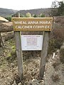
 Calciners at Devon Great Consols (4982).jpg 4,288 × 2,848; 6.31 MB
-
 Caution sign in Myndtown, Shropshire, England.jpg 600 × 450; 197 KB
-
 Christon Bank MMB 05.jpg 3,756 × 2,874; 5.26 MB
-
 Crevasses^, Abraham Crags - geograph.org.uk - 650398.jpg 480 × 640; 96 KB
-

-
 Cyclists dismount - geograph.org.uk - 1000862.jpg 640 × 413; 79 KB
-
 Deep Water Sign, Cockington Mill Pond.jpg 3,864 × 5,152; 12.99 MB
-
 DGC Calciner Sign.jpg 3,864 × 5,152; 7.08 MB
-
 Enter at your own risk^ - geograph.org.uk - 1063828.jpg 480 × 640; 88 KB
-
-
 Foxton Locks notice.JPG 2,304 × 3,072; 2.52 MB
-
 Free range Children - geograph.org.uk - 1469599.jpg 640 × 427; 113 KB
-

-
 GOC Tring & Wendover Woods 069 Children at play (34669071061).jpg 4,019 × 3,009; 3.67 MB
-
 Godstow Abbey, Oxfordshire 46.jpg 4,128 × 3,096; 4.63 MB
-
 Holy Well, Eastbourne 01.jpg 1,488 × 1,984; 938 KB
-
 Holy Well, Eastbourne 02.jpg 1,984 × 1,488; 1.26 MB
-
 Hook Bridge, Stoke St Gregory.jpg 5,152 × 3,864; 4.35 MB
-
 2019 at Hull Paragon - platform water tank.JPG 1,366 × 1,024; 622 KB
-

-
 Kingsway tunnels -JPP 7843 (14436558928).jpg 1,154 × 768; 995 KB
-
 Leeds (34002499780).jpg 6,000 × 4,000; 12.83 MB
-
 Leeds and Liverpool Canal (34403808741).jpg 5,592 × 2,921; 9.09 MB
-
 Leeds and Liverpool Canal (34492581076).jpg 5,992 × 3,129; 10.14 MB
-
 Low tide at Weston-super-Mare (2022).JPG 1,366 × 820; 290 KB
-
 Low-flying aircraft - but only a model - geograph.org.uk - 847176.jpg 534 × 640; 181 KB
-
 Manston R.O.C Post (8446022166).jpg 1,042 × 722; 151 KB
-
 Manston R.O.C Post (8446022254).jpg 5,184 × 3,456; 1.85 MB
-
 Marsh House Pumping Station - geograph.org.uk - 415340.jpg 640 × 539; 96 KB
-
 Mercury (23496741314).jpg 2,736 × 3,648; 2.26 MB
-
 Mereworth Wood Ammunition Depot (49902040096).jpg 6,000 × 4,000; 7.72 MB
-
 Mereworth Wood Ammunition Depot (49902326162).jpg 6,000 × 4,000; 9.2 MB
-
 Middleton Towers station fence.jpg 7,360 × 4,912; 14.09 MB
-
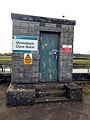 Monksleaze Clyce Sluice, River Parrett 02.jpg 3,864 × 5,152; 8.63 MB
-
 N W (23757173039).jpg 1,605 × 1,605; 1.01 MB
-
 Notices (23498155033).jpg 3,501 × 2,543; 2.08 MB
-
 On your own risk, Chale (10488967745).jpg 4,896 × 3,672; 6.18 MB
-
 Orford Ness - No Access (14534921203).jpg 2,736 × 2,971; 1.68 MB
-
 Orford Ness - Solvent Store (14511420641).jpg 2,659 × 2,670; 1.42 MB
-
 Orford Ness - Warning (14328186969).jpg 1,555 × 1,554; 555 KB
-
 Pedestrian level crossing, Dunbridge, Hampshire 01.jpg 2,816 × 2,112; 3.78 MB
-
 Pipeline plaque, Kirkdale rail-canal bridge.jpg 5,091 × 3,394; 13.76 MB
-
 Portland Bill. Dorset. (4792478707).jpg 1,763 × 1,322; 990 KB
-
 Quicksand warning.jpg 972 × 1,296; 489 KB
-
 Recipe suggestion, Cockwood - geograph.org.uk - 1265231.jpg 640 × 480; 87 KB
-
 Redgate Beach Warning Sign.jpg 6,000 × 4,000; 12.48 MB
-

-
 River Medway 10.jpg 3,864 × 5,152; 11.1 MB
-
 ROC Post Peterchurch (5348587223).jpg 4,752 × 3,168; 8.21 MB
-
 Route of a gas piprline, Port Werburgh - geograph.org.uk - 1603607.jpg 640 × 430; 162 KB
-
 Schrikdraad^ - geograph.org.uk - 1597034.jpg 640 × 480; 102 KB
-
 Sewardstonebury, Bury Road - geograph.org.uk - 672645.jpg 640 × 480; 93 KB
-
 Shipley (34447955732).jpg 6,000 × 4,000; 10.17 MB
-
 Sign 4 UK.jpg 756 × 1,136; 151 KB
-
 Sign by badger sett - Primrose Wood - geograph.org.uk - 537124.jpg 481 × 640; 131 KB
-
 Sign on Humphrey Head - geograph.org.uk - 1297999.jpg 640 × 480; 112 KB
-
 Solway Plain, near Bowness on Solway - May 2012 - panoramio (2).jpg 2,048 × 1,536; 619 KB
-
 Sound Advice^ - geograph.org.uk - 1278116.jpg 428 × 640; 60 KB
-
 Southampton Row - geograph.org.uk - 3004774.jpg 480 × 640; 194 KB
-
 Stanningley (39433712931).jpg 6,000 × 4,000; 6 MB
-
 Subway under the A229 at Blue Bell Hill 01.jpg 5,152 × 3,864; 4.42 MB
-
 Subway under the A229 at Blue Bell Hill 02.jpg 5,152 × 3,864; 4.34 MB
-
 Subway under the A229 at Blue Bell Hill 03.jpg 5,152 × 3,864; 4.5 MB
-
 Subway under the A229 at Blue Bell Hill 04.jpg 5,152 × 3,864; 4.35 MB
-
 Toxic warning - geograph.org.uk - 1083468.jpg 640 × 480; 147 KB
-
 Warning - slug pellets - geograph.org.uk - 1067484.jpg 427 × 640; 171 KB
-

-
 Warning notices, Spadeadam Range - geograph.org.uk - 241611.jpg 640 × 480; 68 KB
-
 Warning or Statement ^ - geograph.org.uk - 327856.jpg 640 × 398; 109 KB
-
 Warning sign - geograph.org.uk - 735349.jpg 640 × 427; 85 KB
-
 Warning sign at Nash Quarry - geograph.org.uk - 901665.jpg 640 × 480; 106 KB
-

-
 Warning Sign on the Seafront - geograph.org.uk - 1580790.jpg 640 × 430; 88 KB
-
 Warning sign, Brow Grain Hill, Meltham - geograph.org.uk - 499644.jpg 640 × 480; 125 KB
-
 Warning signs - geograph.org.uk - 4022775.jpg 2,000 × 1,500; 1.08 MB
-

-
 Warning^ Newbold Quarry Park - geograph.org.uk - 720211.jpg 640 × 428; 134 KB
-
 Woodhouse Lane is not a Tip - geograph.org.uk - 1121120.jpg 640 × 480; 51 KB
-
 You have been warned! - 7475249152.jpg 1,200 × 795; 329 KB
-
 You have been warned^ - geograph.org.uk - 1443638.jpg 480 × 640; 170 KB
-
 Dangerous hut - geograph.org.uk - 731899.jpg 480 × 640; 119 KB
-
 Otters crossing - geograph.org.uk - 592772.jpg 640 × 480; 75 KB
-
 Unusual Road Sign - geograph.org.uk - 275709.jpg 640 × 480; 99 KB
-
 Warning sign near Holwell, Leics - geograph.org.uk - 165427.jpg 407 × 640; 150 KB
-
 Warning sign, Hillhead - geograph.org.uk - 438597.jpg 640 × 480; 201 KB
.jpg)
.JPG)
.JPG)


.jpg)


.jpg)


.jpg)


.jpg)


.jpg)
.jpg)
.jpg)
.jpg)
.JPG)

.jpg)
.jpg)

.jpg)
.jpg)
.jpg)


.jpg)
.jpg)
.jpg)
.jpg)
.jpg)
.jpg)


.jpg)


.jpg)


.jpg)


.jpg)


.jpg)


