Category:Wandertafeln Dönche
Jump to navigation
Jump to search
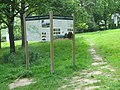
Deutsch: Naturschutzgebiet im Regierungsbezirk Kassel 1611004, „Dönche“ - 2019 erfolgte eine Neuausweisung der Wege in der Dönche, die bestehenden Wandertafeln im Gebiet wurden ausgetauscht.
Media in category "Wandertafeln Dönche"
The following 14 files are in this category, out of 14 total.
-
 NSG 1611004 Dönche 2020-06-30 b.JPG 3,648 × 2,736; 4.01 MB
-
 NSG 1611004 Dönche 2020-06-30.JPG 3,648 × 2,736; 4.02 MB
-
 NSG 1611004 Dönche 2020-07-01 b.JPG 3,648 × 2,736; 4.37 MB
-
 NSG 1611004 Dönche 2020-07-01 d.JPG 3,648 × 2,736; 4.47 MB
-
 NSG 1611004 Dönche 2020-07-02 b.JPG 3,648 × 2,736; 4.49 MB
-
 NSG 1611004 Dönche 2020-07-02 d.JPG 3,648 × 2,736; 4.18 MB
-
 NSG 1611004 Dönche 2020-07-05.JPG 3,648 × 2,736; 4.09 MB
-
 Wandertafel Auf der Dönche.PNG 960 × 640; 1.23 MB
-
 Wandertafel Dachsbergstraße.PNG 960 × 640; 1.08 MB
-
 Wandertafel Landesfeuerwehrschule.PNG 960 × 640; 1.23 MB
-
 Wandertafel Nordshausen Dönche.JPG 3,264 × 2,448; 2.94 MB
-
 Wandertafel Nordshausen Linde.JPG 3,264 × 2,448; 3.12 MB
-
 Wandertafel Schöne Aussicht.JPG 3,264 × 2,448; 2.59 MB
-
 Wandertafel Wiederholdstraße.PNG 960 × 640; 1.16 MB


