Category:Walford (near Ross-on-Wye)
Jump to navigation
Jump to search
village and civil parish near Ross-on-Wye, Herefordshire, England | |||||
| Upload media | |||||
| Instance of | |||||
|---|---|---|---|---|---|
| Location | Herefordshire, West Midlands, England | ||||
| Population |
| ||||
 | |||||
Cymraeg: Pentref yn Swydd Henffordd, Gorllewin Canolbarth Lloegr, Lloegr ydy Walford. Yr enw Gymraeg yw Rhyd Helyg.
English: Walford is a village in south Herefordshire, England, two miles south of the market town of Ross-on-Wye. It includes the settlements of Bishopswood, Coughton, Deep Dean, Hom Green and Walford.
Nederlands: Walford is een plaats en civil parish in het bestuurlijke gebied Herefordshire, in het Engelse graafschap Herefordshire.
Polski: Walford – wieś i civil parish w Anglii, w hrabstwie Herefordshire. Leży 22 km na południe od miasta Hereford i 176 km na zachód od Londynu. W 2011 roku civil parish liczyła 1514 mieszkańców. Walford jest wspomniana w Domesday Book (1086) jako Walecford.
Subcategories
This category has the following 11 subcategories, out of 11 total.
Media in category "Walford (near Ross-on-Wye)"
The following 200 files are in this category, out of 510 total.
(previous page) (next page)-
20 when lights flash, Walford - geograph.org.uk - 3571623.jpg 800 × 653; 171 KB
-
20 When lights flash, Walford - geograph.org.uk - 5075179.jpg 756 × 800; 179 KB
-
40mph zone in Walford - geograph.org.uk - 3571634.jpg 800 × 800; 214 KB
-
5 miles to Lydbrook from Ross-on-Wye - geograph.org.uk - 3566924.jpg 798 × 800; 165 KB
-
A collection of wild and cultivated flowers - geograph.org.uk - 5814191.jpg 1,600 × 1,450; 1.06 MB
-
A motley assortment of sheds - geograph.org.uk - 4092052.jpg 3,872 × 2,592; 4.27 MB
-
A pile of fodder - geograph.org.uk - 6000967.jpg 1,600 × 901; 765 KB
-
Abilene in Walford - geograph.org.uk - 5543459.jpg 800 × 563; 88 KB
-
Acer glade - geograph.org.uk - 5776062.jpg 1,600 × 1,005; 938 KB
-
Acer japonicum 'Vitifolium', 1 - geograph.org.uk - 5915735.jpg 1,023 × 1,024; 228 KB
-
Acer japonicum 'Vitifolium', 2 - geograph.org.uk - 5927332.jpg 1,600 × 1,202; 961 KB
-
Acer palmatum 'Bloodgood' - geograph.org.uk - 5741058.jpg 1,600 × 1,385; 680 KB
-
Acer palmatum 'Deshojo' - geograph.org.uk - 6109439.jpg 1,600 × 848; 564 KB
-
Acer palmatum 'Deshojo' - geograph.org.uk - 6120910.jpg 1,600 × 1,165; 794 KB
-
Acer palmatum 'Nicholsonii' - geograph.org.uk - 5741056.jpg 1,200 × 1,600; 998 KB
-
Acer palmatum 'Nicholsonii' - geograph.org.uk - 6464160.jpg 1,600 × 1,600; 822 KB
-
Acer palmatum 'Nicholsonii', 2 - geograph.org.uk - 5927513.jpg 1,457 × 1,208; 585 KB
-
Across the River Wye - geograph.org.uk - 4546638.jpg 2,592 × 1,944; 1.35 MB
-
Agapanthus, African Lily, 1 - geograph.org.uk - 5857935.jpg 1,599 × 1,600; 1.3 MB
-
Agapanthus, African Lily, 2 - geograph.org.uk - 5857957.jpg 1,600 × 1,200; 801 KB
-
Alder Close, Walford - geograph.org.uk - 3571575.jpg 800 × 550; 98 KB
-
Alder Close, Walford - geograph.org.uk - 5075004.jpg 800 × 594; 102 KB
-
Alder Preece van, Walford Road, Walford - geograph.org.uk - 5543394.jpg 800 × 733; 126 KB
-
Anthriscus sylvestris, Cow Parsley - geograph.org.uk - 5832954.jpg 1,600 × 1,200; 1.02 MB
-
Approach to Walford - geograph.org.uk - 2339500.jpg 640 × 480; 78 KB
-
Approaching Walford war memorial - geograph.org.uk - 3617919.jpg 1,024 × 768; 135 KB
-
Arable field above Bishopswood - geograph.org.uk - 5999975.jpg 1,600 × 899; 634 KB
-
Arbour Hill farm - geograph.org.uk - 4092045.jpg 3,872 × 2,592; 3.6 MB
-
Ashes are burning - geograph.org.uk - 3742883.jpg 800 × 450; 250 KB
-
Asparagus growing on an industrial scale - geograph.org.uk - 3743170.jpg 800 × 450; 285 KB
-
Asparagus land near Walford church - geograph.org.uk - 975705.jpg 640 × 480; 83 KB
-
At Kerne Lodge - geograph.org.uk - 3617924.jpg 1,024 × 768; 151 KB
-
Atlas Farm and The Dam - geograph.org.uk - 6251138.jpg 1,600 × 900; 634 KB
-
Ayles Marsh - geograph.org.uk - 118674.jpg 640 × 418; 87 KB
-
B4234 at the entrance to Hazelhurst - geograph.org.uk - 5709432.jpg 1,600 × 1,200; 822 KB
-
B4234 through Bishopswood - geograph.org.uk - 5001955.jpg 800 × 529; 132 KB
-
Backlit Acer palmatum 'Bloodgood' - geograph.org.uk - 5915734.jpg 1,024 × 532; 189 KB
-
Bailey Brook, Walford - geograph.org.uk - 3571672.jpg 800 × 685; 228 KB
-
Barn at Howle Hill - geograph.org.uk - 5818034.jpg 1,600 × 1,200; 703 KB
-
Beech avenue at Hill Court - geograph.org.uk - 5757463.jpg 1,600 × 899; 595 KB
-
Beech branches - geograph.org.uk - 6435941.jpg 1,600 × 960; 1.23 MB
-
Bend in the road at Sharman's Pitch - geograph.org.uk - 5854477.jpg 1,600 × 900; 921 KB
-
Big 'ole in the ground - geograph.org.uk - 4091859.jpg 3,872 × 2,592; 3.55 MB
-
Big boys' Tonka toys - geograph.org.uk - 4091875.jpg 3,872 × 2,592; 4.31 MB
-
Blackbird's nest - geograph.org.uk - 5857449.jpg 1,600 × 1,200; 974 KB
-
Blue Agapanthus, 2 - geograph.org.uk - 5866672.jpg 1,600 × 1,200; 863 KB
-
Bluebells at Hill Court - geograph.org.uk - 5854481.jpg 1,600 × 962; 1.32 MB
-
Bluebells beside the Wye Valley Walk - geograph.org.uk - 4470293.jpg 2,592 × 1,944; 1.71 MB
-
Bollin Farm buildings near Coughton - geograph.org.uk - 3567044.jpg 800 × 639; 129 KB
-
Bottom of Sharman's Pitch - geograph.org.uk - 5814180.jpg 1,600 × 1,200; 1.38 MB
-
Branch of an ash tree - geograph.org.uk - 5826521.jpg 1,600 × 1,200; 1.15 MB
-
Brook alongside the B4234 in Walford - geograph.org.uk - 3571687.jpg 768 × 800; 198 KB
-
Brook enters a culvert, Walford - geograph.org.uk - 3571689.jpg 800 × 600; 189 KB
-
BT phonebox on a Coughton corner - geograph.org.uk - 5176107.jpg 800 × 685; 168 KB
-
Bull's Hill - geograph.org.uk - 4820275.jpg 1,600 × 1,200; 1.05 MB
-
Bull's Hill from Howle Hill - geograph.org.uk - 1280660.jpg 640 × 480; 214 KB
-
Bus shelter and postbox, Walford - geograph.org.uk - 4323016.jpg 3,872 × 2,592; 4.68 MB
-
Bus stop at the southern edge of Walford - geograph.org.uk - 5165815.jpg 594 × 800; 155 KB
-
Bus stop, Walford - geograph.org.uk - 745281.jpg 426 × 640; 82 KB
-
By Cinderberry Wood - geograph.org.uk - 5959810.jpg 1,600 × 900; 646 KB
-
Canoes in transit, Bishopswood - geograph.org.uk - 5001876.jpg 800 × 747; 167 KB
-
Cattle grazing by Broomy Hall Woods - geograph.org.uk - 2073060.jpg 1,024 × 768; 419 KB
-
Cedar Grove, Walford - geograph.org.uk - 3568627.jpg 800 × 552; 107 KB
-
Cedar Grove, Walford - geograph.org.uk - 5243867.jpg 800 × 532; 104 KB
-
Cercis siliquastrum, Judas Tree - geograph.org.uk - 5818025.jpg 1,200 × 1,600; 590 KB
-
Chaenomeles japonica - geograph.org.uk - 5676035.jpg 1,488 × 1,600; 631 KB
-
Chaenomeles speciosa 'Moerloosei' - geograph.org.uk - 6058877.jpg 800 × 800; 108 KB
-
Chaenomeles speciosa - geograph.org.uk - 6078240.jpg 1,600 × 1,305; 767 KB
-
Chase Hill - geograph.org.uk - 2168803.jpg 1,600 × 1,071; 347 KB
-
Chase Hill from the south - geograph.org.uk - 1280581.jpg 640 × 480; 204 KB
-
Chase Hill viewed from Coughton - geograph.org.uk - 3568568.jpg 800 × 675; 120 KB
-
Chestnut Cottage, Walford - geograph.org.uk - 5543445.jpg 800 × 555; 98 KB
-
Collection of Hostas - geograph.org.uk - 5815416.jpg 1,600 × 900; 454 KB
-
Copse in a barren field - geograph.org.uk - 6754929.jpg 1,600 × 1,200; 861 KB
-
Cottages at Howle Hill - geograph.org.uk - 5741050.jpg 1,600 × 900; 491 KB
-
Cottages near The Homme - geograph.org.uk - 955288.jpg 640 × 451; 126 KB
-
Coughton boundary sign - geograph.org.uk - 5176014.jpg 800 × 736; 218 KB
-
Coughton Farm - geograph.org.uk - 6394432.jpg 1,600 × 900; 624 KB
-
Coughton Farm, Coughton - geograph.org.uk - 5194278.jpg 800 × 536; 113 KB
-
Coughton House, Coughton - geograph.org.uk - 5194261.jpg 800 × 692; 117 KB
-
Coughton Place, 1 - geograph.org.uk - 5853891.jpg 1,600 × 899; 523 KB
-
Coughton Place, 2 - geograph.org.uk - 5853893.jpg 1,600 × 1,200; 752 KB
-
Coughton Place, 3 - geograph.org.uk - 5853894.jpg 1,600 × 899; 558 KB
-
Coughton Road - geograph.org.uk - 5821747.jpg 1,600 × 899; 631 KB
-
Coughton valley bottom - geograph.org.uk - 5740768.jpg 1,600 × 900; 521 KB
-
Country Lane near Howle Hill - geograph.org.uk - 1128765.jpg 640 × 481; 185 KB
-
Course of Ross - Monmouth railway at Kerne Bridge - geograph.org.uk - 4300403.jpg 3,872 × 2,592; 4.72 MB
-
Cow pasture near Hom Farm Cottages - geograph.org.uk - 955510.jpg 640 × 480; 168 KB
-
Crop land by Sharman's Pitch - geograph.org.uk - 6691508.jpg 1,600 × 900; 540 KB
-
Crop of rape near Howle Hill - geograph.org.uk - 6444811.jpg 1,600 × 900; 716 KB
-
Crop of rape near Howle Hill, July 2020 - geograph.org.uk - 6545609.jpg 1,600 × 900; 564 KB
-
Crop of rhubarb - geograph.org.uk - 6425112.jpg 1,600 × 900; 851 KB
-
Cross in shady woodland - geograph.org.uk - 955338.jpg 480 × 640; 194 KB
-
Dactylorhiza fuchsii - geograph.org.uk - 5811288.jpg 1,200 × 1,600; 693 KB
-
Danger - overhead cables, Walford - geograph.org.uk - 3575468.jpg 800 × 753; 125 KB
-
Daycroft Farm, Walford - geograph.org.uk - 1128501.jpg 640 × 481; 162 KB
-
Deep Dean - geograph.org.uk - 6305939.jpg 1,600 × 1,600; 2.25 MB
-
Derelict greenhouse at Howle Hill House - geograph.org.uk - 4091743.jpg 3,872 × 2,592; 4.55 MB
-
Detail of two of the features at 'dreary corner' - geograph.org.uk - 5814150.jpg 1,200 × 1,600; 1,014 KB
-
Dewy spider's web - geograph.org.uk - 5944041.jpg 1,600 × 902; 456 KB
-
Dicksonia antarctica, Tree Fern - geograph.org.uk - 5851045.jpg 1,600 × 1,200; 865 KB
-
Digger - geograph.org.uk - 4322533.jpg 3,872 × 2,592; 3.42 MB
-
Distances from Coughton - geograph.org.uk - 5176054.jpg 800 × 637; 149 KB
-
Disused post box at Walford - geograph.org.uk - 4323520.jpg 2,592 × 3,872; 4.22 MB
-
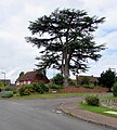
Dominant cedar on a Walford corner - geograph.org.uk - 5243862.jpg 722 × 800; 159 KB
-
Drive to The Homme - geograph.org.uk - 968543.jpg 640 × 480; 64 KB
-
Dropwort, Filipendula vulgaris - geograph.org.uk - 7200809.jpg 1,600 × 1,600; 881 KB
-
Dryopteris wallichiana - geograph.org.uk - 5915732.jpg 1,024 × 642; 185 KB
-
Echinacea purpurea - geograph.org.uk - 5853246.jpg 1,600 × 1,202; 872 KB
-
Edge of Chase Hill - geograph.org.uk - 6739632.jpg 1,200 × 735; 355 KB
-
Edge of Walford - geograph.org.uk - 5814173.jpg 1,600 × 900; 589 KB
-
Edward VII postbox - geograph.org.uk - 5830417.jpg 1,200 × 1,600; 696 KB
-
Elder flowers, Sambucus nigra - geograph.org.uk - 4057447.jpg 800 × 601; 273 KB
-
Entrance to Hill Court - geograph.org.uk - 4370040.jpg 800 × 536; 110 KB
-
Entrance to Hill House - geograph.org.uk - 5740751.jpg 1,600 × 1,200; 1.19 MB
-
Entrance to Marling Pitts - geograph.org.uk - 5740742.jpg 1,600 × 1,200; 1.3 MB
-
Entrance to Walford Primary School - geograph.org.uk - 3571578.jpg 800 × 600; 110 KB
-
Entrance to Walford Timber Ltd, Walford - geograph.org.uk - 3577682.jpg 800 × 598; 117 KB
-
Eupatorium purpureum - geograph.org.uk - 5851057.jpg 1,600 × 1,200; 578 KB
-
Evernia prunastri - geograph.org.uk - 5684789.jpg 1,600 × 1,404; 794 KB
-
Eyots in the Wye near Kerne Bridge - geograph.org.uk - 3678508.jpg 800 × 518; 110 KB
-
Farm building, Coughton - geograph.org.uk - 5194291.jpg 800 × 660; 123 KB
-
Farm road and public path - geograph.org.uk - 5310822.jpg 1,600 × 901; 724 KB
-
Farm track by the churchyard, Walford - geograph.org.uk - 6643172.jpg 1,024 × 768; 305 KB
-
Farm track on the edge of town - geograph.org.uk - 6691493.jpg 1,600 × 900; 813 KB
-
Farm workers' caravans, Coleraine Farm - geograph.org.uk - 1130013.jpg 640 × 481; 115 KB
-
Farmland near Howle Green - geograph.org.uk - 4415165.jpg 3,456 × 2,304; 3.57 MB
-
Farmland near Walford - geograph.org.uk - 766004.jpg 640 × 426; 52 KB
-
Ficaria verna, Lesser Celandine - geograph.org.uk - 5310840.jpg 1,600 × 1,200; 1.13 MB
-
Field of asparagus, Walford - geograph.org.uk - 1439087.jpg 640 × 426; 87 KB
-
Field of barley, approaching harvest - geograph.org.uk - 6543553.jpg 1,600 × 900; 654 KB
-
Fields near Kerne Bridge - geograph.org.uk - 4470295.jpg 2,592 × 1,944; 1.96 MB
-
Fields near Walford.jpg 3,624 × 2,512; 4.78 MB
-
Fields of barley - geograph.org.uk - 5853252.jpg 1,600 × 1,200; 740 KB
-
Fine fungi - geograph.org.uk - 5643398.jpg 1,600 × 1,092; 742 KB
-
Fine house at Forest Green - geograph.org.uk - 4814103.jpg 1,600 × 1,070; 713 KB
-
Fine old beech - geograph.org.uk - 5643399.jpg 1,200 × 1,600; 1.25 MB
-
Footbridge across Lodgegrove Brook - geograph.org.uk - 4104685.jpg 800 × 451; 218 KB
-
Footbridge over a brook, Walford - geograph.org.uk - 3571715.jpg 800 × 600; 223 KB
-
Footpath crossroads at Forest Green - geograph.org.uk - 4814097.jpg 1,600 × 900; 783 KB
-
Footpath south from Walford church - geograph.org.uk - 975836.jpg 640 × 480; 109 KB
-
Footpath to Walford - geograph.org.uk - 4091916.jpg 3,872 × 2,592; 4.8 MB
-
Forestry tracks in Chase Wood - geograph.org.uk - 4091827.jpg 3,872 × 2,592; 4.82 MB
-
Fowbridge Gardens - geograph.org.uk - 5817931.jpg 1,600 × 903; 672 KB
-
Fowbridge Gardens, Coughton - geograph.org.uk - 5176069.jpg 800 × 554; 99 KB
-
Fowbridge Gardens, Coughton - geograph.org.uk - 5244338.jpg 800 × 507; 129 KB
-
Fowbridge Gardens, Coughton - geograph.org.uk - 5834794.jpg 1,600 × 898; 645 KB
-
From 30 to 40 in Walford - geograph.org.uk - 5075336.jpg 800 × 708; 125 KB
-
From 40 to 20, Walford Road, Walford - geograph.org.uk - 5075192.jpg 800 × 613; 156 KB
-
Frost protection near Walford - geograph.org.uk - 2317233.jpg 3,008 × 2,000; 1.56 MB
-
Fruits of Viburnum opulus - geograph.org.uk - 5909824.jpg 1,600 × 899; 853 KB
-
Galanthus nivalis, Common Snowdrop - geograph.org.uk - 4820277.jpg 1,600 × 1,127; 709 KB
-
Ginkgo biloba, autumnal foliage - geograph.org.uk - 5973656.jpg 640 × 361; 161 KB
-
Give Way 50yds, Coughton - geograph.org.uk - 5194408.jpg 800 × 646; 181 KB
-
Give Way and Clean It Up in Coughton - geograph.org.uk - 5176050.jpg 800 × 709; 145 KB
-
Glimpse of a barn at Coughton - geograph.org.uk - 5814184.jpg 1,600 × 959; 895 KB
-
Glimpse of a cut haylage field - geograph.org.uk - 5814183.jpg 1,600 × 951; 822 KB
-
Grassy field and Hengrove Wood - geograph.org.uk - 5853244.jpg 1,600 × 910; 740 KB
-
Grassy field at Howle Hill - geograph.org.uk - 5814115.jpg 1,600 × 901; 747 KB
-
Grassy field at Howle Hill - geograph.org.uk - 5871069.jpg 1,600 × 901; 661 KB
-
Grassy track - geograph.org.uk - 975845.jpg 640 × 480; 93 KB
-
Great Howle - geograph.org.uk - 1280647.jpg 640 × 480; 213 KB
-
Great Howle Farm - geograph.org.uk - 5959812.jpg 1,600 × 900; 506 KB
-
Green Colley Grove, Walford - geograph.org.uk - 3575478.jpg 800 × 600; 134 KB
-
Green Colley Grove, Walford - geograph.org.uk - 5075268.jpg 800 × 604; 115 KB
-
Green hillside - geograph.org.uk - 5858357.jpg 1,600 × 901; 667 KB
-
Green Meadows - geograph.org.uk - 6723209.jpg 1,200 × 675; 419 KB
-
Hamamelis mollis - geograph.org.uk - 5676039.jpg 1,205 × 1,600; 670 KB
-
Hay cutting in the summer sun - geograph.org.uk - 5826500.jpg 1,600 × 1,071; 552 KB
-
Hazelhurst grounds - geograph.org.uk - 5692675.jpg 1,600 × 901; 774 KB
-
Hazelhurst grounds in March - geograph.org.uk - 5708478.jpg 1,600 × 901; 704 KB
-
Hazelhurst Nursing Home garden - geograph.org.uk - 5637522.jpg 1,600 × 901; 702 KB
-
Helleborus argutifolius - geograph.org.uk - 5683716.jpg 1,200 × 1,600; 1.11 MB
-
Hemerocallis fulva, Day Lily - geograph.org.uk - 5799165.jpg 1,600 × 1,200; 535 KB
-
Hengrove Wood - geograph.org.uk - 5965996.jpg 1,600 × 901; 625 KB


