Category:WGSRPD maps
Jump to navigation
Jump to search
Maps based on the World Geographical Scheme for Recording Plant Distributions.
Media in category "WGSRPD maps"
The following 68 files are in this category, out of 68 total.
-
Central Asia - political map - 2000-pa.svg 995 × 790; 153 KB
-
Central Asia - political map 2008 as.svg 996 × 790; 164 KB
-
Central Asia - political map 2008 hu.svg 996 × 790; 163 KB
-
Central Asia - political map 2008-es.svg 996 × 790; 302 KB
-
Central Asia - political map 2008-gu.svg 996 × 790; 165 KB
-
Central Asia - political map 2008-kn.svg 933 × 740; 142 KB
-
Central Asia - political map 2008-mr.svg 996 × 790; 138 KB
-
Central Asia - political map 2008-pa.svg 996 × 790; 156 KB
-
Central Asia - political map 2008-te.svg 996 × 790; 138 KB
-
Central Asia - political map 2008.svg 996 × 790; 164 KB
-
Mongolia on the globe (Asia centered).svg 793 × 793; 409 KB
-
Palearctic-Ecozone-Macaronesia.svg 476 × 685; 58 KB
-
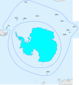
WGSRPD Antarctic.svg 2,580 × 2,767; 133 KB
-
WGSRPD Arabian Peninsula.svg 797 × 795; 594 KB
-
WGSRPD Australasia.svg 782 × 624; 1,011 KB
-
WGSRPD Brazil.svg 740 × 800; 408 KB
-
WGSRPD Caribbean.svg 527 × 312; 261 KB
-
WGSRPD Caucasus.svg 1,092 × 630; 208 KB
-
WGSRPD Central America.svg 527 × 312; 258 KB
-
WGSRPD Central Europe.svg 2,045 × 1,720; 713 KB
-
WGSRPD China.png 900 × 794; 240 KB
-
WGSRPD Clean text.svg 2,693 × 1,474; 1.41 MB
-
WGSRPD East Asia.svg 536 × 536; 633 KB
-
WGSRPD East Tropical Africa.svg 1,000 × 1,000; 188 KB
-
WGSRPD Eastern Canada.svg 1,789 × 2,154; 368 KB
-
WGSRPD Eastern Europe (inc. Russia).svg 845 × 736; 603 KB
-
WGSRPD Eastern Europe (Russia).svg 1,092 × 630; 209 KB
-
WGSRPD Eastern Europe.svg 2,045 × 1,720; 708 KB
-
WGSRPD Europe.svg 845 × 736; 603 KB
-
WGSRPD Indian Subcontinent.png 3,669 × 4,130; 2.62 MB
-
WGSRPD Indochina.svg 300 × 374; 553 KB
-
WGSRPD Malesia.svg 492 × 378; 615 KB
-
WGSRPD Mexico.jpg 1,211 × 990; 314 KB
-
WGSRPD Middle Atlantic Ocean.png 330 × 299; 16 KB
-
WGSRPD North Africa.jpg 1,662 × 1,662; 370 KB
-
WGSRPD North America.jpg 498 × 620; 71 KB
-
WGSRPD North-Central United States.svg 1,789 × 2,154; 368 KB
-
WGSRPD Northeast Tropical Africa.svg 1,024 × 1,024; 267 KB
-
WGSRPD Northeastern United States.svg 1,789 × 2,154; 368 KB
-
WGSRPD Northern America.svg 1,789 × 2,154; 1.03 MB
-
WGSRPD Northern Europe.svg 2,045 × 1,720; 713 KB
-
WGSRPD Northern South America.svg 740 × 800; 408 KB
-
WGSRPD Northwestern United States.svg 1,789 × 2,154; 368 KB
-
WGSRPD Pacific.svg 709 × 641; 262 KB
-
WGSRPD Papuasia.svg 1,020 × 680; 371 KB
-
WGSRPD Russian Far East.svg 1,092 × 630; 208 KB
-
WGSRPD Siberia.svg 1,092 × 630; 208 KB
-
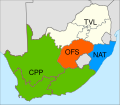
WGSRPD South Africa regions.svg 811 × 709; 620 KB
-
WGSRPD South Tropical Africa.svg 1,000 × 1,000; 188 KB
-
WGSRPD South-Central United States.svg 1,789 × 2,154; 368 KB
-
WGSRPD Southeast Europe2.jpg 4,544 × 3,823; 678 KB
-
WGSRPD Southeastern United States.svg 1,789 × 2,154; 368 KB
-
WGSRPD Southern Africa regions.svg 329 × 249; 2.84 MB
-
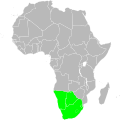
WGSRPD Southern Africa.svg 1,000 × 1,000; 188 KB
-
WGSRPD Southern America with regions.svg 740 × 800; 434 KB
-
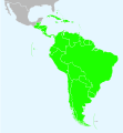
WGSRPD Southern America.svg 740 × 800; 414 KB
-
WGSRPD Southern South America.svg 740 × 800; 409 KB
-
WGSRPD Southwestern Europe.jpg 3,408 × 2,867; 1.82 MB
-
WGSRPD Southwestern United States.svg 1,789 × 2,154; 368 KB
-
WGSRPD Subarctic America.svg 1,789 × 2,154; 369 KB
-
WGSRPD Svět.jpg 2,693 × 1,474; 508 KB
-
WGSRPD West Tropical Africa.svg 1,000 × 1,000; 189 KB
-
WGSRPD West-Central Tropical Africa.svg 1,000 × 1,000; 189 KB
-
WGSRPD Western Asia.svg 797 × 795; 594 KB
-
WGSRPD Western Canada.svg 1,789 × 2,154; 368 KB
-
WGSRPD Western Indian Ocean.svg 553 × 553; 1.58 MB
-
WGSRPD Western South America.svg 740 × 800; 409 KB
-
WGSRPD World.svg 2,693 × 1,474; 1.73 MB


