Category:Volcano monitoring in the Canary Islands
Jump to navigation
Jump to search
Autonomous communities of Spain: Canary Islands · Autonomous cities:
Subcategories
This category has the following 3 subcategories, out of 3 total.
2
- 2011-2012 El Hierro eruption (18 F)
R
- Radar images of Teide (3 F)
S
- Satellite pictures of Teide (63 F)
Media in category "Volcano monitoring in the Canary Islands"
The following 7 files are in this category, out of 7 total.
-
 Estación sísmica en Timanfaya- Lanzarote- Illas Canarias- Spain-T16.jpg 5,463 × 2,940; 14.89 MB
-
 Geochemical monitoring station Teide.jpg 3,232 × 2,029; 4.71 MB
-
 TanDEM-X 3D model of Mount Teide on Tenerife Island (PNG).png 2,336 × 1,344; 5.34 MB
-
 TanDEM-X 3D model of Mount Teide on Tenerife Island (TIFF).tif 2,336 × 1,344; 7.46 MB
-
 TEIDE.JPG 3,600 × 2,180; 1.89 MB
-
 Teneguia volcano on La Palma - 2007-01-04 D.jpg 3,888 × 2,592; 7.67 MB
-
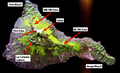 TNF-NASAmap-Labels.png 720 × 436; 431 KB


.png)


