Category:Visscher (cartographers)
Jump to navigation
Jump to search
publishing house of the Dutch engravers and cartographers Visscher in Europe in the 17th century. | |||||
| Upload media | |||||
| Instance of | |||||
|---|---|---|---|---|---|
| |||||
Category is for members of this family of cartographers, engravers etc.
- Claes Jansz. Visscher (I) (1550-1612)
- Claes Jansz. Visscher (II) (1587-1652)
- Cornelis Visscher (1629-1662)
- Nicolaes Visscher I (1618-1679)
- Nicolaes Visscher II (1649-1702)
Subcategories
This category has the following 15 subcategories, out of 15 total.
A
C
- Claes Jansz. Visscher (I) (20 F)
L
N
P
- Piscator Bible (9 F)
S
- Speculum Zelandiae (55 F)
T
- Theatrum Biblicum (20 F)
V
Media in category "Visscher (cartographers)"
The following 46 files are in this category, out of 46 total.
-
1604 Lierman C J Visscher.jpg 1,200 × 912; 544 KB
-
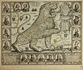
1609 Novissima et Accuratissima Leonis Belgici Visscher.jpg 3,346 × 2,761; 8.73 MB
-
1609 Novissima Visscher³.jpg 3,358 × 2,770; 13.78 MB
-
1616 London Visscher mr.jpg 4,500 × 1,071; 4 MB
-
1622 Caerte van t'Vrije - sijnde een gedeelte en lidt van Vlaenderen - Visscher.jpg 6,090 × 4,754; 10.69 MB
-
1650 Leo Visscher.jpg 3,343 × 2,803; 4.23 MB
-
1670 America Visscher mr.jpg 2,500 × 2,022; 4.72 MB
-
1684 Germania Inferior Visscher.JPG 354 × 556; 232 KB
-
1690 Nova Tabula Visscher.jpg 3,986 × 5,060; 2.45 MB
-
1695 Flandriae Occi Visscher.jpg 7,580 × 6,431; 6.89 MB
-
1700 Orbis Terrarum Visscher mr.jpg 2,250 × 1,918; 4.58 MB
-
1748 Topo graphy le Rouge.jpg 9,556 × 8,277; 38.3 MB
-
1785 Zelande LeRouge 9x GAV copy.jpg 8,818 × 7,707; 21.8 MB
-
3016 Print 14929kopie.jpg 500 × 408; 2.28 MB
-
Afbeelding der stadt fortressen van Parayba.jpg 4,227 × 3,152; 4.69 MB
-
Belgium Foederatum 1680.jpg 5,500 × 4,626; 5.27 MB
-
Cartouche in a Ceylon map by Visscher.jpeg 1,859 × 1,755; 903 KB
-
De Heylige en Wytvermaerde Stadt Ierusalem Eerst Genaemt Salem Genesis 14 Vers 18.jpg 11,959 × 8,199; 29.61 MB
-
De Heylige en Wytvermaerde Stadt Ierusalem Eerst Genaemt Salem Genesis 14. Vers 18.jpg 1,751 × 1,515; 777 KB
-
Doren-1641-Otto-de-Visscher.jpg 677 × 522; 436 KB
-
Drukkersmerk C J Visscher.jpg 219 × 78; 32 KB
-
Exactissima Tabula qua tam Danubii Fluvii Pars Inferior.jpg 4,934 × 4,068; 3.89 MB
-
Figurative cartouche on an Americas map by Visscher.jpg 1,134 × 506; 661 KB
-
Filipeia detalhe Afbeelding der stadt.jpg 2,096 × 1,660; 1.19 MB
-
Galliae seu Franciae tabula Visscher Nicolas.jpg 2,003 × 1,447; 572 KB
-
KLEMMBACH VISSCHER 1670.jpg 2,048 × 1,152; 435 KB
-
Leo Hollandicus (Comitatus Hollandiae denuo forma Leonis) CJ Visscher 1648.jpg 6,705 × 5,569; 14.34 MB
-
London Bridge (1616) by Claes Van Visscher.jpg 1,850 × 1,210; 1.77 MB
-
Maastricht 1700 Visscher.jpg 1,550 × 1,890; 2.83 MB
-
Mapa Conquista da Paraiba.jpg 6,047 × 4,524; 5.78 MB
-
Michiel van Musscher 002.jpg 2,142 × 2,500; 494 KB
-
Middelburg 1671 Visscher.jpg 5,427 × 1,361; 7.23 MB
-
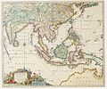
Orientalis Idiae.jpg 2,069 × 1,718; 1.37 MB
-
Panorama of London by Claes Van Visscher, 1616 no angels.jpg 2,555 × 290; 594 KB
-
Peloponnesus hodie Morea... - per Nicolaum Visscher - btv1b5962341w.jpg 6,720 × 5,520; 6.14 MB
-
Piscator Bible 274.jpg 989 × 851; 212 KB
-
Piscator Bible Apocalyps Angel with book.jpg 667 × 514; 102 KB
-
Piscators.jpg 582 × 402; 69 KB
-
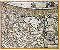
RHENOLANDIA AMSTELANDIA 1681.jpg 4,400 × 3,674; 4.54 MB
-
Ter Nisse op een kaart uit 1748 (Topography le Rouge).jpg 699 × 523; 254 KB
-
Totius Alsatiae Nicolas Visscher map - Ochsenstein detail.jpg 521 × 318; 176 KB
-
Zs10 Vlissingen Lant 1 Roman.JPG 1,200 × 912; 735 KB


