Category:Violence maps
Jump to navigation
Jump to search
Subcategories
This category has the following 2 subcategories, out of 2 total.
R
V
Media in category "Violence maps"
The following 18 files are in this category, out of 18 total.
-
2012 Assam Violence map as.svg 419 × 565; 314 KB
-
2012 Assam Violence map.svg 419 × 565; 317 KB
-
AlexanderReidRoss IncidentMap.png 1,918 × 940; 622 KB
-
Bangladesh districts affected by 2013 Anti-Hindu violence.svg 700 × 800; 1.71 MB
-
GVA Map 2023.jpg 715 × 486; 123 KB
-
India map Naxal Left-wing violence or activity affected districts 2013.SVG 1,578 × 1,738; 862 KB
-
LatinAmericaViolence.svg 1,023 × 645; 2.06 MB
-
Map of states showing number of gun murders in 2010.svg 1,000 × 630; 73 KB
-
MNS violence map.svg 1,639 × 1,852; 1.06 MB
-
Naxal Left-wing violence or activity affected districts of India 2018.svg 1,649 × 1,858; 772 KB
-
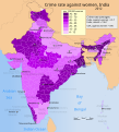
Unsafe areas for women in india.png 1,000 × 1,167; 159 KB
-
Violence against women in the European Union.svg 600 × 550; 223 KB
-
Violencia27022007.jpg 2,257 × 1,525; 930 KB
-
Zones de conflit en Birmanie.png 1,324 × 2,938; 266 KB


