Category:Viburnum lentago range maps
Jump to navigation
Jump to search
Media in category "Viburnum lentago range maps"
The following 5 files are in this category, out of 5 total.
-
 Viburnum lentago NY-dist-map.png 500 × 375; 11 KB
-
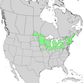
 Viburnum lentago range map 0.png 9,624 × 12,505; 1.24 MB
-
 Viburnum lentago range map 1.png 6,901 × 6,902; 756 KB
-
 Viburnum lentago range map 2.png 3,984 × 3,985; 295 KB
-
 Viburnum lentago range map 3.png 3,924 × 2,943; 255 KB


