Category:Verlag Carl Flemming, Glogau
Jump to navigation
Jump to search
Subcategories
This category has the following 9 subcategories, out of 9 total.
E
F
- Flemmings Kriegskarten (77 F)
H
M
- Maps by Carl Flemming (2 F)
R
- Reineke Fuchs von Fedor Flinzer (1 P, 60 F)
S
Media in category "Verlag Carl Flemming, Glogau"
The following 29 files are in this category, out of 29 total.
-
Alt und Neu Lönnewitz Karte.jpg 1,147 × 714; 298 KB
-
Chile.1855.djvu 7,863 × 6,388; 4.74 MB
-
Composite. Europaischen Russland. 1855. (A).jpg 1,811 × 1,250; 702 KB
-
Composite. Europaischen Russland. 1855. (B).jpg 934 × 627; 276 KB
-
Composite. Europaischen Russland. 1855. (C).jpg 756 × 348; 128 KB
-
Composite. Europaischen Russland. 1855. (D).jpg 2,290 × 1,694; 1.09 MB
-
Composite. Europaischen Russland. 1855. (E).jpg 967 × 984; 296 KB
-
Composite. Europaischen Russland. 1855.jpg 5,351 × 6,367; 7.21 MB
-
Eisenbahn- und Dampschiffrouten-Karte von Europa - bearbeitet von J. Franz - btv1b53093089c.jpg 22,062 × 17,053; 55.66 MB
-
Eisenbahn-und-Dampfschiff-routen-Karte von Europa - bearbeitet von J. Franz - btv1b532394204.jpg 22,125 × 16,963; 61.44 MB
-
Elbthal, das (1837).jpg 864 × 640; 351 KB
-
Floßgraben Elsterwerda 2.jpg 4,276 × 4,310; 8.59 MB
-
Floßgraben Elsterwerda.jpg 3,673 × 2,952; 4.67 MB
-
Heidaer Heide Karte.jpg 1,242 × 963; 1.25 MB
-
Karte Elsterwerda Grödel Floßkanal.jpg 1,813 × 2,040; 1.39 MB
-
Kreis Liebenwerda.jpg 8,275 × 7,190; 17.47 MB
-
Landkreis Liebenwerda 1860.jpg 4,408 × 3,240; 13.09 MB
-
Raab's Karte der Eisenbahnen Russland's - btv1b53025287r.jpg 7,173 × 7,825; 11.68 MB
-
Rathaus Breslau c1885.jpg 859 × 1,200; 355 KB
-
The Grand Duchies of Mecklenburg (1855).jpg 8,098 × 6,468; 6.65 MB
-
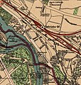
ZLB-Silva-Karte-1925-Ausschnitt-Rummelsburg.JPG 787 × 829; 171 KB


