Category:Upper Silesia
Jump to navigation
Jump to search
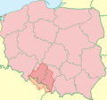
part of the historical region of Silesia in Poland and Czechia | |||||
| Upload media | |||||
| Instance of | |||||
|---|---|---|---|---|---|
| Patron saint | |||||
| Location |
| ||||
| Located in or next to body of water | |||||
| Capital | |||||
| Currency | |||||
| Highest point |
| ||||
| Population |
| ||||
| Area |
| ||||
| Different from | |||||
 | |||||
Górny Śląsk / Oberschlesien / Horní Slezsko / Upper Silesia
Subcategories
This category has the following 14 subcategories, out of 14 total.
Pages in category "Upper Silesia"
The following 2 pages are in this category, out of 2 total.
Media in category "Upper Silesia"
The following 39 files are in this category, out of 39 total.
-
"Szczoteczka" ("pliśborta").jpg 608 × 335; 79 KB
-
02022 0313 Maria Konopnicka’s manor house in Żarnowiec.jpg 2,654 × 2,151; 964 KB
-
02023 1349 Uopolski Ślůnsk, 17th March for Autonomy in Silesia.jpg 4,053 × 2,695; 1.63 MB
-
CCI10022022 00000.jpg 6,366 × 4,146; 15.92 MB
-
Chusta "purpurka".jpg 152 × 514; 53 KB
-
De-Oberschlesien.ogg 2.3 s; 22 KB
-
ETH-BIB-Elektrische Förderung unter Tag, Ober-Schlesien-Dia 247-02219-1.tif 3,595 × 2,719; 9.4 MB
-
ETH-BIB-Grobblechwalzwerk, Ober-Schlesien-Dia 247-02219-2.tif 3,590 × 2,731; 28.15 MB
-
ETH-BIB-Hochofenanlage bei Nacht, Ober-Schlesien-Dia 247-02221-2.tif 3,595 × 2,752; 28.4 MB
-
ETH-BIB-Pfeilerabbau im ansteigenden Flötz, Ober-Schlesien-Dia 247-02224-1.tif 3,633 × 2,660; 9.3 MB
-
ETH-BIB-Stahlwerk, Abstich eines Martinofens, Ober-Schlesien-Dia 247-02223-1.tif 3,638 × 2,634; 27.5 MB
-
Fakten schlesischer Geschichte 2001 Seite 69.jpg 1,081 × 1,365; 588 KB
-
Górny Śląsk TT mapa.png 808 × 755; 130 KB
-
Heimatmuseum Vertriebene IMG 3700.JPG 4,000 × 3,000; 3.05 MB
-
Hymn Norodu Ślůnskjygo manuscript.jpg 1,923 × 2,679; 4.79 MB
-
Kabotek do merynki.jpg 3,549 × 1,964; 1.1 MB
-
Karte des Deutschen Reiches - Composite 519, Ratibor 5820519c.jpg 11,695 × 9,333; 29.58 MB
-
Karte des Oberschlesischen Industriebezirks.jpg 9,442 × 7,795; 37.28 MB
-
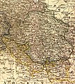
Karte Oberschlesiens 1818.jpg 1,677 × 1,856; 1.38 MB
-
Land- und Stadtkreise Beuthen 1920.png 1,222 × 1,086; 491 KB
-
Lange diercke sachsen deutschland oberschlesien.jpg 2,528 × 1,004; 1.53 MB
-
Merinka.jpg 2,668 × 1,810; 1.05 MB
-
Moryrok.jpg 697 × 1,475; 167 KB
-
Oberschlesien, Landkreise 1922 - 1939.png 1,000 × 941; 184 KB
-
Oberschlesisches Weihnachtsessen- Makówki.jpg 1,600 × 1,067; 844 KB
-
Ozdoby, Półwieś, okres brązu, Wrocław.jpg 2,816 × 2,112; 1.71 MB
-
Pled - przykład.jpg 4,128 × 3,096; 3.79 MB
-
Purpurka.jpg 1,027 × 1,551; 431 KB
-
Spódnica-halka.jpg 2,931 × 2,597; 1.01 MB
-
Stefan Norblin - Polska. Górny Śląsk (ok. 1925).jpg 3,000 × 4,843; 833 KB
-
Szpigel.jpg 4,128 × 3,096; 3.88 MB
-
Upper Silesia public transport system map (with stations).png 10,357 × 9,249; 41.93 MB
-
Watówka.jpg 3,068 × 3,783; 1.52 MB
-
Wietrzenie "tureckiej chusty", używanej na Górnym Śląsku w stroju ludowym.jpg 1,541 × 1,180; 675 KB
-
Zapaska.jpg 3,066 × 2,945; 1.38 MB
-
Zbiór starych górnośląskich pieśni ludowych z nutami (1920).djvu 2,210 × 3,425, 98 pages; 2.57 MB
-
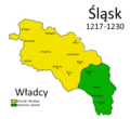
Śląsk 1217-1230.png 1,000 × 915; 107 KB
-
Środek "tureckiej chusty".jpg 1,024 × 768; 451 KB


