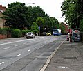
Category:Upper Newtownards Road, Belfast
Jump to navigation
Jump to search
Media in category "Upper Newtownards Road, Belfast"
The following 66 files are in this category, out of 66 total.
-
613 Upper Newtownards Road, Belfast - geograph.org.uk - 2534922.jpg 640 × 438; 118 KB
-
Bloomfield Baptist Church, Belfast - geograph.org.uk - 1427850.jpg 640 × 411; 71 KB
-
Conn's Water above the Upper Newtownards Road Bridge - geograph.org.uk - 5464731.jpg 3,515 × 2,635; 1.14 MB
-
Dandelion and tree, Belfast - geograph.org.uk - 1806546.jpg 640 × 491; 195 KB
-
Development site, Knock, Belfast - geograph.org.uk - 694531.jpg 640 × 374; 85 KB
-
East Bread Street, off Upper Newtownards Road - geograph.org.uk - 5469920.jpg 3,661 × 2,746; 1.06 MB
-
Ravenscroft Avenue off Upper Newtownards Road - geograph.org.uk - 5469926.jpg 3,340 × 2,505; 1.03 MB
-
Ravenscroft Avenue, off Upper Newtownards Road, Belfast - geograph.org.uk - 5467934.jpg 4,000 × 3,000; 2.14 MB
-
The Albertbridge Road junction on the Upper Newtownards Road - geograph.org.uk - 5470127.jpg 4,000 × 3,000; 1.86 MB
-
The Holywood Arches, Belfast (3) - geograph.org.uk - 721956.jpg 640 × 411; 83 KB
-
The Upper Newtownards Road, Belfast - geograph.org.uk - 1655442.jpg 640 × 367; 77 KB
-
Townsley Street off the Upper Newtownards Road - geograph.org.uk - 2991307.jpg 1,024 × 751; 135 KB
-
Upper Newtownards Road house ripe for redevelopment - geograph.org.uk - 5468107.jpg 3,599 × 2,699; 1.53 MB
-
Upper Newtownards Road, Belfast - geograph.org.uk - 877888.jpg 640 × 482; 426 KB
-
Upper Newtownards Road, Belfast - geograph.org.uk - 877891.jpg 640 × 546; 437 KB


