Category:Upper German - Raetian Limes
Jump to navigation
Jump to search
|
This place is a UNESCO World Heritage Site, listed as
Frontiers of the Roman Empire.
|
Für römische Bauwerke abseits des Limes siehe Category:Ancient Roman architecture in Germany.
Deutsch: Der Obergermanisch-Raetische Limes (ORL) ist ein 550 km langer Abschnitt der ehemaligen Außengrenze des Römischen Reichs zwischen Rhein und Donau. Er erstreckt sich von Rheinbrohl bis zum Kastell Eining an der Donau. Der Obergermanisch-Raetische Limes ist ein Bodendenkmal und seit 2005 Weltkulturerbe der UNESCO.
archaeological site in Germany | |||||
| Upload media | |||||
| Instance of | |||||
|---|---|---|---|---|---|
| Part of | |||||
| Location | |||||
| Heritage designation |
| ||||
 | |||||
Subcategories
This category has the following 6 subcategories, out of 6 total.
A
- Alblimes (3 F)
D
- Deutscher Limes-Radweg (9 F)
L
- Lautertal-Limes (2 F)
- Limes in Osterburken (26 F)
R
U
Media in category "Upper German - Raetian Limes"
The following 32 files are in this category, out of 32 total.
-
200910071500MEZ Limesübergang (H.W.v.Goddenthow).jpg 2,155 × 2,199; 2.05 MB
-
201010311448MEZ Saalburg Limes 01.jpg 3,264 × 2,448; 6.54 MB
-
201010311448MEZ Saalburg Limes 02.jpg 3,264 × 2,448; 7.18 MB
-
Agri decumates Karte.png 2,950 × 3,050; 3.02 MB
-
Das Numeruskastell Wörth am Main Bestand.png 444 × 491; 79 KB
-
Der Römische Limes (8753348107).jpg 3,802 × 3,061; 7.74 MB
-
Forest and Limes.jpg 5,184 × 3,888; 10.3 MB
-
Holzbach Limesdurchbruch R0018176.jpg 3,648 × 2,736; 3.68 MB
-
Kastell Trennfurt - Grundriss.jpg 896 × 1,176; 535 KB
-
Kastell Trennfurt - Lageplan.jpg 1,482 × 1,557; 1.74 MB
-
Limes (Ausschnitt).jpg 1,205 × 651; 520 KB
-
Limes (Übersichtskarte).jpg 3,506 × 2,550; 1.74 MB
-
Limes Entwicklungsphasen.jpg 344 × 560; 49 KB
-
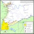
Limes germanico-retico Domiziano.png 1,680 × 1,686; 173 KB
-
Limes Neckar Odenwald Kreis Karte Scheidental IMG 20230518 1119.jpg 2,328 × 3,168; 2.13 MB
-
Limes Unesco (8757659567).jpg 4,238 × 2,789; 5.87 MB
-
Limes-Denkmal in Gundelshalm2.JPG 2,048 × 1,536; 1.63 MB
-
Limessäule Höttingen.jpg 1,987 × 2,981; 362 KB
-
Mainhardt-Limesanlage 2011-01.jpg 2,816 × 1,880; 3.02 MB
-
Mainhardt-Limesanlage 2011-02.jpg 2,816 × 1,880; 3.33 MB
-
ORL 33 tab 02 pic 01 Grundriss.jpg 8,070 × 11,328; 6.53 MB
-
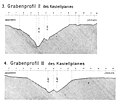
ORL 33 tab 03 pic 03+04 Grabenprofile.jpg 7,645 × 6,669; 4.53 MB
-
ORL 33 tab 04 pic 01-09 Thermen.jpg 8,680 × 12,600; 10.13 MB
-
ORL 33 tab 05 pic 01 Mithraeum und Dolichenum Lage.jpg 15,023 × 4,840; 1.91 MB
-
ORL 33 tab 06 pic 02 Anlegestelle.jpg 5,940 × 8,313; 16.99 MB
-
Römerstein in Trennfurt - Inschrift.jpg 660 × 791; 458 KB
-
RömerWelt Rheinbrohl (Limes) 19.jpg 5,472 × 3,648; 4.99 MB
-
RömerWelt Rheinbrohl (Limes) 20.jpg 5,472 × 3,648; 4.67 MB
-
RömerWelt Rheinbrohl (Limes) 21.jpg 5,472 × 3,648; 6.04 MB
-
RömerWelt Rheinbrohl (Limes) 22.jpg 5,472 × 3,648; 4.92 MB
-
Turmreste Gaulskopf.jpg 3,121 × 2,073; 2 MB
-
Upper Germanic-Rhaetian Limes banner.jpg 4,568 × 653; 2.44 MB


