Category:Uploads by Polarlys
Jump to navigation
Jump to search
Subcategories
This category has the following 24 subcategories, out of 24 total.
Media in category "Uploads by Polarlys"
The following 200 files are in this category, out of 291 total.
(previous page) (next page)-
Adalbert Grüllich.jpg 829 × 1,143; 494 KB
-
Adelbert von Chamisso - map of the Caroline Islands.jpg 5,590 × 3,840; 5.16 MB
-
Adolph Seeligmüller.webp 459 × 590; 50 KB
-
Alexander Ritter im Jahr 1885.jpg 971 × 1,384; 581 KB
-
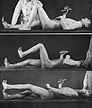
Arthur Simons - Hemiplegic associated reactions.jpg 706 × 822; 367 KB
-
August Heinrich Sahland (cropped).png 688 × 1,003; 959 KB
-
August Heinrich Sahland.png 839 × 1,329; 1.38 MB
-
Belagerung von Kolberg 1807.png 2,147 × 1,677; 4.49 MB
-
Bruno Schulz - Karte der südlichen Ostsee.jpg 5,462 × 3,071; 2.32 MB
-
Carl Frey (cropped).jpg 1,169 × 1,685; 1 MB
-
Carl Frey.jpg 1,434 × 2,114; 1.23 MB
-
Chaddock reflex.jpg 1,786 × 950; 251 KB
-
Die Akademie der Tonkunst in München.jpg 1,409 × 941; 565 KB
-
Drolshagen - Übersichtskarte der Rentengutskolonie Beestland 1911.png 6,462 × 4,675; 30.1 MB
-
Einwohner von Klucken 1898.jpg 4,500 × 3,176; 1.04 MB
-
Ernst Brausewetter.jpg 397 × 556; 90 KB
-
Festung Geldern.tif 13,253 × 9,284; 42.31 MB
-
Rudolf Flex und Familie (cropped).jpg 1,247 × 1,719; 852 KB
-
Rudolf Flex und Familie (Rückseite).jpg 1,320 × 2,009; 869 KB
-
Rudolf Flex und Familie.jpg 1,305 × 1,995; 922 KB
-
Rudolf Flex.jpg 417 × 547; 677 KB
-
Rudolf und Margarete Flex (cropped).jpg 1,168 × 1,644; 852 KB
-
Rudolf und Margarete Flex.jpg 1,315 × 2,025; 957 KB
-
Martin and Walter Flex (cropped).jpg 1,184 × 1,780; 826 KB
-
Martin and Walter Flex.jpg 1,290 × 2,002; 907 KB
-
Martin und Walter Flex (back).jpg 1,290 × 2,005; 833 KB
-
Walter Flex (and other soldier) (cropped).jpg 1,034 × 1,652; 844 KB
-
Walter Flex (and other soldier).jpg 1,068 × 1,697; 853 KB
-
Walter Flex (and other soldier, back).jpg 1,068 × 1,696; 828 KB
-
Walter Flex (August 1914).jpg 1,307 × 2,013; 894 KB
-
Walter Flex (August 1914, back).jpg 1,275 × 2,013; 901 KB
-
Walter Flex (back).jpg 1,083 × 1,679; 826 KB
-
Walter Flex (cropped).jpg 946 × 1,419; 806 KB
-
Walter Flex (crossing to Saaremaa).jpg 1,053 × 702; 713 KB
-
Walter Flex (crossing to Saaremaa, back).jpg 1,053 × 702; 731 KB
-
Walter Flex (group photo).jpg 1,697 × 1,087; 943 KB
-
Walter Flex (group photo, back).jpg 1,697 × 1,088; 862 KB
-
Walter Flex (June 1916) (cropped).jpg 921 × 1,404; 779 KB
-
Walter Flex (June 1916).jpg 1,055 × 1,671; 823 KB
-
Walter Flex (June 1916, back).jpg 1,055 × 1,674; 839 KB
-
Walter Flex (on horseback).jpg 1,673 × 1,058; 833 KB
-
Walter Flex (on horseback, back).jpg 1,672 × 1,057; 809 KB
-
Walter Flex (Ostfront).jpg 1,019 × 1,575; 788 KB
-
Walter Flex (Ostfront, back).jpg 1,000 × 1,576; 780 KB
-
Walter Flex (standing 2).jpg 1,058 × 1,674; 810 KB
-
Walter Flex (standing 2, back).jpg 1,057 × 1,674; 779 KB
-
Walter Flex (standing) (cropped).jpg 984 × 1,619; 745 KB
-
Walter Flex (standing).jpg 1,063 × 1,667; 759 KB
-
Walter Flex (standing, back).jpg 1,666 × 1,074; 912 KB
-
Friedrich von Hausegger.png 259 × 388; 85 KB
-
Garnisonsumgebungskarte Leipzig (1911).jpg 10,858 × 9,265; 18.87 MB
-
Gneisenau-Nettelbeck-Denkmal.png 1,044 × 1,570; 2.5 MB
-
Grundriss der Festung Spandau.tif 10,516 × 7,766; 25.82 MB
-
Grundriss von Prenzlau 1741.tif 8,436 × 5,226; 12.11 MB
-
Gustav Eskuche.png 917 × 1,421; 876 KB
-
Gustav Jahn (Schriftsteller).jpg 571 × 791; 137 KB
-
Hans Bensmann.webp 814 × 1,131; 165 KB
-
Hans Peter Hallbeck.jpg 1,009 × 1,280; 404 KB
-
Hertha v. Hausegger, geb. Ritter.jpg 938 × 1,402; 614 KB
-
Hoogeweg - Karte der Stifte und Klöster der Provinz Pommern (1925).png 5,821 × 3,201; 19.22 MB
-
Joachim Nettelbeck.png 1,092 × 1,317; 1.84 MB
-
Joseph von Gerlach.jpg 373 × 500; 28 KB
-
Julie von Behr (verh. von Massow) (cropped).jpg 983 × 1,204; 709 KB
-
Julie von Behr (verh. von Massow).jpg 1,372 × 2,208; 979 KB
-
Karl Gottfried Salzmann Litho (cropped).jpg 1,286 × 1,918; 332 KB
-
Karl Röhrig (cropped).jpg 421 × 689; 24 KB
-
Karl Röhrig.jpg 532 × 840; 49 KB
-
Karte der Festung Dömitz - 1.tif 7,040 × 5,483; 6.96 MB
-
Karte der Festung Dömitz - 2.tif 9,331 × 7,234; 10.24 MB
-
Karte der Festung Heldrungen.tif 6,603 × 5,239; 11.56 MB
-
Karte der Festung Peitz.tif 5,111 × 5,079; 8.81 MB
-
Karte der Festung Regenstein.tif 6,163 × 4,711; 5.67 MB
-
Karte der Festung Wülzburg.tif 6,309 × 7,752; 7.65 MB
-
Karte der Hetlinger Schanze.tif 8,979 × 6,463; 17.51 MB
-
Karte der Stadt Pirna und der Festung Sonnenstein.tif 9,844 × 7,784; 24.46 MB
-
Karte des Klosters Strausberg.tif 7,158 × 5,232; 6.27 MB
-
Karte Seidau.jpg 1,586 × 2,226; 387 KB
-
Karte von Altentreptow.tif 6,355 × 4,572; 9.65 MB
-
Karte von Aussig (ca. 1750).tif 10,771 × 7,635; 30.32 MB
-
Karte von Bautzen (etwa 1750).tif 6,143 × 8,180; 15.69 MB
-
Karte von Bautzen (um 1750).tif 7,919 × 6,103; 15.86 MB
-
Karte von Braunschweig - 1.tif 6,952 × 8,869; 21.2 MB
-
Karte von Braunschweig - 2.tif 5,661 × 7,332; 8.5 MB
-
Karte von Budweis (um 1745).tif 7,167 × 5,414; 5.35 MB
-
Karte von Burg (um 1750).tif 8,595 × 6,415; 6.29 MB
-
Karte von Calbe (Saale) um 1750.tif 8,829 × 5,323; 5.25 MB
-
Karte von Dippoldiswalde.tif 5,981 × 4,201; 9.75 MB
-
Karte von Dresden (mit Neustadt, um 1730).tif 6,601 × 8,674; 9.69 MB
-
Karte von Dresden (um 1730).tif 10,317 × 7,542; 14.59 MB
-
Karte von Egeln.tif 8,450 × 5,332; 11.48 MB
-
Karte von Elbing, ca. 1720.webp 4,522 × 3,655; 22.34 MB
-
Karte von Elbing.tif 6,511 × 8,660; 19.38 MB
-
Karte von Emden.tif 7,489 × 10,047; 15.82 MB
-
Karte von Erfurt (um 1730).tif 8,117 × 6,190; 8.61 MB
-
Karte von Erfurt (um 1750).tif 9,690 × 8,113; 20.01 MB
-
Karte von Fort Peenemünde (um 1750).tif 5,687 × 4,384; 7.26 MB
-
Karte von Frankfurt (Oder) um 1700.tif 3,435 × 4,610; 45.31 MB
-
Karte von Frauenstein (um 1750).tif 5,724 × 3,565; 7.65 MB
-
Karte von Freiberg (um 1750).tif 3,315 × 4,347; 4.88 MB
-
Karte von Freyburg (Unstrut).tif 6,385 × 5,283; 12.34 MB
-
Karte von Greifswald um 1825 (Rückseite).tif 7,028 × 5,188; 4.93 MB
-
Karte von Greifswald um 1825 (Vorderseite).tif 7,028 × 5,188; 6.36 MB
-
Karte von Grimma (um 1750).tif 8,935 × 6,568; 20.7 MB
-
Karte von Gross-Glogau (1750).jpg 10,999 × 7,864; 17.71 MB
-
Karte von Groß-Glogau (um 1730).tif 7,852 × 5,752; 7.38 MB
-
Karte von Gross-Glogau (um 1750).jpg 9,760 × 6,554; 13.26 MB
-
Karte von Gross-Glogau (um 1750).tif 11,031 × 7,808; 30.96 MB
-
Karte von Hadmersleben.tif 8,626 × 5,292; 12.78 MB
-
Karte von Herford.tif 7,834 × 5,204; 8.2 MB
-
Karte von Ilmenau.tif 3,274 × 5,315; 5.19 MB
-
Karte von Jägerndorf.tif 7,688 × 4,921; 6.45 MB
-
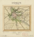
Karte von Köslin 1836.tif 2,310 × 2,513; 7.56 MB
-
Karte von Küstrin (um 1700).tif 7,369 × 9,377; 12.57 MB
-
Karte von Küstrin.tif 10,591 × 7,977; 18.34 MB
-
Karte von Leitmeritz 1742.tif 8,503 × 6,510; 20.05 MB
-
Karte von Leitmeritz 1742.tiff 9,136 × 7,930; 27.87 MB
-
Karte von Lippstadt.tif 6,666 × 5,836; 15.95 MB
-
Karte von Löbau um 1750.tif 4,558 × 3,765; 5.35 MB
-
Karte von Magdeburg (um 1750).tif 10,006 × 8,071; 24.45 MB
-
Karte von Marienberg.tif 5,563 × 6,772; 14.45 MB
-
Karte von Marienwerder und Umland.tif 9,429 × 7,649; 26.21 MB
-
Karte von Meißen (um 1750).tif 6,528 × 8,409; 13.79 MB
-
Karte von Namslau.tif 3,293 × 2,703; 25.47 MB
-
Karte von Neisse (Nysa).tif 11,151 × 8,338; 32.25 MB
-
Karte von Neuhaldensleben (um 1750).tif 5,926 × 5,222; 8.86 MB
-
Karte von Neustadt Eberswalde.tiff 10,174 × 8,082; 24.23 MB
-
Karte von Oebisfelde (um 1750).tiff 5,292 × 5,703; 8.5 MB
-
Karte von Olmütz (Olomouc).tif 9,377 × 8,491; 14.33 MB
-
Karte von Pirmasens (um 1790).tiff 11,267 × 7,879; 28.51 MB
-
Karte von Prenzlau (um 1750).tif 2,686 × 2,321; 17.84 MB
-
Karte von Pressburg.tif 8,740 × 6,109; 16.83 MB
-
Karte von Pritzwalk.tif 6,632 × 11,712; 12.18 MB
-
Karte von Pulsnitz.tif 2,530 × 2,963; 2.68 MB
-
Karte von Ratibor (ca. 1750).tif 7,785 × 5,080; 11.41 MB
-
Karte von Ratibor (um 1750).tif 7,746 × 4,981; 10.67 MB
-
Karte von Sankt Petersburg (um 1717).tif 11,104 × 7,958; 18.55 MB
-
Karte von Schweidnitz.tif 9,635 × 7,454; 11.64 MB
-
Karte von Tetschen (Děčín).tif 5,369 × 3,451; 3.85 MB
-
Karte von Wanzleben.tif 5,992 × 7,341; 10.79 MB
-
Karte von Wilsdruff (1746).tif 6,592 × 5,460; 6.71 MB
-
Karte von Wittenberg (ca. 1750).tif 9,420 × 7,810; 21.91 MB
-
Karte von Wittenberg (um 1700).tif 3,865 × 6,252; 5.04 MB
-
Karte von Wittenberg (um 1750).tif 8,555 × 6,254; 8.67 MB
-
Karte von Wurzen.tif 9,736 × 7,057; 22.3 MB
-
Karte von Zittau.tif 8,089 × 5,515; 9.31 MB
-
Karte von Zwickau (um 1750).tif 4,885 × 3,871; 3.17 MB
-
Karte von Zwickau.tif 9,556 × 8,767; 17.74 MB
-
Karte Westliches Hinterpommern Anfang des 18. Jahrhunderts.png 3,023 × 4,702; 22.6 MB
-
Kirche Herz Jesu in Plauen im Vogtland.jpg 1,389 × 2,100; 860 KB
-
Ludwig Giesebrecht.png 723 × 915; 922 KB
-
Map of Belfort (around 1750).tif 11,702 × 8,355; 37.35 MB
-
Map of Bergen op Zoom (around 1747).tif 10,089 × 7,076; 7.95 MB
-
Map of Breda.tif 10,845 × 9,656; 27.48 MB
-
Map of Dundalk (around 1750).tif 9,255 × 6,970; 19.52 MB
-
Map of Dunkerque.tif 3,563 × 2,826; 28.81 MB
-
Map of Grodków.tif 3,316 × 2,742; 26.02 MB
-
Map of Gryfino.tif 7,706 × 6,163; 4.29 MB
-
Map of Göteborg (around 1710) - 1.tif 9,390 × 6,749; 17.55 MB
-
Map of Göteborg (around 1710).tif 9,594 × 7,494; 15.1 MB
-
Map of Göteborg (around 1740).tif 8,336 × 6,720; 12.45 MB
-
Map of Hlučín.tif 3,285 × 2,709; 25.46 MB
-
Map of Iglau.tif 10,969 × 7,975; 32.08 MB
-
Map of Ivančice.tif 8,423 × 6,556; 19.2 MB
-
Map of Khotyn (around 1739).tif 11,020 × 7,669; 17.85 MB
-
Map of Kluczbork.tif 3,539 × 2,936; 2.31 MB
-
Map of Krapkowice.tif 2,958 × 3,520; 1.85 MB
-
Map of Kłodzko.tif 7,796 × 10,928; 22.64 MB
-
Map of Leipzig 1863 (Werl's neuester Plan von Leipzig und angrenzenden Ortschaften).jpg 9,624 × 7,659; 9.37 MB
-
Map of Mariembourg.tif 10,598 × 7,448; 25.28 MB
-
Map of Neuf-Brisach (around 1750).tif 7,502 × 5,741; 12.84 MB
-
Map of Niemodlin.tif 3,534 × 2,951; 4.03 MB
-
Map of Olomouc (1752).tif 10,536 × 8,080; 11.03 MB
-
Map of Riga (1718).tif 11,765 × 8,598; 18.89 MB
-
Map of Riga (around 1700).tif 9,960 × 6,675; 16.04 MB
-
Map of Riga (around 1710).tif 9,940 × 7,227; 14.56 MB
-
Map of Riga (around 1740).tif 6,994 × 5,186; 5.87 MB
-
Map of Riga (around 1750).tif 9,100 × 7,677; 20.93 MB
-
Map of Rochefort (around 1750).tif 8,465 × 6,085; 16.52 MB
-
Map of Saint-Jean-Pied-de-Port (1751).tif 10,892 × 7,332; 18.93 MB
-
Map of Stockholm (1713).tif 9,700 × 8,401; 21.44 MB
-
Map of Syców.tif 3,304 × 2,686; 25.39 MB
-
Map of the city and fortress of Prague (around 1750).tif 9,998 × 7,021; 11.73 MB
-
Map of the Fort de Lisle Ste. Marguerite.tif 8,916 × 6,825; 20.01 MB
-
Map of the fortress and ville Sisteron.tif 9,569 × 6,104; 19.28 MB
-
Map of the fortress of Sedan (1714).jpg 13,477 × 11,067; 26.9 MB
-
Map of Valencia (1713).tif 11,301 × 7,721; 13.33 MB
-
Map of Verdun (around 1700).tif 11,794 × 8,559; 20.83 MB
-
Map of Veurne.tif 5,487 × 7,405; 11.93 MB
-
Map of Zemun.tif 11,486 × 8,345; 25.27 MB
-
Martin Plüddemann im Kreise seiner Grazer Balladenschule.jpg 1,215 × 1,064; 589 KB
-
Nikolaikirche Chemnitz - Altarrelief (Oskar Rassau).jpg 1,930 × 1,202; 608 KB
-
Oscar Achenbach - Aquarelle und Steinzeichnungen - 01.jpg 2,000 × 2,545; 565 KB
-
Oscar Achenbach - Aquarelle und Steinzeichnungen - 02.jpg 2,000 × 2,372; 577 KB
-
Oscar Achenbach - Aquarelle und Steinzeichnungen - 03.jpg 2,000 × 2,666; 922 KB
-
Oscar Achenbach - Aquarelle und Steinzeichnungen - 04.jpg 2,000 × 2,614; 719 KB
-
Oscar Achenbach - Aquarelle und Steinzeichnungen - 05.jpg 2,000 × 1,500; 273 KB
-
Oscar Achenbach - Aquarelle und Steinzeichnungen - 06.jpg 2,000 × 2,776; 647 KB
-
Oscar Achenbach - Aquarelle und Steinzeichnungen - 07.jpg 2,000 × 2,603; 733 KB
-
Oscar Achenbach - Aquarelle und Steinzeichnungen - 08.jpg 2,000 × 2,558; 469 KB


