Category:Unspec SVG created with QGIS
Jump to navigation
Jump to search
Media in category "Unspec SVG created with QGIS"
The following 200 files are in this category, out of 1,032 total.
(previous page) (next page)-
 Railway map of France - 1880 - fr - medium.svg 1,053 × 744; 21.96 MB
-
 Railway map of France - 22 - 1950 - fr - small.svg 705 × 914; 7.76 MB
-
 Railway map of France - 49 - 1900 - fr - small.svg 705 × 985; 9.58 MB
-
 Railway map of France - 84 - 1900 - fr - small.svg 564 × 861; 4.41 MB
-
 Railway map of France - 86 - 1950 - fr - small.svg 564 × 1,074; 7.45 MB
-
 Railway map of France - 25 - 1980 - fr - small.svg 564 × 1,039; 6.79 MB
-
 Railway map of France - 85 - 1900 - fr - small.svg 705 × 914; 7.54 MB
-
 Transport map of France - 02.svg 921 × 1,098; 8.58 MB
-
 Railway map of France - 60 - 1950 - fr - small.svg 564 × 861; 7 MB
-
 Railway map of France - 25 - 2020 - fr - small.svg 564 × 1,039; 6.61 MB
-
 Railway map of France - 18 - 1900 - fr - small.svg 564 × 1,145; 7.54 MB
-
 Railway map of France - 17 - 1870 - fr - small.svg 1,184 × 829; 6.03 MB
-
 Railway map of France - 19 - 1880 - fr - small.svg 705 × 950; 5.24 MB
-
 Railway map of France - 51 - 1913 - fr - small.svg 740 × 1,020; 8.88 MB
-
 Rail transport infrastructure map - Entire Ireland.svg 1,360 × 1,701; 10.86 MB
-
 Railway map of France - 33 - 1913 - fr - small.svg 1,273 × 879; 7.44 MB
-
 Günthersberge in Harzgerode.svg 1,052 × 744; 130 KB
-
 Transport map of France - 87.svg 850 × 886; 6.93 MB
-
 Railway map of France - 13 - 1860 - fr - small.svg 705 × 1,109; 4.53 MB
-
 Railway map of France - 71 - 1930 - fr - small.svg 705 × 1,020; 8.53 MB
-
 Railway map of France - 10 - 1900 - fr - small.svg 564 × 914; 6.39 MB
-
 Transport map of France - 35.svg 850 × 1,098; 8.57 MB
-
 Railway map of France - 84 - 1980 - fr - small.svg 564 × 861; 4.49 MB
-
 Rail transport infrastructure map - ES - Aragón.svg 719 × 699; 3.03 MB
-
 Santos Reis, Parnamirim (RN).svg 800 × 625; 55 KB
-
 Wülknitz in Köthen.svg 926 × 697; 82 KB
-
 Railway map of France - 16 - 1980 - fr - small.svg 564 × 1,003; 4.77 MB
-
 Railway map of France - 62 - 1880 - fr - small.svg 705 × 1,014; 7.64 MB
-
 Railway map of France - 81 - 1980 - fr - small.svg 564 × 914; 4.91 MB
-
 Railway map of France - 81 - 1900 - fr - small.svg 564 × 914; 4.78 MB
-
 Railway map of France - 61 - 1914 - fr - small.svg 705 × 879; 7.18 MB
-
 Districts of Merseburg.svg 570 × 548; 91 KB
-
 Geusa in Merseburg.svg 570 × 548; 93 KB
-
 Railway map of France - 78 - 1870 - fr - small.svg 705 × 1,616; 11.84 MB
-
 Merseburg in Merseburg.svg 570 × 548; 91 KB
-
 Meuschau in Merseburg.svg 570 × 548; 91 KB
-
 Railway map of France - 43 - 2020 - fr - small.svg 705 × 914; 5.25 MB
-
 Railway map of France - 69 - 1900 - fr - small.svg 564 × 950; 7.03 MB
-
 Railway map of France - 89 - 1980 - fr - small.svg 564 × 1,091; 7.31 MB
-
 Railway map of France - 39 - 1980 - fr - small.svg 564 × 1,056; 7.51 MB
-
 Railway map of France - 19 - 1950 - fr - small.svg 705 × 950; 5.44 MB
-
 Railway map of France - 44 - 1913 - fr - small.svg 705 × 985; 8.71 MB
-
 Railway map of France - 75 - 1900 - fr - small.svg 564 × 1,020; 4.17 MB
-
 Rail transport infrastructure map - FR - Centre-Val de Loire.svg 907 × 775; 4.95 MB
-
 Railway map of France - 38 - 1914 - fr - small.svg 705 × 1,145; 8.86 MB
-
 Transport map of France - 38.svg 1,027 × 1,045; 13.14 MB
-
 Railway map of France - 74 - 1950 - fr - small.svg 564 × 1,039; 6.05 MB
-
 Railway map of France - 17 - 1924 - fr - small.svg 1,184 × 829; 6.67 MB
-
 Railway map of France - 2020 - fr - medium.svg 1,053 × 744; 21.9 MB
-
 Railway map of France - 25 - 1900 - fr - small.svg 564 × 1,039; 6.64 MB
-
 Railway map of France - 19 - 2020 - fr - small.svg 705 × 950; 5.22 MB
-
 Railway map of France - 87 - 1950 - fr - small.svg 564 × 1,031; 5.06 MB
-
 Railway map of France - 54 - 1900 - fr - small.svg 705 × 1,091; 9.01 MB
-
 Railway map of France - 16 - 1900 - fr - small.svg 564 × 1,003; 4.68 MB
-
 Railway map of France - 18 - 2020 - fr - small.svg 564 × 1,145; 7.39 MB
-
 Railway map of France - 87 - 1930 - fr - small.svg 564 × 1,031; 5.17 MB
-
 Railway map of France - 33 - 1939 - fr - small.svg 1,273 × 879; 7.41 MB
-
 Railway map of France - HDF - 2020 - fr - small.svg 564 × 1,045; 7.08 MB
-
 Vahldorf in Niedere Börde.svg 699 × 700; 104 KB
-
 Railway map of France - 75 - 2000 - fr - small.svg 564 × 1,020; 4.49 MB
-
 Railway map of France - 80 - 1980 - fr - small.svg 705 × 914; 8.49 MB
-
 Railway map of France - PACA - 2020 - fr - small.svg 568 × 815; 5.3 MB
-
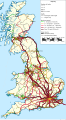 Rail transport infrastructure map - UK - Great Britain.svg 680 × 1,228; 22.08 MB
-
 Railway map of France - 69 - 1939 - fr - small.svg 564 × 950; 7.3 MB
-
 Railway map of France - 61 - 1980 - fr - small.svg 705 × 879; 7.1 MB
-
 Railway map of France - 45 - 1913 - fr - small.svg 705 × 968; 8.24 MB
-
 Renneritz in Sandersdorf-Brehna.svg 726 × 687; 105 KB
-
 Railway map of France - 71 - 1980 - fr - small.svg 705 × 1,020; 8.35 MB
-
 Railway map of France - 77 - 1900 - fr - small.svg 564 × 1,056; 8.04 MB
-
 Dingelstedt in Huy.svg 1,052 × 744; 150 KB
-
 Railway map of France - 57 - 1980 - fr - small.svg 705 × 985; 8.67 MB
-
 Railway map of France - 08 - 1930 - fr - small.svg 564 × 968; 6.77 MB
-
 Railway map of France - 1900 - fr - medium.svg 1,053 × 744; 23.03 MB
-
 Railway map of France - 26 - 1880 - fr - small.svg 564 × 1,109; 6.87 MB
-
 Railway map of France - 34 - 1939 - fr - small.svg 705 × 1,041; 5.36 MB
-
 Railway map of France - 78 - 1880 - fr - small.svg 705 × 1,616; 12.03 MB
-
 Beuna in Merseburg.svg 570 × 548; 91 KB
-
 Trebnitz in Merseburg.svg 570 × 548; 91 KB
-
 Transport map of France - 13.svg 1,063 × 921; 15.95 MB
-
 Railway map of France - 01 - 1900 - fr - small.svg 564 × 1,020; 7.54 MB
-
 Railway map of France - 01 - 1930 - fr - small.svg 564 × 1,020; 7.8 MB
-
 Railway map of France - 01 - 2020 - fr - small.svg 564 × 1,020; 7.48 MB
-
 Transport map of France - 69M.svg 779 × 1,098; 7.17 MB
-
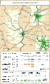
 Rail transport infrastructure map - UK - East Midlands.svg 983 × 1,020; 6.31 MB
-
 Railway map of France - CVL - 2020 - fr - small.svg 564 × 1,063; 6.99 MB
-
 Railway map of France - 17 - 1950 - fr - small.svg 1,184 × 829; 6.47 MB
-
 Railway map of France - 62 - 1980 - fr - small.svg 705 × 1,014; 8.05 MB
-
 Klein Ammensleben in Niedere Börde.svg 699 × 700; 104 KB
-
 Rail transport infrastructure map - FR - Normandie.svg 1,059 × 680; 3.03 MB
-
 Railway map of France - 33 - 1885 - fr - small.svg 1,273 × 879; 6.87 MB
-
 Railway map of France - 78 - 2020 - fr - small.svg 705 × 1,616; 13 MB
-
 Districts of Calbe.svg 611 × 525; 32 KB
-
 Railway map of France - 11 - 1980 - fr - small.svg 705 × 914; 5.16 MB
-
 Railway map of France - 82 - 1880 - fr - small.svg 564 × 879; 4.9 MB
-
 Cuenca-010-011-012-013-B.svg 944 × 831; 4.85 MB
-
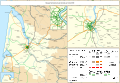
 Rail transport infrastructure map - FR - Île-de-France.svg 2,268 × 1,020; 5.57 MB
-
 Railway map of France - 31 - 1890 - fr - small.svg 705 × 1,126; 6.36 MB
-
 Railway map of France - 77 - 1980 - fr - small.svg 564 × 1,056; 8.38 MB
-
 Reuden in Elsteraue.svg 595 × 616; 142 KB
-
 Railway map of France - 35 - 1900 - fr - small.svg 564 × 1,056; 7.83 MB
-
 Cuenca-014-015-016-B.svg 1,537 × 1,047; 4.17 MB
-
 Cuenca-017-018-B.svg 1,162 × 1,645; 2.99 MB
-
 Cuenca-028-029-B.svg 1,067 × 1,461; 9.53 MB
-
 Railway map of France - 2020 - fr - small.svg 496 × 701; 16.01 MB
-
 Cuenca-123-B.svg 1,153 × 1,524; 2.8 MB
-
 Districts of Köthen.svg 926 × 697; 82 KB
-
 Railway map of France - 1940 - fr - medium.svg 1,053 × 744; 23.58 MB
-
 Railway map of France - 75 - 1860 - fr - small.svg 564 × 1,020; 4.02 MB
-
 Cuenca-092-093-094-095-B.svg 1,178 × 603; 11.79 MB
-
 Distribution of primary schools in Peninsular Malaysia (with district boundaries).svg 1,052 × 1,127; 9.75 MB
-
 Railway map of France - 03 - 1980 - fr - small.svg 705 × 950; 7.55 MB
-
 Railway map of France - 76 - 2020 - fr - small.svg 705 × 1,126; 7.21 MB
-
 Railway map of France - 974 - 1955 - fr - small.svg 564 × 914; 3.71 MB
-
 Transport map of France - 11.svg 1,063 × 921; 8.91 MB
-
 Railway map of France - 06 - 1980 - fr - small.svg 705 × 1,410; 5.55 MB
-
 Cuenca-032-B.svg 1,158 × 762; 5.39 MB
-
 Railway map of France - 75 - 2010 - fr - small.svg 564 × 1,020; 4.5 MB
-
 Cuenca-100-B.svg 617 × 795; 1.79 MB
-
 Cuenca-042-043-B.svg 1,960 × 1,522; 12.23 MB
-
 Railway map of France - 38 - 1932 - fr - small.svg 705 × 1,145; 8.89 MB
-
 Cuenca-100-101-102-B.svg 1,177 × 611; 9.16 MB
-
 Cuenca-104-B.svg 1,174 × 851; 5.23 MB
-
 Cuenca-105-B.svg 976 × 882; 2.67 MB
-
 Cuenca-107-108-B.svg 1,276 × 822; 2.13 MB
-
 Cuenca-111-B.svg 2,206 × 1,365; 10.26 MB
-
 Cuenca-113-B.svg 1,914 × 1,460; 4.27 MB
-
 Cuenca-120-B.svg 881 × 1,567; 3.24 MB
-
 Cuenca-072-073-074-080-B.svg 2,063 × 1,256; 10.46 MB
-
 Cuenca-081-082-B.svg 2,520 × 1,346; 7.33 MB
-
 Cuenca-083-B.svg 1,832 × 1,619; 8.64 MB
-
 Cuenca-0832-0837-0838-B.svg 2,515 × 1,146; 4.35 MB
-
 Cuenca-084-B.svg 1,052 × 744; 2.11 MB
-
 Cuenca-085-086-087-B.svg 1,027 × 724; 3.63 MB
-
 Cuenca-088-B.svg 1,151 × 832; 4.18 MB
-
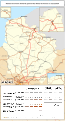
 Rail transport infrastructure map - ES - Castilla-La Mancha.svg 1,096 × 832; 4.65 MB
-
 Cuenca-038-039-040-041-042-B.svg 1,308 × 871; 3.24 MB
-
 Cuenca-044-B.svg 1,245 × 1,457; 2.92 MB
-
 Cuenca-045-B.svg 1,008 × 818; 4.32 MB
-
 Cuenca-046-B.svg 469 × 933; 3.75 MB
-
 Cuenca-047-048-049-B.svg 1,004 × 840; 6.33 MB
-
 Cuenca-050-051-B.svg 2,026 × 701; 2.72 MB
-
 Cuenca-052-053-054-B.svg 1,300 × 844; 5.14 MB
-
 Cuenca-052-B.svg 1,139 × 427; 2.65 MB
-
 Cuenca-055-056-057-058-B.svg 2,079 × 1,356; 5.94 MB
-
 Cuenca-060-B.svg 1,301 × 841; 8.04 MB
-
 Cuenca-061-070-B.svg 662 × 847; 4.95 MB
-
 Cuenca-023-024-025-026-027-028-B.svg 2,133 × 1,873; 6.03 MB
-
 Cuenca-034-035-036-037-B.svg 1,465 × 1,414; 7.03 MB
-
 Railway map of France - 90 - 1980 - fr - small.svg 564 × 1,126; 3.39 MB
-
 Cuenca-020-021-B.svg 1,552 × 1,528; 7.64 MB
-
 Cuenca-022-B.svg 487 × 1,495; 3.62 MB
-
 Railway map of France - 78 - 1990 - fr - small.svg 705 × 1,616; 13.21 MB
-
 Transport map of France - 19.svg 850 × 974; 8.35 MB
-
 Railway map of France - 68 - 1870 - fr - small.svg 564 × 933; 6.39 MB
-
 Railway map of France - 68 - 1900 - fr - small.svg 564 × 933; 6.45 MB
-
 Railway map of France - 68 - 1913 - fr - small.svg 564 × 933; 6.53 MB
-
 Railway map of France - 68 - 1919 - fr - small.svg 564 × 933; 6.66 MB
-
 Railway map of France - 68 - 1930 - fr - small.svg 564 × 933; 6.69 MB
-
 Railway map of France - 68 - 1950 - fr - small.svg 564 × 933; 6.65 MB
-
 Railway map of France - 68 - 1980 - fr - small.svg 564 × 933; 6.62 MB
-
 Railway map of France - 68 - 2020 - fr - small.svg 564 × 933; 6.43 MB
-
 Railway map of France - 84 - 1870 - fr - small.svg 564 × 861; 4.25 MB
-
 Railway map of France - 84 - 1930 - fr - small.svg 564 × 861; 4.5 MB
-
 Railway map of France - 84 - 2020 - fr - small.svg 564 × 861; 4.31 MB
-
 Transport map of France - 84.svg 744 × 850; 8.88 MB
-
 Rail transport infrastructure map - FR - Bretagne.svg 983 × 511; 3.24 MB
-
 Rail transport infrastructure map - FR - Nouvelle-Aquitaine.svg 832 × 983; 7.39 MB
-
 Rail transport infrastructure map - FR - Occitanie.svg 812 × 793; 5.29 MB
-
 Rail transport infrastructure map - FR - Pays de la Loire.svg 945 × 699; 4.45 MB
-
 Transport map of France - 67-68.svg 709 × 1,346; 10.14 MB
-
 Early French railway companies - 1937 map.svg 709 × 868; 16.45 MB
-
 Dankerode in Harzgerode.svg 1,052 × 744; 130 KB
-
 Rail transport infrastructure map - UK - South East England.svg 1,247 × 983; 8.83 MB
-
 Dahlenwarsleben in Niedere Börde.svg 699 × 700; 104 KB
-
 Rail transport infrastructure map - ES - Cataluña.svg 832 × 737; 2.93 MB
-
 Rail transport infrastructure map - ES - Comunidad de Madrid.svg 680 × 737; 2.05 MB
-

-
 Rail transport infrastructure map - ES - La Rioja, Navarra & País Vasco.svg 832 × 492; 2.37 MB
-
 Rail transport infrastructure map - España.svg 1,399 × 1,115; 17.67 MB
-
 Railway map of France - 2020 - en - small.svg 496 × 701; 16.02 MB
-
 Bad Salzelmen in Schönebeck.svg 664 × 597; 106 KB
-
 Districts of Niedere Börde.svg 699 × 700; 104 KB
-
 Districts of Schönebeck.svg 664 × 597; 106 KB
-
 Elbenau in Schönebeck.svg 664 × 597; 106 KB
-
 Felgeleben in Schönebeck.svg 664 × 597; 106 KB
-
 Frohse in Schönebeck.svg 664 × 597; 106 KB
-
 Groß Ammensleben in Niedere Börde.svg 699 × 700; 104 KB
-
 Grünewalde in Schönebeck.svg 664 × 597; 105 KB
-
 Gutenswegen in Niedere Börde.svg 699 × 700; 104 KB
-
 Jersleben in Niedere Börde.svg 699 × 700; 104 KB
-
 Meseberg in Niedere Börde.svg 699 × 700; 104 KB
-
 Plötzky in Schönebeck.svg 664 × 597; 106 KB
-
 Pretzien in Schönebeck.svg 664 × 597; 106 KB
-
 Railway map of France - 2020 - en - large.svg 2,105 × 1,489; 41.64 MB
-
 Railway map of France - 2020 - en - medium.svg 1,053 × 744; 21.89 MB
-
 Ranies in Schönebeck.svg 664 × 597; 106 KB
-
 Samswegen in Niedere Börde.svg 699 × 700; 104 KB
-
 Schönebeck in Schönebeck.svg 664 × 597; 105 KB
-
 Map Тёсовская УЖД 2022-03-10.svg 655 × 655; 340 KB
-


.svg)


.svg)


