Category:United States Senate election maps of Nevada
Jump to navigation
Jump to search
States of the United States: Alabama · Alaska · Arizona · Arkansas · California · Colorado · Connecticut · Delaware · Florida · Hawaii · Idaho · Illinois · Indiana · Iowa · Kansas · Kentucky · Louisiana · Maine · Maryland · Massachusetts · Michigan · Minnesota · Mississippi · Missouri · Montana · Nebraska · Nevada · New Hampshire · New Jersey · New Mexico · New York · North Carolina · North Dakota · Ohio · Oklahoma · Oregon · Pennsylvania · Rhode Island · South Carolina · South Dakota · Tennessee · Texas · Utah · Vermont · Virginia · Washington · West Virginia · Wisconsin · Wyoming
Subcategories
This category has only the following subcategory.
Media in category "United States Senate election maps of Nevada"
The following 21 files are in this category, out of 21 total.
-
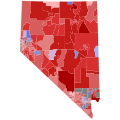
 06NevadaSenateCounties.PNG 405 × 599; 35 KB
-
 1964 NV.png 2,000 × 3,110; 244 KB
-
 1970 NV.png 2,000 × 3,110; 245 KB
-
 1974 NV.png 2,000 × 3,110; 241 KB
-
 1980 NV.png 2,000 × 3,110; 246 KB
-
 1982 NV.png 2,000 × 3,110; 241 KB
-
-
 2012 Nevada Senate election by congressional district.svg 810 × 810; 29 KB
-
 2018 United States Senate election in Nevada map by precinct.svg 810 × 810; 666 KB
-
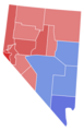
 2018 US Senate Election Nevada by precinct.png 2,303 × 2,449; 511 KB
-
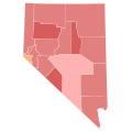
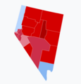
 2022 Nevada us senate election swing map by county.svg 512 × 288; 31 KB
-
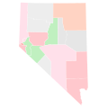
 2022 NV US Senate Democratic primary.svg 744 × 744; 60 KB
-
 2022 NV US Senate Republican primary.svg 744 × 744; 60 KB
-

-

-

-

-
 98NVSenateCounties.PNG 405 × 599; 35 KB
-
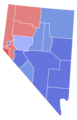
 Nevada Senate Election Results by County, 2018.png 6,900 × 4,275; 903 KB
-
 NV Senate 2016.svg 810 × 810; 6.43 MB
-
 Results of the 2018 Senate election in Nevada.png 2,843 × 2,956; 401 KB


