Category:United Kingdom photographs taken on 2021-11-20
Jump to navigation
Jump to search
| ← | Saturday 20 November 2021 | → | ||
| ← | November 2021 | → | ||
United Kingdom photographs taken on 20 November 2021.
Image files should be categorized here automatically using {{taken on}} template. Direct categorisation is also possible, if automatic is impossible.
Media in category "United Kingdom photographs taken on 2021-11-20"
The following 96 files are in this category, out of 96 total.
-
'Breckon Howe' round barrow, Sleights Moor.jpg 3,024 × 4,032; 4.38 MB
-
2021 at Copplestone station - entrance.JPG 1,366 × 910; 515 KB
-
2021 at Copplestone station - platform.JPG 1,366 × 820; 429 KB
-
2021 at Copplestone station - station garden.JPG 1,366 × 910; 597 KB
-
2021 at Copplestone station - station house.JPG 1,366 × 910; 578 KB
-
2021 at Crediton station - main building from the road side.JPG 1,366 × 820; 428 KB
-
2021 at Crediton station - main building.JPG 1,366 × 820; 426 KB
-
2021 at Crediton station - platform 1.JPG 1,366 × 820; 452 KB
-
2021 at Crediton station - platform 2.JPG 1,366 × 820; 489 KB
-
2021 at Pill Bridge - down stream side.JPG 1,366 × 820; 472 KB
-
2021 at Pill Bridge - piles.JPG 1,366 × 910; 479 KB
-
2021 at Pill Bridge - up stream side.JPG 1,366 × 820; 453 KB
-
2021 at Yeoford station - Barnstaple platform.JPG 1,366 × 910; 697 KB
-
2021 at Yeoford station - hut and waiting room.JPG 1,366 × 910; 812 KB
-
2021 at Yeoford station - Plymouth platform.JPG 1,366 × 910; 696 KB
-
2021 at Yeoford station - road bridge.JPG 1,366 × 820; 486 KB
-
2021 at Yeoford station - to the station.JPG 1,366 × 910; 709 KB
-
2021 at Yeoford station - view from the bridge.JPG 1,366 × 910; 670 KB
-
A64 and commercial premises - geograph.org.uk - 7023918.jpg 1,024 × 683; 185 KB
-
A64 and cycle path - geograph.org.uk - 7023947.jpg 1,024 × 683; 262 KB
-
A64 and former pub - geograph.org.uk - 7023939.jpg 1,024 × 683; 296 KB
-
A64 and signs - geograph.org.uk - 7023929.jpg 1,024 × 683; 207 KB
-
A64 in High Plumps Wood - geograph.org.uk - 7023949.jpg 1,024 × 683; 271 KB
-
A64 near Thompson's Fish and Chips - geograph.org.uk - 7023912.jpg 1,024 × 683; 195 KB
-
Along Sandy Lane - geograph.org.uk - 7023894.jpg 1,024 × 683; 209 KB
-
Approaching Hazelbush Crossroads - geograph.org.uk - 7023906.jpg 1,024 × 683; 254 KB
-
Barnstaple - GWR 158957 approaching from Exeter.JPG 1,366 × 910; 723 KB
-
Barnstaple - GWR 158957 Exeter Central service.JPG 1,366 × 910; 481 KB
-
Barr Lane - geograph.org.uk - 7023892.jpg 1,024 × 683; 186 KB
-
Bend in Stockton Lane - geograph.org.uk - 7023872.jpg 1,024 × 683; 204 KB
-
Birches on Walney Road - geograph.org.uk - 7023867.jpg 1,024 × 683; 270 KB
-
Blacksmiths Cottage.jpg 3,024 × 4,032; 4.53 MB
-
Bligh's Restaurant.jpg 3,024 × 4,032; 3.66 MB
-
Bridge over the A64 - geograph.org.uk - 7023877.jpg 1,024 × 683; 255 KB
-
Cllr sue greenaway (51692265367).jpg 768 × 1,024; 103 KB
-
Coleford Junction - GWR 150232+150261 first day of the Dartmoor Line.JPG 1,366 × 910; 677 KB
-
Common Lane - geograph.org.uk - 7023904.jpg 1,024 × 683; 331 KB
-
Copplestone - GWR 158798 departing for Exeter.JPG 1,356 × 910; 795 KB
-
Copplestone - GWR 158950 Barnstaple service.jpg 1,366 × 910; 530 KB
-
Copplestone Road bridge (2021).JPG 1,366 × 910; 768 KB
-
Crediton - GWR 150221 passing 150232 on first day of the Dartmoor Line.JPG 1,366 × 910; 394 KB
-
Crediton - GWR 150221+150233 first day of the Dartmoor Line.JPG 1,366 × 820; 398 KB
-
Crediton - GWR 150261+150232 first day of the Dartmoor Line.JPG 1,366 × 910; 510 KB
-
Crediton - GWR 158798 Barnstaple service.JPG 1,366 × 910; 604 KB
-
Crediton - GWR 158950 arriving from Barnstaple at dusk.JPG 1,366 × 910; 345 KB
-
Crediton - GWR 158957 Exeter Central service.JPG 1,366 × 910; 483 KB
-
Crediton - GWR 158957 passing 158798.JPG 1,366 × 910; 541 KB
-
Cystoderma amianthinum 171072665.jpg 1,766 × 2,048; 682 KB
-
Descent from the A64 Bridge - geograph.org.uk - 7023876.jpg 1,024 × 683; 282 KB
-
Edge of High Plumps Wood - geograph.org.uk - 7023944.jpg 1,024 × 683; 277 KB
-
End of Sandy Lane - geograph.org.uk - 7023903.jpg 1,024 × 683; 241 KB
-
Exeter St Davids - GWR 150221 first arrival from Okehampton.JPG 1,366 × 910; 469 KB
-
Exeter St Davids - GWR 150221+150233 first arrival from Okehampton.JPG 1,366 × 820; 449 KB
-
Exeter St Davids - GWR 150221+150233 first day of the Dartmoor Line.JPG 1,366 × 910; 381 KB
-
Exeter St Davids - GWR 150233+150221 first day of the Dartmoor Line.JPG 1,366 × 910; 488 KB
-
Exeter St Davids - GWR 150261+150232 first day of the Dartmoor Line.JPG 1,366 × 910; 373 KB
-
Family grave of Benjamin Robert Wheatley in Highgate Cemetery.jpg 2,745 × 2,905; 3.02 MB
-
Family grave of John Philipps Emslie in Highgate Cemetery.jpg 3,024 × 4,032; 4.39 MB
-
Family grave of Octavius Oakley in Highgate Cemetery.jpg 1,777 × 3,801; 2.97 MB
-
Family grave of Thomas Jones Barker in Highgate Cemetery.jpg 1,833 × 3,929; 3.25 MB
-
Family vault of James Vetch in Highgate Cemetery.jpg 2,857 × 2,101; 2.64 MB
-
Fence and field beside Sandy Lane - geograph.org.uk - 7023900.jpg 1,024 × 683; 279 KB
-
Field at Hazelbush - geograph.org.uk - 7023936.jpg 1,024 × 683; 274 KB
-
Field beside Sandy Lane - geograph.org.uk - 7023895.jpg 1,024 × 683; 237 KB
-
Fields beside New Lane - geograph.org.uk - 7030102.jpg 1,024 × 498; 91 KB
-
Former railway crossing - geograph.org.uk - 7023898.jpg 1,024 × 683; 234 KB
-
Grave of Alexander Dick Gough in Highgate Cemetery.jpg 2,309 × 1,449; 1.51 MB
-
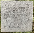
Grave of Douglas Geoffrey Bridson in Highgate Cemetery.jpg 3,005 × 2,945; 5.16 MB
-
Grave of Joseph William Comyns Carr in Highgate Cemetery.jpg 2,633 × 3,277; 4.03 MB
-
Grave of William Andrew Chatto in Highgate Cemetery.jpg 2,261 × 2,129; 2.24 MB
-
Halesowen Christmas 1 (51693064141).jpg 4,032 × 3,024; 3.55 MB
-
Halesowen Christmas 2 (51693330228).jpg 3,024 × 4,032; 3.13 MB
-
Halesowen Christmas 3 (51693330018).jpg 3,024 × 4,032; 3.11 MB
-
Halesowen Christmas 4 (51693951105).jpg 5,520 × 3,680; 11.72 MB
-
Halesowen lights (51693161191).jpg 5,520 × 3,680; 2.38 MB
-
Halesowen lights 2 (51693160931).jpg 4,227 × 2,896; 1.06 MB
-
Hazelbush Crossroads - geograph.org.uk - 7023910.jpg 1,024 × 683; 243 KB
-
Houses on Stockton Lane - geograph.org.uk - 7023875.jpg 1,024 × 683; 252 KB
-
Hygrocybe ceracea 169589409.jpg 1,536 × 2,048; 2.16 MB
-
Keymelford bridge (2021).JPG 1,366 × 910; 817 KB
-
Laurel Cottage.jpg 3,024 × 4,032; 3.53 MB
-
Leafs Shop Muir Lea.jpg 4,032 × 3,024; 3.63 MB
-
Number 2 (Maryondale Cottage) And Chip Shop.jpg 3,024 × 4,032; 3.58 MB
-
Penstone (Coleford Junction) bridge (2021).JPG 1,366 × 910; 587 KB
-
Penstone (Tarka Line) bridge (2021).JPG 1,366 × 910; 645 KB
-
Pill Bridge - GWR 158798 St James Park train.JPG 1,366 × 820; 442 KB
-
Potatoes for sale - geograph.org.uk - 7023878.jpg 1,024 × 683; 258 KB
-
Road near Stockton Hall Hospital - geograph.org.uk - 7023889.jpg 1,024 × 683; 249 KB
-
Speed signs on Stockton Lane - geograph.org.uk - 7023870.jpg 1,024 × 683; 242 KB
-
Stockton Lane and Stone Riggs - geograph.org.uk - 7023890.jpg 1,024 × 683; 255 KB
-
TDOR 2021 memorial in Radcliffe Square, Oxford, November 2021.jpg 4,032 × 3,024; 7.61 MB
-
Temporary traffic lights on Hempland Lane - geograph.org.uk - 7023868.jpg 1,024 × 683; 228 KB
-
Track to Ryethorpe Grange - geograph.org.uk - 7023871.jpg 1,024 × 683; 252 KB
-
Trees along Stockton Lane - geograph.org.uk - 7023873.jpg 683 × 1,024; 335 KB
-
Yeoford - GWR 150233+150221 first day of the Dartmoor Line.JPG 1,366 × 910; 657 KB
-
Yeoford - GWR 158950 Barnstpale service.JPG 1,366 × 910; 583 KB


