Category:United Kingdom photographs taken on 2020-04-09
Jump to navigation
Jump to search
| ← | Thursday 9 April 2020 | → | ||
| ← | April 2020 | → | ||
United Kingdom photographs taken on 9 April 2020.
Image files should be categorized here automatically using {{taken on}} template. Direct categorisation is also possible, if automatic is impossible.
Subcategories
This category has only the following subcategory.
S
Media in category "United Kingdom photographs taken on 2020-04-09"
The following 40 files are in this category, out of 40 total.
-
-2019-04-09 Saint John the Baptist, Mundesley Road, Trimingham.JPG 5,152 × 3,864; 6.1 MB
-
-2020-04-09 Saint John the Baptist, Trimingham (1).jpg 5,152 × 3,864; 7.55 MB
-
-2020-04-09 Saint John the Baptist, Trimingham (2).jpg 5,152 × 3,864; 8.32 MB
-
60055 passes Basingstoke 9th April 2020.jpg 3,264 × 2,448; 2.76 MB
-
A64 from Long Lane Bridge - geograph.org.uk - 6439909.jpg 1,024 × 683; 395 KB
-
Badger Hill recreation ground - geograph.org.uk - 6439941.jpg 1,024 × 683; 481 KB
-
Cattle at Ox Close Farm - geograph.org.uk - 6439915.jpg 1,024 × 683; 407 KB
-
Coronavirus in Jedburgh April 2020 at Learmonth butchers.jpg 4,608 × 3,456; 5.08 MB
-
Coronavirus in Jedburgh April 2020 at the co opers.jpg 4,608 × 3,456; 4.83 MB
-
Cowslips on Heslington East - geograph.org.uk - 6439933.jpg 1,024 × 683; 501 KB
-
Daffodils in Heslington - geograph.org.uk - 6439903.jpg 1,024 × 683; 586 KB
-
Daffodils near the library - geograph.org.uk - 6439896.jpg 1,024 × 683; 761 KB
-
Dicranoweisia cirrata 66263793.jpg 2,048 × 1,152; 1.14 MB
-
Dicranoweisia cirrata 66263817.jpg 2,048 × 1,152; 1.1 MB
-
Drain near Grimston Grange - geograph.org.uk - 6439922.jpg 1,024 × 683; 442 KB
-
Farmland beside Ox Close Lane - geograph.org.uk - 6439911.jpg 1,024 × 683; 402 KB
-
Field Lane roundabout - geograph.org.uk - 6439939.jpg 1,024 × 683; 402 KB
-
Footpath to Grimston Grange - geograph.org.uk - 6439923.jpg 1,024 × 683; 680 KB
-
From the velodrome - geograph.org.uk - 6439926.jpg 1,024 × 683; 428 KB
-
Hammet Street, Taunton (2020) looking east.JPG 1,366 × 910; 299 KB
-
Heslington East lake shoreline - geograph.org.uk - 6439938.jpg 1,024 × 683; 457 KB
-
Heslington Village - geograph.org.uk - 6439900.jpg 683 × 1,024; 624 KB
-
Lake shore - geograph.org.uk - 6439936.jpg 1,024 × 683; 467 KB
-
Lake shoreline - geograph.org.uk - 6439935.jpg 1,024 × 683; 413 KB
-
Ox Close Farm - geograph.org.uk - 6439916.jpg 1,024 × 683; 450 KB
-
Penzance - Laregan Hill benchmark position.jpg 3,024 × 4,032; 7.45 MB
-
Penzance - Laregan Hill benchmark.jpg 3,024 × 4,032; 4.46 MB
-
Penzance - Penlee Park.jpg 3,024 × 4,032; 6.13 MB
-
Post Office in Heslington - geograph.org.uk - 6439897.jpg 1,024 × 683; 428 KB
-
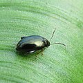
Psylliodes chrysocephalus (01).jpeg 1,210 × 1,210; 886 KB
-
Rape field near Grange Farm - geograph.org.uk - 6439905.jpg 1,024 × 683; 455 KB
-
Sports Village Velodrome - geograph.org.uk - 6439929.jpg 1,024 × 683; 361 KB
-
St James Close, Taunton (2020).JPG 1,366 × 1,024; 346 KB
-
St James Street, Taunton (2020) The Ring of Bells.JPG 1,024 × 1,024; 199 KB
-
Taunton Municipal Buildings (2020) north side.JPG 1,366 × 820; 277 KB
-
Towards Grimston Grange - geograph.org.uk - 6439920.jpg 1,024 × 683; 490 KB
-
University Velodrome - geograph.org.uk - 6439927.jpg 1,024 × 683; 384 KB
-
Whirligig Lane, Taunton (2020).JPG 1,366 × 1,024; 436 KB
-
York Sport Velodrome - geograph.org.uk - 6439931.jpg 1,024 × 683; 342 KB


