Category:United Kingdom photographs taken on 2018-07-11
Jump to navigation
Jump to search

Subcategories
This category has only the following subcategory.
L
Media in category "United Kingdom photographs taken on 2018-07-11"
The following 160 files are in this category, out of 160 total.
-
 -2018-07-11 Bridge over the Norwich Castle moat, Norfolk.jpg 800 × 595; 574 KB
-
 -2018-07-11 Lamb Inn, Orford Street, Norwich, Norfolk (1).jpg 800 × 592; 440 KB
-
 -2018-07-11 Lamb Inn, Orford Street, Norwich, Norfolk.jpg 800 × 597; 463 KB
-
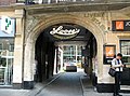 -2018-07-11 Loose’s, Red Lion Street, Norwich, Norfolk.jpg 800 × 591; 439 KB
-
 -2018-07-11 Marks & Spencer store, Norwich, Norfolk.jpg 800 × 580; 423 KB
-

-

-
 -2018-07-11 McDonald’s restaurant, Hay Hill, Norwich, Norfolk.jpg 800 × 592; 494 KB
-
 -2018-07-11 Orford Place, Norwich, Norfolk.jpg 800 × 593; 475 KB
-
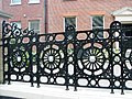 -2018-07-11 Railings, Norwich Free School, Norwich, Norfolk (1).jpg 800 × 597; 579 KB
-
 -2018-07-11 Railings, Norwich Free School, Norwich, Norfolk.jpg 800 × 596; 595 KB
-
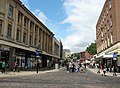 -2018-07-11 Rampant Horse Street, Norwich, Norfolk.jpg 800 × 584; 442 KB
-
 -2018-07-11 Shirehall Chambers, Norwich, Norfolk (1).jpg 640 × 480; 96 KB
-
 -2018-07-11 Shirehall Chambers, Norwich, Norfolk.jpg 800 × 592; 548 KB
-
 -2018-07-11 Shirehall, Norwich, Norfolk.jpg 640 × 474; 114 KB
-
 -2018-07-11 Sir Thomas Browne Statue, Norwich, Norfolk (1).jpg 800 × 775; 736 KB
-
 -2018-07-11 Sir Thomas Browne Statue, Norwich, Norfolk (2).jpg 773 × 800; 696 KB
-
 -2018-07-11 Sir Thomas Browne Statue, Norwich, Norfolk.jpg 800 × 585; 526 KB
-
 2018-07-11 Bench on the Boardwalk across Southrepps common, Norfolk.JPG 5,152 × 3,864; 7.32 MB
-
 2018-07-11 Boardwalk across Southrepps common, Norfolk.JPG 3,864 × 5,152; 7.27 MB
-
 2018-07-11 Bordwalk and footbridge over Fox's Beck, Southrepps common, Norfolk.JPG 5,152 × 3,864; 6.71 MB
-
 2018-07-11 Cromer Road, Sidestrand.JPG 3,864 × 5,152; 4.59 MB
-
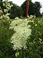 2018-07-11 Fern-leaf Dropwort (Filipendula vulgaris), Southrepps common.JPG 3,864 × 5,152; 4.89 MB
-
 2018-07-11 Finger post direction sign, Southrepps circular walk, Norfolk.JPG 3,864 × 5,152; 8.84 MB
-
 2018-07-11 Footbridge over Fox's Beck, Southrepps common, Norfolk.JPG 5,152 × 3,864; 6.62 MB
-
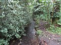 2018-07-11 Fox's Beck, Southrepps common, Norfolk (1).JPG 5,152 × 3,864; 6.73 MB
-
 2018-07-11 Fox's Beck, Southrepps common, Norfolk (2).JPG 5,152 × 3,864; 7.07 MB
-
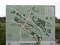 2018-07-11 Information and map board, Southrepps common.JPG 5,152 × 3,864; 5.27 MB
-
 2018-07-11 Information map board, Southrepps common.JPG 5,152 × 3,864; 4.63 MB
-
 2018-07-11 Looking south east along Warren Road, Lower Southrepps (2).JPG 5,152 × 3,864; 5.8 MB
-
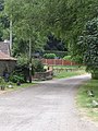 2018-07-11 Looking south east along Warren Road, Lower Southrepps.JPG 3,864 × 5,152; 8 MB
-
 2018-07-11 School sign, Cromer Road, Sidestrand.JPG 3,864 × 5,152; 6.23 MB
-
 2018-07-11 Street name sign, Starling Rise, Sidestrand.JPG 5,152 × 3,864; 6.83 MB
-
 2018-07-11 Street name sign, Warren Road, Lower Southrepps.JPG 5,152 × 3,864; 7.73 MB
-
 2018-07-11 The village sign, Warren Road, Lower Southrepps.JPG 3,864 × 5,152; 7.41 MB
-
 2018-07-11 Thistle (Carduus crispus), Southrepps common, Norfolk.JPG 3,864 × 5,152; 4.35 MB
-
 2018-07-11 View across Southrepps common, Norfolk (1).JPG 5,152 × 3,864; 7.09 MB
-
 2018-07-11 View across Southrepps common, Norfolk (2).JPG 5,152 × 3,864; 5.55 MB
-
 2018-07-21 Antingham Road, Lower Southrepps (1).JPG 3,864 × 5,152; 7.81 MB
-
 2018-07-21 Antingham Road, Lower Southrepps (2).JPG 3,864 × 5,152; 7.48 MB
-
 2018-07-21 Bridge over Fox's Beck, Lower Street, Lower Southrepps.JPG 5,152 × 3,864; 7.56 MB
-
 2018-07-21 Fire hydrant post, Pit street, Lower Southrepps.JPG 5,152 × 3,864; 8.57 MB
-
 2018-07-21 Fox's Beck, Lower Street, Lower Southrepps.JPG 3,864 × 5,152; 8.77 MB
-
 2018-07-21 Lower street, Lower Southrepps.JPG 3,864 × 5,152; 5.23 MB
-
 2018-07-21 Street sign, Pit street and Lower street, Lower Southrepps.JPG 5,152 × 3,864; 7.03 MB
-
 2018-07-21, Pit street, Lower Southrepps.JPG 3,864 × 5,152; 5.87 MB
-
 Acrobasis advenella (44236132424).jpg 1,500 × 1,165; 1.4 MB
-
 Angel and White Horse Tadcaster 11 July 2018.jpg 3,264 × 2,448; 2.17 MB
-
 Ark Kirkgate Tadcaster 11 July 2018 1.jpg 3,072 × 2,304; 2.28 MB
-
 Ark Kirkgate Tadcaster 11 July 2018 2.jpg 3,072 × 2,304; 1.77 MB
-
 Ash Tree Barkston Ash 11 July 2018.jpg 2,397 × 1,712; 1.49 MB
-
 Barkston Ash Fir Tree Court 11 July 2018.jpg 3,264 × 2,448; 2.33 MB
-
 Barkston Ash Hollyhocks Lane 11 July 2018.jpg 3,264 × 2,448; 2.5 MB
-
 Barkston Ash post office 11 July 2018.jpg 3,264 × 2,448; 2.3 MB
-
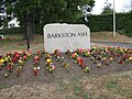 Barkston Ash stone 11 July 2018.jpg 3,264 × 2,448; 3.41 MB
-
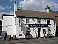 Boot and Shoe Barkston Ash 11 July 2018.jpg 3,264 × 2,448; 2.03 MB
-
 Cetonia aurata 2018-07-11.jpg 1,200 × 800; 636 KB
-
 Chapel Street, Tadcaster 11 July 2018 Nos 1,3 etc.jpg 3,072 × 2,304; 1.76 MB
-
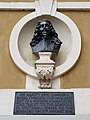 Charles 1er Banqueting House Londres.jpg 3,024 × 4,032; 2.45 MB
-
 Church on Sanday.jpg 1,920 × 1,280; 207 KB
-

-
 Duke of Somerset House, Kirkgate, Tadcaster 11 July 2018.jpg 2,304 × 3,072; 2.5 MB
-
 Eana incanana (43943478444).jpg 1,500 × 1,950; 2.49 MB
-

-

-
-

-

-

-
-

-

-

-

-

-

-

-

-

-

-

-

-

-

-

-

-

-
-

-
-
 Ellers Road off Harehills Avenue, Leeds (geograph 5845008).jpg 1,600 × 1,065; 531 KB
-
 Ellers Road, Leeds (geograph 5845183).jpg 1,600 × 1,065; 590 KB
-
 Entrance to Bargoed railway station (geograph 5839232).jpg 800 × 495; 98 KB
-
 Esso garage on Harrogate Road, Leeds (geograph 5844973).jpg 1,600 × 1,065; 644 KB
-
 Falcon, Chapel Street, Tadcaster 11 July 2018.jpg 3,072 × 2,304; 1.84 MB
-
 Farm Hill Way, Leeds (geograph 5843076).jpg 1,600 × 1,065; 459 KB
-
 Gosberton Risegate- aerial 2018 (geograph 5935093).jpg 533 × 800; 85 KB
-
 Harehills Lane at Cower Road, Leeds (geograph 5845457).jpg 1,600 × 1,065; 546 KB
-
 Harehills Lane at Strathmore Drive, Leeds (geograph 5845441).jpg 1,600 × 1,065; 529 KB
-
 Harehills Lane, Leeds (geograph 5845450).jpg 1,600 × 1,065; 533 KB
-
 Harehills Place off Harehills Road, Leeds (geograph 5845301).jpg 1,600 × 1,065; 571 KB
-
 Harrogate Road at Street Lane, Leeds (geograph 5844752).jpg 1,600 × 1,065; 503 KB
-
 Harrogate Road, Chapel Allerton, Leeds (geograph 5844930).jpg 1,600 × 1,065; 625 KB
-
 Harrogate Road, Chapel Allerton, Leeds (geograph 5844942).jpg 1,600 × 1,065; 433 KB
-
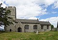
 Holy Trinity Church, Meanwood, Leeds (geograph 5843312).jpg 1,600 × 1,065; 573 KB
-
 Holy Trinity Church, Meanwood, Leeds (geograph 5843314).jpg 617 × 1,600; 403 KB
-
 Holy Trinity Church, Meanwood, Leeds (geograph 5843318).jpg 622 × 1,600; 443 KB
-
 Holy Trinity Church, Meanwood, Leeds (geograph 5843324).jpg 1,123 × 1,600; 854 KB
-
 Holy Trinity Church, Meanwood, Leeds (geograph 5843326).jpg 1,600 × 1,065; 429 KB
-
 Holy Trinity Church, Meanwood, Leeds (geograph 5843526).jpg 1,065 × 1,600; 541 KB
-
 Houses on Allerton Hill, Chapel Allerton, Leeds (geograph 5844907).jpg 1,600 × 1,065; 564 KB
-
 Houses on Teale Court (geograph 5844979).jpg 1,600 × 1,065; 806 KB
-
 Howden Arms 11 July 2018 1.jpg 3,264 × 2,448; 2.43 MB
-
 Howden Arms 11 July 2018 2.jpg 2,275 × 1,692; 1.91 MB
-
 Jamia Masjid Bilal Mosque (geograph 5845306).jpg 1,600 × 1,065; 539 KB
-
 Kirkgate Fisheries 11 July 2018.jpg 2,704 × 3,154; 2.96 MB
-
 Lambton Grove joins Harehills Road, Leeds (geograph 5845196).jpg 1,600 × 1,065; 573 KB
-
 Leeds Student Medical Practice, Leeds (geograph 5842794).jpg 1,600 × 1,056; 525 KB
-
 Lower Street off Harehills Road, Leeds (geograph 5845250).jpg 1,600 × 1,065; 485 KB
-
 Magpie Moth (44236128994).jpg 1,500 × 1,120; 1.75 MB
-
 Magpie Moth (44236130154).jpg 1,500 × 1,041; 1.45 MB
-
 Mansion Gate off Harehills Lane, Leeds (geograph 5844976).jpg 1,600 × 1,065; 720 KB
-
 MV Eilean Dhiura leaving Feolin Ferry (geograph 5844321).jpg 1,600 × 1,200; 310 KB
-
 NCN Millennium Milepost MP282 Whitburn South Tyneside.jpeg 1,600 × 1,200; 550 KB
-
 Old Market Place Tadcaster 11 July 2018 1.jpg 2,420 × 1,799; 1.99 MB
-
 Old Market Place Tadcaster 11 July 2018 2.jpg 2,920 × 1,778; 2.13 MB
-
 Ruins of St Marys Church, Somerton.jpg 2,000 × 1,333; 3.67 MB
-
 Salvation Army, Chapel Street Tadcaster 11 July 2018.jpg 3,264 × 2,448; 2.35 MB
-
 Shops on Lingfield Drive, Leeds (geograph 5844473).jpg 1,600 × 1,065; 390 KB
-
 St Mary Tadcaster 11 July 2018 1.jpg 4,000 × 3,000; 2.72 MB
-
 St Mary Tadcaster 11 July 2018 2.jpg 3,264 × 2,448; 2.21 MB
-
 St Mary Tadcaster 11 July 2018 3.jpg 3,264 × 2,448; 2.34 MB
-
 St Mary Tadcaster 11 July 2018 4.jpg 3,072 × 2,304; 2.29 MB
-
 St Mary Tadcaster 11 July 2018 5.jpg 3,264 × 2,448; 2.54 MB
-
 St Mary Tadcaster 11 July 2018 6.jpg 4,000 × 3,000; 3.76 MB
-
 St Mary Tadcaster 11 July 2018 interior 1.jpg 2,592 × 1,944; 1.2 MB
-
 St Mary Tadcaster 11 July 2018 interior 2.jpg 3,072 × 2,304; 2.08 MB
-
 St Mary Tadcaster 11 July 2018 interior 3.jpg 3,072 × 2,304; 2.21 MB
-
 St Mary Tadcaster 11 July 2018 interior 4.jpg 3,072 × 2,304; 2.03 MB
-
 St Mary Tadcaster 11 July 2018 pulpit.jpg 1,510 × 2,126; 1.79 MB
-
 St Mary Tadcaster 11 July 2018 window 1.jpg 2,448 × 3,264; 2.29 MB
-
 Stainbeck Lane, Chapel Allerton, Leeds (geograph 5844935).jpg 1,600 × 1,065; 431 KB
-
 Stainbeck Road, Chapel Allerton, Leeds (geograph 5844897).jpg 1,600 × 1,065; 703 KB
-
 Stonegate Crescent, Leeds (geograph 5843103).jpg 1,600 × 1,065; 560 KB
-
 Stonegate Crescent, Leeds (geograph 5843104).jpg 1,600 × 1,065; 648 KB
-
 Stonegate Crescent, Leeds (geograph 5843105).jpg 1,600 × 1,065; 522 KB
-
 Stonelea Court from Stonegate Crescent, Leeds (geograph 5843101).jpg 1,600 × 1,065; 517 KB
-
 Tadcaster Brewery 11 July 2018 1.jpg 3,264 × 2,448; 3.01 MB
-
 Tadcaster Brewery 11 July 2018 2.jpg 2,760 × 1,776; 2.6 MB
-
 Tadcaster Brewery 11 July 2018 3.jpg 3,072 × 2,304; 2.89 MB
-
 Tadcaster Brewery 11 July 2018 4.jpg 3,072 × 2,304; 2.3 MB
-
 Tadcaster Brewery 11 July 2018 5.jpg 3,072 × 2,304; 2.15 MB
-
 Tadcaster Bus Station 11 July 2018.jpg 3,072 × 2,304; 1.83 MB
-
 Tadcaster Old Brewery 11 July 2018 1.jpg 2,706 × 2,061; 2.13 MB
-
 Tadcaster Social Club, Chapel Street 11 July 2018.jpg 3,264 × 2,448; 2.43 MB
-
 The Lingfield Centre at Lingfield Hill, Leeds (geograph 5844314).jpg 1,600 × 1,065; 662 KB
-
 The Nags Head, Chapel Allerton, Leeds (geograph 5844948).jpg 988 × 1,600; 393 KB
-
 The Shah Jalal Mosque, Ellers Road, Leeds (geograph 5845016).jpg 1,600 × 1,065; 521 KB
-
 Trinity United Reformed Church, Harehills Avenue, Leeds (geograph 5844992).jpg 1,600 × 1,065; 754 KB
-
 Victorian Postbox on Stainbeck Road, Chapel Allerton, Leeds (geograph 5844890).jpg 1,065 × 1,600; 781 KB

.jpg)


.jpg)


.jpg)


.jpg)


.jpg)
.jpg)


,_Southrepps_common.JPG)


.JPG)
.JPG)


.JPG)


,_Southrepps_common,_Norfolk.JPG)
.JPG)
.JPG)
.JPG)
.JPG)


.jpg)


.jpg)

.jpg)


.jpg)
.jpg)
.jpg)
.jpg)

.jpg)
.jpg)
.jpg)
.jpg)
.jpg)
.jpg)
.jpg)
.jpg)
.jpg)
.jpg)
.jpg)
.jpg)
.jpg)
.jpg)
.jpg)


.jpg)

.jpg)
.jpg)
.jpg)
.jpg)
.jpg)
.jpg)
.jpg)


.jpg)


.jpg)
.jpg)
.jpg)
.jpg)
.jpg)
.jpg)


.jpg)
.jpg)
.jpg)
.jpg)
.jpg)
.jpg)
.jpg)