Category:United Kingdom photographs taken on 2009-06-27
Jump to navigation
Jump to search

Subcategories
This category has the following 3 subcategories, out of 3 total.
Media in category "United Kingdom photographs taken on 2009-06-27"
The following 200 files are in this category, out of 1,693 total.
(previous page) (next page)-
 "Tangmere" Steam Train - Stevenage June 2009 (3665739355).jpg 2,048 × 1,366; 462 KB
-
 "Tangmere" Steam Train - Stevenage June 2009 (3665739919).jpg 2,048 × 1,365; 480 KB
-
 "Tangmere" Steam Train - Stevenage June 2009 (3665740499).jpg 2,048 × 1,366; 440 KB
-
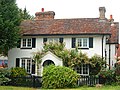 'Fairways', Salisbury Road, Amesbury - geograph.org.uk - 1375706.jpg 640 × 478; 151 KB
-
 (1345) Brown China-mark (Elophila nymphaeata) (3670194536).jpg 1,500 × 1,004; 1.46 MB
-
 (1348) Ringed China-mark (Parapoynx stratiotata) (3670196156).jpg 1,500 × 1,004; 1.26 MB
-
 (1653) Buff Arches (Habrosyne pyritoides) (3670198112).jpg 1,500 × 1,004; 1.44 MB
-
 (1690) Small Blood-vein (Scopula imitaria) (3670199734).jpg 1,500 × 1,004; 1.35 MB
-
 (1954) Bordered White (Bupalus piniaria) (3669394917).jpg 1,500 × 1,004; 1.19 MB
-
 (2000) Iron Prominent (Notodonta dromedarius) (3670202960).jpg 1,500 × 1,004; 1.26 MB
-
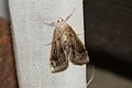
 (2155) Dot Moth (Melanchra persicariae) (3669398473).jpg 1,500 × 1,004; 1.4 MB
-
 (2205) Shoulder-striped Wainscot (Mythimna comma) (3670206578).jpg 1,500 × 1,004; 1.55 MB
-
 (2278) Poplar Grey (Acronicta megacephala) (3670208538).jpg 1,500 × 1,004; 1.67 MB
-
 . - Flickr - chaps1.jpg 3,581 × 3,581; 926 KB
-
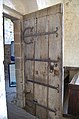 12th Century Door, Kempley Church - geograph.org.uk - 1373638.jpg 424 × 640; 66 KB
-
 1C bus in Peterborough Road - geograph.org.uk - 1373412.jpg 640 × 480; 52 KB
-
 2 Willow Road, Hampstead - geograph.org.uk - 1510847.jpg 640 × 480; 85 KB
-
 2009 Oughtibridge Gala ... Fire Engine - geograph.org.uk - 1628226.jpg 640 × 480; 116 KB
-
 2009 Oughtibridge Gala ... Hot Dog Queue - geograph.org.uk - 1628234.jpg 480 × 640; 117 KB
-

-

-

-
 2009 Oughtibridge Gala ... Stilt Walker - geograph.org.uk - 1628245.jpg 480 × 640; 121 KB
-

-

-

-
-

-

-

-

-

-

-
 36 Strathan - geograph.org.uk - 1380244.jpg 505 × 640; 113 KB
-
 A field of poppies beside the A46 - geograph.org.uk - 1374028.jpg 640 × 480; 93 KB
-

-
 A glimpse of Luscombe Park (2) - geograph.org.uk - 1382193.jpg 480 × 640; 608 KB
-
 A green lane to Long Stratton - geograph.org.uk - 1374956.jpg 640 × 480; 77 KB
-
 A Manxman on the Godalming Navigation - geograph.org.uk - 1374213.jpg 640 × 480; 123 KB
-
-
 A Queue for the Tram - geograph.org.uk - 1377654.jpg 604 × 640; 166 KB
-
 A Splash of Colour - geograph.org.uk - 1374588.jpg 640 × 480; 57 KB
-

-
 A stile or gate to navigate - geograph.org.uk - 1389352.jpg 640 × 480; 109 KB
-
 A stream runs through Buck's Mills - geograph.org.uk - 1386990.jpg 427 × 640; 110 KB
-

-
 A typical Cotswold stone wall - geograph.org.uk - 1374103.jpg 640 × 480; 95 KB
-
 A166 towards Fridaythorpe - geograph.org.uk - 1374832.jpg 640 × 480; 56 KB
-
 A166 towards Fridaythorpe - geograph.org.uk - 1374838.jpg 640 × 480; 67 KB
-
 A166 towards Fridaythorpe - geograph.org.uk - 1374848.jpg 640 × 480; 79 KB
-
 A166 towards Fridaythorpe - geograph.org.uk - 1374850.jpg 640 × 480; 62 KB
-
 A166 towards Wetwang - geograph.org.uk - 1374337.jpg 640 × 480; 78 KB
-
 A166 towards Wetwang - geograph.org.uk - 1374385.jpg 640 × 480; 53 KB
-
 A166 towards Wetwang - geograph.org.uk - 1374407.jpg 640 × 480; 71 KB
-
 A166 towards Wetwang - geograph.org.uk - 1374806.jpg 640 × 480; 76 KB
-
 A166 towards York (Man Street) - geograph.org.uk - 1374855.jpg 640 × 480; 79 KB
-
 A379 Teignmouth Road, Dawlish - geograph.org.uk - 1381578.jpg 640 × 480; 351 KB
-
 A379 Teignmouth Road, Dawlish - geograph.org.uk - 1381585.jpg 640 × 480; 404 KB
-
 A38 Dual Carriageway - geograph.org.uk - 1375221.jpg 640 × 428; 98 KB
-
 A38 Dual carriageway - geograph.org.uk - 1375262.jpg 640 × 428; 65 KB
-
 A38 Dual Carriageway - geograph.org.uk - 1375273.jpg 640 × 428; 75 KB
-
 A38 Dual Carriageway - geograph.org.uk - 1375298.jpg 640 × 428; 75 KB
-
 A380 at Ashcombe Cross in Haldon Forest - geograph.org.uk - 1433928.jpg 640 × 427; 388 KB
-
 A502, Hampstead High Street - geograph.org.uk - 1386007.jpg 640 × 480; 95 KB
-
 A502, Heath Street - geograph.org.uk - 1386003.jpg 640 × 480; 96 KB
-
 A96 Dual Carriageway - geograph.org.uk - 1377374.jpg 640 × 426; 78 KB
-
 A96 Roundabout - geograph.org.uk - 1377763.jpg 640 × 426; 77 KB
-

-
 Aberdeen Airport Control Tower - geograph.org.uk - 1544151.jpg 640 × 426; 51 KB
-
 Aberdyfi Station - geograph.org.uk - 1383954.jpg 640 × 480; 82 KB
-
 Access Road to Brixedone Farm - geograph.org.uk - 1375880.jpg 640 × 427; 171 KB
-
 Access road to Le Grys Farm - geograph.org.uk - 1374891.jpg 640 × 480; 79 KB
-
 Afon Gwy - River Wye - geograph.org.uk - 1375842.jpg 640 × 480; 109 KB
-
 Afon Gwy - River Wye - geograph.org.uk - 1375919.jpg 640 × 480; 115 KB
-
 Afon Gwy - River Wye - geograph.org.uk - 1375993.jpg 640 × 480; 123 KB
-
 Afon Gwy - River Wye - geograph.org.uk - 1376052.jpg 640 × 480; 122 KB
-
 Afon Gwy - River Wye - geograph.org.uk - 1376071.jpg 640 × 480; 81 KB
-
 Afon Gwy - River Wye - geograph.org.uk - 1376087.jpg 640 × 480; 76 KB
-
 Afon Tarell - geograph.org.uk - 1383546.jpg 640 × 427; 69 KB
-
 Albert Dock, Lerwick - geograph.org.uk - 1373503.jpg 640 × 425; 81 KB
-
 Albion Place - Waterloo Road - geograph.org.uk - 1373749.jpg 640 × 480; 247 KB
-
 Albion Street - Waterloo Road - geograph.org.uk - 1373746.jpg 640 × 480; 235 KB
-
 All Saints Church - C14 rood screen - geograph.org.uk - 1373954.jpg 640 × 512; 107 KB
-

-
 All Saints Church - C17 memorial - geograph.org.uk - 1373978.jpg 600 × 537; 83 KB
-
 All Saints Church - view east - geograph.org.uk - 1373948.jpg 640 × 547; 109 KB
-
 All Saints Church - view west - geograph.org.uk - 1373986.jpg 640 × 480; 98 KB
-
 All Saints Church - wineglass pulpit - geograph.org.uk - 1373968.jpg 480 × 640; 66 KB
-
 Alldens Lane - geograph.org.uk - 1373726.jpg 640 × 480; 134 KB
-
 Aller Brook, Dawlish - geograph.org.uk - 1382209.jpg 480 × 640; 643 KB
-

-
 Allotments - Waterloo Road - geograph.org.uk - 1375066.jpg 640 × 480; 237 KB
-
 Allotments off Aller Hill, Dawlish (2) - geograph.org.uk - 1382340.jpg 640 × 480; 453 KB
-
 Allotments off Aller Hill, Dawlish - geograph.org.uk - 1382233.jpg 640 × 480; 500 KB
-
 Altrincham Platform 1 - geograph.org.uk - 1377320.jpg 640 × 480; 135 KB
-
 Altrincham Station - geograph.org.uk - 1377278.jpg 640 × 485; 114 KB
-
 Altrincham Station - geograph.org.uk - 1377313.jpg 640 × 480; 122 KB
-

-
 Amesbury post office, Salisbury Street - geograph.org.uk - 1375688.jpg 640 × 459; 106 KB
-
 An anchor beside the coast path - geograph.org.uk - 1375903.jpg 588 × 640; 226 KB
-

-

-
 Anglers on the beach at Buck's Mills - geograph.org.uk - 1387028.jpg 640 × 427; 79 KB
-

-
 Anvil Street - Old Lane - geograph.org.uk - 1376409.jpg 640 × 480; 254 KB
-
 Anvil Street - Thornhill Bridge Lane - geograph.org.uk - 1375889.jpg 640 × 480; 256 KB
-
 Appleshaw - Appleshaw Cottage - geograph.org.uk - 1381462.jpg 640 × 480; 110 KB
-
 Appleshaw - St Peter In The Woods - geograph.org.uk - 1381438.jpg 640 × 480; 95 KB
-
 Appleshaw - St Peter In The Woods - geograph.org.uk - 1381444.jpg 640 × 480; 58 KB
-
 Appleshaw - St Peter In The Woods - geograph.org.uk - 1381452.jpg 480 × 640; 72 KB
-
 Appleshaw - Street Scene - geograph.org.uk - 1381487.jpg 640 × 480; 63 KB
-
 Appleshaw - Street Scene - geograph.org.uk - 1381518.jpg 640 × 480; 91 KB
-
 Appleshaw - Walnut Tree Public House - geograph.org.uk - 1381474.jpg 640 × 480; 91 KB
-
 Appleshaw - Walnut Tree Public House - geograph.org.uk - 1381479.jpg 480 × 640; 102 KB
-
 Approaching Le Grys Farm - geograph.org.uk - 1374903.jpg 640 × 480; 89 KB
-

-

-

-

-

-

-
 Ardan Breac and Hill of Allamuc - geograph.org.uk - 1377658.jpg 640 × 480; 70 KB
-
 Ardan Breac track - geograph.org.uk - 1377624.jpg 640 × 480; 76 KB
-
 Argyle Street, Glasgow, scene - geograph.org.uk - 1374222.jpg 640 × 480; 103 KB
-
 Around Town Wold - geograph.org.uk - 1376576.jpg 640 × 480; 73 KB
-

-
 Art deco window at RNLI shop - geograph.org.uk - 1375936.jpg 640 × 426; 102 KB
-
 Ashcombe Road approaches Dawlish - geograph.org.uk - 1382438.jpg 480 × 640; 594 KB
-
 Awaiting re-development - geograph.org.uk - 1458148.jpg 640 × 457; 334 KB
-
 Awaiting re-development - geograph.org.uk - 1458156.jpg 640 × 457; 318 KB
-
 B1248 towards Malton - geograph.org.uk - 1374825.jpg 640 × 480; 78 KB
-
 B1248 towards Wetwang - geograph.org.uk - 1374947.jpg 640 × 480; 74 KB
-
 B1251 towards Fimber - geograph.org.uk - 1374914.jpg 640 × 480; 68 KB
-
 B1251 towards Fimber - geograph.org.uk - 1374966.jpg 640 × 480; 78 KB
-
 B1251 Towards Sledmere - geograph.org.uk - 1374926.jpg 640 × 480; 105 KB
-
 B1251 Towards Sledmere - geograph.org.uk - 1374952.jpg 640 × 480; 70 KB
-
 B1251 Towards Sledmere - geograph.org.uk - 1374958.jpg 640 × 480; 79 KB
-
 B1252 Towards Sledmere - geograph.org.uk - 1374364.jpg 640 × 480; 51 KB
-
 B1253 towards Cowlam - geograph.org.uk - 1375004.jpg 640 × 480; 79 KB
-
 B1253 towards Cowlam - geograph.org.uk - 1375014.jpg 640 × 480; 61 KB
-
 B1253 towards Cowlam - geograph.org.uk - 1375035.jpg 640 × 480; 69 KB
-
 B2026, South - geograph.org.uk - 1375297.jpg 640 × 430; 170 KB
-
 Back Lane - geograph.org.uk - 1510729.jpg 640 × 480; 89 KB
-
 Back Street, Fridaythorpe - geograph.org.uk - 1374857.jpg 640 × 480; 63 KB
-
 Bad an Teachdaire - geograph.org.uk - 1377492.jpg 640 × 480; 67 KB
-
 Bad an Teachdaire plantation - geograph.org.uk - 1377562.jpg 640 × 480; 94 KB
-
 Badenscallie Burn - geograph.org.uk - 1380561.jpg 640 × 480; 117 KB
-
 Badentarbat Bay - geograph.org.uk - 1380506.jpg 640 × 343; 37 KB
-
 Badger Sett near Crouch Farm - geograph.org.uk - 1377117.jpg 640 × 480; 119 KB
-
 Badlake Hill, Dawlish - geograph.org.uk - 1382490.jpg 640 × 480; 434 KB
-
 Bainbridge green - geograph.org.uk - 1390268.jpg 640 × 397; 250 KB
-
 Bainbridge Institute - geograph.org.uk - 1390238.jpg 640 × 424; 224 KB
-
 Bainbridge Methodist Church - geograph.org.uk - 1390243.jpg 640 × 420; 276 KB
-
 Bainbridge Old Hall - geograph.org.uk - 1390254.jpg 640 × 443; 246 KB
-

-
 Ballyvaddy Gospel Hall - geograph.org.uk - 1374527.jpg 640 × 480; 51 KB
-
 Balronald Wood - geograph.org.uk - 1378309.jpg 640 × 480; 65 KB
-
 Balronald Wood - geograph.org.uk - 1378350.jpg 640 × 480; 79 KB
-
 Balronald Wood junction - geograph.org.uk - 1378330.jpg 640 × 480; 116 KB
-
 Balronald Wood shrinking - geograph.org.uk - 1378327.jpg 640 × 480; 88 KB
-
 Balronald Wood track - geograph.org.uk - 1378314.jpg 640 × 480; 101 KB
-
 Balronald Wood track - geograph.org.uk - 1378336.jpg 640 × 480; 86 KB
-
 Bandstand on Wellington Crescent - geograph.org.uk - 1374325.jpg 640 × 427; 115 KB
-
 Barber Street - Old Lane - geograph.org.uk - 1376400.jpg 640 × 480; 255 KB
-
 Barber Street - Thornhill Bridge Lane - geograph.org.uk - 1375948.jpg 640 × 480; 241 KB
-
 Barn at Preston Court Farm - geograph.org.uk - 1374401.jpg 640 × 427; 81 KB
-
 Barn doors open at Shopham Bridge - geograph.org.uk - 1379434.jpg 640 × 480; 97 KB
-
 Barn, Sandfield Farm - geograph.org.uk - 1376768.jpg 640 × 430; 132 KB
-
 Barn, Tollhurst Farm - geograph.org.uk - 1375215.jpg 640 × 430; 137 KB
-
 Barnfield Kiosk - geograph.org.uk - 1376019.jpg 640 × 427; 252 KB
-
 Barrington Road - geograph.org.uk - 1377215.jpg 640 × 524; 104 KB
-
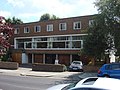
 Barrington's Hotel - geograph.org.uk - 1377206.jpg 640 × 501; 124 KB
-
 Barton Crescent, Dawlish - geograph.org.uk - 1382578.jpg 640 × 480; 400 KB
-
 Barton Upon Humber - geograph.org.uk - 1653821.jpg 640 × 480; 39 KB
-

-

-

-

-
 Basalt dyke below Aird Mheadhonach - geograph.org.uk - 1462846.jpg 640 × 427; 137 KB
-
 Bassett's Barn, Mote Lane - geograph.org.uk - 1378030.jpg 640 × 430; 160 KB
-
 Bassett's Cottages, Mote Lane - geograph.org.uk - 1378110.jpg 640 × 430; 143 KB
-
 Bassett's Farm Oast from Mote Lane - geograph.org.uk - 1378034.jpg 640 × 430; 175 KB
-
 Bassett's Farm Oast, Mote Lane - geograph.org.uk - 1378042.jpg 640 × 430; 167 KB
-
 Bassett's, Mote Lane - geograph.org.uk - 1378045.jpg 640 × 430; 153 KB
-
 Battersea railway lines - geograph.org.uk - 1375579.jpg 640 × 480; 64 KB
-
 Beach Huts at Westward Ho^ - geograph.org.uk - 1387493.jpg 640 × 427; 74 KB
-
 Beacon Lane Plantation - geograph.org.uk - 1373880.jpg 640 × 480; 44 KB
-
 Beetham Tower - geograph.org.uk - 1377619.jpg 480 × 640; 98 KB
-
 Ben Donich - geograph.org.uk - 1373915.jpg 640 × 480; 19 KB
-

-
 Beneath M27 motorway bridge - geograph.org.uk - 1375894.jpg 640 × 427; 210 KB
-

-

-
 Benkid77 Upton-Shrewsbury Rail Ticket.jpg 2,052 × 1,308; 569 KB
-
 Benn's Ait - geograph.org.uk - 1374602.jpg 640 × 475; 83 KB
-
 Bennetts Coaches - geograph.org.uk - 1374771.jpg 640 × 480; 64 KB
-
 Bideford from East-The-Water - geograph.org.uk - 1387497.jpg 640 × 414; 40 KB
-
 Bignor Park Estate - geograph.org.uk - 1374862.jpg 640 × 480; 79 KB
-
 Bignor Park House - geograph.org.uk - 1374868.jpg 640 × 495; 59 KB
-
 Bird island in Regent's Park - geograph.org.uk - 1389338.jpg 640 × 480; 120 KB
.jpg)
.jpg)
.jpg)

_Brown_China-mark_(Elophila_nymphaeata)_(3670194536).jpg)
_Ringed_China-mark_(Parapoynx_stratiotata)_(3670196156).jpg)
_Buff_Arches_(Habrosyne_pyritoides)_(3670198112).jpg)
_Small_Blood-vein_(Scopula_imitaria)_(3670199734).jpg)
_Bordered_White_(Bupalus_piniaria)_(3669394917).jpg)
_Iron_Prominent_(Notodonta_dromedarius)_(3670202960).jpg)
_Dot_Moth_(Melanchra_persicariae)_(3669398473).jpg)
_Shoulder-striped_Wainscot_(Mythimna_comma)_(3670206578).jpg)
_Poplar_Grey_(Acronicta_megacephala)_(3670208538).jpg)


_-_geograph.org.uk_-_1373663.jpg)
_-_geograph.org.uk_-_1373859.jpg)
_-_geograph.org.uk_-_1373697.jpg)
_-_geograph.org.uk_-_1373707.jpg)
_-_geograph.org.uk_-_1373706.jpg)
_-_geograph.org.uk_-_1373718.jpg)
_-_geograph.org.uk_-_1373710.jpg)
_-_geograph.org.uk_-_1373711.jpg)
_-_geograph.org.uk_-_1373716.jpg)
_-_geograph.org.uk_-_1373828.jpg)


_-_geograph.org.uk_-_1382193.jpg)


_-_geograph.org.uk_-_1374855.jpg)


_-_geograph.org.uk_-_1382340.jpg)


