Category:United Kingdom photographs taken on 2009-02-07
Jump to navigation
Jump to search
| ← | Saturday 7 February 2009 | → | ||
| ← | February 2009 | → | ||

United Kingdom photographs taken on 7 February 2009.
Image files should be categorized here automatically using {{taken on}} template. Direct categorisation is also possible, if automatic is impossible.
Subcategories
This category has the following 2 subcategories, out of 2 total.
L
Media in category "United Kingdom photographs taken on 2009-02-07"
The following 200 files are in this category, out of 2,114 total.
(previous page) (next page)-
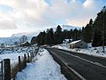
 "Reeth" on Blackdown - geograph.org.uk - 1151777.jpg 640 × 370; 81 KB
-
-
 15 miles to Yarmouth - geograph.org.uk - 1152039.jpg 640 × 451; 95 KB
-
 2 donkeys 1 head - geograph.org.uk - 1152073.jpg 640 × 480; 135 KB
-

-
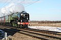
 46115 Scots Guardsman at Hellifield - geograph.org.uk - 1469222.jpg 480 × 640; 85 KB
-
-
 60163 Tornado 7 Feb 2009 pic 1.jpg 3,872 × 2,592; 2.33 MB
-
 60163 Tornado 7 Feb 2009 pic 2.jpg 3,872 × 2,592; 3.18 MB
-
 60163 Tornado 7 Feb 2009 pic 3.jpg 3,872 × 2,592; 4.03 MB
-
 60163 Tornado 7 Feb 2009 pic 4.jpg 3,872 × 2,452; 2.52 MB
-
 84, Cowper Street - geograph.org.uk - 1151247.jpg 640 × 550; 86 KB
-
 A and E, Kent and Sussex Hospital - geograph.org.uk - 1155009.jpg 640 × 430; 70 KB
-
 A choice of paths - geograph.org.uk - 1152895.jpg 640 × 480; 64 KB
-
 A colourful splash - geograph.org.uk - 1151913.jpg 640 × 480; 110 KB
-
 A cool walk in Carpenters Down wood - geograph.org.uk - 1184055.jpg 640 × 475; 77 KB
-

-
 A lichen - Flavoparmelia caperata - geograph.org.uk - 1155285.jpg 640 × 480; 120 KB
-
 A Mourne gate near Bryansford (2) - geograph.org.uk - 1151587.jpg 640 × 350; 83 KB
-
 A new house rises, Reynolds Lane - geograph.org.uk - 1154956.jpg 640 × 430; 69 KB
-
 A sheepfold by the Kirkton Burn - geograph.org.uk - 1152051.jpg 640 × 427; 144 KB
-
 A slushy Poltimore Road - geograph.org.uk - 1154490.jpg 480 × 640; 78 KB
-

-

-
 A snowy descent at Stag Hill - geograph.org.uk - 1153958.jpg 640 × 480; 81 KB
-
 A snowy Guildford Station - geograph.org.uk - 1153330.jpg 640 × 480; 69 KB
-
 A snowy scene behind Alresford Road - geograph.org.uk - 1154170.jpg 640 × 480; 80 KB
-
 A snowy Stag Hill - geograph.org.uk - 1153755.jpg 640 × 480; 81 KB
-
 A view to Lynders Wood - geograph.org.uk - 1152003.jpg 480 × 640; 116 KB
-

-

-
 A wintery Coldwell Bottom - geograph.org.uk - 1156360.jpg 640 × 426; 32 KB
-
 A wintry Hillside Crescent - geograph.org.uk - 1153548.jpg 640 × 479; 55 KB
-
 A379 above Maidencombe - geograph.org.uk - 1156119.jpg 480 × 640; 106 KB
-
 A469 just south of Brithdir - geograph.org.uk - 1152632.jpg 640 × 480; 68 KB
-
 A82 with Stob Dearg to the left - geograph.org.uk - 1166212.jpg 640 × 480; 43 KB
-
 A9 approaching Dalnaspidal - geograph.org.uk - 1158128.jpg 640 × 480; 69 KB
-
 A9, Glen Garry - geograph.org.uk - 1158108.jpg 640 × 480; 69 KB
-
 A9, Glen Garry - geograph.org.uk - 1158156.jpg 640 × 359; 59 KB
-
 Abandoned shopping trolley, Barton - geograph.org.uk - 1162665.jpg 480 × 640; 109 KB
-
 Abbey Street, Chester - geograph.org.uk - 1152385.jpg 640 × 427; 79 KB
-
 Above Coldwell Bottom - geograph.org.uk - 1156860.jpg 640 × 426; 47 KB
-

-
 Across Compton - geograph.org.uk - 1154044.jpg 640 × 426; 179 KB
-
 Across Compton - geograph.org.uk - 1154059.jpg 640 × 426; 189 KB
-
 Across Roden Downs - geograph.org.uk - 1153826.jpg 427 × 640; 173 KB
-
 Adam Viaduct - geograph.org.uk - 1151893.jpg 640 × 427; 74 KB
-
 Agraria Road - geograph.org.uk - 1154451.jpg 640 × 480; 61 KB
-
 Agricultural Machinery - geograph.org.uk - 1152211.jpg 640 × 335; 122 KB
-
 Agricultural Machinery near Gabwell - geograph.org.uk - 1159199.jpg 640 × 480; 136 KB
-
 Albion Mill - geograph.org.uk - 1151203.jpg 640 × 480; 58 KB
-
 Alder Croft - geograph.org.uk - 1156017.jpg 640 × 480; 70 KB
-
 Alexandra Park, Penarth - geograph.org.uk - 1152143.jpg 640 × 363; 69 KB
-

-
 All Saints Church, Margaret Street - geograph.org.uk - 1154620.jpg 480 × 640; 79 KB
-

-
 Almost a blizzard (3263545280).jpg 2,816 × 2,112; 2.68 MB
-
 Along the Ridgeway - geograph.org.uk - 1153672.jpg 426 × 640; 173 KB
-
 Alpacas in the snow in Winsley - geograph.org.uk - 1181694.jpg 640 × 481; 89 KB
-

-
 Alternative footpath sign at Aldworth, Berkshire.jpg 640 × 426; 197 KB
-
 Altnafeadh - geograph.org.uk - 1166270.jpg 640 × 480; 51 KB
-
 Altnafeadh - geograph.org.uk - 1166273.jpg 640 × 480; 49 KB
-
 Am Fraoch Eilean - geograph.org.uk - 1164078.jpg 640 × 316; 70 KB
-
 Amphitheatre by Eastrop roundabout - geograph.org.uk - 1336835.jpg 640 × 474; 75 KB
-
-
 An icy car park at Guildford Cathedral - geograph.org.uk - 1153930.jpg 640 × 480; 102 KB
-
 Anagach Wood - geograph.org.uk - 1158471.jpg 640 × 480; 150 KB
-
 Anagach Wood - geograph.org.uk - 1158645.jpg 640 × 359; 105 KB
-
 Andover - Poppies In The Snow - geograph.org.uk - 1160105.jpg 640 × 480; 67 KB
-
 Andover - St Marys Church - geograph.org.uk - 1160117.jpg 640 × 480; 85 KB
-
 Andover - Trafalgar Way Plaque - geograph.org.uk - 1160128.jpg 480 × 640; 98 KB
-
 Andover - War Memorial - geograph.org.uk - 1160094.jpg 480 × 640; 108 KB
-

-
 Approaching Blewbury - geograph.org.uk - 1155668.jpg 428 × 640; 213 KB
-

-
-

-
 Ardpatrick Point - geograph.org.uk - 1162943.jpg 640 × 290; 72 KB
-
 Arnfield Covert - geograph.org.uk - 1156538.jpg 640 × 471; 90 KB
-
 Arnfield Lane looking NW - geograph.org.uk - 1156475.jpg 480 × 640; 41 KB
-
 Arnfield Reservoir - geograph.org.uk - 1152323.jpg 640 × 480; 70 KB
-

-
 Ashwood Drive - Church Street - geograph.org.uk - 1151704.jpg 640 × 480; 285 KB
-
 Ashwood Drive - Greenfield Avenue - geograph.org.uk - 1151755.jpg 640 × 439; 201 KB
-
 Ashwood Gardens - Scott Green - geograph.org.uk - 1151751.jpg 640 × 431; 183 KB
-

-
 Avenue of trees at Asthall - geograph.org.uk - 1155090.jpg 451 × 640; 197 KB
-
 Road closed at Asthall - geograph.org.uk - 1155082.jpg 640 × 440; 129 KB
-
 Asthall Manor - geograph.org.uk - 1155101.jpg 640 × 436; 153 KB
-
 Deer at Dean's Bottom - geograph.org.uk - 1156241.jpg 640 × 428; 146 KB
-
 Deer at Dean's Bottom - geograph.org.uk - 1156244.jpg 427 × 640; 164 KB
-
 Towards Aston Tirrold - geograph.org.uk - 1154313.jpg 640 × 426; 64 KB
-
 Aston Upthorpe Downs - geograph.org.uk - 1156009.jpg 640 × 426; 171 KB
-
 Aston Upthorpe Downs - geograph.org.uk - 1156219.jpg 640 × 426; 146 KB
-
 Aston Upthorpe Downs - geograph.org.uk - 1156223.jpg 640 × 428; 202 KB
-

-

-
 Auchenroddan Forest - geograph.org.uk - 1151781.jpg 640 × 427; 64 KB
-
 Auchenroddan Forest - geograph.org.uk - 1151804.jpg 640 × 427; 82 KB
-
 Auchenroddan Forest - geograph.org.uk - 1151844.jpg 640 × 427; 109 KB
-
 Auchenroddan Forest - geograph.org.uk - 1151860.jpg 427 × 640; 102 KB
-
 Audley Cottages, 1896 - geograph.org.uk - 1151316.jpg 640 × 480; 103 KB
-
 Avebury - the south west quarter looking north east in snow.jpg 3,200 × 2,400; 1.83 MB
-
 Aviemore in snow - geograph.org.uk - 1158168.jpg 640 × 480; 89 KB
-
 Ayton House - geograph.org.uk - 1151371.jpg 640 × 480; 134 KB
-
 B4224 crossing the Rudhall Valley - geograph.org.uk - 1155147.jpg 480 × 640; 114 KB
-
 Back Lane in Boroughbridge - geograph.org.uk - 1152702.jpg 640 × 394; 65 KB
-
 Bagh an Achain - geograph.org.uk - 1167166.jpg 640 × 334; 98 KB
-
 Balliekine - geograph.org.uk - 1163247.jpg 640 × 428; 63 KB
-
 Balliekine ruins - geograph.org.uk - 1163283.jpg 640 × 428; 93 KB
-
 Holy Trinity Church, Balsham - geograph.org.uk - 1439234.jpg 427 × 640; 76 KB
-
 Holy Trinity Church, Balsham - geograph.org.uk - 1439236.jpg 640 × 427; 73 KB
-
 Balsham Bandstand - geograph.org.uk - 1439229.jpg 640 × 427; 80 KB
-
 Banks of the river Loddon - geograph.org.uk - 1334179.jpg 640 × 470; 92 KB
-
 Banstead Heath - geograph.org.uk - 1152722.jpg 640 × 426; 43 KB
-
 Banstead Heath - geograph.org.uk - 1152726.jpg 640 × 426; 100 KB
-
 Banstead Heath - geograph.org.uk - 1152729.jpg 640 × 426; 80 KB
-
 Banstead Heath - geograph.org.uk - 1152732.jpg 640 × 426; 68 KB
-
 Banstead Heath - geograph.org.uk - 1152740.jpg 640 × 426; 40 KB
-
 Banstead Heath - geograph.org.uk - 1152741.jpg 640 × 426; 85 KB
-
 Banstead Heath - geograph.org.uk - 1152742.jpg 640 × 426; 68 KB
-
 Barbed Wire (3262725005).jpg 2,816 × 2,112; 2.13 MB
-
 Barchington Avenue, Torquay - geograph.org.uk - 1162528.jpg 640 × 480; 98 KB
-
 Barn at the Lees - geograph.org.uk - 1154053.jpg 640 × 426; 44 KB
-
 Barn in the snow - geograph.org.uk - 1154504.jpg 640 × 426; 67 KB
-
 Barn on the bridleway - geograph.org.uk - 1153864.jpg 640 × 426; 187 KB
-
 Barns and fields near Abdon - geograph.org.uk - 1153574.jpg 640 × 480; 85 KB
-
-
 Barns at Aston Tirrold - geograph.org.uk - 1154345.jpg 640 × 426; 50 KB
-
 Barns at the Lees - geograph.org.uk - 1154091.jpg 640 × 426; 57 KB
-
 Barns on Little Champions Farm - geograph.org.uk - 1152876.jpg 640 × 480; 86 KB
-
 Barnsley Courthouse railway station (site) (geograph 3483952).jpg 1,024 × 768; 169 KB
-
 Barrow Haven Timber Wharf - geograph.org.uk - 1151867.jpg 640 × 426; 63 KB
-
 Barrow Haven Timber Wharf - geograph.org.uk - 1151894.jpg 640 × 480; 92 KB
-
 Basil House, 1876 - geograph.org.uk - 1151242.jpg 640 × 480; 103 KB
-
 Basingstoke reflected - geograph.org.uk - 1336190.jpg 640 × 471; 87 KB
-
 Basketball Courts - geograph.org.uk - 1335895.jpg 640 × 471; 105 KB
-
 Basketball Courts in the snow - geograph.org.uk - 1335883.jpg 640 × 473; 104 KB
-
 Baxter Healthcare - geograph.org.uk - 1154113.jpg 640 × 427; 219 KB
-
 Beacon Hill Playground - geograph.org.uk - 1152815.jpg 640 × 480; 71 KB
-
 Beacon Hill Recreation Ground - geograph.org.uk - 1152817.jpg 640 × 480; 79 KB
-
 Beananach Farm Steading - geograph.org.uk - 1152630.jpg 640 × 427; 196 KB
-
 Bedside Manor - geograph.org.uk - 1153822.jpg 640 × 512; 99 KB
-
 Beech trees, Castle Hill - geograph.org.uk - 1153073.jpg 640 × 427; 324 KB
-
 Beechfield Avenue, Barton - geograph.org.uk - 1162687.jpg 640 × 480; 67 KB
-
 Beechfield Avenue, Torquay - geograph.org.uk - 1162698.jpg 480 × 640; 85 KB
-
 Beechfield Avenue, Torquay - geograph.org.uk - 1162742.jpg 640 × 480; 94 KB
-
 Beinn Chuirn from the A85 carpark - geograph.org.uk - 1166147.jpg 640 × 480; 47 KB
-
 Beinn Chuirn from the A85 Glen Lochy - geograph.org.uk - 1166152.jpg 640 × 480; 55 KB
-
-
 Beinn Dorain from the A82 - geograph.org.uk - 1166157.jpg 640 × 480; 43 KB
-
 Beinn Dorain from the A82 - geograph.org.uk - 1166171.jpg 640 × 480; 41 KB
-
 Bellingham Bridge - geograph.org.uk - 1152150.jpg 640 × 344; 74 KB
-
 Below Lowbury Hill - geograph.org.uk - 1156229.jpg 425 × 640; 171 KB
-
 Belton Cottages, 1897 - geograph.org.uk - 1151204.jpg 640 × 480; 83 KB
-
 Bench on open space above Capel - geograph.org.uk - 1152563.jpg 640 × 427; 102 KB
-
 Benches in the sun - geograph.org.uk - 1334164.jpg 640 × 474; 89 KB
-
 Beside the road to Treoes - geograph.org.uk - 1152119.jpg 640 × 480; 103 KB
-
 Beside the road to Treoes - geograph.org.uk - 1152145.jpg 640 × 480; 147 KB
-
 Beside the road to Treoes - geograph.org.uk - 1152155.jpg 640 × 480; 106 KB
-

-
 Bidbury Junior School playing field - geograph.org.uk - 1151943.jpg 640 × 480; 60 KB
-
 Bidgood's Farm, Woodbury Salterton - geograph.org.uk - 1154618.jpg 640 × 480; 74 KB
-
 Birdlip Hill - geograph.org.uk - 1157418.jpg 640 × 426; 66 KB
-
 Birdlip Primary School - geograph.org.uk - 1154529.jpg 640 × 426; 102 KB
-
 Birdlip Radio Station - geograph.org.uk - 1156347.jpg 640 × 426; 56 KB
-
 Bishop's Court Lane - geograph.org.uk - 1156398.jpg 640 × 480; 129 KB
-
 Bishop's Court, near Clyst St Mary - geograph.org.uk - 1156394.jpg 640 × 480; 83 KB
-
 Black Cleugh - geograph.org.uk - 1152584.jpg 640 × 357; 54 KB
-
 Black Hill - geograph.org.uk - 1151577.jpg 640 × 406; 275 KB
-
 Black Hill car park - geograph.org.uk - 1152208.jpg 640 × 427; 293 KB
-
 Black Hill from Pinnacle Hill - geograph.org.uk - 1152170.jpg 640 × 427; 281 KB
-
 Black Loch - geograph.org.uk - 1152590.jpg 640 × 480; 102 KB
-
 Blackblakehope - geograph.org.uk - 1152397.jpg 640 × 387; 49 KB
-
 Blackdown House - geograph.org.uk - 1151713.jpg 640 × 360; 76 KB
-

-
-
 Blackmount carpark - geograph.org.uk - 1166178.jpg 640 × 480; 40 KB
-
 Blackmount carpark view - geograph.org.uk - 1166180.jpg 640 × 480; 48 KB
-
 Blackmount Carpark view - geograph.org.uk - 1166181.jpg 640 × 480; 52 KB
-
 Blackmount Carpark view - geograph.org.uk - 1166183.jpg 640 × 480; 68 KB
-
 Blakehope Burn - geograph.org.uk - 1152422.jpg 640 × 370; 76 KB
-
 Blakehopeburnhaugh - geograph.org.uk - 1152370.jpg 640 × 427; 55 KB
-
 Blaxter Quarry - geograph.org.uk - 1152473.jpg 640 × 346; 100 KB
-
 Blewbury Green - geograph.org.uk - 1155834.jpg 640 × 427; 206 KB
-
 Boham's Road - geograph.org.uk - 1155110.jpg 640 × 427; 220 KB
-
 Bridge brickwork - geograph.org.uk - 1155083.jpg 640 × 427; 210 KB
-
 Byway over the railway bridge - geograph.org.uk - 1155067.jpg 426 × 640; 146 KB
-
 House at Blewbury - geograph.org.uk - 1155806.jpg 640 × 426; 213 KB
-
 London Road, Blewbury - geograph.org.uk - 1155687.jpg 640 × 426; 197 KB
-
 London Road, Blewbury - geograph.org.uk - 1155783.jpg 640 × 426; 209 KB
-
 Nottingham Fee, Blewbury - geograph.org.uk - 1155681.jpg 427 × 640; 192 KB
-
 Nottingham Fee, Blewbury - geograph.org.uk - 1155694.jpg 640 × 425; 185 KB
-
 Nottingham Fee, Blewbury - geograph.org.uk - 1155704.jpg 640 × 426; 197 KB
-
 Nottingham Fee, Blewbury - geograph.org.uk - 1155709.jpg 640 × 425; 217 KB
-
 Old barn, Blewbury - geograph.org.uk - 1155776.jpg 426 × 640; 191 KB
-
 Railway across the downs - geograph.org.uk - 1155075.jpg 640 × 428; 199 KB
-
 Blewbury Down - geograph.org.uk - 1155030.jpg 640 × 426; 122 KB
-
 Blewbury Down - geograph.org.uk - 1155033.jpg 640 × 427; 170 KB


_-_geograph.org.uk_-_1151587.jpg)


.jpg)


.jpg)


_(geograph_3483952).jpg)


