Category:United Kingdom photographs taken on 2008-01-13
Jump to navigation
Jump to search
| ← | Sunday 13 January 2008 | → | ||
| ← | January 2008 | → | ||

United Kingdom photographs taken on 13 January 2008.
Image files should be categorized here automatically using {{taken on}} template. Direct categorisation is also possible, if automatic is impossible.
Subcategories
This category has only the following subcategory.
Media in category "United Kingdom photographs taken on 2008-01-13"
The following 200 files are in this category, out of 456 total.
(previous page) (next page)-
 201 at Butlers Hill - geograph.org.uk - 661627.jpg 640 × 480; 88 KB
-
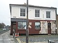 A sad fate for the Dorchester Arms - geograph.org.uk - 658005.jpg 640 × 480; 61 KB
-
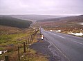 A689 Road - geograph.org.uk - 657149.jpg 640 × 475; 58 KB
-
 Abandoned vehicle near Oldington Bridge - geograph.org.uk - 657282.jpg 640 × 480; 200 KB
-
 Abbotts Ann - Footpath - geograph.org.uk - 657578.jpg 640 × 512; 195 KB
-
 Abbotts Ann - Manor Farm - geograph.org.uk - 657653.jpg 640 × 512; 117 KB
-
 Abbotts Ann - Manor Farm - geograph.org.uk - 657658.jpg 640 × 507; 140 KB
-
 Abbotts Ann - Manor Farm - geograph.org.uk - 657663.jpg 512 × 640; 104 KB
-
 Abbotts Ann - Primary School - geograph.org.uk - 657608.jpg 640 × 512; 93 KB
-
 Abbotts Ann - Railway Bridge - geograph.org.uk - 657575.jpg 640 × 512; 114 KB
-
 Abbotts Ann - St Mary's Church - geograph.org.uk - 657627.jpg 640 × 528; 157 KB
-
 Abbotts Ann - Street Scene - geograph.org.uk - 657614.jpg 640 × 550; 106 KB
-

-
 Abbotts Ann - War Memorial - geograph.org.uk - 657633.jpg 640 × 512; 171 KB
-
 Abbotts Ann - War Memorial - geograph.org.uk - 657640.jpg 640 × 587; 151 KB
-
 Abbotts Ann - War Memorial - geograph.org.uk - 657643.jpg 640 × 388; 118 KB
-
 Abbotts Ann - War Memorial Hall - geograph.org.uk - 657590.jpg 640 × 512; 132 KB
-
 Albert Street, Clayton-le-Moors - geograph.org.uk - 658705.jpg 640 × 480; 225 KB
-
 All Saints Churchyard - geograph.org.uk - 657915.jpg 640 × 480; 97 KB
-
 All Saints Portsea - geograph.org.uk - 657896.jpg 640 × 480; 70 KB
-
 All Saints Street - geograph.org.uk - 657925.jpg 640 × 480; 57 KB
-
 Ancient and Modern - geograph.org.uk - 657353.jpg 640 × 480; 64 KB
-

-
 Approaching Sprey Point - geograph.org.uk - 665102.jpg 640 × 480; 50 KB
-
 Arundel Court Nursery - geograph.org.uk - 660881.jpg 640 × 480; 48 KB
-
 Arundel Court School - geograph.org.uk - 660758.jpg 640 × 480; 65 KB
-
 Part of the Aylestone Meadows - geograph.org.uk - 676565.jpg 640 × 466; 85 KB
-
 Ballyholme Road, Bangor (2) - geograph.org.uk - 658607.jpg 640 × 480; 83 KB
-

-
 Bark Graffiti - geograph.org.uk - 658340.jpg 480 × 640; 118 KB
-
 Air Raid Shelter - geograph.org.uk - 657543.jpg 640 × 480; 164 KB
-
 High Street, Barton Upon Humber - geograph.org.uk - 657573.jpg 640 × 550; 108 KB
-
 North Lincolnshire Council Offices - geograph.org.uk - 657564.jpg 640 × 480; 123 KB
-
 W.A.Clark Shoe Shop, High Street - geograph.org.uk - 657568.jpg 640 × 480; 96 KB
-
 Bestwood Colliery Headframe - geograph.org.uk - 657905.jpg 640 × 397; 82 KB
-

-
 Bestwood Country Park - Alexandra Lodges - geograph.org.uk - 658329.jpg 640 × 476; 127 KB
-
 Bestwood Country Park - Car Park - geograph.org.uk - 657908.jpg 640 × 384; 75 KB
-
 Bestwood Country Park - geograph.org.uk - 657914.jpg 640 × 402; 90 KB
-
 Bestwood Country Park - geograph.org.uk - 657916.jpg 640 × 457; 91 KB
-

-

-
 Bestwood Country Park - Parkside Pasture - geograph.org.uk - 661595.jpg 640 × 480; 100 KB
-
 Bestwood Country Park - the River Leen - geograph.org.uk - 661616.jpg 640 × 480; 130 KB
-
 Bestwood Country Park - Woodman's Cottage - geograph.org.uk - 661590.jpg 640 × 442; 149 KB
-
 Bestwood Country Park- Mill Lakes - geograph.org.uk - 661620.jpg 640 × 480; 113 KB
-
 Bestwood Country Park- Mill Lakes - geograph.org.uk - 661632.jpg 640 × 480; 79 KB
-
 Bestwood Country Park- Mill Lakes - geograph.org.uk - 661635.jpg 640 × 433; 53 KB
-

-
 Bestwood Pumping Station - geograph.org.uk - 661575.jpg 640 × 419; 51 KB
-
 Bestwood Pumping Station - geograph.org.uk - 661581.jpg 640 × 480; 73 KB
-
 Bestwood Village, Coronation Road - geograph.org.uk - 661614.jpg 640 × 480; 112 KB
-
 Bestwood Village, The Spinney - geograph.org.uk - 661606.jpg 640 × 429; 76 KB
-
 Bestwood Village, The Spinney - geograph.org.uk - 661609.jpg 640 × 480; 129 KB
-
 Bestwood Village, The Spinney - geograph.org.uk - 661611.jpg 640 × 437; 93 KB
-

-
 St Mary The Virgin church, Betteshanger - geograph.org.uk - 660105.jpg 480 × 640; 198 KB
-
 Black Shoulder - geograph.org.uk - 764162.jpg 640 × 426; 43 KB
-
 Breaking waves, Seacliff Road - geograph.org.uk - 658576.jpg 640 × 561; 69 KB
-
 Bridge by Portsmouth Central Library - geograph.org.uk - 661684.jpg 640 × 480; 64 KB
-
 Bridge over the railway on Ripple Road - geograph.org.uk - 660547.jpg 640 × 480; 226 KB
-
 British Transport Police Station - geograph.org.uk - 661679.jpg 640 × 480; 76 KB
-
 Burghley Road, N8 - geograph.org.uk - 659677.jpg 640 × 480; 75 KB
-
 Bus approaches Commercial Road - geograph.org.uk - 659122.jpg 640 × 480; 66 KB
-
 Bus stop by Commercial Road roundabout - geograph.org.uk - 657938.jpg 640 × 480; 101 KB
-
 Bus stop by St Agatha's - geograph.org.uk - 659070.jpg 640 × 480; 44 KB
-
 Cairnsmore of Carsphairn - geograph.org.uk - 764144.jpg 640 × 426; 37 KB
-
 Cairnsmore of Carsphairn - geograph.org.uk - 764149.jpg 640 × 426; 38 KB
-
 Caltongate - geograph.org.uk - 685278.jpg 640 × 480; 91 KB
-
 Canal bridge (road) at Moira - geograph.org.uk - 657657.jpg 640 × 429; 60 KB
-
 Cannon on plinth at Commercial Road - geograph.org.uk - 657991.jpg 640 × 480; 92 KB
-
 Canongate Kirk - geograph.org.uk - 685265.jpg 640 × 480; 80 KB
-
 Caravan site near Tophouse farm - geograph.org.uk - 661574.jpg 640 × 440; 93 KB
-
 Cascades Car Park - geograph.org.uk - 659074.jpg 640 × 480; 64 KB
-
 Castell Tinboeth 659389.jpg 640 × 480; 76 KB
-
 Cathedral retail park Wakefield - geograph.org.uk - 658176.jpg 640 × 512; 104 KB
-
 Celebs. - geograph.org.uk - 685282.jpg 480 × 640; 106 KB
-
 Chippermore Heughs - geograph.org.uk - 657719.jpg 640 × 428; 67 KB
-
 Chippermore Heughs - geograph.org.uk - 657729.jpg 640 × 480; 69 KB
-

-
 Christ Church, Prestatyn - geograph.org.uk - 656726.jpg 480 × 640; 64 KB
-
 Churchyard at Betteshanger - geograph.org.uk - 660132.jpg 640 × 480; 220 KB
-

-
 Cleveland Way approaching Scarborough - geograph.org.uk - 659983.jpg 640 × 480; 159 KB
-
 Cleveland Way near Wheatcroft - geograph.org.uk - 659991.jpg 640 × 480; 140 KB
-
 Cleveland Way toward Cunstone Nab - geograph.org.uk - 660024.jpg 640 × 480; 146 KB
-
 Cliff near Under Nine Rocks - geograph.org.uk - 660035.jpg 640 × 480; 129 KB
-
 Cliffs at Back Bay - geograph.org.uk - 657656.jpg 640 × 480; 81 KB
-
 Cliffs at West Runton Beach, Norfolk - geograph.org.uk - 804157.jpg 640 × 480; 84 KB
-
 Co-Op near Guildhall Square - geograph.org.uk - 661694.jpg 640 × 480; 82 KB
-
 Coastguard Shed And Transmitter - geograph.org.uk - 657585.jpg 640 × 480; 41 KB
-
 Cold War Museum, Cosford - geograph.org.uk - 657785.jpg 640 × 480; 96 KB
-
 Commercial Road roundabout - geograph.org.uk - 657928.jpg 640 × 480; 58 KB
-
 Cottage View, off Arundel Street - geograph.org.uk - 660896.jpg 640 × 480; 53 KB
-
 Cracoe war memorial - geograph.org.uk - 1059833.jpg 480 × 640; 40 KB
-
 Crane by Dockyard Wall - geograph.org.uk - 659078.jpg 480 × 640; 36 KB
-
 Damage to foot of seawall, Teignmouth - geograph.org.uk - 665083.jpg 640 × 480; 111 KB
-
 Day's end - geograph.org.uk - 657924.jpg 640 × 480; 62 KB
-

-
 Deal bound train - geograph.org.uk - 660543.jpg 640 × 480; 257 KB
-
 Debenhams at Commercial Road - geograph.org.uk - 660905.jpg 640 × 480; 47 KB
-
 Drainage Pump - geograph.org.uk - 657565.jpg 640 × 480; 75 KB
-
 Drumderg Wind Turbine - geograph.org.uk - 660767.jpg 640 × 480; 58 KB
-
 Ducketts Common (1) - geograph.org.uk - 658810.jpg 640 × 480; 116 KB
-
 Ducketts Common (2) - geograph.org.uk - 658811.jpg 640 × 480; 121 KB
-
 Durham County road sign - geograph.org.uk - 657171.jpg 640 × 475; 52 KB
-
 East Anstey, St.Michael's - geograph.org.uk - 673315.jpg 574 × 640; 143 KB
-
 East Hull United Reformed Church - geograph.org.uk - 657050.jpg 640 × 453; 178 KB
-
 Eastern shore of Luce Bay - geograph.org.uk - 657747.jpg 640 × 480; 42 KB
-
 Edinburgh City Council - geograph.org.uk - 685280.jpg 640 × 480; 72 KB
-
 Entrance to Great Harwood Cemetery - geograph.org.uk - 658737.jpg 640 × 480; 157 KB
-
 Family of the Black Sheep - geograph.org.uk - 661592.jpg 640 × 396; 90 KB
-

-
 Faringdon Folly Tower, Faringdon - geograph.org.uk - 657716.jpg 479 × 640; 54 KB
-

-
 Filey Sands - geograph.org.uk - 660044.jpg 640 × 480; 111 KB
-
 Filling station, Robson Way, Hull - geograph.org.uk - 656990.jpg 640 × 438; 190 KB
-
 Flats in Arundel Street - geograph.org.uk - 659904.jpg 640 × 480; 81 KB
-
 Flooded River Avon - geograph.org.uk - 1007990.jpg 428 × 640; 59 KB
-
 Foam near Changue Port - geograph.org.uk - 657712.jpg 640 × 465; 65 KB
-
 Footbridge over Railway at Hornsey - geograph.org.uk - 661965.jpg 640 × 480; 136 KB
-
 Footpath to Hucknall - geograph.org.uk - 661618.jpg 480 × 640; 110 KB
-
-
 Footpath towards Sheep Wash, Betteshanger - geograph.org.uk - 659579.jpg 640 × 480; 209 KB
-
 Former Boys' School, Welton le Wold - geograph.org.uk - 657438.jpg 640 × 480; 88 KB
-
 Former naval store^ - geograph.org.uk - 659092.jpg 640 × 480; 82 KB
-
 Former Police Station, St Mary Cray - geograph.org.uk - 657088.jpg 640 × 480; 80 KB
-
 Former Ship Building Yards - geograph.org.uk - 657907.jpg 640 × 427; 64 KB
-
 Formerly St Agatha's Parish Church - geograph.org.uk - 659066.jpg 640 × 480; 50 KB
-
 Formerly The Albany - geograph.org.uk - 661002.jpg 640 × 480; 84 KB
-

-
 Function Rooms in Arundel Street - geograph.org.uk - 659902.jpg 640 × 480; 60 KB
-
 Garnock in flood.JPG 2,288 × 1,712; 1.37 MB
-
 Gravestone at Kirkmaiden - geograph.org.uk - 657639.jpg 480 × 640; 172 KB
-
 Grease holes - geograph.org.uk - 1252840.jpg 428 × 640; 98 KB
-

-
 Groynes on Teignmouth Beach - geograph.org.uk - 665006.jpg 640 × 480; 48 KB
-
 Haggersgate - geograph.org.uk - 657723.jpg 427 × 640; 62 KB
-

-
 Harpenden Arms - geograph.org.uk - 908563.jpg 640 × 480; 66 KB
-
 Hedgerow along railway cutting - geograph.org.uk - 660554.jpg 640 × 480; 268 KB
-

-
 Entrance to Worth Farms - geograph.org.uk - 657567.jpg 640 × 480; 64 KB
-
 Hollow near Top Whiteheads Lodge - geograph.org.uk - 659420.jpg 640 × 480; 72 KB
-

-
 Hornsey Station - geograph.org.uk - 661963.jpg 640 × 480; 83 KB
-
 Humphry Reptons Grave.jpg 2,304 × 1,728; 1.67 MB
-
 Impressive sheds - geograph.org.uk - 660753.jpg 640 × 480; 69 KB
-
 Inland Revenue Offices, Portsmouth - geograph.org.uk - 657923.jpg 480 × 640; 81 KB
-
 Inside Princes Street - geograph.org.uk - 685547.jpg 640 × 480; 103 KB
-
 Iron Railway Bridge - geograph.org.uk - 657707.jpg 640 × 427; 73 KB
-

-
 Joke shop par excellence - geograph.org.uk - 659890.jpg 640 × 480; 102 KB
-

-
 K2 frozen foods - geograph.org.uk - 660897.jpg 640 × 480; 45 KB
-
 Kebab Shop near Commercial Road - geograph.org.uk - 659131.jpg 480 × 640; 55 KB
-
 Keighley and Worth Valley Railway - geograph.org.uk - 794527.jpg 480 × 640; 73 KB
-
 Kelp Mountains - geograph.org.uk - 656896.jpg 640 × 426; 113 KB
-
 Kirkmaiden in Ferness - geograph.org.uk - 657630.jpg 640 × 480; 92 KB
-
 Lindsay's Bridge, Banbridge (3) - geograph.org.uk - 657402.jpg 640 × 429; 83 KB
-
 Lockerley Baptist Chapel - geograph.org.uk - 656872.jpg 640 × 490; 57 KB
-
 Lockerley Post Ofiice stores - geograph.org.uk - 656890.jpg 640 × 480; 83 KB
-

-
 Looking down towards Commercial Road - geograph.org.uk - 657903.jpg 640 × 480; 64 KB
-

-

-
 Looking NE along the Ripple Road - geograph.org.uk - 660553.jpg 640 × 480; 169 KB
-
-
 Looking West at Skipton on Swale - geograph.org.uk - 659508.jpg 640 × 426; 76 KB
-
 Ludlam Street bus depot - geograph.org.uk - 657360.jpg 640 × 501; 59 KB
-

-
 Main post office for Portsmouth - geograph.org.uk - 660997.jpg 640 × 480; 92 KB
-
 Marshmellow Land - geograph.org.uk - 657461.jpg 640 × 479; 62 KB
-

-

-
-

-
 Masonic Hall, Commercial Road - geograph.org.uk - 657931.jpg 640 × 480; 96 KB
-
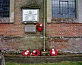
 Memorial plaque in Kirkmaiden churchyard - geograph.org.uk - 657644.jpg 640 × 480; 118 KB
-
-
 Methodist Chapel, Oldways End - geograph.org.uk - 673304.jpg 640 × 624; 113 KB
-
 Methodist Church, Bampton, Devon - geograph.org.uk - 673332.jpg 640 × 504; 116 KB
-
 Mill Lakes outlet - geograph.org.uk - 661638.jpg 640 × 480; 112 KB
-
 Monxton - Railway Line - geograph.org.uk - 657672.jpg 640 × 512; 131 KB
-
 Muddy Banks - geograph.org.uk - 658429.jpg 640 × 480; 62 KB
-
 Mull Hill of Airyolland - geograph.org.uk - 657739.jpg 640 × 495; 117 KB
-

-

-
 Newsagents in Arundel Street - geograph.org.uk - 660884.jpg 640 × 480; 61 KB
-
 North Level Main Drain - geograph.org.uk - 658368.jpg 640 × 480; 58 KB
-
 Northern end of Commercial Road - geograph.org.uk - 657993.jpg 640 × 480; 79 KB
-
 Offshoot of Highbury College - geograph.org.uk - 659900.jpg 640 × 480; 59 KB
-
 Old Barn - geograph.org.uk - 659433.jpg 640 × 480; 119 KB
-
 Old millrace at Millmount, Banbridge (2) - geograph.org.uk - 657316.jpg 640 × 407; 103 KB
-

-
 Orpington Halls - geograph.org.uk - 657063.jpg 640 × 480; 83 KB
-
 Outflow, Whitehead's Middle Lodge - geograph.org.uk - 659431.jpg 640 × 480; 119 KB
-
 Outside Sutton Park Golf Course, Hull - geograph.org.uk - 657022.jpg 640 × 480; 173 KB
-
 Pasture From Larpool Lane - geograph.org.uk - 657887.jpg 640 × 427; 64 KB
-
 Path from Arundel Street - geograph.org.uk - 660885.jpg 640 × 480; 83 KB


_-_geograph.org.uk_-_658607.jpg)


_at_Moira_-_geograph.org.uk_-_657657.jpg)


_-_geograph.org.uk_-_658810.jpg)
_-_geograph.org.uk_-_658811.jpg)


,_Aghalee_-_geograph.org.uk_-_657268.jpg)


_-_geograph.org.uk_-_657402.jpg)


_in_Tarnsyke_Clough,and_Alex_-_geograph.org.uk_-_739875.jpg)


_-_geograph.org.uk_-_657316.jpg)
_-_geograph.org.uk_-_657240.jpg)


