Category:United Kingdom photographs taken on 2007-03-22
Jump to navigation
Jump to search
| ← | Thursday 22 March 2007 | → | ||
| ← | March 2007 | → | ||

United Kingdom photographs taken on 22 March 2007.
Image files should be categorized here automatically using {{taken on}} template. Direct categorisation is also possible, if automatic is impossible.
Subcategories
This category has the following 2 subcategories, out of 2 total.
Media in category "United Kingdom photographs taken on 2007-03-22"
The following 200 files are in this category, out of 461 total.
(previous page) (next page)-
 A607 at Welbourn looking northwards - geograph.org.uk - 390758.jpg 640 × 480; 56 KB
-
 Academy Building - geograph.org.uk - 374124.jpg 640 × 427; 265 KB
-
 Access road to Asloun Castle - geograph.org.uk - 374360.jpg 640 × 436; 70 KB
-
 Alexandra Road - geograph.org.uk - 374181.jpg 640 × 427; 248 KB
-
 Alexandra Road - geograph.org.uk - 374652.jpg 640 × 413; 223 KB
-
 Alexandra Road - geograph.org.uk - 374655.jpg 640 × 427; 254 KB
-
 Archway - geograph.org.uk - 374120.jpg 498 × 640; 273 KB
-
 Aspire - geograph.org.uk - 373824.jpg 640 × 532; 268 KB
-
 Auchencarroch Quarry Tramway Route - geograph.org.uk - 904370.jpg 480 × 640; 75 KB
-
 Baggeridge Car Park - geograph.org.uk - 374581.jpg 640 × 480; 127 KB
-
 Balgedie toll.jpg 640 × 424; 63 KB
-
 Ballantines Distillery Dumbarton - geograph.org.uk - 374005.jpg 640 × 480; 118 KB
-
 Ballinamallard Orange Hall - geograph.org.uk - 373707.jpg 640 × 479; 47 KB
-
 Ballinamallard River - geograph.org.uk - 375218.jpg 640 × 479; 72 KB
-
 Ballycassidy Post Office - geograph.org.uk - 375196.jpg 640 × 479; 55 KB
-
 BandQ, Maesglas Retail Park, Newport. - geograph.org.uk - 376611.jpg 640 × 432; 77 KB
-
 Bankhead from Heathcote wood - geograph.org.uk - 373910.jpg 640 × 480; 92 KB
-
 Bankhead of Perkhill - geograph.org.uk - 373924.jpg 640 × 480; 94 KB
-
 Barn Conversion - Moot Lane - geograph.org.uk - 373690.jpg 640 × 480; 127 KB
-
 Bishop Hill - geograph.org.uk - 374097.jpg 640 × 424; 55 KB
-
 Boat house at Trory, Lough Erne - geograph.org.uk - 374320.jpg 640 × 284; 32 KB
-
 Boeing 727-100 at London Southend Airport, 2007 - 375287.jpg 640 × 480; 168 KB
-
 Boundary Wall - geograph.org.uk - 373959.jpg 640 × 480; 141 KB
-
 Bridge over Red Burn - geograph.org.uk - 373998.jpg 640 × 427; 249 KB
-
 Broken Gate - geograph.org.uk - 373839.jpg 640 × 369; 213 KB
-
 Burnside - geograph.org.uk - 373991.jpg 640 × 427; 269 KB
-
 Bus shelter at Esker - geograph.org.uk - 375222.jpg 640 × 271; 25 KB
-
 Canal at Kidwelly Quay - geograph.org.uk - 389010.jpg 480 × 640; 128 KB
-
 Castle Amongst The Leaves.jpg 3,176 × 2,383; 908 KB
-
 Castle and River.jpg 3,056 × 2,289; 1.29 MB
-
 Castle Towers.jpg 3,036 × 2,173; 714 KB
-
 Cattle at Trory - geograph.org.uk - 375073.jpg 640 × 479; 72 KB
-
 Caysbriggs - geograph.org.uk - 374686.jpg 640 × 427; 224 KB
-

-

-
 Chappel anti tank obstacles 2.jpg 3,648 × 2,736; 4.37 MB
-
 Chappel anti tank obstacles.jpg 3,648 × 2,736; 4.26 MB
-
 Chappel South box EARM.jpg 2,736 × 3,648; 4.29 MB
-
 Chappel Viaduct - geograph.org.uk - 542679.jpg 640 × 480; 113 KB
-
 Church at Trory, Enniskillen - geograph.org.uk - 375065.jpg 640 × 479; 46 KB
-
 Church Road, Powderham - geograph.org.uk - 379517.jpg 640 × 391; 116 KB
-
-
 Clifton Court - Clifton Road - geograph.org.uk - 374257.jpg 635 × 536; 60 KB
-
 Clifton suspension bridge. - geograph.org.uk - 538767.jpg 640 × 459; 80 KB
-
 Cloughbally Mill, Ballycassidy - geograph.org.uk - 375195.jpg 640 × 292; 48 KB
-
 Coastguard launch on the Bann - geograph.org.uk - 374128.jpg 640 × 426; 149 KB
-
 Coastguard lookout, Portstewart - geograph.org.uk - 373847.jpg 640 × 426; 105 KB
-
 Coleton Fishacre - geograph.org.uk - 1057815.jpg 640 × 480; 295 KB
-
 Colourful Castle Wall.jpg 3,073 × 2,229; 1.05 MB
-
 Cress Beds - geograph.org.uk - 374566.jpg 640 × 480; 158 KB
-
 Dark Pool - geograph.org.uk - 373856.jpg 427 × 640; 316 KB
-
 Delivery Van at Digby Fen - geograph.org.uk - 390949.jpg 640 × 480; 62 KB
-
 Digby Fen - geograph.org.uk - 390944.jpg 640 × 480; 62 KB
-
 Digby Fen - geograph.org.uk - 390964.jpg 640 × 480; 55 KB
-
 Roadside drain at Digby Fen - geograph.org.uk - 390955.jpg 640 × 480; 64 KB
-
 Dow's Road joins Mealough Road. - geograph.org.uk - 373601.jpg 640 × 480; 98 KB
-
 Drink Canada Dry - geograph.org.uk - 373803.jpg 640 × 480; 112 KB
-
 Drumcullion - geograph.org.uk - 375214.jpg 640 × 479; 59 KB
-
 Drumcullion Townland - geograph.org.uk - 373718.jpg 640 × 479; 55 KB
-
 Drumcullion Townland - geograph.org.uk - 373720.jpg 640 × 297; 45 KB
-
 Drumcullion Townland - geograph.org.uk - 373724.jpg 640 × 479; 73 KB
-
 Drumcullion Townland - geograph.org.uk - 375211.jpg 640 × 479; 50 KB
-
 Drumgay Lough - geograph.org.uk - 374294.jpg 640 × 479; 63 KB
-
 Drumgay Lough - geograph.org.uk - 374296.jpg 640 × 479; 52 KB
-
 Drumgay Lough, Enniskillen - geograph.org.uk - 374295.jpg 640 × 479; 58 KB
-
 Drumgay Lough, Enniskillen - geograph.org.uk - 374297.jpg 640 × 479; 55 KB
-
 Duinish - geograph.org.uk - 915224.jpg 640 × 360; 74 KB
-
 Eglwys Llanfihangel-y-traethau 376726.jpg 640 × 480; 67 KB
-
 Elgin Library - geograph.org.uk - 374651.jpg 640 × 350; 191 KB
-
 Elgin railway station.jpg 640 × 427; 250 KB
-
 Essex County Hotel - geograph.org.uk - 375278.jpg 640 × 480; 163 KB
-
 Evening Rush - geograph.org.uk - 375028.jpg 640 × 480; 109 KB
-
 Field road - geograph.org.uk - 390396.jpg 640 × 480; 91 KB
-
 Findlay's Seat - geograph.org.uk - 374037.jpg 640 × 427; 298 KB
-

-

-

-
 Golf Course - geograph.org.uk - 374208.jpg 640 × 424; 61 KB
-
 Grahamstone Avenue - geograph.org.uk - 374223.jpg 640 × 424; 61 KB
-
 Grass cutting - geograph.org.uk - 374195.jpg 640 × 424; 45 KB
-
 Greyfriars Street - geograph.org.uk - 373813.jpg 640 × 381; 220 KB
-
 Greyfriars Street - geograph.org.uk - 373818.jpg 640 × 374; 223 KB
-
 Grove Works - Cemetery Road - geograph.org.uk - 373860.jpg 639 × 473; 62 KB
-
 Harrow Inn Close - geograph.org.uk - 374165.jpg 427 × 640; 200 KB
-
 High Kirk - geograph.org.uk - 374142.jpg 640 × 427; 214 KB
-
 High Street - geograph.org.uk - 373809.jpg 640 × 378; 223 KB
-
 High Street - geograph.org.uk - 374169.jpg 640 × 427; 284 KB
-
 High Street, Royston - geograph.org.uk - 432255.jpg 640 × 480; 81 KB
-
 Houses by Portrush harbour - geograph.org.uk - 373931.jpg 640 × 426; 146 KB
-
 Howmill - geograph.org.uk - 374413.jpg 640 × 480; 96 KB
-
 Hunt Hill - geograph.org.uk - 374042.jpg 640 × 427; 285 KB
-

-

-
 Interior of St. Leonard's, Hythe, Kent - geograph.org.uk - 2103923.jpg 1,200 × 1,600; 405 KB
-
 Invermossat quarry loading bay - geograph.org.uk - 374407.jpg 640 × 480; 94 KB
-

-
 King Water - geograph.org.uk - 379695.jpg 640 × 480; 158 KB
-
 Kinnesswood and Bishop Hill - geograph.org.uk - 374955.jpg 640 × 399; 36 KB
-
 Kyme View - geograph.org.uk - 392297.jpg 640 × 480; 68 KB
-
 Larch - geograph.org.uk - 373953.jpg 427 × 640; 283 KB
-
 Larch Twigs - geograph.org.uk - 373961.jpg 362 × 640; 250 KB
-
 A17 goes by Leadenham - geograph.org.uk - 390388.jpg 640 × 480; 70 KB
-
 Entrance to Leadenham House - geograph.org.uk - 390380.jpg 640 × 480; 111 KB
-
 Leadenham House Sign - geograph.org.uk - 390383.jpg 480 × 640; 136 KB
-
 Lees Hill sunset - geograph.org.uk - 379751.jpg 640 × 480; 87 KB
-
 Letterbox - geograph.org.uk - 374084.jpg 388 × 640; 228 KB
-
 Lidl - geograph.org.uk - 374088.jpg 640 × 383; 214 KB
-
 Lifeboat at Portrush - geograph.org.uk - 373917.jpg 640 × 426; 147 KB
-
 Lone Pine - geograph.org.uk - 374327.jpg 491 × 640; 93 KB
-
 Looking up Loch Arkaig - geograph.org.uk - 429344.jpg 640 × 480; 73 KB
-
 Looking West along Arkaig - geograph.org.uk - 430721.jpg 640 × 480; 69 KB
-
 Lord Butes Walk - geograph.org.uk - 753074.jpg 640 × 480; 132 KB
-
 Lossie Estuary - geograph.org.uk - 374659.jpg 640 × 326; 186 KB
-
 Lossiemouth - geograph.org.uk - 374662.jpg 640 × 359; 191 KB
-
 Lough Erne at Trory - geograph.org.uk - 374318.jpg 640 × 298; 43 KB
-
 Lough Erne at Trory - geograph.org.uk - 375056.jpg 640 × 479; 47 KB
-
 Lough Erne, Enniskillen - geograph.org.uk - 375070.jpg 640 × 479; 80 KB
-
 Lowtown Sunday School - Lowtown - geograph.org.uk - 374255.jpg 633 × 347; 50 KB
-
 Maida Place - geograph.org.uk - 373826.jpg 640 × 473; 239 KB
-
 Martlesham Church - geograph.org.uk - 374080.jpg 640 × 480; 94 KB
-
 Masonic Hall - Church Lane - geograph.org.uk - 374248.jpg 596 × 640; 115 KB
-
 Mealough Masonic Hall - geograph.org.uk - 373612.jpg 640 × 480; 128 KB
-
 Mill Road West joins Ballycoan Road. - geograph.org.uk - 373617.jpg 640 × 480; 107 KB
-

-

-
 Moray College - geograph.org.uk - 374122.jpg 640 × 427; 222 KB
-
 Moray Street - geograph.org.uk - 374117.jpg 640 × 485; 267 KB
-
 Moss of Findlayseat - geograph.org.uk - 374018.jpg 640 × 427; 227 KB
-
 Moss of Findlayseat - geograph.org.uk - 374022.jpg 640 × 427; 212 KB
-
 Moss of Findlayseat - geograph.org.uk - 374026.jpg 640 × 427; 207 KB
-
 Moss Street - geograph.org.uk - 374075.jpg 640 × 330; 185 KB
-
 Mouth of Martlesham Creek - geograph.org.uk - 373967.jpg 640 × 480; 135 KB
-
 Narrow bridge on A980 - geograph.org.uk - 374347.jpg 640 × 403; 63 KB
-

-
 North Port - geograph.org.uk - 374647.jpg 640 × 371; 193 KB
-

-
 Northern end of Sound of Mull - geograph.org.uk - 893617.jpg 640 × 480; 54 KB
-

-
 Old Police Station - Tofts Road - geograph.org.uk - 374249.jpg 639 × 466; 66 KB
-
 Old railway bridge at Drumcullion - geograph.org.uk - 373726.jpg 640 × 297; 47 KB
-

-

-
 Paddling the Allt Shallainn - geograph.org.uk - 915209.jpg 640 × 360; 92 KB
-
 Peat haggs - geograph.org.uk - 373892.jpg 640 × 480; 88 KB
-
 Piglets - geograph.org.uk - 374691.jpg 640 × 427; 247 KB
-
 Pool Seat - geograph.org.uk - 374572.jpg 640 × 480; 130 KB
-
 Portree Swimming Pool - geograph.org.uk - 374179.jpg 640 × 482; 123 KB
-
 Public Library - geograph.org.uk - 374186.jpg 640 × 252; 141 KB
-
 Ramsgate Breakwater - geograph.org.uk - 377221.jpg 640 × 422; 92 KB
-
 Ramsgate Harbour multi-architecture - geograph.org.uk - 373902.jpg 640 × 425; 57 KB
-
 Rath at Drumcullion - geograph.org.uk - 373729.jpg 640 × 479; 59 KB
-
 Rear of Wymering Manor - geograph.org.uk - 597434.jpg 480 × 640; 86 KB
-
 Red Burn - geograph.org.uk - 373836.jpg 640 × 427; 303 KB
-
 Red deer on heathland - geograph.org.uk - 385293.jpg 640 × 439; 60 KB
-
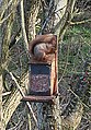 Red Squirrel - geograph.org.uk - 374666.jpg 384 × 552; 229 KB
-
 Redburn - geograph.org.uk - 374014.jpg 640 × 427; 257 KB
-
 River Lossie - geograph.org.uk - 374676.jpg 640 × 427; 266 KB
-
 River Wiske - geograph.org.uk - 376133.jpg 640 × 426; 109 KB
-
 Road at Drumcullion - geograph.org.uk - 375212.jpg 640 × 315; 29 KB
-
 Road Junction - geograph.org.uk - 373717.jpg 640 × 479; 89 KB
-
 Road, drain, farms Digby Fen - geograph.org.uk - 390970.jpg 640 × 480; 60 KB
-
 Rothes Cycle Trail - geograph.org.uk - 373862.jpg 640 × 427; 282 KB
-
 The Royse Stone - geograph.org.uk - 374839.jpg 640 × 450; 99 KB
-
 Rusholme Health Centre waiting area - panoramio.jpg 2,816 × 2,112; 1.61 MB
-
 Shore line at Trory, Lough Erne - geograph.org.uk - 374321.jpg 640 × 479; 75 KB
-
 Shy Tractor, Canada - geograph.org.uk - 373785.jpg 640 × 480; 99 KB
-
 South Guildry Street - geograph.org.uk - 374103.jpg 640 × 427; 237 KB
-
 South Guildry Street - geograph.org.uk - 374109.jpg 640 × 427; 225 KB
-
 South Kirk - geograph.org.uk - 374113.jpg 446 × 640; 214 KB
-
 South Kirk - geograph.org.uk - 374138.jpg 482 × 640; 233 KB
-
 South Wales Main Railway line - geograph.org.uk - 376575.jpg 640 × 446; 112 KB
-
 St Angelo Airport, Enniskillen - geograph.org.uk - 375068.jpg 640 × 479; 72 KB
-
 St Angelo, Enniskillen - geograph.org.uk - 375205.jpg 640 × 479; 55 KB
-
 St Columba's Church - geograph.org.uk - 374066.jpg 640 × 427; 264 KB
-
 St Columba's Church - geograph.org.uk - 374069.jpg 640 × 330; 176 KB
-
-

-
 St Martins Church Acrise - geograph.org.uk - 955865.jpg 480 × 640; 98 KB
-
 St Peter and St Paul, Wymering - geograph.org.uk - 597412.jpg 640 × 480; 76 KB
-
 St Peter's Church Holwell - geograph.org.uk - 374033.jpg 640 × 436; 69 KB
-
 St Sylvester gargoyle. - geograph.org.uk - 373943.jpg 426 × 640; 134 KB
-
 St. Mary's Churchyard, Cross - geograph.org.uk - 879400.jpg 640 × 428; 84 KB
-
 St. Thomas Beckett, Fairfield, Kent - geograph.org.uk - 1603865.jpg 640 × 480; 61 KB
-
 Sunset over River Teign - geograph.org.uk - 379534.jpg 640 × 468; 51 KB
-
 Supervalu, Irvinestown - geograph.org.uk - 375219.jpg 640 × 479; 55 KB
-
 Swans - geograph.org.uk - 392315.jpg 640 × 480; 60 KB
-

-
 Tannery Yard - Lowtown - geograph.org.uk - 374250.jpg 633 × 404; 58 KB
-
 Teindland Forest - geograph.org.uk - 373829.jpg 427 × 640; 268 KB
-
 Teindland Forest - geograph.org.uk - 373833.jpg 427 × 640; 278 KB
-
 Teindland Forest - geograph.org.uk - 373870.jpg 427 × 640; 306 KB
-
 Teindland Forest - geograph.org.uk - 373875.jpg 640 × 427; 248 KB
-
 Teindland Forest - geograph.org.uk - 373920.jpg 640 × 427; 311 KB
-
 Teindland Forest - geograph.org.uk - 373929.jpg 427 × 640; 311 KB
-
 Teindland Forest - geograph.org.uk - 373935.jpg 640 × 427; 265 KB
-
 Teindland Forest - geograph.org.uk - 373942.jpg 640 × 427; 295 KB
-
 Teindland Forest - geograph.org.uk - 373949.jpg 427 × 640; 283 KB
-
 Teindland Mains - geograph.org.uk - 373845.jpg 640 × 427; 251 KB
-
 Teindland Mains - geograph.org.uk - 373848.jpg 640 × 427; 216 KB
-
 Teindland Wells - geograph.org.uk - 373850.jpg 640 × 313; 158 KB


_and_Ballynagarrick_Road_join_Mealough_Road_-_geograph.org.uk_-_373608.jpg)
_joins_Ballycoan_Road._-_geograph.org.uk_-_373614.jpg)


