Category:United Kingdom photographs taken on 2006-07-22
Jump to navigation
Jump to search

Subcategories
This category has only the following subcategory.
Media in category "United Kingdom photographs taken on 2006-07-22"
The following 200 files are in this category, out of 645 total.
(previous page) (next page)-
 .. - panoramio (46).jpg 2,592 × 1,944; 993 KB
-
 A Bend in the Road - geograph.org.uk - 209136.jpg 640 × 427; 104 KB
-
 A Bus in a Field - geograph.org.uk - 208242.jpg 640 × 426; 87 KB
-
 A Modern Haystack - geograph.org.uk - 208606.jpg 640 × 427; 106 KB
-
 A40 - geograph.org.uk - 207111.jpg 640 × 480; 73 KB
-
 A47 Eastwards - geograph.org.uk - 207188.jpg 640 × 480; 104 KB
-

-
 A857 Bridge - geograph.org.uk - 207113.jpg 640 × 480; 89 KB
-
 Above Loch Affric - geograph.org.uk - 213404.jpg 640 × 478; 134 KB
-
 Above the Bealach Buidhe - geograph.org.uk - 208241.jpg 640 × 480; 70 KB
-
 Above the crags on Milldown - geograph.org.uk - 207762.jpg 640 × 480; 98 KB
-
 Access to Trans Pennine Trail - geograph.org.uk - 1076297.jpg 640 × 481; 107 KB
-

-
 All Saints, Bawdeswell, Norfolk - geograph.org.uk - 321227.jpg 640 × 626; 80 KB
-
 Allt Dubhaig - geograph.org.uk - 232310.jpg 640 × 480; 120 KB
-
 Ambleside Church - geograph.org.uk - 218122.jpg 480 × 640; 65 KB
-
 Ambleside, Compston Rd IMG 3935.JPG - panoramio.jpg 1,200 × 848; 470 KB
-
 Apethorn to Godley - geograph.org.uk - 1076308.jpg 640 × 457; 103 KB
-
 Ardda and Tyddyn Wilym Road Junction - geograph.org.uk - 208029.jpg 640 × 427; 98 KB
-
 Arnside Viaduct from the Knott - geograph.org.uk - 947545.jpg 640 × 428; 140 KB
-
 Arnside Viaduct from the Knott - geograph.org.uk - 947549.jpg 640 × 428; 149 KB
-
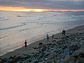
 Barafundle Beach - geograph.org.uk - 208706.jpg 640 × 480; 64 KB
-
 Barley Field and Wood - geograph.org.uk - 206813.jpg 640 × 427; 104 KB
-
 Barvas Cemetery - geograph.org.uk - 210291.jpg 640 × 480; 70 KB
-
 Barvas Church of Scotland - geograph.org.uk - 207097.jpg 640 × 480; 70 KB
-
 Bathtub race, Lifeboat Day, Lyme Regis - geograph.org.uk - 231644.jpg 640 × 480; 285 KB
-
 Beach near Tal-y-Bont - geograph.org.uk - 212750.jpg 640 × 480; 75 KB
-
 Bealach Beag and Beinn Fhionnlaidh - geograph.org.uk - 213503.jpg 640 × 478; 112 KB
-
 Beinn a Chliabhain - geograph.org.uk - 212989.jpg 480 × 640; 78 KB
-
 Beinn Fhionnlaidh - geograph.org.uk - 213508.jpg 640 × 478; 93 KB
-
 Beinn Sgeireach - geograph.org.uk - 213913.jpg 640 × 480; 85 KB
-
 Beinn Sgeireach - geograph.org.uk - 213915.jpg 640 × 480; 114 KB
-
 Beinn Sgeireach - geograph.org.uk - 213939.jpg 640 × 480; 65 KB
-
 Beinn Udlamain , Munro No 119 - geograph.org.uk - 234630.jpg 640 × 480; 137 KB
-
 Below Corserine - geograph.org.uk - 207764.jpg 640 × 480; 75 KB
-
 Below Meikle Millyea to Milldown - geograph.org.uk - 207761.jpg 640 × 480; 78 KB
-
 Below the south ridge of Corserine - geograph.org.uk - 207161.jpg 640 × 480; 82 KB
-
 Beltex Sheep near Whygill - geograph.org.uk - 209731.jpg 640 × 426; 139 KB
-
 Bench, Langmoor Gardens, Lyme Regis - geograph.org.uk - 231656.jpg 640 × 480; 341 KB
-
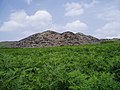
 Berwyn Quarry - geograph.org.uk - 206765.jpg 640 × 480; 90 KB
-
 Berwyn Quarry waste - geograph.org.uk - 206761.jpg 640 × 480; 106 KB
-
 Binny Craig - geograph.org.uk - 374086.jpg 480 × 640; 107 KB
-
 Bixter Quarry, Shetland - geograph.org.uk - 226200.jpg 640 × 480; 76 KB
-
 Black Gairy - geograph.org.uk - 208057.jpg 640 × 480; 49 KB
-
 Boat House at Dougarie Lodge. - geograph.org.uk - 208881.jpg 640 × 480; 109 KB
-
 Bolton Arms , Downholme - geograph.org.uk - 206801.jpg 640 × 484; 98 KB
-
-
 Bridge in Broughton, Milton Keynes in 2006.jpg 480 × 640; 81 KB
-
 Bridge in the Valley Bottom - geograph.org.uk - 209138.jpg 640 × 427; 124 KB
-
 Bridleway - geograph.org.uk - 207290.jpg 640 × 480; 54 KB
-
 Bridleway at SE996455 - geograph.org.uk - 208901.jpg 640 × 480; 80 KB
-

-
 Brighton England - panoramio.jpg 3,072 × 2,304; 980 KB
-
 Brighton Pier - panoramio (3).jpg 3,072 × 2,304; 1.19 MB
-
 Broad Street, Lyme Regis - geograph.org.uk - 231660.jpg 480 × 640; 280 KB
-
 Brockton Farm - geograph.org.uk - 206841.jpg 640 × 480; 71 KB
-
 Brooke Road bridges River Chater - geograph.org.uk - 207180.jpg 640 × 480; 98 KB
-
 Buchan Burn - geograph.org.uk - 207711.jpg 640 × 480; 129 KB
-
 Buckholm Tower - geograph.org.uk - 206859.jpg 640 × 480; 81 KB
-
 Buildwas Church - geograph.org.uk - 207014.jpg 427 × 640; 71 KB
-
 Bus shelter - geograph.org.uk - 207201.jpg 640 × 480; 132 KB
-

-
 Cairn on Carlin's Cairn - geograph.org.uk - 207172.jpg 640 × 480; 87 KB
-
 Cairngorm Gliding Club - geograph.org.uk - 1134947.jpg 640 × 480; 46 KB
-
 Canoeing on the Spey - geograph.org.uk - 1238413.jpg 640 × 480; 91 KB
-
 Canoes on the River Spey - geograph.org.uk - 1238417.jpg 480 × 640; 90 KB
-
 Capel Bethesda - geograph.org.uk - 206978.jpg 640 × 480; 92 KB
-
 Capel Hebron, Rhewl - geograph.org.uk - 1587249.jpg 640 × 457; 86 KB
-
 Carn Eige - geograph.org.uk - 212489.jpg 640 × 478; 136 KB
-
 Carn Eige to Beinn Fhionnlaidh ridge - geograph.org.uk - 213487.jpg 640 × 478; 97 KB
-
 Carrickfergus marina - geograph.org.uk - 206725.jpg 640 × 426; 142 KB
-
 Castle - panoramio (24).jpg 2,304 × 3,072; 1.9 MB
-
 Cattle Grazing - geograph.org.uk - 206795.jpg 640 × 427; 117 KB
-
 Cattle Grid , Downholme - geograph.org.uk - 206797.jpg 640 × 479; 112 KB
-
 Cattle Grid , Downholme Moor - geograph.org.uk - 206789.jpg 640 × 479; 95 KB
-
 Chadwell Mill - geograph.org.uk - 206934.jpg 427 × 640; 84 KB
-
 Chalk Hill Blue, Sheffield Park - geograph.org.uk - 239698.jpg 640 × 471; 331 KB
-
 Chapel Chorlton Church - geograph.org.uk - 207383.jpg 640 × 480; 93 KB
-
 Chapel in Foel - geograph.org.uk - 211664.jpg 640 × 480; 87 KB
-
 Chapel on the Glendaruel Estate - geograph.org.uk - 362767.jpg 427 × 640; 123 KB
-
 Church at Pennard - geograph.org.uk - 207115.jpg 640 × 480; 75 KB
-
 Church Street North Luffenham - geograph.org.uk - 207199.jpg 640 × 480; 83 KB
-
 Clatteringshaws Loch - geograph.org.uk - 1205142.jpg 640 × 480; 51 KB
-
 The Coach House Inn South Luffenham - geograph.org.uk - 207202.jpg 640 × 420; 87 KB
-
 Coates - geograph.org.uk - 206979.jpg 640 × 427; 47 KB
-
 Cobb Gate and clock, Lyme Regis - geograph.org.uk - 231658.jpg 640 × 480; 273 KB
-
 Coire Creagach - geograph.org.uk - 234442.jpg 640 × 480; 143 KB
-
 Colourful House, Wetwood - geograph.org.uk - 207410.jpg 640 × 480; 118 KB
-
-
 Commemorative bench, Lyme Regis harbour - geograph.org.uk - 231636.jpg 640 × 480; 245 KB
-
 Converted Church, Upper Barvas - geograph.org.uk - 207107.jpg 640 × 480; 73 KB
-
 Cottage, Farway - geograph.org.uk - 231442.jpg 640 × 480; 250 KB
-
 Cottages in Standon - geograph.org.uk - 207391.jpg 640 × 480; 117 KB
-
 Creag Mhigeachaidh - geograph.org.uk - 704620.jpg 640 × 480; 52 KB
-
 Crowberries - geograph.org.uk - 208230.jpg 640 × 480; 68 KB
-
 Derelict Mill Building - geograph.org.uk - 206861.jpg 640 × 480; 83 KB
-
 Disused Barn and Telephone Box - geograph.org.uk - 209146.jpg 640 × 427; 133 KB
-
 Disused railway at Barnham - geograph.org.uk - 206844.jpg 640 × 427; 80 KB
-
 Doorway, Glasgow School of Art.jpg 2,448 × 3,264; 1.8 MB
-
 Douglas Hall - geograph.org.uk - 906691.jpg 640 × 480; 67 KB
-
 Drumlin field and Clints of Dromore - geograph.org.uk - 219201.jpg 600 × 400; 79 KB
-
 East over Ladybower Reservoir - geograph.org.uk - 309579.jpg 640 × 426; 110 KB
-
 East ridge of Carn Eige - geograph.org.uk - 212783.jpg 640 × 478; 86 KB
-
 East ridge of Carn Eige - geograph.org.uk - 212787.jpg 640 × 478; 108 KB
-
 East towards the Grey Dogs - geograph.org.uk - 1274486.jpg 640 × 428; 50 KB
-
 Eggleston Church (former) - geograph.org.uk - 209150.jpg 556 × 381; 119 KB
-
 Eglwys Llantysilio - geograph.org.uk - 206736.jpg 640 × 480; 128 KB
-
 Elegug Stacks - geograph.org.uk - 208723.jpg 640 × 480; 115 KB
-
 Eliseg's Pillar - geograph.org.uk - 1587578.jpg 480 × 640; 65 KB
-
 Eliseg's Pillar - geograph.org.uk - 206975.jpg 500 × 640; 70 KB
-
 Empingham Road - geograph.org.uk - 207208.jpg 640 × 391; 58 KB
-
 England - panoramio (1).jpg 2,592 × 1,944; 940 KB
-
 England - panoramio (2).jpg 2,592 × 1,944; 1,014 KB
-
 Entrance to Maer Hall - geograph.org.uk - 208537.jpg 640 × 480; 98 KB
-
 Entrance to Puttenden Manor, Surrey - geograph.org.uk - 206781.jpg 640 × 480; 121 KB
-
 Eroded footpath on Moel y Gamelin - geograph.org.uk - 1587534.jpg 640 × 480; 109 KB
-
 Excavators, Marine Parade, Lyme Regis - geograph.org.uk - 231664.jpg 640 × 480; 294 KB
-
 Farm at Wolborough - geograph.org.uk - 213591.jpg 632 × 420; 16 KB
-
 Farm Buildings at Tredinnick - geograph.org.uk - 206827.jpg 640 × 451; 104 KB
-
 Farm Buildings Near Brockton Hall - geograph.org.uk - 206838.jpg 640 × 480; 80 KB
-
 Farmer in the field with cows - geograph.org.uk - 213594.jpg 511 × 640; 31 KB
-
 Farmhouse at Chatcull - geograph.org.uk - 207398.jpg 640 × 480; 100 KB
-
 Farmland at SE998449 - geograph.org.uk - 208928.jpg 640 × 480; 101 KB
-
 Farmland at Thorpe le Fallows - geograph.org.uk - 206901.jpg 640 × 427; 70 KB
-
 Field Bindweed Flowers - geograph.org.uk - 208603.jpg 458 × 640; 91 KB
-
 Field of Brassicas - geograph.org.uk - 206823.jpg 640 × 427; 133 KB
-
 Fishing boat, Lyme Regis harbour - geograph.org.uk - 231641.jpg 640 × 480; 314 KB
-
 Fishing boat, Threipmuir - geograph.org.uk - 243553.jpg 640 × 480; 99 KB
-
 Fishing boats, Lyme Regis - geograph.org.uk - 231639.jpg 480 × 640; 280 KB
-
 Fitzwilliam station.jpg 2,304 × 1,728; 929 KB
-
 Foot Bridge and Ford on Batt House Road - geograph.org.uk - 210158.jpg 640 × 480; 154 KB
-
 Footpath behind the Supermarket - geograph.org.uk - 208232.jpg 640 × 510; 115 KB
-

-
 Footpath to Great Asby - geograph.org.uk - 209734.jpg 640 × 426; 115 KB
-
 Footpath to Low Farm - geograph.org.uk - 206984.jpg 640 × 427; 72 KB
-
 Footpath to Plummers Rd - geograph.org.uk - 208132.jpg 426 × 640; 138 KB
-
 Footpath up Moel y Gaer - geograph.org.uk - 206780.jpg 480 × 640; 75 KB
-
 Forest edge below Milldown - geograph.org.uk - 207174.jpg 640 × 480; 84 KB
-
 Forest life - geograph.org.uk - 216811.jpg 640 × 480; 106 KB
-
 Forest track in Forrest Estate - geograph.org.uk - 207788.jpg 640 × 480; 70 KB
-
 Forestry road to Succoth Lodge - geograph.org.uk - 206877.jpg 640 × 480; 67 KB
-
 Frog - geograph.org.uk - 211043.jpg 640 × 480; 87 KB
-
 From Barley Field to Farm - geograph.org.uk - 206805.jpg 480 × 640; 137 KB
-
 Gairland Burn - geograph.org.uk - 208050.jpg 640 × 480; 82 KB
-
 Galashiels War Memorial - geograph.org.uk - 206870.jpg 480 × 640; 87 KB
-
 Gate Entrance to Trefriw Cemetery - geograph.org.uk - 213651.jpg 640 × 427; 106 KB
-
 Gatehouse to Westwood park - geograph.org.uk - 207582.jpg 640 × 426; 126 KB
-
 Gencoo Penguin - geograph.org.uk - 208471.jpg 640 × 480; 90 KB
-
 Glasgow School of Art - 197481293.jpg 2,448 × 3,264; 1.42 MB
-
 Glasgow School of Art 2006.jpg 3,264 × 2,448; 1.81 MB
-
 Glen Clunie - geograph.org.uk - 211036.jpg 640 × 480; 74 KB
-
 Grange Lane - geograph.org.uk - 206905.jpg 640 × 427; 65 KB
-
 Great Asby Scar - geograph.org.uk - 208143.jpg 640 × 426; 143 KB
-
 Great Kinmond - geograph.org.uk - 207991.jpg 640 × 426; 165 KB
-
 Hawthorn on Limestone Pavement - geograph.org.uk - 208004.jpg 640 × 426; 158 KB
-
 Hay Bales - geograph.org.uk - 206809.jpg 640 × 427; 118 KB
-
 High Street, Stogursey (1) - geograph.org.uk - 207012.jpg 640 × 480; 104 KB
-
 Holiday Park outside Padstow - geograph.org.uk - 206791.jpg 640 × 427; 87 KB
-
 Holly Hill Inn - geograph.org.uk - 206777.jpg 640 × 479; 101 KB
-
 Horseshoe Falls - geograph.org.uk - 206973.jpg 640 × 480; 112 KB
-
 House by the Crossroads - geograph.org.uk - 206812.jpg 640 × 427; 104 KB
-
 Houses in Charnes - geograph.org.uk - 207413.jpg 640 × 480; 85 KB
-
 Hudswell.jpg 640 × 479; 88 KB
-
 Hut on Scolt Head Island - geograph.org.uk - 503905.jpg 640 × 480; 47 KB
-
 Information board , Downholme Moor - geograph.org.uk - 206793.jpg 640 × 479; 87 KB
-
 Islets in Loch - geograph.org.uk - 207145.jpg 640 × 480; 67 KB
-
 Kelso Abbey - geograph.org.uk - 429910.jpg 640 × 427; 87 KB
-
 Ketton Windmill - geograph.org.uk - 207210.jpg 640 × 480; 48 KB
-
 Kynnersley Arms, Leighton - geograph.org.uk - 206945.jpg 640 × 427; 84 KB
-
 Lady's mantle - geograph.org.uk - 208214.jpg 640 × 480; 52 KB
-
 Lagganlia - geograph.org.uk - 704629.jpg 640 × 480; 68 KB
-
 Lake Wood - geograph.org.uk - 208913.jpg 640 × 480; 97 KB
-
 Landing place on Eilach an Naoimh - geograph.org.uk - 210701.jpg 640 × 480; 73 KB
-
 Langmoor Gardens renovation, Lyme Regis - geograph.org.uk - 231654.jpg 640 × 480; 278 KB
-
 Lesmahagow Church - geograph.org.uk - 689245.jpg 640 × 426; 85 KB
-
 Lewis Burn - geograph.org.uk - 210842.jpg 640 × 480; 226 KB
-
 Lewis Burn Near High Long House - geograph.org.uk - 210856.jpg 640 × 480; 233 KB
-
 Lifeboat at Lyme Regis harbour - geograph.org.uk - 231631.jpg 480 × 640; 246 KB
-

-
 Loch an Duin - geograph.org.uk - 210301.jpg 640 × 480; 68 KB
-

-
 Loch Harrow - geograph.org.uk - 207771.jpg 640 × 480; 87 KB
-
 Loch Mannoch - geograph.org.uk - 207772.jpg 640 × 480; 74 KB
-
 Loch Twachtan - geograph.org.uk - 206833.jpg 640 × 480; 79 KB
-
 Lochwood Castle - geograph.org.uk - 220345.jpg 432 × 640; 164 KB
-
 Longacre, Boscastle - geograph.org.uk - 1095207.jpg 640 × 480; 54 KB
-
 Looking down the Hawse Burn - geograph.org.uk - 207504.jpg 640 × 480; 76 KB
-

-

-
 Looking up towards the Rig of Clenrie - geograph.org.uk - 207779.jpg 640 × 480; 84 KB
-

-
 Luton Airport New Terminal - geograph.org.uk - 206707.jpg 640 × 395; 87 KB
-
 Lyme Regis beach - geograph.org.uk - 231648.jpg 640 × 480; 275 KB
-
 Lyme Regis harbour - geograph.org.uk - 231625.jpg 640 × 480; 245 KB
-
 Lyme Regis harbour - geograph.org.uk - 231646.jpg 640 × 480; 240 KB
-
 Lyme Regis harbour and beach - geograph.org.uk - 231629.jpg 640 × 480; 276 KB
-
 Maer Church - geograph.org.uk - 208534.jpg 640 × 480; 104 KB
-
 Maer Hall - geograph.org.uk - 207996.jpg 640 × 480; 99 KB
-
 Mainline Near Millmeece - geograph.org.uk - 206848.jpg 640 × 480; 92 KB
-
 Mam Sodhail - geograph.org.uk - 212757.jpg 640 × 478; 113 KB
.jpg)


.jpg)


.jpg)


_-_geograph.org.uk_-_209150.jpg)


.jpg)
.jpg)


_-_geograph.org.uk_-_207012.jpg)


