Category:United Kingdom photographs taken on 2006-06-08
Jump to navigation
Jump to search

Subcategories
This category has only the following subcategory.
Media in category "United Kingdom photographs taken on 2006-06-08"
The following 200 files are in this category, out of 447 total.
(previous page) (next page)-
 18C cottages, New Hey Road, Rastrick - geograph.org.uk - 189853.jpg 480 × 640; 116 KB
-
 2002 Bentley State Limousine.jpg 1,876 × 1,304; 420 KB
-
 A Grand Day Out, 2006. - geograph.org.uk - 309364.jpg 640 × 480; 140 KB
-
 A nod's as good as a wink... - geograph.org.uk - 183996.jpg 640 × 480; 121 KB
-
 Abingdon Road - geograph.org.uk - 810505.jpg 640 × 480; 353 KB
-
 Addiscott - geograph.org.uk - 186133.jpg 640 × 480; 75 KB
-
 Alton Towers Submission.jpg 1,600 × 1,200; 350 KB
-
 Approaching Tarbet Bay - geograph.org.uk - 186850.jpg 640 × 480; 107 KB
-

-
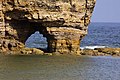 Arch in Marsden Rock - geograph.org.uk - 1260839.jpg 640 × 427; 89 KB
-
 Arch in Marsden Rock - geograph.org.uk - 1260879.jpg 640 × 419; 78 KB
-
 Arncliffe Hall - geograph.org.uk - 612142.jpg 640 × 480; 112 KB
-
 Art Deco building Linthorpe Road - geograph.org.uk - 807444.jpg 640 × 480; 339 KB
-

-
 Badger Hill, Rastrick - geograph.org.uk - 189878.jpg 640 × 480; 95 KB
-
 Barley, cows and maize - geograph.org.uk - 186127.jpg 640 × 480; 121 KB
-
-
-
 Beans in flower - geograph.org.uk - 183759.jpg 480 × 640; 134 KB
-
 Bee on Hawthorn - geograph.org.uk - 186131.jpg 480 × 640; 104 KB
-
 Bowling Harbour - geograph.org.uk - 429802.jpg 640 × 427; 120 KB
-
-
 Buachaille Etive Mor - geograph.org.uk - 228005.jpg 640 × 427; 57 KB
-
 Burnham Harbour - geograph.org.uk - 369426.jpg 640 × 480; 62 KB
-
-
 Calton - geograph.org.uk - 495170.jpg 640 × 480; 81 KB
-
 Cam Loch - geograph.org.uk - 367303.jpg 640 × 480; 122 KB
-
 Cave at Clashach Cove - geograph.org.uk - 185464.jpg 640 × 480; 102 KB
-
 Centrale tram stop.jpg 2,304 × 1,728; 1.63 MB
-
 Chapple - geograph.org.uk - 184349.jpg 640 × 480; 116 KB
-
 Charles Street. - geograph.org.uk - 506305.jpg 480 × 640; 142 KB
-
 Church of St Edward the Confessor - geograph.org.uk - 493340.jpg 480 × 640; 75 KB
-
 Church of St Edward the Confessor - geograph.org.uk - 493353.jpg 480 × 640; 101 KB
-
 Church of St Margaret, Wychling - geograph.org.uk - 183530.jpg 480 × 640; 120 KB
-
 Clashach Cove - geograph.org.uk - 185412.jpg 640 × 480; 103 KB
-
 Clashach Cove - geograph.org.uk - 185449.jpg 640 × 480; 145 KB
-
 Clashach Cove - geograph.org.uk - 185453.jpg 640 × 480; 125 KB
-
 Clauchlands, Arran - geograph.org.uk - 185763.jpg 640 × 480; 79 KB
-
 Cliff detail - geograph.org.uk - 782431.jpg 480 × 640; 77 KB
-
 Cliff slump - geograph.org.uk - 782392.jpg 640 × 480; 157 KB
-
 Cliff slump and bay - geograph.org.uk - 782387.jpg 640 × 480; 133 KB
-
 Clock Tower, Hurst Green - geograph.org.uk - 183227.jpg 640 × 480; 115 KB
-
 Cockett, Waunarlwydd Road - geograph.org.uk - 184797.jpg 640 × 427; 163 KB
-
 Converted chapel at Murchington - geograph.org.uk - 184303.jpg 640 × 480; 108 KB
-
 Coombe Lane tram stop.jpg 2,304 × 1,728; 1.6 MB
-
 Corkscrew (Alton Towers).jpg 1,600 × 1,200; 452 KB
-
 Cottage at Kersey Upland - geograph.org.uk - 185365.jpg 640 × 480; 72 KB
-
 Cottages at East Week - geograph.org.uk - 185837.jpg 640 × 480; 123 KB
-

-
 Crimond - geograph.org.uk - 186215.jpg 640 × 423; 168 KB
-
 Crimond Airfield - Anne Burgess - Geograph - 186257.jpg 640 × 318; 150 KB
-
 Cropsprayer takes to the road - geograph.org.uk - 185361.jpg 640 × 480; 56 KB
-
 Dappled shade in Filmer Wood - geograph.org.uk - 183617.jpg 640 × 480; 147 KB
-
 Derelict Cottage at Easter Stoul - geograph.org.uk - 186252.jpg 640 × 480; 81 KB
-

-
 Dinghy Park - Christchurch - geograph.org.uk - 782269.jpg 640 × 480; 73 KB
-
 Doughty's butcher shop, Doddington - geograph.org.uk - 183698.jpg 640 × 480; 111 KB
-
 Driveway to Holme Laithe, Elland - geograph.org.uk - 185258.jpg 640 × 480; 164 KB
-

-
 Dune^ - geograph.org.uk - 185461.jpg 640 × 480; 124 KB
-
 Dunvant, Dunvant Primary School - geograph.org.uk - 184753.jpg 640 × 427; 150 KB
-
 Dunvant, The Found Out - geograph.org.uk - 184762.jpg 640 × 427; 173 KB
-
 Dunvant, the road to Gowerton - geograph.org.uk - 184784.jpg 640 × 427; 165 KB
-
 Dyfnant Ebenezer Chapel.jpg 640 × 427; 162 KB
-
 East Ash - geograph.org.uk - 185803.jpg 640 × 480; 99 KB
-
 Elderflower - geograph.org.uk - 183675.jpg 640 × 480; 124 KB
-
 Elgin - geograph.org.uk - 185409.jpg 640 × 535; 169 KB
-

-
 Fairhaven Farm, Whiddon Down - geograph.org.uk - 185889.jpg 640 × 480; 117 KB
-

-

-
 Fields on the lower slopes of Cosdon Hill - geograph.org.uk - 184557.jpg 640 × 480; 119 KB
-
 Fishmongers' Hall.jpg 1,600 × 1,200; 256 KB
-
 Flint Barn at Seed - geograph.org.uk - 183734.jpg 640 × 480; 103 KB
-
 Flint oast at Frith - geograph.org.uk - 183958.jpg 640 × 480; 108 KB
-
 Footpath through the wheat - geograph.org.uk - 183957.jpg 480 × 640; 114 KB
-
 Ford and granite footbridge, Forder Brook - geograph.org.uk - 185776.jpg 640 × 480; 152 KB
-
-
 Fountain and Pyramid, Stanway House - geograph.org.uk - 192853.jpg 426 × 640; 56 KB
-

-

-
 Friars cliff groynes - geograph.org.uk - 782417.jpg 640 × 480; 54 KB
-
 Fulmar at Clashach Cove - geograph.org.uk - 185471.jpg 640 × 480; 118 KB
-
 Furlong Mill - geograph.org.uk - 183391.jpg 640 × 480; 88 KB
-
 Geese and a gosling - geograph.org.uk - 183694.jpg 640 × 480; 146 KB
-
-
 Geograph-186230-Anne Burgess-Starnafin pool at Loch of Strathbeg.jpg 640 × 339; 64 KB
-

-
 Geograph-186254-Anne Burgess-Loch of Strathbeg from the Bank Hide.jpg 640 × 357; 156 KB
-
 Goldhanger Creek, by Joyce's Farm. - geograph.org.uk - 195646.jpg 640 × 438; 167 KB
-
 Gorseinon, bus station - geograph.org.uk - 184967.jpg 640 × 427; 167 KB
-

-
 Gowerton Railway Station.jpg 640 × 427; 198 KB
-
 Grass track to Wichling church - geograph.org.uk - 183541.jpg 640 × 480; 178 KB
-
 Grassy Field - geograph.org.uk - 183339.jpg 640 × 480; 69 KB
-
 Gravel Hill tram stop.jpg 2,304 × 1,728; 1.49 MB
-
 St Bartholomew's Church, Groton - geograph.org.uk - 185487.jpg 640 × 480; 67 KB
-
 Grovesend, housing on the B4296 - geograph.org.uk - 184972.jpg 640 × 427; 163 KB
-

-
 Haven House Inn - geograph.org.uk - 782330.jpg 640 × 480; 48 KB
-
 Headwaters of the Polshagg Burn - geograph.org.uk - 183435.jpg 480 × 640; 114 KB
-
 Highcliffe beach - geograph.org.uk - 782402.jpg 640 × 480; 103 KB
-
 Highcliffe Beach - low tide - geograph.org.uk - 782439.jpg 640 × 480; 63 KB
-

-

-
 Holland Barn, Livaton - geograph.org.uk - 186137.jpg 640 × 480; 91 KB
-

-

-
 Inch Abbey (geograph 183149).jpg 640 × 480; 120 KB
-
 Inner Sound - geograph.org.uk - 275940.jpg 640 × 480; 74 KB
-
 Ivy clad barn at Green Farm - geograph.org.uk - 183673.jpg 640 × 480; 135 KB
-
 Jellyfish - geograph.org.uk - 185478.jpg 640 × 480; 83 KB
-
 Jellyfish - geograph.org.uk - 185481.jpg 594 × 517; 89 KB
-
 Kersey Tye - geograph.org.uk - 185363.jpg 640 × 480; 77 KB
-
 Kersey Upland - geograph.org.uk - 185366.jpg 640 × 480; 70 KB
-
 Kissing gate - geograph.org.uk - 183994.jpg 640 × 482; 94 KB
-
 Lane to Scorhill - geograph.org.uk - 1702373.jpg 640 × 480; 139 KB
-
 Langstone, Throwleigh - geograph.org.uk - 185783.jpg 640 × 480; 103 KB
-
 Leat water crossing Creaber Pound - geograph.org.uk - 185757.jpg 640 × 480; 151 KB
-
 Little Avon River from Matford Bridge - geograph.org.uk - 183315.jpg 480 × 640; 101 KB
-
 Little oak, big oak - geograph.org.uk - 186151.jpg 640 × 480; 108 KB
-
 Llwchwr Community, Stafford Common - geograph.org.uk - 184965.jpg 640 × 427; 183 KB
-
 Lobster pots - Mudeford Quay - geograph.org.uk - 782282.jpg 640 × 480; 103 KB
-
 Loch Ness Lodge Hotel. Drumnadrochit - geograph.org.uk - 1119961.jpg 640 × 480; 142 KB
-
 Loch Nevis - Ardintigh Bay - geograph.org.uk - 186856.jpg 640 × 480; 88 KB
-
 Loch Nevis - Fish Farm near Tarbet - geograph.org.uk - 186858.jpg 640 × 480; 102 KB
-
 Lodge Farm, Broad Street - geograph.org.uk - 185667.jpg 640 × 480; 79 KB
-

-
 Looking south to Boghall - geograph.org.uk - 1048219.jpg 640 × 426; 84 KB
-
-
 Low Tide west of Gore Saltings. - geograph.org.uk - 195651.jpg 640 × 438; 149 KB
-
-
 Maldon Waterfront - geograph.org.uk - 195825.jpg 640 × 440; 113 KB
-
 Marsden Bay - geograph.org.uk - 1260794.jpg 640 × 424; 73 KB
-
 Marsden Grotto - geograph.org.uk - 1260843.jpg 640 × 427; 73 KB
-
 Marsden Rock - geograph.org.uk - 1260779.jpg 640 × 412; 72 KB
-
 Marsden Rock - geograph.org.uk - 1260849.jpg 640 × 408; 64 KB
-
 Marsden Rock - geograph.org.uk - 1260871.jpg 640 × 420; 94 KB
-
 Marsden Rock and lift to The Grotto - geograph.org.uk - 1260806.jpg 640 × 414; 68 KB
-
 Meadow east of Shulland Wood - geograph.org.uk - 183726.jpg 640 × 480; 107 KB
-
 Meadow, Teigncombe - geograph.org.uk - 1702276.jpg 640 × 480; 71 KB
-
 Meadow, Teigncombe - geograph.org.uk - 1702310.jpg 640 × 480; 108 KB
-
 Meanders on the Benloch Burn - geograph.org.uk - 183476.jpg 640 × 480; 78 KB
-
 Middle Week - geograph.org.uk - 185834.jpg 640 × 480; 119 KB
-
 Mill Leat at Yeo - geograph.org.uk - 184298.jpg 640 × 480; 145 KB
-
 Millfield House.jpg 640 × 389; 90 KB
-
 Monks Withecombe, Chagford - geograph.org.uk - 184309.jpg 640 × 480; 136 KB
-

-
 Mudeford Lifeboat station - geograph.org.uk - 782327.jpg 640 × 480; 64 KB
-
 Mudeford sea wall. - geograph.org.uk - 782339.jpg 640 × 480; 66 KB
-
 Mulberry Cottage, Groton - geograph.org.uk - 185888.jpg 640 × 480; 72 KB
-
 Mystery structure in Boxford - geograph.org.uk - 185353.jpg 640 × 480; 86 KB
-
 Nessie's view of Urquhart Castle - geograph.org.uk - 1112369.jpg 640 × 258; 58 KB
-

-
 North Auchenharvie Farm - geograph.org.uk - 183410.jpg 640 × 480; 56 KB
-

-
 Not Exactly Racing. - geograph.org.uk - 183263.jpg 640 × 361; 67 KB
-
 Old lighthouse, Hodbarrow - geograph.org.uk - 540401.jpg 640 × 480; 71 KB
-
-
 Old Tractor - geograph.org.uk - 183412.jpg 640 × 480; 145 KB
-
 Oldrattary.jpg 640 × 307; 165 KB
-
 On Kennon Hill - geograph.org.uk - 184566.jpg 640 × 480; 106 KB
-
 On the downs near Upton Lovell - geograph.org.uk - 190798.jpg 640 × 427; 111 KB
-
 On the downs near Upton Lovell - geograph.org.uk - 190804.jpg 640 × 427; 90 KB
-
 Over Lewiston towards Drumnadrochit - geograph.org.uk - 1120090.jpg 640 × 480; 144 KB
-
 Paddock near Groton - geograph.org.uk - 185355.jpg 640 × 480; 90 KB
-
 Padley Common, Chagford - geograph.org.uk - 184292.jpg 640 × 480; 101 KB
-
 Park House Folly - geograph.org.uk - 183311.jpg 640 × 480; 63 KB
-
 Partially vegetated cliff - geograph.org.uk - 782421.jpg 480 × 640; 99 KB
-
 Patford Bridge Substation - geograph.org.uk - 183276.jpg 480 × 640; 72 KB
-
 Pineapple mayweed (Chamomilla suaveolens) - geograph.org.uk - 183956.jpg 640 × 485; 188 KB
-
 Pink baths for sheep - geograph.org.uk - 183979.jpg 640 × 479; 116 KB
-
 Pond - geograph.org.uk - 185532.jpg 640 × 480; 90 KB
-
 Pontarddulais, St Teilo Street - geograph.org.uk - 184974.jpg 640 × 427; 160 KB
-
 Pop Art - geograph.org.uk - 184564.jpg 640 × 480; 128 KB
-

-
 Powerlines over River Lark - geograph.org.uk - 456975.jpg 640 × 480; 110 KB
-
 Pyramid at Stanway House - geograph.org.uk - 1387097.jpg 426 × 640; 85 KB
-
 Pyramid, Stanway House - geograph.org.uk - 1387064.jpg 426 × 640; 78 KB
-
 Railway Bridge near Long Buckby - geograph.org.uk - 183253.jpg 640 × 480; 102 KB
-
 Railway cottages, Tebay - geograph.org.uk - 608033.jpg 640 × 372; 87 KB
-
 Railway Viaduct over the Nene - geograph.org.uk - 184515.jpg 640 × 480; 97 KB
-
 Ramsden Square - geograph.org.uk - 484935.jpg 640 × 480; 142 KB
-
 Rattarybeach.jpg 640 × 389; 153 KB
-
 Rattray Head Lighthouse - geograph.org.uk - 195991.jpg 512 × 640; 231 KB
-
 Rattray Head lighthouse, Aberdeenshire.jpg 640 × 396; 229 KB
-
 Rattray Lighthouse cottages, Aberdeenshire.jpg 640 × 367; 213 KB
-
 Ringhill Cross - geograph.org.uk - 186152.jpg 480 × 640; 114 KB
-
 River Roach - geograph.org.uk - 234781.jpg 640 × 480; 33 KB
-
 River Taw meander - geograph.org.uk - 184574.jpg 640 × 480; 119 KB
-
 Roadside daisies - geograph.org.uk - 183757.jpg 480 × 640; 161 KB
-

-
 Rockpool at Clashach Cove - geograph.org.uk - 185447.jpg 640 × 480; 151 KB
-
 Rocky Black Shoulder - geograph.org.uk - 183424.jpg 640 × 480; 88 KB
-
 Royal Northern Infirmary building - geograph.org.uk - 279895.jpg 640 × 480; 86 KB
-
 Ruin - geograph.org.uk - 183408.jpg 640 × 480; 102 KB
-
 Salt Marsh Channel, by Gore Saltings. - geograph.org.uk - 195658.jpg 640 × 402; 158 KB
-

-

-
 Sandstone Geology at Clashach Cove - geograph.org.uk - 185418.jpg 640 × 480; 168 KB


.jpg)


.jpg)


_-_geograph.org.uk_-_183956.jpg)


