Category:United Kingdom photographs taken on 2005-06-22
Jump to navigation
Jump to search

Subcategories
This category has only the following subcategory.
Media in category "United Kingdom photographs taken on 2005-06-22"
The following 200 files are in this category, out of 351 total.
(previous page) (next page)-
 A house in Halliford Road, Sunbury - geograph.org.uk - 20605.jpg 640 × 480; 90 KB
-
 Agricultural scene - geograph.org.uk - 20704.jpg 640 × 480; 149 KB
-
 Aldcliffe Marsh Cutting, Lancaster - geograph.org.uk - 58178.jpg 640 × 480; 164 KB
-
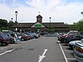 Asda Supermarket - geograph.org.uk - 20963.jpg 640 × 480; 98 KB
-
 Aston Cantlow - geograph.org.uk - 20834.jpg 640 × 480; 107 KB
-
 Aston Cantlow village hall - geograph.org.uk - 20830.jpg 640 × 480; 89 KB
-
 Barn in Fairford - geograph.org.uk - 22492.jpg 640 × 480; 157 KB
-
 Basalt formation - geograph.org.uk - 859046.jpg 640 × 457; 334 KB
-

-
 Bearley Church - geograph.org.uk - 20867.jpg 640 × 480; 112 KB
-
 Bearley Manor - geograph.org.uk - 20858.jpg 640 × 480; 98 KB
-
 Bearley railway station 1.jpg 640 × 480; 112 KB
-
 Beckford's Tower - geograph.org.uk - 746959.jpg 426 × 640; 82 KB
-
 Billinge Hill - geograph.org.uk - 20805.jpg 640 × 480; 116 KB
-
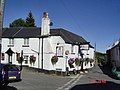 Bishopsteignton pub - geograph.org.uk - 20706.jpg 640 × 480; 120 KB
-
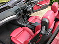
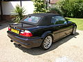
 BMW M3 E46 Convertible - Flickr - The Car Spy (1).jpg 1,600 × 1,200; 612 KB
-
 BMW M3 E46 Convertible - Flickr - The Car Spy (10).jpg 1,600 × 1,200; 597 KB
-
 BMW M3 E46 Convertible - Flickr - The Car Spy (11).jpg 1,600 × 1,200; 723 KB
-
 BMW M3 E46 Convertible - Flickr - The Car Spy (12).jpg 1,600 × 1,200; 439 KB
-
 BMW M3 E46 Convertible - Flickr - The Car Spy (13).jpg 1,600 × 1,200; 671 KB
-
 BMW M3 E46 Convertible - Flickr - The Car Spy (14).jpg 1,600 × 1,200; 651 KB
-
 BMW M3 E46 Convertible - Flickr - The Car Spy (15).jpg 1,600 × 1,200; 607 KB
-
 BMW M3 E46 Convertible - Flickr - The Car Spy (16).jpg 1,600 × 1,200; 740 KB
-
 BMW M3 E46 Convertible - Flickr - The Car Spy (17).jpg 1,600 × 1,200; 747 KB
-
 BMW M3 E46 Convertible - Flickr - The Car Spy (2).jpg 1,600 × 1,200; 725 KB
-
 BMW M3 E46 Convertible - Flickr - The Car Spy (3).jpg 1,600 × 1,200; 683 KB
-
 BMW M3 E46 Convertible - Flickr - The Car Spy (4).jpg 1,600 × 1,200; 709 KB
-
 BMW M3 E46 Convertible - Flickr - The Car Spy (5).jpg 1,600 × 1,200; 587 KB
-
 BMW M3 E46 Convertible - Flickr - The Car Spy (6).jpg 1,600 × 1,200; 670 KB
-
 BMW M3 E46 Convertible - Flickr - The Car Spy (7).jpg 1,600 × 1,200; 624 KB
-
 BMW M3 E46 Convertible - Flickr - The Car Spy (8).jpg 1,600 × 1,200; 743 KB
-
 BMW M3 E46 Convertible - Flickr - The Car Spy (9).jpg 1,600 × 1,200; 609 KB
-
 BMW M3 E46 Convertible - Flickr - The Car Spy.jpg 1,600 × 1,200; 716 KB
-
 Bridge over the River Swale Richmond - geograph.org.uk - 707014.jpg 480 × 640; 85 KB
-

-
 St Mary's Church - geograph.org.uk - 20953.jpg 640 × 480; 122 KB
-

-
 Bury St Edmunds railway station - geograph.org.uk - 20750.jpg 640 × 427; 78 KB
-
 Canal, Road and Railway Intersect - geograph.org.uk - 922568.jpg 480 × 640; 64 KB
-
 Castle Pool, Hereford - geograph.org.uk - 21335.jpg 640 × 508; 185 KB
-
 Celtic Cross - geograph.org.uk - 80221.jpg 480 × 640; 135 KB
-
 Church Row, Fulmer - geograph.org.uk - 20802.jpg 640 × 480; 132 KB
-
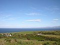 Coastline near Mynydd Eilian - geograph.org.uk - 79351.jpg 640 × 480; 94 KB
-
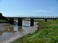 Conder Viaduct, Glasson Dock - geograph.org.uk - 47792.jpg 640 × 480; 95 KB
-
 Cottage in Hampstead Norreys - geograph.org.uk - 20825.jpg 640 × 480; 175 KB
-
 County Upper School - geograph.org.uk - 20735.jpg 640 × 427; 62 KB
-
 Cross Keys Hotel - geograph.org.uk - 20871.jpg 640 × 480; 86 KB
-
 Dalesway - geograph.org.uk - 20700.jpg 640 × 480; 133 KB
-

-
 Derelict building - geograph.org.uk - 859052.jpg 640 × 457; 306 KB
-
 Derwent Water MMB 11 Surprise View.jpg 1,600 × 1,200; 773 KB
-
 Derwent Water MMB 12 Surprise View.jpg 1,600 × 1,200; 767 KB
-
 Derwent Water MMB 13 Surprise View.jpg 1,600 × 1,200; 778 KB
-
 Derwent Water MMB 14 Surprise View.jpg 1,600 × 1,200; 809 KB
-
 Derwent Water MMB 15 Surprise View.jpg 1,600 × 1,200; 779 KB
-
 Derwent Water MMB 16 Surprise View.jpg 1,600 × 1,200; 779 KB
-
 Deserted buildings at Capel Tor - geograph.org.uk - 88765.jpg 640 × 480; 156 KB
-
 Devon fields - geograph.org.uk - 20703.jpg 640 × 480; 128 KB
-
 Dinefwr Castle.jpg 3,000 × 1,024; 466 KB
-
 Duart Castle - geograph.org.uk - 859039.jpg 640 × 457; 274 KB
-
 Ebley Mill - geograph.org.uk - 114616.jpg 427 × 640; 138 KB
-
 Eccup Reservoir Lodge - geograph.org.uk - 20705.jpg 640 × 480; 84 KB
-
 Edstone Aqueduct - geograph.org.uk - 20849.jpg 640 × 480; 90 KB
-
 Eilean Musdile - geograph.org.uk - 859037.jpg 640 × 457; 274 KB
-
 Entrance to Knap of Howar - geograph.org.uk - 285693.jpg 640 × 480; 115 KB
-
 Exit from the Knap of Howar - geograph.org.uk - 285698.jpg 640 × 519; 131 KB
-
 Falls on the River Nevis - geograph.org.uk - 987208.jpg 480 × 640; 112 KB
-
 Farmland near Eling - geograph.org.uk - 20831.jpg 640 × 480; 143 KB
-
 Featherstone Park Prisoner of War Camp - geograph.org.uk - 135597.jpg 640 × 480; 100 KB
-
 Featherstone Park Station - geograph.org.uk - 127849.jpg 640 × 369; 90 KB
-
 Fingal's Cave Staffa - geograph.org.uk - 859042.jpg 640 × 457; 315 KB
-
 Fingal's Cave Staffa - geograph.org.uk - 859045.jpg 640 × 457; 379 KB
-
 Fionnport - geograph.org.uk - 859040.jpg 640 × 457; 292 KB
-
 Flats near Gaviots Green, Gerrards Cross - geograph.org.uk - 20886.jpg 640 × 480; 102 KB
-
 Footpath near New Farm - geograph.org.uk - 20788.jpg 640 × 480; 239 KB
-
 Fornham All Saints Church - geograph.org.uk - 20732.jpg 640 × 427; 85 KB
-
 St James Church, Fulmer - geograph.org.uk - 20809.jpg 640 × 480; 123 KB
-
 Fulmer Drive, Gerrards Cross - geograph.org.uk - 20841.jpg 640 × 480; 135 KB
-
 Gaviots Green, Gerrards Cross - geograph.org.uk - 20885.jpg 640 × 480; 110 KB
-
 St James Church, Gerrards Cross - geograph.org.uk - 21046.jpg 640 × 480; 124 KB
-
 Gerrards Cross Common - geograph.org.uk - 20890.jpg 640 × 480; 102 KB
-
 Gerrards Cross town centre from the common - geograph.org.uk - 21047.jpg 640 × 480; 105 KB
-
 Golden-acre-park.jpg 640 × 480; 123 KB
-
 Great Kimble Church - geograph.org.uk - 94812.jpg 640 × 427; 123 KB
-
 Grey Seals - geograph.org.uk - 1037425.jpg 640 × 448; 107 KB
-
 Church in Hampstead Norreys - geograph.org.uk - 20819.jpg 640 × 480; 162 KB
-
 Harewood House - geograph.org.uk - 20701.jpg 640 × 480; 100 KB
-
 Haverthwaite railway station MMB 01.jpg 1,600 × 1,200; 796 KB
-
 Haverthwaite railway station MMB 02 Princess.jpg 1,600 × 1,200; 856 KB
-
 Haverthwaite railway station MMB 03 Princess.jpg 1,600 × 1,200; 852 KB
-
 Haverthwaite railway station MMB 04 Princess.jpg 1,600 × 1,200; 848 KB
-
 Haverthwaite railway station MMB 05 Princess.jpg 1,600 × 1,200; 784 KB
-
 Haverthwaite railway station MMB 06 Cumbria.jpg 1,600 × 1,200; 792 KB
-
 Haverthwaite railway station MMB 07 Princess.jpg 1,600 × 1,200; 770 KB
-
 Haverthwaite railway station MMB 08 Princess.jpg 1,600 × 1,200; 786 KB
-
 Hengrave Hall 1.jpg 640 × 427; 79 KB
-
 Hillhead Exhibition 2005 - geograph.org.uk - 426678.jpg 640 × 480; 124 KB
-
 Hillhead Quarry Show - geograph.org.uk - 729857.jpg 640 × 480; 116 KB
-
 Horsebridge - geograph.org.uk - 22243.jpg 640 × 480; 132 KB
-
 House in Camp Road, Gerrards Cross - geograph.org.uk - 21044.jpg 640 × 480; 135 KB
-
 House in Gerrards Cross - geograph.org.uk - 20822.jpg 640 × 480; 143 KB
-
 House on Fulmer Lane near Gerrards Cross - geograph.org.uk - 20847.jpg 640 × 480; 126 KB
-
 Houses at Allhusen Gardens, Fulmer - geograph.org.uk - 20813.jpg 640 × 480; 98 KB
-
 Ideford pub - Devon - geograph.org.uk - 20702.jpg 640 × 480; 138 KB
-
 In Blanchdown Wood - geograph.org.uk - 21694.jpg 640 × 480; 163 KB
-
 Installing a new landmark - geograph.org.uk - 85365.jpg 640 × 426; 105 KB
-
 Iona - geograph.org.uk - 859051.jpg 640 × 457; 326 KB
-
 Iona - geograph.org.uk - 859053.jpg 640 × 457; 318 KB
-
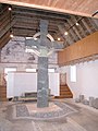
 Iona Abbey Celtic Cross.jpg 400 × 528; 43 KB
-
 Iona Fire Station - geograph.org.uk - 80220.jpg 640 × 470; 124 KB
-
 Kingswear waterside - geograph.org.uk - 64448.jpg 640 × 425; 117 KB
-
 Laggan Bay, Mull - geograph.org.uk - 73309.jpg 640 × 482; 112 KB
-
 Lake Windermere MMB 01 Lakeside.jpg 1,600 × 1,200; 765 KB
-
 Lake Windermere MMB 02 Lakeside.jpg 1,600 × 1,200; 788 KB
-
 Lake Windermere MMB 03 Lakeside.jpg 1,600 × 1,200; 788 KB
-
 Lake Windermere MMB 04 Lakeside - MV Swan.jpg 1,600 × 1,200; 798 KB
-
 Lake Windermere MMB 05 Lakeside - MV Swan.jpg 1,600 × 1,200; 783 KB
-
 Lake Windermere MMB 06 Lakeside - MV Swan.jpg 1,600 × 1,200; 798 KB
-
 Lake Windermere MMB 07 Lakeside - MV Swan.jpg 1,600 × 1,200; 773 KB
-
 Lake Windermere MMB 08 Lakeside.jpg 1,600 × 1,200; 808 KB
-
 Lake Windermere MMB 09 Lakeside.jpg 1,600 × 1,200; 785 KB
-
 Lake Windermere MMB 10 Lakeside.jpg 1,600 × 1,200; 794 KB
-
 Lake Windermere MMB 11 Lakeside.jpg 1,600 × 1,200; 839 KB
-
 Lake Windermere MMB 12 Lakeside.jpg 1,600 × 1,200; 808 KB
-
 Lake Windermere MMB 13.jpg 1,600 × 1,200; 789 KB
-
 Lake Windermere MMB 14.jpg 1,600 × 1,200; 742 KB
-
 Lake Windermere MMB 15.jpg 1,600 × 1,200; 762 KB
-
 Lakeside MMB 01 Lakeside & Haverthwaite Railway.jpg 1,600 × 1,200; 793 KB
-
 Lakeside railway station MMB 01.jpg 1,600 × 1,200; 774 KB
-
 Landing jetty - geograph.org.uk - 859047.jpg 640 × 457; 414 KB
-
 Late Spring Lambs^ - geograph.org.uk - 639861.jpg 640 × 482; 108 KB
-
 Late Train (21000439).jpg 3,008 × 2,000; 3.12 MB
-
 Late Turbo (21001296).jpg 3,008 × 2,000; 2.82 MB
-
 Launching the lifeboat - geograph.org.uk - 744088.jpg 640 × 427; 92 KB
-
 LCW Horsforth.jpg 640 × 480; 118 KB
-
 Leeds shaft, Great Work Mine - geograph.org.uk - 986568.jpg 563 × 562; 96 KB
-
 Level Crossing - Ottery St Mary - geograph.org.uk - 20713.jpg 640 × 480; 172 KB
-
 Levens Hall MMB 01.jpg 1,600 × 1,200; 825 KB
-
 Levens Hall MMB 02.jpg 1,200 × 1,600; 788 KB
-
 Levens Hall MMB 03.jpg 1,600 × 1,200; 790 KB
-
 Levens Hall MMB 04.jpg 1,200 × 1,600; 766 KB
-
 Levens Hall MMB 05.jpg 1,600 × 1,200; 804 KB
-
 Lighthouse depot - geograph.org.uk - 831118.jpg 640 × 457; 285 KB
-
 Llangunnor Parish Church - geograph.org.uk - 21094.jpg 640 × 426; 91 KB
-
 Looking across the Water of Nevis - geograph.org.uk - 987216.jpg 480 × 640; 116 KB
-

-
 Low Tide in Loch Linnhe - geograph.org.uk - 987196.jpg 640 × 480; 63 KB
-
 M4 Bridge near Little Hungerford - geograph.org.uk - 20846.jpg 640 × 480; 200 KB
-
 Magdalene Road, Torquay - geograph.org.uk - 152216.jpg 640 × 480; 98 KB
-
 Markeaton Park, Derby - geograph.org.uk - 20688.jpg 640 × 480; 90 KB
-
 Marsh Orchid on grass verge, Papa Westray - geograph.org.uk - 285149.jpg 640 × 480; 166 KB
-
 Meadow by the River Tamar - geograph.org.uk - 88761.jpg 480 × 640; 130 KB
-
 Morton Bagot - geograph.org.uk - 20778.jpg 640 × 480; 93 KB
-
 Morton Bagot - geograph.org.uk - 20789.jpg 640 × 480; 97 KB
-
 Morton Bagot church - geograph.org.uk - 20781.jpg 640 × 480; 131 KB
-
 Naunton Meadows - geograph.org.uk - 20680.jpg 640 × 479; 81 KB
-

-

-

-
 Old lock on River Lark - geograph.org.uk - 20738.jpg 427 × 640; 123 KB
-
 Outbuildings at Stilesweek - geograph.org.uk - 88759.jpg 640 × 480; 129 KB
-
 Panoramic Mapping Plate at Norman's Law - geograph.org.uk - 161783.jpg 640 × 480; 101 KB
-
 Porth Dinllaen from the beach - geograph.org.uk - 1037419.jpg 640 × 480; 104 KB
-
 Pride of the fleet, still (21001470).jpg 3,008 × 2,000; 2.56 MB
-
 Prime location - geograph.org.uk - 1037429.jpg 640 × 480; 73 KB
-

-
 Reading Turbo (69727636).jpg 2,504 × 1,778; 2.02 MB
-
 Redland Rail Station3 - Flickr - Greater Bristol Metro Rail.jpg 1,654 × 1,252; 2.19 MB
-
 Remains of Nunnery, Iona - geograph.org.uk - 80225.jpg 640 × 480; 176 KB
-
 Cornforth Hill from Castle Walk Richmond - geograph.org.uk - 728779.jpg 640 × 480; 100 KB
-
 Risby Church - geograph.org.uk - 20719.jpg 640 × 427; 125 KB
-
 Risby Village Green - geograph.org.uk - 20710.jpg 640 × 427; 92 KB
-
 River Lark at Ducksluice Farm - geograph.org.uk - 20733.jpg 640 × 427; 121 KB
-
 River Lark north of Bury St Edmunds - geograph.org.uk - 20737.jpg 427 × 640; 103 KB
-
 River Nevis below the Gorge - geograph.org.uk - 922562.jpg 640 × 480; 79 KB
-
 River Nevis Plunges under the Road Bridge - geograph.org.uk - 922559.jpg 640 × 480; 119 KB
-
 River Swale at Morton on Swale - geograph.org.uk - 1253358.jpg 640 × 480; 54 KB
-
 Road into Glen Nevis - geograph.org.uk - 922557.jpg 640 × 480; 54 KB
-
 Rock formation - geograph.org.uk - 859048.jpg 640 × 457; 378 KB
-
 Saxham Industrial Estate - geograph.org.uk - 20717.jpg 640 × 427; 86 KB
-
 Scotland,Yorkshire - geograph.org.uk - 20878.jpg 640 × 480; 123 KB
-
 Seaside House - geograph.org.uk - 1037427.jpg 480 × 640; 94 KB
-
 Shelfield Park Farm - geograph.org.uk - 20818.jpg 640 × 480; 98 KB
-
 Skinningrove.jpg 640 × 427; 134 KB
-
 St Kenneth's Church And Burial Ground - geograph.org.uk - 20845.jpg 640 × 466; 155 KB
-
 St Mary's and St Nicholas, Compton - geograph.org.uk - 20753.jpg 640 × 480; 196 KB
-
 St. John's School, Lacey Green - geograph.org.uk - 94801.jpg 640 × 427; 122 KB
-
 Staffa - geograph.org.uk - 859044.jpg 640 × 457; 322 KB
-
 Staffa - geograph.org.uk - 859049.jpg 640 × 457; 303 KB
-
 Staffa - geograph.org.uk - 859050.jpg 640 × 457; 358 KB
-

-
 Stoke Mandeville Church - geograph.org.uk - 94825.jpg 640 × 427; 161 KB
-
 Stratford upon Avon Canal - geograph.org.uk - 20852.jpg 640 × 480; 123 KB
-
 Swans on the water - geograph.org.uk - 750376.jpg 640 × 426; 99 KB
-

-
 The Bridge Golden Acre Park - geograph.org.uk - 20718.jpg 640 × 480; 131 KB
-
 The Great Corrie of Balglass - geograph.org.uk - 20872.jpg 640 × 480; 46 KB
-
 The Great Face - geograph.org.uk - 859041.jpg 640 × 457; 298 KB
-
 The Great Face and Fingal's Cave - geograph.org.uk - 859043.jpg 640 × 457; 288 KB
-
 The Old Farmhouse, Darvills Hill - geograph.org.uk - 94794.jpg 640 × 427; 135 KB


.jpg)
.jpg)
.jpg)
.jpg)
.jpg)
.jpg)
.jpg)
.jpg)
.jpg)
.jpg)
.jpg)
.jpg)
.jpg)
.jpg)
.jpg)
.jpg)
.jpg)


.jpg)
.jpg)


.jpg)


.jpg)


