Category:United Kingdom photographs taken on 2005-01-22
Jump to navigation
Jump to search
| ← | Saturday 22 January 2005 | → | ||
| ← | January 2005 | → | ||

United Kingdom photographs taken on 22 January 2005.
Image files should be categorized here automatically using {{taken on}} template. Direct categorisation is also possible, if automatic is impossible.
Media in category "United Kingdom photographs taken on 2005-01-22"
The following 60 files are in this category, out of 60 total.
-
 A dyke on Lochcraig Head - geograph.org.uk - 583492.jpg 640 × 480; 114 KB
-
 Barkston East - geograph.org.uk - 423289.jpg 640 × 469; 58 KB
-
 Barkston East signal box - geograph.org.uk - 423285.jpg 640 × 475; 52 KB
-
 Beddgelert - geograph.org.uk - 2669.jpg 640 × 481; 54 KB
-
 Before the chord - geograph.org.uk - 423305.jpg 640 × 476; 119 KB
-
 Black Hill Holme Moss - geograph.org.uk - 21329.jpg 640 × 480; 107 KB
-
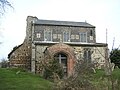
 Castleton Church - geograph.org.uk - 205694.jpg 640 × 480; 92 KB
-
 Cemetery - geograph.org.uk - 130931.jpg 640 × 480; 161 KB
-
 Concrete and Groyne - geograph.org.uk - 530218.jpg 640 × 480; 97 KB
-
 Deal beach and seafront - geograph.org.uk - 15876.jpg 640 × 480; 73 KB
-
 End of the road - geograph.org.uk - 205703.jpg 640 × 480; 69 KB
-
 Erosion on Spurn Peninsula. - geograph.org.uk - 530217.jpg 640 × 480; 64 KB
-

-
 Fell Head cairn - geograph.org.uk - 1082011.jpg 640 × 480; 77 KB
-
 Feltwell St Nicholas Church - geograph.org.uk - 376393.jpg 640 × 480; 99 KB
-
 Fishing the Wiltshire Avon - geograph.org.uk - 309663.jpg 640 × 409; 61 KB
-

-
 Groyne on Spurn Beach. - geograph.org.uk - 530223.jpg 640 × 480; 53 KB
-
 High Orchard - geograph.org.uk - 50981.jpg 426 × 640; 56 KB
-
 Looking back to Wasdale. - panoramio.jpg 1,726 × 1,190; 2.21 MB
-
 Rail Track on Spurn Peninsula - geograph.org.uk - 534820.jpg 640 × 449; 62 KB
-
 Railway near Westry - geograph.org.uk - 349218.jpg 640 × 420; 117 KB
-
 Rectory Junction - geograph.org.uk - 423282.jpg 640 × 493; 67 KB
-
 Rumbling Bridge - Twin Bridges - geograph.org.uk - 6466.jpg 640 × 480; 91 KB
-
 Seafront car park, Barmouth - geograph.org.uk - 613978.jpg 640 × 480; 43 KB
-
 Snowdon Ranger Station - geograph.org.uk - 2676.jpg 640 × 481; 49 KB
-
 Snowdrops at Little Durnford Manor - geograph.org.uk - 309673.jpg 640 × 410; 139 KB
-
 Stone and slate - geograph.org.uk - 130935.jpg 640 × 480; 166 KB
-
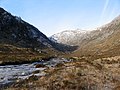
 Stream coming off Fountains Fell - geograph.org.uk - 23991.jpg 640 × 480; 162 KB
-
 Summit, Garbh-bheinn. - geograph.org.uk - 8485.jpg 640 × 390; 63 KB
-
 Taylor Park - St Helens - geograph.org.uk - 235406.jpg 640 × 480; 79 KB
-
 The Bridge at Kirkham - geograph.org.uk - 1143730.jpg 640 × 480; 74 KB
-
 The concrete road to Spurn Point. - geograph.org.uk - 530255.jpg 640 × 480; 71 KB
-
 The hills near West Hythe - geograph.org.uk - 264.jpg 640 × 480; 64 KB
-

-
 The Royal Military Canal - geograph.org.uk - 265.jpg 640 × 480; 109 KB
-
 Waterfalls, Glen Brittle - geograph.org.uk - 56469.jpg 640 × 479; 156 KB
-
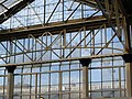 Waterloo Station and the Eye - geograph.org.uk - 1417948.jpg 640 × 480; 99 KB
-
 West Barnes Lane - geograph.org.uk - 23373.jpg 640 × 480; 75 KB
-
 West Beach Newhaven - geograph.org.uk - 244477.jpg 640 × 480; 79 KB
-
 Wrigley's Cabin - geograph.org.uk - 21330.jpg 640 × 480; 58 KB
-
 Allington Junction - geograph.org.uk - 423300.jpg 640 × 480; 88 KB
-
 Castleton Market Square - geograph.org.uk - 205697.jpg 640 × 480; 93 KB
-
 Castleton Shops and Peveril Castle - geograph.org.uk - 205690.jpg 450 × 600; 41 KB
-
 Chew Valley - geograph.org.uk - 21331.jpg 640 × 480; 71 KB
-
 Coire an Iubhair - geograph.org.uk - 8477.jpg 640 × 480; 94 KB
-
 Coire an Iubhair - geograph.org.uk - 8478.jpg 640 × 480; 89 KB
-
 Coire an Iubhair - geograph.org.uk - 8479.jpg 640 × 480; 96 KB
-
 Footbridge - geograph.org.uk - 158572.jpg 640 × 480; 153 KB
-
 Garbh Coire Mor. - geograph.org.uk - 8480.jpg 502 × 640; 91 KB
-

-
 Mountain biking on Black Hill. - geograph.org.uk - 585275.jpg 640 × 480; 101 KB
-
 Old telephone box at Stowting - geograph.org.uk - 398880.jpg 640 × 480; 98 KB
-
 River Dee from Dinnet Bridge - geograph.org.uk - 14086.jpg 640 × 480; 77 KB
-
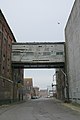
 Satanic Mills - geograph.org.uk - 158564.jpg 640 × 480; 97 KB
-

-
 Summit of Sron a'Choire Bhig - geograph.org.uk - 8483.jpg 640 × 443; 79 KB
-
 Sunrise - geograph.org.uk - 2864.jpg 640 × 480; 37 KB
-
 The Arrochar Alps - geograph.org.uk - 282025.jpg 640 × 441; 68 KB
-
 Winter Panorama - geograph.org.uk - 423312.jpg 640 × 466; 65 KB


