Category:United Kingdom photographs taken on 2004-08-08
Jump to navigation
Jump to search
| ← | Sunday 8 August 2004 | → | ||
| ← | August 2004 | → | ||
United Kingdom photographs taken on 8 August 2004.
Image files should be categorized here automatically using {{taken on}} template. Direct categorisation is also possible, if automatic is impossible.
Media in category "United Kingdom photographs taken on 2004-08-08"
The following 55 files are in this category, out of 55 total.
-
Abercorn Church - geograph.org.uk - 545408.jpg 496 × 640; 71 KB
-
Arriving at North Ronaldsay - geograph.org.uk - 1759332.jpg 2,304 × 1,728; 434 KB
-
Avonmouth, Bristol, St Andrew's Church - geograph.org.uk - 68470.jpg 640 × 480; 88 KB
-
Boat Bay, Loch Sionascaig - geograph.org.uk - 9508.jpg 640 × 439; 59 KB
-
CaledonianCanal01.jpg 681 × 511; 91 KB
-
Chithurst Church, West Sussex - geograph.org.uk - 52130.jpg 640 × 480; 99 KB
-
Clifftop Summer colour Nanjulian - geograph.org.uk - 706953.jpg 640 × 480; 188 KB
-
Deddington Arms Hotel, Deddington - geograph.org.uk - 1234210.jpg 640 × 462; 87 KB
-
Demolition of Strule House, Omagh - geograph.org.uk - 1707818.jpg 1,024 × 766; 470 KB
-
Easby moor sunset - geograph.org.uk - 175770.jpg 640 × 480; 63 KB
-
From Stein Jetty - geograph.org.uk - 315929.jpg 640 × 480; 49 KB
-
Georgemas Junction - geograph.org.uk - 84277.jpg 640 × 480; 92 KB
-
Sundial, Gillamoor - geograph.org.uk - 407796.jpg 640 × 480; 157 KB
-
Glen Croe - geograph.org.uk - 850421.jpg 640 × 480; 102 KB
-
Lacock, A Car going through the Ford - geograph.org.uk - 210922.jpg 480 × 640; 120 KB
-
Lon na Stapaig - geograph.org.uk - 103612.jpg 640 × 480; 84 KB
-
North York Moors Railway - North Dale - geograph.org.uk - 116952.jpg 640 × 416; 76 KB
-
Rhossili Bay - geograph.org.uk - 39768.jpg 640 × 481; 121 KB
-
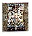
Royal Appointment badge - geograph.org.uk - 254425.jpg 577 × 640; 197 KB
-
Saltwell Towers - geograph.org.uk - 70553.jpg 640 × 480; 125 KB
-
Shelter near Strathy - geograph.org.uk - 87799.jpg 640 × 480; 109 KB
-
St. Michael's Church, Madeley - geograph.org.uk - 120520.jpg 360 × 540; 49 KB
-
Stac Pollaidh - geograph.org.uk - 9502.jpg 640 × 413; 66 KB
-
Stac Pollaidh from Loch Lurgain. - geograph.org.uk - 9501.jpg 640 × 480; 76 KB
-
Stac Pollaidh from the west - geograph.org.uk - 9506.jpg 640 × 357; 30 KB
-
Stac Pollaidh, Summit - geograph.org.uk - 9504.jpg 640 × 458; 85 KB
-
Summervale House - geograph.org.uk - 234370.jpg 480 × 640; 94 KB
-
Sunset on Oulton Broad with cruisers - geograph.org.uk - 59986.jpg 640 × 480; 57 KB
-
The Clock Tower at Blair Castle - geograph.org.uk - 6954.jpg 400 × 617; 93 KB
-
The Kyle of Tongue Bridge - geograph.org.uk - 84268 (cropped).jpg 560 × 381; 39 KB
-
The Kyle of Tongue Bridge - geograph.org.uk - 84268.jpg 640 × 512; 61 KB
-
The Light House at Strathy Point - geograph.org.uk - 84271.jpg 640 × 480; 54 KB
-
The Royal Oak Inn, Gillamoor - geograph.org.uk - 407794.jpg 640 × 480; 120 KB
-
Walking in the air... - geograph.org.uk - 1586412.jpg 640 × 479; 87 KB
-
Westend Cottage, Ballinluig - geograph.org.uk - 1474798.jpg 640 × 479; 86 KB
-
Whitefield Castle - geograph.org.uk - 78164.jpg 640 × 480; 103 KB
-
Bank Top Farm - geograph.org.uk - 437209.jpg 640 × 480; 36 KB
-
Blea Beck - geograph.org.uk - 437214.jpg 640 × 480; 57 KB
-
Blea Beck dam - geograph.org.uk - 437220.jpg 640 × 480; 49 KB
-
Derwent Dam - geograph.org.uk - 1726.jpg 640 × 481; 58 KB
-
Footbridge by Fish Farm - geograph.org.uk - 437207.jpg 640 × 480; 65 KB
-
Hamilton Hill - geograph.org.uk - 294312.jpg 640 × 482; 54 KB
-
Husbands Bosworth Tunnel - geograph.org.uk - 336805.jpg 640 × 480; 101 KB
-
Kinpauch Hill looking north - geograph.org.uk - 9317.jpg 640 × 480; 50 KB
-
Sampson's Lane - Rook End - geograph.org.uk - 274078.jpg 640 × 480; 92 KB
-
The road to the beach - geograph.org.uk - 296341.jpg 640 × 427; 66 KB
-
Yarnbury from Old Moor Lane - geograph.org.uk - 440814.jpg 640 × 480; 38 KB


