Category:United Kingdom photographs taken on 1969-11-22
Jump to navigation
Jump to search
| ← | Saturday 22 November 1969 | → | ||
| ← | November 1969 | → | ||

United Kingdom photographs taken on 22 November 1969.
Image files should be categorized here automatically using {{taken on}} template. Direct categorisation is also possible, if automatic is impossible.
Media in category "United Kingdom photographs taken on 1969-11-22"
The following 23 files are in this category, out of 23 total.
-
 A lost cause, Omagh - geograph.org.uk - 1081358.jpg 640 × 389; 36 KB
-
 Campsie Playing Fields flooded - geograph.org.uk - 1081366.jpg 640 × 394; 39 KB
-
-
 Dublin Road Corner blocked, Omagh - geograph.org.uk - 1081353.jpg 640 × 390; 51 KB
-

-
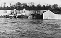
 Flooding at Campsie, Omagh - geograph.org.uk - 152145.jpg 640 × 442; 68 KB
-
 Flooding at Dublin Road, Omagh - geograph.org.uk - 152148.jpg 640 × 417; 39 KB
-
 Flooding, Mountjoy Road, Omagh - geograph.org.uk - 1081372.jpg 404 × 640; 48 KB
-
 Floods at Campsie Road, Omagh - geograph.org.uk - 1081373.jpg 412 × 640; 57 KB
-
 Floods at Old Dromore Road, Omagh - geograph.org.uk - 1080597.jpg 640 × 410; 42 KB
-
 Floods at Old Dromore Road, Omagh - geograph.org.uk - 1080599.jpg 640 × 390; 33 KB
-
 Floods at Sedan Avenue, Omagh - geograph.org.uk - 1081333.jpg 640 × 404; 50 KB
-

-

-
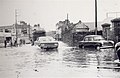
 Omagh Flooding (1969).jpg 640 × 414; 48 KB
-
 Omagh floods, 1969 - geograph.org.uk - 1081311.jpg 640 × 396; 32 KB
-
 Reflections, County Hall, Omagh - geograph.org.uk - 1081367.jpg 640 × 393; 48 KB
-
 River bank burst, Omagh - geograph.org.uk - 1081349.jpg 640 × 401; 55 KB
-

-
 Stranded at Dublin Road, Omagh - geograph.org.uk - 1081348.jpg 640 × 406; 37 KB
-
 Strule in flood, Omagh - geograph.org.uk - 1081326.jpg 640 × 393; 57 KB
-
 The Strule about to burst, Omagh - geograph.org.uk - 1081338.jpg 640 × 395; 36 KB
-


.jpg)


