Category:Ulm Ptolemy
Jump to navigation
Jump to search
| Cosmographia Nicolai Germani impressa Ulmae anno 1482 | |||
|---|---|---|---|
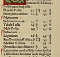
| The 3rd recension of Ptolemy’s Cosmographia modified by donus Nicolaus Germanus (donus being a title, dominus), Order of Saint Benedict, native of Ulm. In Florence he produced fine atlases for the upper clergy. As with all Germanus’ editions and recensions, the text is the 1410 translation of Jacopo d'Angelo from Greek to Latin. The world map was a woodcut made by Johannes Schnitzer from Armsheim. The recension was produced for Pope Paul II (died in 1471). In 1468 he loaned the manuscript to Germanus for printing by his nephew, Lienhart Holle, at Ulm. After over a decade of preparation the printing in 1482 was so expensive that Holle went out of business. The manuscript was never returned to the Vatican, and has not reappeared. The world map found by accident in the library of Schloss Wolfegg in 1900 attesting to the word “America” is not the one that went with the 1482 manuscript. Germanus updated the names throughout. The 2nd recension, later in 1482, added 3 Tabulae Novae to Book 8, while the 3rd added two more. A third recension was published in 1486. The 1482 printed book is generally called “the Ulm Cosmographia” or “the Ulm edition.” Multiple copies still exist.
1468: lent to Lienhart Holle by Vatican Library More scans available for download at the Boston Public Library |

| ||
Media in category "Ulm Ptolemy"
The following 43 files are in this category, out of 43 total.
-
Batauorum.jpg 1,147 × 1,076; 298 KB
-
Cosmographia, 1482.djvu 2,309 × 4,015, 276 pages; 17.21 MB
-
11th Map of Europe.jpg 2,000 × 1,429; 1.03 MB
-
1482 Cosmographia Germanus.JPG 6,055 × 4,360; 11.53 MB
-
1482 cosmographia nicolaus germanus left.jpg 1,514 × 2,619; 3.97 MB
-
1482 Ulm Ptolemy World Map.jpg 27,077 × 19,358; 77.44 MB
-
Prima Affrice Tabula.jpg 2,304 × 1,650; 4.18 MB
-
Ptolemys Fifth Map.jpg 800 × 516; 190 KB
-
Undecima Asie Tabula.jpg 4,000 × 2,960; 3.33 MB
-
Taprobana Insul.jpg 723 × 759; 120 KB
-
Bodleian Libraries, Ptolemy map of the World.jpg 1,000 × 675; 135 KB
-
Bodleian Library Auct.P1.4 roll279.1 frame15.jpg 1,000 × 772; 806 KB
-
Claudius Ptolemy- The World.jpg 8,073 × 5,813; 18.03 MB
-
Cosmographia – Ulm 1482 - Kungliga Biblioteket - 3276974-thumb.png 10,880 × 8,160; 439.68 MB
-
Cosmographia – Ulm 1482 - Kungliga Biblioteket - 3276974.tif 10,880 × 8,160, 2 pages; 508.04 MB
-
Cosmographia. - Norman B. Leventhal Map Center at the BPL.jpg 1,200 × 843; 478 KB
-
Prima Europe tabula.jpg 6,000 × 4,293; 9.63 MB
-
Prima Europe Tabula.jpg 919 × 673; 224 KB
-
Ptolemy-british-isles.jpg 2,283 × 1,650; 1.77 MB
-
Secunda Europe Tabula (1486).jpg 1,500 × 1,086; 339 KB
-
Sexta Europa Tabula.jpg 10,312 × 7,280; 25.58 MB
-
Septima Europe Tabula.jpg 700 × 400; 87 KB
-
Nona Europe Tabula (1482).jpg 1,000 × 694; 242 KB
-
Ptolemy's Ninth European Map.jpg 640 × 439; 88 KB
-
11th Map of Europe (Ulm Ptolemy).jpg 1,772 × 1,076; 480 KB
-
Cosmographia Northern Europe 1482.jpg 3,436 × 2,276; 1.38 MB
-
Nordenkart - no-nb krt 00481.jpg 4,863 × 3,161; 3.55 MB
-
Italia Antica.jpg 1,800 × 1,251; 304 KB
-
Johannes Schnitzer Weltkarte.jpg 3,603 × 2,605; 8.07 MB
-
Lucas 1898 Plate 3 Map of the North Donis Ptolemy 1482 annalsofvoyageso00luca 0270.jpg 4,802 × 3,289; 4.34 MB
-
PtolemaicMap.jpg 2,265 × 1,726; 6.42 MB
-
Ptolemy 2nd cent 1.jpg 10,336 × 7,312; 21.43 MB
-
Ptolemy map 15th century.jpg 1,870 × 1,431; 2.85 MB
-
Ptolemy. CIPRVS. 1482.jpg 2,376 × 1,267; 1.01 MB
-
Ptolemy. Palestina-Iudea. 1482.jpg 2,837 × 1,684; 1.72 MB
-
Ptolemys first projection.png 1,205 × 997; 2.02 MB
-
Ptolemys second projection.png 1,156 × 1,270; 1.98 MB
-
Ptolomey map.jpg 768 × 512; 94 KB
-
Quarta Asie Tabula.jpg 6,717 × 4,805; 6.48 MB
-
Quinta Europe Tabula.jpg 2,105 × 1,450; 3.28 MB
-
Ulm Ptolemy, Scheepvaartmuseum 1822.jpg 4,412 × 3,184; 7.54 MB
-
World of Ptolemy as shown by Johannes de Armsshein - Ulm 1482.png 1,168 × 849; 2.97 MB


