Category:Uinta Basin
Jump to navigation
Jump to search
basin in northeastern Utah and northwestern Colorado in the United States | |||||
| Upload media | |||||
| Instance of | |||||
|---|---|---|---|---|---|
| Location |
| ||||
| Elevation above sea level |
| ||||
 | |||||
English: Media related to the Uinta Basin (sometimes spelled as Uintah Basin), a physiographic section of the larger Colorado Plateau Province.
- Located in eastern Utah (but extending slightly into western Colorado), in the Southwestern United States.
Subcategories
This category has the following 20 subcategories, out of 20 total.
Media in category "Uinta Basin"
The following 45 files are in this category, out of 45 total.
-
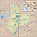
Greenutrivermap.png 500 × 500; 409 KB
-
Allosaurus-fossilized skull.jpg 472 × 313; 21 KB
-
Bonanza Operations, American Gilsonite Company (Bonanza, Utah, USA) 1.jpg 4,203 × 2,267; 6 MB
-
Fossil mammals of the Uinta Basin - expedition of 1894 (IA bulletin-american-museum-natural-history-7-071-105).pdf 825 × 1,275, 36 pages; 2.89 MB
-
Dinosaur national monument.jpg 2,048 × 3,072; 2.19 MB
-
Draft environmental impact statement on the Uintah Basin synfuels development v. 1 (IA draftenvironment03unit).pdf 1,297 × 1,643, 792 pages; 128.81 MB
-
Final environmental impact statement on the Uintah Basin synfuels development v. 1 (IA finalenvironment02unit).pdf 1,297 × 1,645, 640 pages; 107.7 MB
-
Final environmental impact statement on the Uintah Basin synfuels development v. 2 (IA finalenvironment28unit).pdf 627 × 820, 452 pages; 85.4 MB
-
Final Uinta-Southwestern Utah regional coal environmental impact statement (IA finaluintasouthw00unit).pdf 1,354 × 1,764, 468 pages; 98.53 MB
-
Green River Canyon. Summit Valley, Uintas Mountains - NARA - 519480.jpg 3,000 × 2,491; 1.54 MB
-
Green River Formation Oil Gas Fields map.png 878 × 546; 112 KB
-
Mancos Mowry shale oil gas fields.png 885 × 545; 205 KB
-
Mesaverde Gas Fields.png 914 × 559; 223 KB
-
Mirror Lake Utah.jpg 7,530 × 5,512; 8 MB
-
My Public Lands Roadtrip- Pariette Wetlands in Utah (20220345702).jpg 4,496 × 3,000; 6.71 MB
-
Nahcolite deposition model.png 985 × 534; 87 KB
-
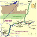
NineMileCanyon map.png 400 × 400; 28 KB
-
Oil Well in Duchense County, Utah.jpg 2,304 × 1,728; 935 KB
-
Oil-impregnated sandstone, Uintah Basin, Utah. (IA oilimpregnatedsa00unse).pdf 1,572 × 2,097, 2 pages; 120 KB
-
Oil shale development in the Piceance Basin and the Uinta Basin (IA oilshaledevelopm00unse).pdf 1,645 × 2,200, 330 pages; 98.37 MB
-
Oil shale development in the Piceance Basin and the Uinta Basin (IA oilshaledevelopm00unse 0).pdf 1,656 × 2,181, 192 pages; 14.09 MB
-
PSM V07 D402 Uinta mountains sectional image.jpg 2,512 × 1,131; 568 KB
-
Skull Fossil in the Uinta Basin in Utah.jpg 3,008 × 2,000; 2.57 MB
-
Southwestern US Sedimentary Basins.tif 5,067 × 4,133; 80.44 MB
-
The American Museum journal (c1900-(1918)) (18159694835).jpg 2,010 × 1,360; 602 KB
-
Uinta Basin geologic cross section.png 1,054 × 564; 96 KB
-
Uinta Basin map.png 976 × 561; 77 KB
-
Uinta Piceance Basin stratigraphic column.gif 1,274 × 1,048; 122 KB
-
Uinta Piceance Basin stratigraphic column.png 531 × 544; 59 KB
-
Uinta Piceance Basins geologic map.gif 1,782 × 1,115; 170 KB
-
Uinta Piceance Basins geologic map.png 1,008 × 545; 185 KB
-
Uinta Basin flora (IA uintabasinflora09good).pdf 1,247 × 1,606, 348 pages; 57.11 MB
-
Uintabasinrail-whitmorepark-indiancanyongrade.png 381 × 476; 35 KB
-
Uintah Basin Drilling Night.jpg 782 × 544; 48 KB
-
Uintah Basin, United States ESA377234.jpg 1,920 × 1,920; 5.91 MB
-
Uintah Basin, United States ESA377234.tiff 10,980 × 10,980; 294.83 MB
-
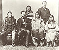
Ute delegation.jpg 490 × 413; 119 KB
-
Wealth of the Uintah Basin, Utah (IA wealthofuintahba00coo).pdf 666 × 910, 88 pages; 5.34 MB
Categories:
- Colorado Plateau region of Utah
- Colorado Plateau region of Colorado
- Geology of Colorado
- Geology of Utah
- Sedimentary basins of Colorado
- Sedimentary basins of Utah
- Regions of Utah
- Colorado Plateau
- Geography of Moffat County, Colorado
- Landforms of Duchesne County, Utah
- Landforms of Daggett County, Utah
- Landforms of Wasatch County, Utah
- Landforms of Uintah County, Utah
- Sedimentary basins of North America
- Locations along U.S. Route 40 in Colorado
- Locations along U.S. Route 40 in Duchesne County, Utah
- Locations along U.S. Route 40 in Uintah County, Utah
- Locations along U.S. Route 191 in Duchesne County, Utah
- Locations along U.S. Route 191 in Uintah County, Utah
- Locations along Colorado State Highway 64
- Locations along Utah State Route 6 (1910-1977) in Duchesne County, Utah
- Locations along Utah State Route 6 (1910-1977) in Uintah County, Utah
- Locations along Utah State Route 35 in Duchesne County, Utah
- Locations along Utah State Route 35 in Wasatch County, Utah
- Locations along Utah State Route 53 (1916-1969)
- Locations along Utah State Route 150
- Locations along the Dinosaur Diamond Prehistoric Highway in Duchesne County, Utah
- Locations along the Dinosaur Diamond Prehistoric Highway in Uintah County, Utah


