Category:US National Archives series: Enumeration District and Related Maps
Jump to navigation
Jump to search
Subcategories
This category has the following 57 subcategories, out of 57 total.
1
A
C
F
I
M
N
O
P
U
V
Media in category "US National Archives series: Enumeration District and Related Maps"
The following 200 files are in this category, out of 42,118 total.
(previous page) (next page)-
1900 Rockbridge County Enumeration District Map - NARA - 109182534.jpg 5,428 × 3,632; 4.62 MB
-
1910 Enumeration District Map for New Haven, Connecticut - NARA - 6860537.jpg 2,105 × 3,150; 3.42 MB
-
1910 Enumeration District Map of Ashland, Wisconsin - NARA - 7369061 (page 1).jpg 7,040 × 5,321; 4.01 MB
-
1910 Enumeration District Map of Ashland, Wisconsin - NARA - 7369061 (page 2).pdf 3,518 × 2,660; 1.9 MB
-
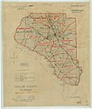
1910 Enumeration District Map, Taylor County, FL - NARA - 117090784.jpg 9,760 × 6,514; 5.44 MB
-
1920 Augusta County Enumeration District Map - NARA - 109182538.jpg 4,960 × 4,630; 5.41 MB
-
1920 Enumeration District Map for Holmes County, Florida - NARA - 6860540.jpg 3,150 × 2,286; 2.45 MB
-
1920 Enumeration District Map for Pierce County, Washington - NARA - 6860538.jpg 3,150 × 2,400; 3.41 MB
-
1920 Enumeration District Map, Taylor County, FL - NARA - 117090786.jpg 9,840 × 6,865; 5.8 MB
-
1930 Enumeration District Map, Defiance County, OH - NARA - 117090790.jpg 5,116 × 4,096; 1.35 MB
-
1930 Enumeration District Map, Polk County, IA - NARA - 117090788.jpg 6,076 × 4,826; 1.95 MB
-
1930 Rockbridge County Enumeration District Map - NARA - 109182540.jpg 2,216 × 3,446; 2.06 MB


