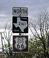
Category:U.S. Route 66 in Texas
Jump to navigation
Jump to search
States of the United States: Arizona · California · Illinois · Kansas · Missouri · New Mexico · Oklahoma · Texas
section of historic former U.S. Numbered Highway in Texas, United States | |||||
| Upload media | |||||
| Instance of | |||||
|---|---|---|---|---|---|
| Location |
| ||||
| Transport network | |||||
| Owned by | |||||
| Maintained by | |||||
| Length |
| ||||
| Terminus | |||||
| |||||
English: Media related to U.S. Route 66 in Texas (US 66}, a 179-mile (288 km) section of a historic former U.S. Numbered Highway in Texas, United States, that connected US 66 in New Mexico with US 66 in Oklahoma.
Subcategories
This category has the following 3 subcategories, out of 3 total.
A
Media in category "U.S. Route 66 in Texas"
The following 16 files are in this category, out of 16 total.
-
Business Loop 40.svg 601 × 601; 24 KB
-
US 66 (TX historic).svg 601 × 751; 30 KB
-
US 66 Texas 1926.svg 1,485 × 1,440; 39 KB
-
Big Texan 20.jpg 2,755 × 2,010; 1.22 MB
-
Groom, Texas 04.jpg 4,752 × 3,129; 1.72 MB
-
Groom, Texas 05.jpg 3,264 × 4,896; 1.53 MB
-
Groom, Texas 06.jpg 4,896 × 3,072; 3 MB
-
Groom, Texas 07.jpg 2,570 × 3,007; 1.44 MB
-
Highway 207 north of conway.jpg 1,536 × 2,056; 1.04 MB
-
Route 66 emblem water tower in Amarillo, Texas.jpg 2,364 × 3,232; 6.92 MB
-
Route 66 sign in San Antonio, TX IMG 5158.JPG 4,272 × 2,848; 5.29 MB
-
Texas State Highway Loop 271, Alanreed Texas.jpg 1,936 × 1,456; 477 KB
-
US Route Icon Banner.jpg 4,352 × 621; 588 KB
-
Vega10.jpg 3,264 × 4,896; 4.16 MB
-
Vega9.jpg 4,896 × 3,264; 4.57 MB
Categories:
- U.S. Route 66
- Former U.S. Highways in Texas
- Road transport in Deaf Smith County, Texas
- Road transport in Oldham County, Texas
- Road transport in Potter County, Texas
- Road transport in Carson County, Texas
- Road transport in Gray County, Texas
- Road transport in Donley County, Texas
- Road transport in Wheeler County, Texas


