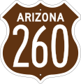
Category:U.S. Route 260 in Arizona
Jump to navigation
Jump to search
States of the United States: Arizona · New Mexico
section of former U.S. Numbered Highway in Navajo and Apache counties in Arizona, United States | |||||
| Upload media | |||||
| Instance of | |||||
|---|---|---|---|---|---|
| Part of | |||||
| Location |
| ||||
| Transport network | |||||
| Inception |
| ||||
| End time |
| ||||
| Length |
| ||||
| Terminus | |||||
| Replaced by | |||||
| |||||
English: Media related to U.S. Route 260 in Arizona (US 260), a (roughly 118-mile [190 km]) section of a former U.S. Numbered Highway in Navajo and Apache counties in Arizona, United States, that connected U.S. Route 66 in Holbrook with US 260 in New Mexico. (In 1962 the entire route was added to U.S. Route 180.)
Subcategories
This category has only the following subcategory.
Media in category "U.S. Route 260 in Arizona"
The following 6 files are in this category, out of 6 total.
-
US 260 (AZ 1960 east).svg 2,160 × 2,065; 7 KB
-
US 260 (AZ 1960 west).svg 2,160 × 2,065; 7 KB
-
US 260 1963 (AZ).svg 2,160 × 2,065; 10 KB
-
US 260 Arizona 1926.svg 1,485 × 1,440; 31 KB
-
US 260 Arizona 1956 East.svg 372 × 384; 20 KB
-
US 260 Arizona 1956 West.svg 372 × 384; 20 KB


