Category:Twyford, Berkshire
Jump to navigation
Jump to search
English: For other places of the same name, see Twyford.
Nederlands: Twyford is een dorp (village en civil parish) in het Engelse graafschap Berkshire. Het dorp ligt in het district Wokingham en telt meer dan 6000 inwoners.
Norsk bokmål: Twyford er en landsby i Berkshire. Den ligger i Thames Valley, ved A4 mellom Reading og Maidenhead, og ikke langt fra Henley-on-Thames, Wokingham og Bracknell.
village and civil parish in Berkshire, UK  | |||||
| Upload media | |||||
| Instance of | |||||
|---|---|---|---|---|---|
| Location | Wokingham, Berkshire, South East England, England | ||||
| Population |
| ||||
| official website | |||||
 | |||||
Subcategories
This category has only the following subcategory.
T
Media in category "Twyford, Berkshire"
The following 137 files are in this category, out of 137 total.
-
 "The Golden Cross" PH - geograph.org.uk - 3609206.jpg 800 × 600; 114 KB
-
 A321 Hurst Road, Twyford - geograph.org.uk - 6236227.jpg 1,024 × 684; 352 KB
-
 A321 Wargrave Road Runners - geograph.org.uk - 5547151.jpg 826 × 551; 177 KB
-
 A321 Wargrave Road, Twyford - geograph.org.uk - 6236233.jpg 1,024 × 684; 334 KB
-
 A321, Twyford - geograph.org.uk - 6236228.jpg 1,024 × 684; 313 KB
-
 Across the railway fence - geograph.org.uk - 2169450.jpg 640 × 427; 174 KB
-
 Allotments at Twyford - geograph.org.uk - 1587735.jpg 640 × 480; 116 KB
-
 Allotments on the edge of Twyford - geograph.org.uk - 3914533.jpg 640 × 408; 62 KB
-
 Allotments, Twyford - geograph.org.uk - 5024787.jpg 640 × 330; 48 KB
-
 Allotments, Twyford - geograph.org.uk - 5132956.jpg 640 × 426; 51 KB
-
 Allotments, Twyford - geograph.org.uk - 5269471.jpg 640 × 426; 59 KB
-

-
 Benchmark on United Reformed Church - geograph.org.uk - 2193186.jpg 600 × 800; 137 KB
-
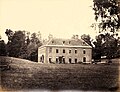 Bere Court Pangbourne Berkshire Beard And Co 1866.jpg 5,461 × 4,178; 4.77 MB
-
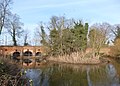 Bridges Over The Loddon - geograph.org.uk - 3372486.jpg 2,418 × 1,734; 1.47 MB
-
 Cake Shop in Station Road - geograph.org.uk - 3365827.jpg 1,600 × 1,157; 357 KB
-
 Car park, Twyford Station - geograph.org.uk - 5374617.jpg 640 × 426; 73 KB
-
 Church Street, Twyford - geograph.org.uk - 3345430.jpg 2,048 × 1,536; 1.5 MB
-
 Church Street, Twyford - geograph.org.uk - 3372515.jpg 2,468 × 1,761; 1.12 MB
-
 Crossroads in Twyford - geograph.org.uk - 3248639.jpg 1,500 × 1,000; 151 KB
-
 Emma's Kitchen - geograph.org.uk - 6626960.jpg 1,200 × 806; 1.21 MB
-
 Farm track off the A4, Twyford - geograph.org.uk - 4609594.jpg 2,304 × 1,728; 868 KB
-
 Field Sunset.jpg 3,000 × 2,000; 4.59 MB
-
 Fields by New Bath Road, Twyford - geograph.org.uk - 6206690.jpg 1,920 × 1,280; 1.1 MB
-
 Fields by New Bath Road, Twyford - geograph.org.uk - 6364634.jpg 1,892 × 1,236; 1.17 MB
-
 Flooding in the Loddon Valley - geograph.org.uk - 3914535.jpg 640 × 430; 57 KB
-
 Flooding, River Loddon - geograph.org.uk - 5269460.jpg 640 × 426; 59 KB
-
 Foot crossing, Twyford station - geograph.org.uk - 4776527.jpg 1,600 × 1,200; 427 KB
-
 Former gravel pit, Twyford - geograph.org.uk - 604989.jpg 640 × 480; 133 KB
-
 Former gravel pit, Twyford - geograph.org.uk - 605005.jpg 640 × 480; 115 KB
-
 Former gravel pit, Twyford - geograph.org.uk - 605018.jpg 640 × 480; 85 KB
-
 Former gravel pit, Twyford - geograph.org.uk - 605019.jpg 640 × 480; 119 KB
-
 Former gravel pit, Twyford - geograph.org.uk - 605021.jpg 640 × 480; 131 KB
-
 Former Twyford Methodist Church - geograph.org.uk - 3638011.jpg 3,322 × 2,529; 1.62 MB
-
 Former Twyford Wesleyan Methodist Church - geograph.org.uk - 3637921.jpg 2,730 × 2,462; 1.2 MB
-
 Freight Train at Twford - geograph.org.uk - 4460240.jpg 1,200 × 802; 1.45 MB
-
 Henley branch line - geograph.org.uk - 2545221.jpg 640 × 457; 193 KB
-
 Hermitage Drive, Twyford - geograph.org.uk - 605027.jpg 640 × 480; 133 KB
-
 High Speed Train at Twyford - geograph.org.uk - 2988638.jpg 1,024 × 695; 1.1 MB
-
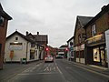
 High Street in Twyford - geograph.org.uk - 3716926.jpg 1,500 × 999; 146 KB
-
 High Street Twyford - geograph.org.uk - 3345434.jpg 2,048 × 1,536; 1.38 MB
-
 High Street Twyford at the crossroads with the A321 - geograph.org.uk - 3345436.jpg 2,048 × 1,536; 1.4 MB
-
 Houses by Twyford Station - geograph.org.uk - 2866533.jpg 640 × 400; 70 KB
-
 Houses in Gas Lane Road - geograph.org.uk - 5513778.jpg 1,600 × 885; 372 KB
-
 Houses in Twyford, Berkshire - geograph.org.uk - 6288889.jpg 4,299 × 3,056; 4.74 MB
-
 Houses on Hurst Road, Twyford - geograph.org.uk - 5918167.jpg 1,920 × 1,280; 1.33 MB
-
 HST through Twyford - geograph.org.uk - 4776513.jpg 1,600 × 1,200; 547 KB
-
 Hurst Park Road - geograph.org.uk - 3881326.jpg 1,024 × 768; 182 KB
-
 Hurst Park Road, Twyford - geograph.org.uk - 3881237.jpg 1,600 × 963; 367 KB
-
 Hurst Road in Twyford - geograph.org.uk - 3927763.jpg 1,500 × 999; 189 KB
-
 Hurst Road into Twyford - geograph.org.uk - 3927762.jpg 1,500 × 999; 211 KB
-
 In a cutting, Twyford - geograph.org.uk - 3959159.jpg 640 × 450; 114 KB
-
 Jubilee sign in Twyford - geograph.org.uk - 3716932.jpg 1,267 × 1,500; 142 KB
-
 Lake in the Loddon Valley - geograph.org.uk - 3914538.jpg 640 × 341; 64 KB
-
 Loddon Nature Reserve, Twyford - geograph.org.uk - 648218.jpg 640 × 480; 121 KB
-

-
 Loddon Nature reserve.jpg 640 × 369; 37 KB
-
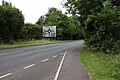
 London Road to Hare Hatch - geograph.org.uk - 3927764.jpg 1,500 × 999; 132 KB
-
 London Road, Twyford - geograph.org.uk - 3345480.jpg 2,048 × 1,536; 1.27 MB
-

-
 St Mary, Twyford - geograph.org.uk - 1525561.jpg 419 × 640; 105 KB
-
 New Bath Road - geograph.org.uk - 3609022.jpg 800 × 600; 101 KB
-
 New Bath Road, Twyford - geograph.org.uk - 5481260.jpg 1,960 × 1,412; 656 KB
-
 New Bath Road, Twyford - geograph.org.uk - 6206689.jpg 1,920 × 1,280; 1.29 MB
-
 Old Bath Road, Twyford - geograph.org.uk - 3345441.jpg 2,048 × 1,536; 1.49 MB
-
 Old Bath Road, Twyford - geograph.org.uk - 3345444.jpg 2,048 × 1,536; 1.54 MB
-
 Paddington to Reading Railway - geograph.org.uk - 1941265.jpg 1,501 × 1,004; 761 KB
-
 Paddock Heights, Twyford - geograph.org.uk - 604666.jpg 640 × 480; 122 KB
-
 Petrol station on New Bath Road - geograph.org.uk - 5481261.jpg 2,048 × 1,536; 1.47 MB
-
 Polytunnels near Loddon Park Farm - geograph.org.uk - 6538343.jpg 5,807 × 3,871; 4.31 MB
-
 Railway bridge at Twyford - geograph.org.uk - 3898036.jpg 4,320 × 3,240; 2.9 MB
-

-
 River Loddon - geograph.org.uk - 6411620.jpg 1,024 × 681; 284 KB
-
 River Loddon and railway bridge - geograph.org.uk - 2072831.jpg 1,704 × 2,272; 2.71 MB
-
 River Loddon at Twyford - geograph.org.uk - 2543542.jpg 640 × 427; 213 KB
-
 Rooftops in Twyford - geograph.org.uk - 3365830.jpg 1,024 × 868; 257 KB
-
 Roundabout on Waltham Road, Twyford - geograph.org.uk - 3345472.jpg 2,048 × 1,536; 1.47 MB
-
 Roundabout, A321 - A4 junction - geograph.org.uk - 4744167.jpg 640 × 426; 58 KB
-
 Ruscombe Road, Twyford - geograph.org.uk - 648219.jpg 640 × 480; 151 KB
-
 Ruscombe Siding geograph-2241975-by-Ben-Brooksbank.jpg 1,024 × 630; 291 KB
-
 Ruscombe Turn roundabout on Waltham Road - geograph.org.uk - 3346599.jpg 2,048 × 1,536; 1.48 MB
-
 Sign at "The Golden Cross" PH - geograph.org.uk - 3609208.jpg 800 × 712; 87 KB
-
 Spring daffs' in Broad Hinton - geograph.org.uk - 525349.jpg 640 × 480; 97 KB
-
 St Thomas More Roman Catholic Church, Twyford - geograph.org.uk - 3663109.jpg 3,648 × 2,736; 2.77 MB
-
 Stanlake Bridge - geograph.org.uk - 2543960.jpg 640 × 427; 182 KB
-
 Stanlake Manor (geograph 3891191).jpg 1,600 × 1,176; 707 KB
-
 Station car park - geograph.org.uk - 6411623.jpg 1,024 × 681; 216 KB
-
 Station LongExp.jpg 5,874 × 3,812; 5.83 MB
-

-
-

-
 The A3032, Ruscombe - geograph.org.uk - 1048351.jpg 640 × 480; 141 KB
-
 The A3032, Twyford - geograph.org.uk - 987684.jpg 640 × 480; 127 KB
-
 The A4 at Twyford - geograph.org.uk - 4609596.jpg 2,152 × 1,500; 884 KB
-
 The Centre of Twyford - geograph.org.uk - 3372468.jpg 2,423 × 1,827; 1.3 MB
-
 The entrance to Loddon Park Farm, Twyford - geograph.org.uk - 4609593.jpg 2,260 × 1,668; 1.18 MB
-
 The Loddon floodplain, Twyford - geograph.org.uk - 504350.jpg 640 × 480; 117 KB
-
 The Mita's Restaurant - geograph.org.uk - 2545213.jpg 640 × 399; 173 KB
-
 The police station on Station Road - geograph.org.uk - 3609213.jpg 800 × 600; 100 KB
-
 The railway line by Twyford Station - geograph.org.uk - 5918166.jpg 1,864 × 1,192; 1.55 MB
-
 The River Loddon - geograph.org.uk - 4843165.jpg 640 × 480; 73 KB
-
 The Waggon and Horses, Twyford - geograph.org.uk - 504349.jpg 640 × 480; 142 KB
-
 Tower of St Mary's Church - geograph.org.uk - 5201383.jpg 640 × 442; 65 KB
-
 Train on the Henley-on-Thames branch line - geograph.org.uk - 6538355.jpg 6,000 × 4,000; 7.03 MB
-
 Twyford , Bus Shelter - geograph.org.uk - 6267192.jpg 4,608 × 3,456; 4.62 MB
-
 Twyford , New Bath Road A4 - geograph.org.uk - 6265129.jpg 4,608 × 3,456; 3.63 MB
-
 Twyford , New Bath Road A4 - geograph.org.uk - 6265130.jpg 4,608 × 3,456; 4.51 MB
-
 Twyford , New Bath Road A4 - geograph.org.uk - 6265134.jpg 4,608 × 3,456; 5.15 MB
-
 Twyford , Pavement - geograph.org.uk - 6265133.jpg 4,608 × 3,456; 5.1 MB
-
 Twyford , Wargrave Road A321 - geograph.org.uk - 6265132.jpg 4,608 × 3,456; 4.69 MB
-
 Twyford - fGWR 43029-43170 down train.JPG 1,366 × 910; 670 KB
-
 Twyford - fGWR 43172+43124 down train.JPG 1,366 × 820; 710 KB
-
 Twyford crossroads - geograph.org.uk - 2545215.jpg 640 × 427; 200 KB
-
 Twyford High Street - geograph.org.uk - 4190772.jpg 1,024 × 768; 164 KB
-
 Twyford Police Station - geograph.org.uk - 6441688.jpg 1,200 × 802; 1.14 MB
-
 Twyford Post Office - geograph.org.uk - 2193166.jpg 800 × 600; 92 KB
-
 Twyford school - geograph.org.uk - 2545210.jpg 640 × 427; 209 KB
-
 Twyford Station Towers - geograph.org.uk - 3881320.jpg 1,600 × 889; 334 KB
-
 Twyford United Reformed Church - geograph.org.uk - 3637907.jpg 2,935 × 2,502; 1.33 MB
-

-
 Unloading heavy plant on the London Road Twyford - geograph.org.uk - 6288895.jpg 3,528 × 2,520; 4.14 MB
-
 Waggon and Horses - geograph.org.uk - 2545225.jpg 426 × 640; 222 KB
-
 Waggon ^ Horses - geograph.org.uk - 2072822.jpg 2,272 × 1,704; 1.43 MB
-
 Waltham Road Bridge - geograph.org.uk - 3959165.jpg 640 × 430; 93 KB
-
 Waltham Road Bridge in Twyford - geograph.org.uk - 1560388.jpg 640 × 410; 82 KB
-
 Wargrave Road, Twyford - geograph.org.uk - 605025.jpg 640 × 480; 171 KB
-
 Winchcombe Road, Twyford - geograph.org.uk - 604689.jpg 640 × 480; 137 KB
-
 Broad Hinton, Twyford - geograph.org.uk - 604711.jpg 640 × 480; 119 KB
-
 Farmland east of Ruscombe - geograph.org.uk - 110834.jpg 640 × 480; 93 KB
-
 Former gravel pit, Twyford - geograph.org.uk - 605006.jpg 640 × 480; 121 KB
-
 Former gravel pit, Twyford - geograph.org.uk - 605011.jpg 640 × 480; 91 KB
-
 Hurst - geograph.org.uk - 4123.jpg 640 × 427; 274 KB
-
 Milley Farm - geograph.org.uk - 24591.jpg 640 × 427; 83 KB
-
 Stanlake Meadow - geograph.org.uk - 67799.jpg 640 × 481; 31 KB
-
 Stanlake Meadow, Twyford - geograph.org.uk - 604670.jpg 640 × 480; 147 KB
-
 Stanlake Park - geograph.org.uk - 17196.jpg 640 × 431; 93 KB
-
 Twyford - geograph.org.uk - 16639.jpg 640 × 431; 94 KB


.jpg)


