Category:Twenty, Lincolnshire
Jump to navigation
Jump to search
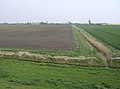
English: Twenty is a small, somewhat remote hamlet, 4 miles (6 km) east of the market town of Bourne, (between Bourne and Spalding) in Lincolnshire, England. Agriculture is the major industry.
hamlet in Lincolnshire, United Kingdom  | |||||
| Upload media | |||||
| Instance of | |||||
|---|---|---|---|---|---|
| Location |
| ||||
 | |||||
Media in category "Twenty, Lincolnshire"
The following 74 files are in this category, out of 74 total.
-
 A151 approaching Twenty - geograph.org.uk - 2448603.jpg 640 × 480; 76 KB
-

-
 Black Sluice pumping station - geograph.org.uk - 1743180.jpg 2,736 × 3,648; 2.15 MB
-
 Entrance to Twenty - geograph.org.uk - 3652120.jpg 640 × 480; 59 KB
-
 Fens in the evening - geograph.org.uk - 589796.jpg 640 × 427; 83 KB
-
 Field of cabbages - geograph.org.uk - 237085.jpg 640 × 480; 83 KB
-
 Footbridge over Forty Foot Drain - geograph.org.uk - 237016.jpg 640 × 480; 88 KB
-
 Owl nesting boxes - geograph.org.uk - 302808.jpg 640 × 480; 101 KB
-

-
 South Fen Farm, Bourne, Lincs - geograph.org.uk - 453422.jpg 640 × 480; 344 KB
-
 Swans and Rape - geograph.org.uk - 437321.jpg 640 × 477; 73 KB
-
 Twenty Drove (also called North Drove) - geograph.org.uk - 3140972.jpg 2,256 × 1,504; 1.06 MB
-
 Twenty Drove - geograph.org.uk - 2448613.jpg 447 × 640; 68 KB
-
 Twenty Drove - geograph.org.uk - 2693261.jpg 4,000 × 3,000; 4.35 MB
-
 Twenty Drove - geograph.org.uk - 3696094.jpg 640 × 480; 66 KB
-
 Twenty Drove heading north - geograph.org.uk - 3696545.jpg 640 × 480; 64 KB
-
 Twenty, Lincolnshire.jpg 640 × 427; 61 KB
-
 Village Hall, Twenty - geograph.org.uk - 128423.jpg 640 × 427; 69 KB
-
 Barns in fields - geograph.org.uk - 144662.jpg 640 × 427; 110 KB
-
 Bird box - geograph.org.uk - 237047.jpg 480 × 640; 80 KB
-
 Blackhole Drove - geograph.org.uk - 418619.jpg 640 × 480; 66 KB
-
 Boundary for the Avoidance of Doubt - geograph.org.uk - 437352.jpg 640 × 477; 74 KB
-
 Bridge over fen drain, Dyke Fen - geograph.org.uk - 128398.jpg 640 × 427; 101 KB
-

-

-

-
 Farm at end of Morton North Drove - geograph.org.uk - 144737.jpg 640 × 427; 143 KB
-
 Farm on Barne's Drove, Bourne Fen - geograph.org.uk - 128358.jpg 640 × 427; 89 KB
-
 Farm on Dyke Drove, Bourne Fen - geograph.org.uk - 128364.jpg 640 × 427; 64 KB
-
 Farm track across the Fen - geograph.org.uk - 589845.jpg 640 × 427; 75 KB
-
 Farm track, Tongue End, Lincs - geograph.org.uk - 105826.jpg 640 × 470; 261 KB
-

-
 Farmland off North Drove - geograph.org.uk - 589812.jpg 640 × 422; 94 KB
-
 Farmstead on Slipe Drove - geograph.org.uk - 436747.jpg 640 × 477; 86 KB
-
 Fen Farm near Bourne Eau - geograph.org.uk - 128551.jpg 640 × 427; 112 KB
-
 Fen fields - geograph.org.uk - 128505.jpg 640 × 427; 57 KB
-
 Fen fields Bourne Drove, Bourne Fen - geograph.org.uk - 128371.jpg 640 × 427; 67 KB
-

-
 Fen fields near Dyke Fen Farm - geograph.org.uk - 128375.jpg 640 × 427; 70 KB
-
 Fen fields near Twenty - geograph.org.uk - 128419.jpg 640 × 427; 81 KB
-

-
 Former rail route - geograph.org.uk - 472957.jpg 640 × 427; 88 KB
-
 Forty Foot Farm - geograph.org.uk - 144703.jpg 640 × 427; 134 KB
-
 Golden pinstripe - geograph.org.uk - 418623.jpg 640 × 480; 77 KB
-
 Hidden House - geograph.org.uk - 418609.jpg 640 × 480; 68 KB
-
 House at end of Leaves Lake Drove - geograph.org.uk - 237078.jpg 640 × 480; 150 KB
-
 Lane to the Turbines - geograph.org.uk - 472969.jpg 640 × 427; 65 KB
-
 More Rape Fields - geograph.org.uk - 437327.jpg 640 × 477; 92 KB
-
 New bridge to Cradge Farm - geograph.org.uk - 589700.jpg 640 × 420; 70 KB
-
 Nunnerley House Farm - geograph.org.uk - 144708.jpg 640 × 427; 138 KB
-

-

-

-

-
-
 Old Railway Bridge - geograph.org.uk - 436766.jpg 640 × 477; 81 KB
-
 On North Drove - geograph.org.uk - 589790.jpg 640 × 480; 75 KB
-
 Owl Houses - geograph.org.uk - 418614.jpg 640 × 480; 91 KB
-
 Pinchbeck South Fen - geograph.org.uk - 275231.jpg 640 × 427; 39 KB
-
 Pinchbeck South Fen, Lincs - geograph.org.uk - 105824.jpg 640 × 470; 294 KB
-
 Remote River Glen - geograph.org.uk - 436749.jpg 640 × 477; 81 KB
-
 Remote River Glen - geograph.org.uk - 436763.jpg 640 × 477; 64 KB
-
 River Glen - geograph.org.uk - 436773.jpg 640 × 477; 77 KB
-
 The A151 at Twenty - geograph.org.uk - 128491.jpg 640 × 427; 69 KB
-
 The Limes Farm - geograph.org.uk - 128499.jpg 640 × 427; 80 KB
-
 Tongue End village - geograph.org.uk - 404217.jpg 640 × 480; 71 KB
-
 Track in the Fens - geograph.org.uk - 237028.jpg 640 × 480; 78 KB
-
 Track to Rose's Cottage - geograph.org.uk - 589755.jpg 640 × 427; 101 KB
-
 Twenty Drove - geograph.org.uk - 128479.jpg 640 × 427; 60 KB
-
 Variegated Thistle - geograph.org.uk - 437311.jpg 640 × 477; 171 KB
-
 Vast Lincolnshire Fields - geograph.org.uk - 437335.jpg 640 × 477; 71 KB
-

-
 West Pinchbeck Water Treatment Works - geograph.org.uk - 393938.jpg 640 × 480; 75 KB
-
 Wonky footbridge in the fens - geograph.org.uk - 144674.jpg 640 × 427; 181 KB


_-_geograph.org.uk_-_3140972.jpg)


