Category:Turnworth
Jump to navigation
Jump to search
English: Turnworth is a hamlet in north Dorset, England, situated on the Dorset Downs five miles west of Blandford Forum. The village consists of a few cottages and farmhouses scattered around a church and manor house. Nearby is Ringmoor, an ancient settlement on the top of the scarp face of the downs. The village has a population of less than 50 .
village and civil parish in Dorset, United Kingdom  | |||||
| Upload media | |||||
| Instance of | |||||
|---|---|---|---|---|---|
| Location |
| ||||
| Population |
| ||||
 | |||||
Media in category "Turnworth"
The following 76 files are in this category, out of 76 total.
-

-
 Bridleway above Turnworth - geograph.org.uk - 4595498.jpg 640 × 480; 147 KB
-
 Bridleway at Turnworth Down - geograph.org.uk - 4595494.jpg 640 × 480; 137 KB
-
 Bridleway to Turnworth - geograph.org.uk - 1950678.jpg 640 × 465; 86 KB
-
 Cottages at Turnworth, Dorset - geograph.org.uk - 4207145.jpg 1,200 × 900; 248 KB
-
 Cottages Turnworth - geograph.org.uk - 2765921.jpg 640 × 469; 83 KB
-

-
 Entrance to Turnworth - geograph.org.uk - 3087571.jpg 640 × 480; 124 KB
-

-
 Field on Ibberton Long Down - geograph.org.uk - 3287530.jpg 640 × 480; 96 KB
-
 Fields at Turnworth - geograph.org.uk - 2765725.jpg 640 × 465; 112 KB
-
 Footpath crossroads in Turnworth - geograph.org.uk - 4890526.jpg 427 × 640; 54 KB
-
 Footpath to Chettle - geograph.org.uk - 1027682.jpg 480 × 640; 156 KB
-
 Home Farm, Turnworth - geograph.org.uk - 295620.jpg 600 × 400; 65 KB
-

-
 Okeford Hill picnic area and car park - geograph.org.uk - 6069956.jpg 3,776 × 2,520; 4.21 MB
-
 Ordnance Survey Cut Mark - geograph.org.uk - 3918490.jpg 4,000 × 3,000; 4.22 MB
-
 Outside at St Mary's, Turnworth - geograph.org.uk - 1871678.jpg 480 × 640; 131 KB
-
 Painting of Ringmoor Cottages.jpg 4,263 × 3,024; 29.08 MB
-
 Part of ancient settlement at Ringmoor (geograph 4864894).jpg 640 × 427; 48 KB
-
 Plants for sales, Turnworth - geograph.org.uk - 2018090.jpg 480 × 640; 82 KB
-
 Ringmoor and Turnworth Down - geograph.org.uk - 372597.jpg 640 × 427; 160 KB
-
 Ruins of Ringmoor Cottages - Gable wall in 2020.jpg 1,920 × 1,080; 930 KB
-
 Ruins of Ringmoor Cottages in 2020 - Garden wall centre, Gable wall on the right .jpg 4,648 × 1,073; 4.57 MB
-
 Sheep grazing on South Down - geograph.org.uk - 444569.jpg 640 × 430; 373 KB
-
 Sign at Okeford Hill - geograph.org.uk - 3087583.jpg 640 × 480; 109 KB
-

-
 Thatched cottage in Turnworth - geograph.org.uk - 163350.jpg 640 × 480; 108 KB
-
 The Common Turnworth Down - geograph.org.uk - 2765691.jpg 640 × 433; 132 KB
-
 The Thatched Cottage, Turnworth - geograph.org.uk - 444341.jpg 640 × 480; 124 KB
-
 The Wessex Ridgeway path at the north-east end of Bell Hill - geograph.org.uk - 6069948.jpg 3,776 × 2,520; 3.29 MB
-
 The Wessex Ridgeway path entering woods on Okeford Hill - geograph.org.uk - 6069979.jpg 3,776 × 2,520; 3.18 MB
-
 Track up eastern end of South Down - geograph.org.uk - 439421.jpg 430 × 640; 335 KB
-
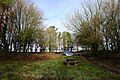
 Turnworth Clump - geograph.org.uk - 295663.jpg 600 × 399; 63 KB
-
 Turnworth Down - geograph.org.uk - 2765685.jpg 640 × 480; 115 KB
-
 Turnworth Farm - geograph.org.uk - 2765920.jpg 640 × 480; 112 KB
-
 Turnworth House - geograph.org.uk - 295613.jpg 600 × 399; 73 KB
-
 Turnworth, a snowy field - geograph.org.uk - 5710871.jpg 640 × 481; 104 KB
-
 Turnworth, a wintry village scene - geograph.org.uk - 5710864.jpg 640 × 480; 60 KB
-
 Turnworth, centre of village - geograph.org.uk - 973044.jpg 640 × 480; 93 KB
-
 Turnworth, Dorset - geograph.org.uk - 1886240.jpg 1,600 × 1,200; 1.22 MB
-

-
 Turnworth, Home Farm and Turnworth House - geograph.org.uk - 973057.jpg 640 × 480; 112 KB
-
 Turnworth, Park View - geograph.org.uk - 973060.jpg 640 × 480; 112 KB
-
 Turnworth, postbox No. DT11 48, Home Farm - geograph.org.uk - 973067.jpg 480 × 640; 142 KB
-
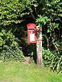
 Turnworth, postbox No. DT11 60 and phone - geograph.org.uk - 973040.jpg 640 × 480; 143 KB
-

-

-

-
 Turnworth, Turnworth Farm - geograph.org.uk - 973076.jpg 640 × 480; 93 KB
-
 Wessex Ridgeway descending towards Okeford Hill - geograph.org.uk - 6059133.jpg 5,184 × 3,456; 7.68 MB
-
 Wessex Ridgeway steadily climbing towards Bell Hill - geograph.org.uk - 6059141.jpg 5,184 × 3,456; 6.86 MB
-
 Wheatfield near Turnworth - geograph.org.uk - 1950389.jpg 640 × 480; 102 KB
-
 Axe Man - geograph.org.uk - 444334.jpg 640 × 480; 86 KB
-
 Bridleway across Turnworth Down - geograph.org.uk - 444288.jpg 640 × 480; 113 KB
-
 Bridleway at Turnworth Down - geograph.org.uk - 444306.jpg 640 × 480; 146 KB
-

-
 Bridleway Junction - geograph.org.uk - 439408.jpg 640 × 430; 336 KB
-
 Bridleway to Brockham (woods) - geograph.org.uk - 439414.jpg 430 × 640; 393 KB
-
 Brockham - geograph.org.uk - 439431.jpg 640 × 430; 310 KB
-
 Dappled sunlight at Turnworth Down - geograph.org.uk - 444329.jpg 640 × 480; 166 KB
-
 East of South Down - geograph.org.uk - 439057.jpg 640 × 430; 250 KB
-
 Eastern end of South Down - geograph.org.uk - 439061.jpg 640 × 430; 227 KB
-
 Field Grove - geograph.org.uk - 382079.jpg 640 × 427; 144 KB
-
 Horses in Coombe Bottom - geograph.org.uk - 439445.jpg 640 × 430; 317 KB
-
 Laundry of former Turnworth House - geograph.org.uk - 295616.jpg 600 × 399; 87 KB
-
 Looking down into South Down - geograph.org.uk - 439209.jpg 640 × 430; 259 KB
-
 Track curving into Coombe Bottom - geograph.org.uk - 439435.jpg 430 × 640; 307 KB
-
 Track towards Pleck - geograph.org.uk - 439425.jpg 640 × 430; 369 KB
-
 Tree surrounded by sheep on South Down - geograph.org.uk - 439212.jpg 640 × 430; 398 KB
-
 View of Brockham - geograph.org.uk - 439457.jpg 640 × 430; 263 KB
-
 Village Street, Turnworth - geograph.org.uk - 444468.jpg 640 × 480; 78 KB
-
 Walled garden, Turnworth House - geograph.org.uk - 295622.jpg 600 × 399; 86 KB
-
 What wind pump^ - geograph.org.uk - 439453.jpg 640 × 430; 445 KB
-
 Wide headland near Turnworth House - geograph.org.uk - 444320.jpg 640 × 480; 108 KB
-
 Winding Bridleways of South Down - geograph.org.uk - 444568.jpg 640 × 430; 270 KB


.jpg)


_-_geograph.org.uk_-_439414.jpg)


